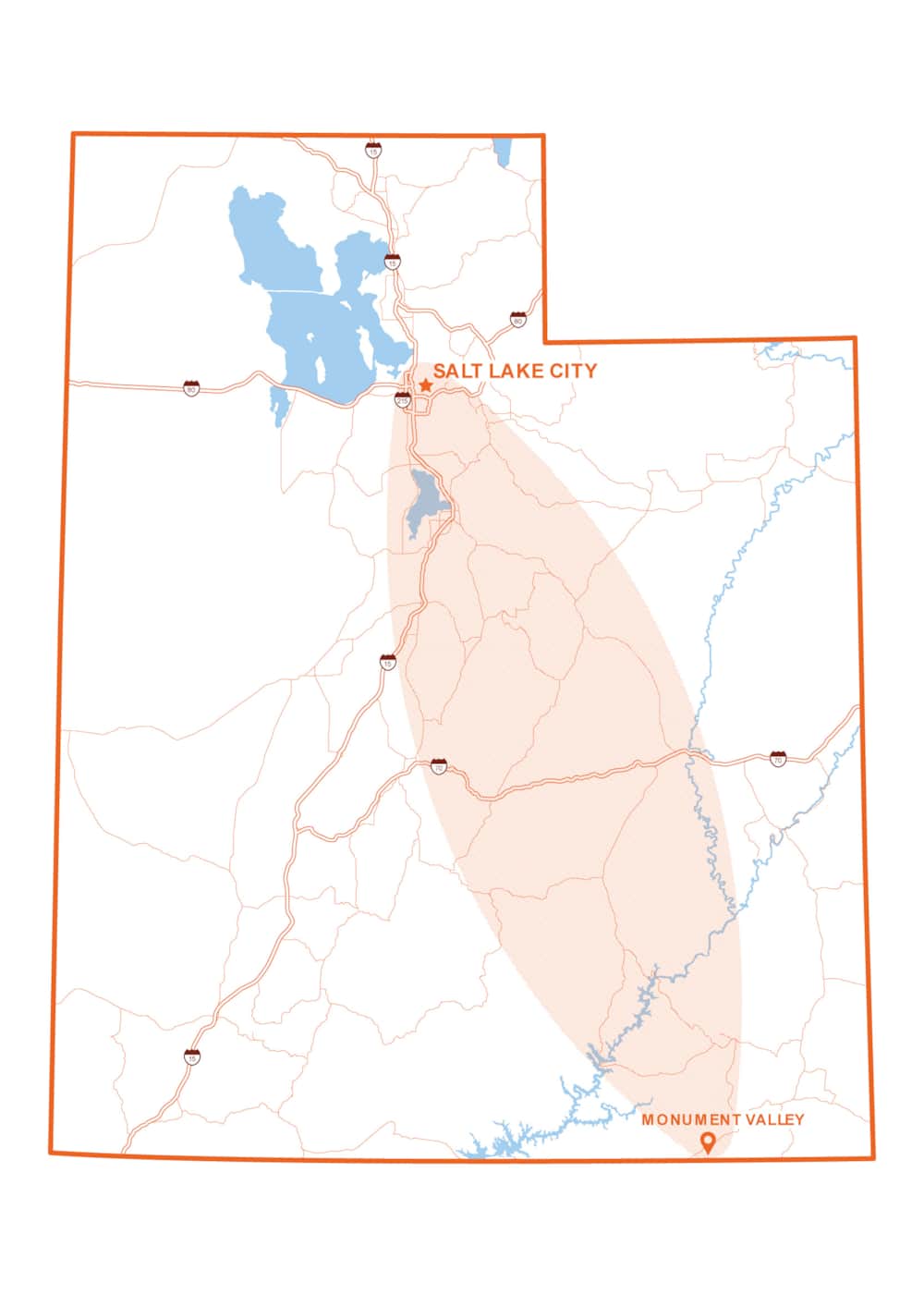
Easy Riding: Southern Wasatch to Monument Valley
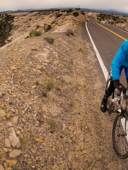
Talking about freedom and living it are two different things. Utah’s iconic American West offers both the picture-perfect backdrops to freedom and the roads for living it. This six-day itinerary follows the open-road inspiration of “Easy Rider."
Start: Lehi to the Alpine Loop S.R. 92
Finish: Southern Utah
Hours of riding: 12 to 16+
Route: The high-elevation loops on this itinerary may not show up on all Maps, and all three close in winter. See days below for maps in closer detail.
Talking about freedom and living it are two different things. Utah’s iconic American West offers both the picture-perfect backdrops to freedom and the roads for living it. Scenic byways connect the parks and monuments along climbs into high-alpine mountains and descents into red rock country. This six-day itinerary launches with a history lesson in Harley-Davidson and two scenic loops excellent for motorcycle touring before making its way south, where it’s a long way from the city and exactly where you’ll want to be. This is “Easy Rider” territory. You won’t need a watch. Just a good sense of direction and a thirst for the freedom of the open road.
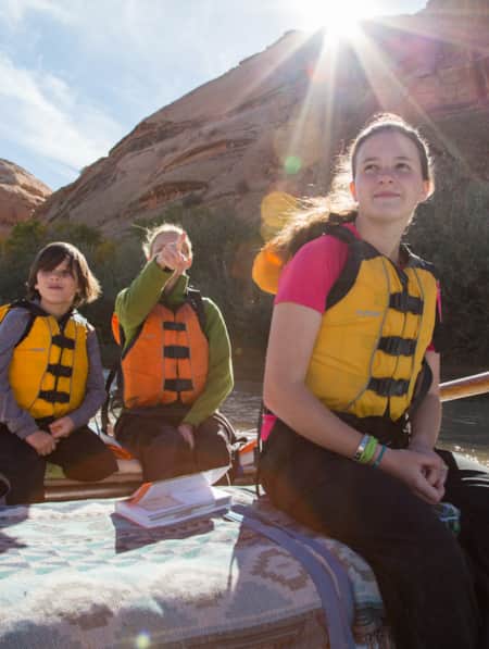
The Alpine Loop and Mount Nebo National Scenic Byway are the scenic highlights of the first two days. Both roads close in the winter, so check ahead for conditions. There are additional spurs in Northern Utah or head southeast. By the end of Day 2 you might be set up on the patio of Red Cliffs listening to the gentle lapping of the Colorado River.
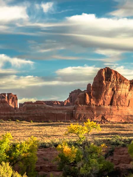
This itinerary opts for the winding La Sal Loop for high-elevation views over “Westworld’s” Castle Valley before heading south toward Bears Ears National Monument. There are options to catch a view of the Needles district of Canyonlands or to set up camp for the night in or near the national park.
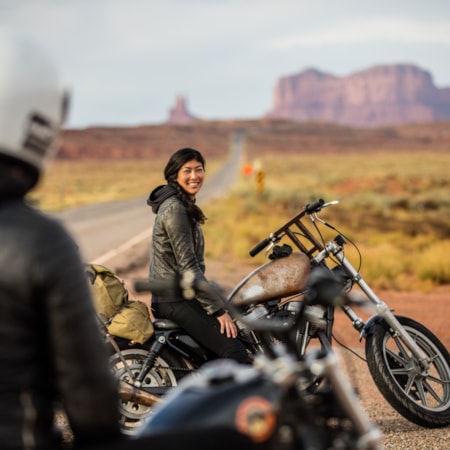
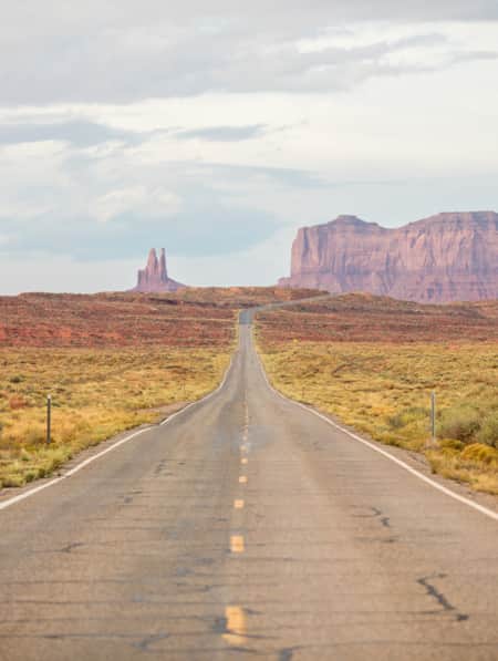
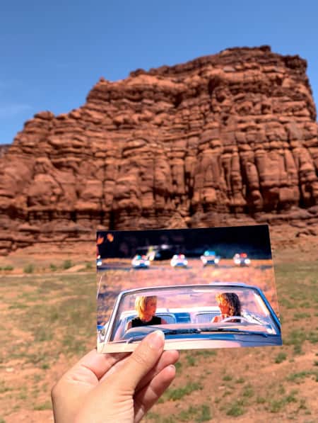
While there are many places to stop and take it all in, a focal point of this tour is Monument Valley Navajo Tribal Park. Stop for the long, sweeping, panoramic views. Listen as the wind blows. Linger late. It is sunset. You are a silhouette against the horizon. Sound familiar? “Easy Rider” captures the moment, but it’s just one of dozens of films shot on location in Monument Valley. Director John Ford made it famous, specifically in "Stagecoach" and "The Searchers."
The trip then turns back north with options to tour the scenic drive around Natural Bridges National Monument and to take the spur into the North Lake Powell region. Spend a day or two with guides to get off the bikes and onto OHVs or paddleboards. From there, it depends on your schedule and direction. If freedom calls, some of Utah’s best drives and parks are still ahead.
For more recommended motorcycle riding routes throughout Utah, visit ridetolive.utah.gov.
Southern Wasatch
75 Miles
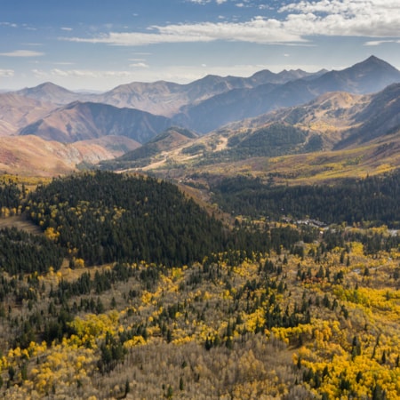
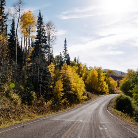
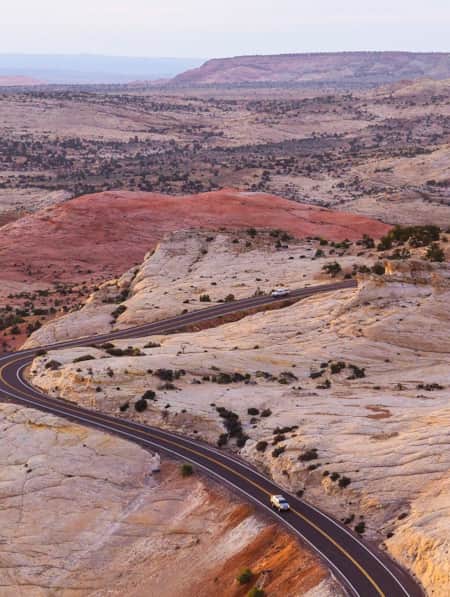
About 35 miles south of Salt Lake City, find one of Utah’s most-loved backways, the 20-mile Alpine Loop scenic drive (S.R. 92). The seasonal stretch of paved road connects American Fork Canyon with Provo Canyon through the Uinta-Wasatch-Cache National Forest (Google Map). Climb a stretch of winding asphalt that tops out at 8,000 feet, through ancient aspen trees that seem to grow right out of the side of the road and jaw-dropping views all around. Departing from Lehi, the Alpine Loop passes Timpanogos Cave National Monument and then Sundance Mountain Resort before descending Provo Canyon to Provo. There are plenty of cultural and dining options and accommodations in Provo for an extended stay or continue south to Springville to visit Legends Motorcycle Museum to get a sense for where it all began. Then walk across the lot for dinner at Strap Tank Brewery.
Overnight: Provo/Utah Valley
Extended Stay: Add a night for a spur trip up Provo Canyon to tour the Heber Valley.
Finding Nebo
285 Miles
Enjoyed the Alpine Loop? It gets better: The Mount Nebo National Scenic Byway, aka Forest Service Road 15 between Payson and Nephi, is a winding 38-mile scenic drive with features like the Grotto Falls Trail, Payson Lakes and Devil's Kitchen (resembles Bryce Canyon). Near the summit, stop at the overlook to the 11,938-foot Mount Nebo, the tallest peak in the Wasatch Mountains.
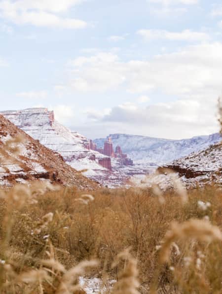
From Nephi, don't let Google Maps fool you into the quickest route. Take the Energy Loop: Huntington and Eccles Canyon National Scenic Byway between Fairview and Colton (S.R. 31 and 96 past Scofield State Park) to cross the Wasatch Plateau's 10,000-foot summit en route to one of Central Utah's most fascinating small towns in Helper, Utah, where great coffee, high art, vintage Harleys and a tranquil river parkway live side-by-side with a rich mining and railroad history. Because this plan opts for an overnight along the Colorado River, take I-70 eastbound to access the terminus of Highway 128, the Upper Colorado Scenic Byway on the Dinosaur Diamond Prehistory Highway. If time permits and you're looking for a stretch, hike the Fisher Towers trail.
If you take the whole scenic route, this is a long day of touring (Google Map). Consider booking a couple of nights at Red Cliffs.
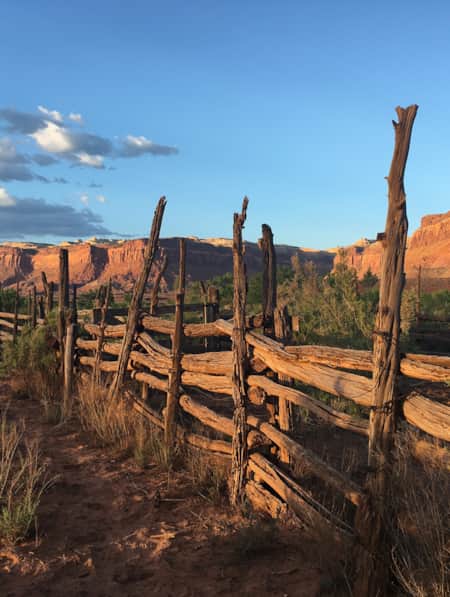
Overnight: Red Cliffs Lodge
Optional: Moab
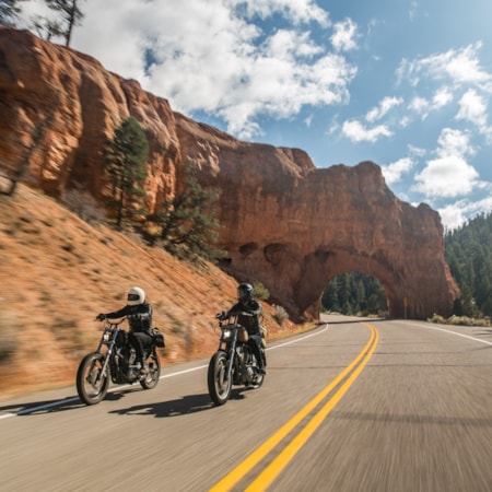
Pines and Needles
200 Miles
Today tours Castle Valley to the La Sal Loop Road before turning south to Needles Overlook Road and Indian Creek Corridor Scenic Byway in Bears Ears National Monument (Google Map).
Few roads can compete with the La Sal Loop when it comes to variety of scenery. It starts with the sculptured red rock country in Castle Valley, climbs into the pines, aspens and high mountain lakes, then drops back into the Moab area's red rock. The paved loop covers 60 miles and, depending on scenic stops (and there are many) it can take anywhere from 90 minutes to 3 hours. The La Sal range is the second-highest in Utah, with some peaks reaching 13,000 feet elevation.
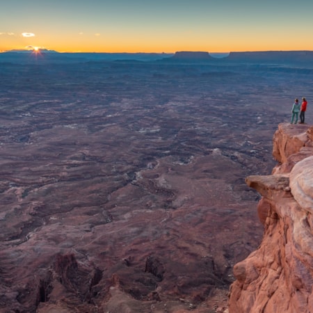
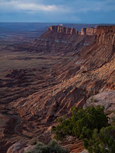
After completing the La Sal Loop, your next expansive vista is the Needles Overlook (C.R. 133). From there, return to U.S. 191 south toward S.R. 211, none other than the Indian Creek Corridor Scenic Byway, part of Bears Ears National Monument, and en route to Canyonlands National Park. Plan a stop at Newspaper Rock — one of the West’s most famous petroglyph sites.
Overnight: Monticello or Blanding
Options: Camp in or near the Needles District of Canyonlands National Park
Easy Riding
100 Miles
Packed with scenic vistas and both archaeological and cultural intrigue, this expansive corner of Utah encounters numerous examples of Ancestral Puebloan history in the Four Corners area.
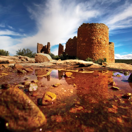
A tour of the Utah portion of the Trail of the Ancients National Scenic Byway includes Bears Ears, Four Corners, Natural Bridges and Hovenweep national monuments as well as Edge of the Cedars State Park Museum and Monument Valley Navajo Tribal Park. Dig into the Bears Ears Starter Kit itinerary to learn more. (This Google Map shows optional stops a trailhead in Bears Ears as well as Hovenweep National Monument.) The national scenic byway includes multiple states and spur routes, but this trip focuses on the Utah sites en route to Monument Valley Navajo Tribal Park and the marquee Hollywood backdrop of this itinerary.
The day ends at Monument Valley. The lingering panoramic pan shot of "Easy Rider" begins to capture the vastness of this place, but it's best understood by visiting. (And it's one of about two dozen productions that have used Monument Valley landscapes as a backdrop.)
Overnight: Goulding's Lodge, Monument Valley or Mexican Hat
Monumental
175 Miles
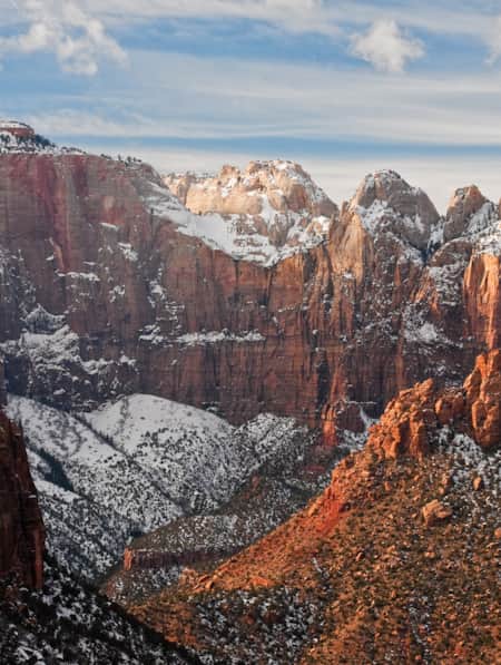
Today is all about the monuments. Leave the bike for a morning guided tour of Monument Valley Navajo Tribal Park. Following Monument Valley, seek out the overlook of the San Juan River at nearby Goosenecks State Park. Then ease yourself up the gravel switchbacks of the Moki Dugway for the scenic drive up S.R. 261, which also includes the best view of the iconic Bears Ears buttes for which the monument got its name.
Plan time to tour of Natural Bridges National Monument. The overlooks alone are worth it, but if time permits, take a hike down into the canyon to stand beneath some of the earth's largest natural bridges. Head northwest on S.R. 95 the Bicentennial National Scenic Byway to S.R. 276 to find your way to Ticaboo. If you're looking at a Google Map, you're probably curious about Hall's Crossing, a ferry across Lake Powell. Water levels can close the ferry, so check with the Utah Department of Transportation for availability.
Overnight: Ticaboo or Bullfrog
Endless Roads
150 Miles
Spend the morning touring the area with Ticaboo guides. Choose from motorized travel through little-known slot canyons or stretch the legs on area hikes or paddleboarding options. From here, the road is yours. We recommend a stop at Goblin Valley State Park if your travels are taking you back north toward Salt Lake City. But if time permits, take the left on S.R. 24 in Hanksville. The Capitol Reef Country Scenic Byway is well worth the ride even if you don't stop in the park. (But, honestly: Stop in the park.) When you reach the junction with S.R. 12, well: to not turn south would be missing Utah's All-American Road: Scenic Byway 12. The 122 miles are not only among Utah's best touring, they're among the world's. In fact, the Michelin Green Guide gave the road it's top honor of three stars. The first award of its kind for a road. (Google Map)
Discover More
-

11 Utah Scenic Byways for Leaf Peeping
Explore 11 Scenic Drives in Utah for some serious leaf peeping. Utah is one of the best places to see fall foliage, visit great attractions, events and festivals.
-
A Life Elevated Road Trip
Hit the road with Aaron Millar, host of The Armchair Explorer podcast, as he takes an adventure tour of Utah — complete with audio postcards along the way.
-
A Van Lifer’s Guide to Responsible Travel in Southern Utah
When Utah’s dirt roads are calling you, it’s time to plan your van life road trip. Here’s what you need to know to travel safely, support Utah’s rural communities, and help preserve the delicate desert landscapes.
-
A Visitor's Guide to Zion's Kolob Canyons
In the Kolob Canyons section of Zion National Park, you’ll find a scenic wonderland with an adventure for everyone. Learn more about this unforgettable attraction and plan a visit.
-
A Winter’s Desert: Visiting Southern Utah in the Slow Months
Experiencing the peace of canyon country in the winter is an attraction of its own.
-
Across a Snow-Covered Desert
Follow this itinerary for a week-long winter road trip across the snow-covered desert of Southeastern Utah.
-
Ancient Pictographs, Petroglyphs and Timeless Mysteries
Exploring Horseshoe Canyon isn’t for everyone. First of all, the effort to get there is an adventure in itself, but those efforts make the reward — namely, the chance to see up close some of the most significant pictograph panels in North America — even more noteworthy.
-
Be Prepared for the Southern Utah Backcountry
Prepare for a trip out into Utah's rugged red rock backcountry by learning as much as possible about the area before heading out. Stop by a ranger station to educate yourself and pick up necessary permits. Always practice good backcountry ethics and proper safety techniques for a safe and enjoyable adventure.
-
Cycling Scenic Byway 12: Escalante to Boulder
Looking for scenic bike rides in Utah? Scenic Byway 12 has all the breathtaking views (and riding) you could ever hope for. Get the scoop and get ready.
-
Filmed in Utah: 7 Itineraries Through Hollywood's Most Iconic Settings
While Utah's striking scenery makes it a go-to for filmmakers, the state is equally a must-visit for road-trippers and outdoor adventurers. Here are a few film and television-themed trips and tips to consider for your Utah visit.
-
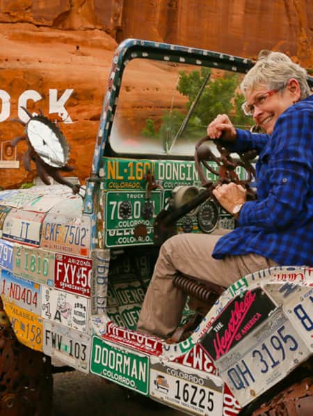
Hole N'' the Rock
Your road trip in Moab might call for a stopover at the famous Hole N” The Rock.
-
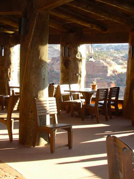
Kiva Koffeehouse
Kiva Koffeehouse is a welcome stop for fresh food and espresso tucked on a hillside down a dirt driveway near milepost 73 on the scenic byway.
-
Movies Filmed in Utah: Plotting a Cinematic Drive-Through
Follow a Germany-based film enthusiast on an extended road trip to discover the rich history of Utah cinematography.
-
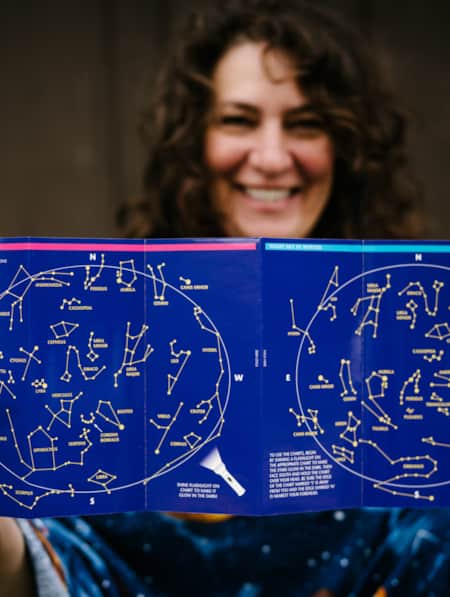
Reclaiming the Stars: Utah’s Dark Sky Initiative
Utah's Dark Sky Initiative helps state park visitors experience the cosmos by protecting night skies, encouraging astrotourism and promoting stargazing.
-
San Juan and the Trail of the Ancients
At almost 8,000 square miles, San Juan is Utah's largest county, nearly the size of New Jersey. Between the Needles district of Canyonlands and Four Corners there are vast lands of incredible wilderness, national forest, the Monument Valley Navajo Tribal Park and beautiful rivers and...
-
San Rafael Swell Throughout the Seasons: 4 Reasons to Visit
From narrow slot canyons to grand sweeping vistas, sandstone plateaus to meandering rivers, San Rafael Country and the San Rafael Swell are home to some of the most spectacular scenery in Utah.
-
Searching for Dinosaur Bones in Capitol Reef Country
The Hanksville-Burpee Dinosaur Quarry dates back to the Jurassic Period and is approximately 150 feet wide by 600 feet long. Hundreds of dinosaur bones have been discovered here, including those of the Stegosaurus, Brontosaurus and Brachiosaurus.
-
See the Fall Leaves Near Utah's National Parks
Sure, any of Utah’s Mighty 5 national parks are spectacular year round — covered in snow, peppered with spring wildflowers, and baked in sunshine. But find them exponentially special when the changing fall leaves are in juxtaposition to the immaculate red rock cliffs.
-
The All-American Road: Scenic Byway 12
This is 122.863 miles (to be exact) of pure driving bliss. Welcome to Utah’s Scenic Byway 12, a designated All-American Road.
-
The Cool Old Hotels, Rich History and Eclectic Shopping of Historic Panguitch
Explore Panguitch, the gateway to Scenic Byway 12 and Bryce Canyon National Park.
-
Touring the Indian Creek Corridor Scenic Byway
Prepare to be captivated as you drive along Indian Creek Utah’s Corridor Scenic Byway. Explore the Needles District, Canyonlands NP and admire Utah’s natural beauty.
-
Traveling Back in Time on the Old Spanish Trail
I strolled among the statues and monuments honoring pioneers and early travelers as my mind traveled back in time to the 1800s, when the Old Spanish National Historic Trail first passed through the area.
-
Utah’s Unexpected Pit Stops
Here are 11 mini-adventures to check off your list next time you’re road-tripping through Utah.
-
Why You Should Ditch I-15 on Your Way to Zion
If you’re not in a rush to get to Zion National Park from Northern Utah, consider taking a long, meandering route that features historic sites, adventure breaks and out-of-this-world scenery. Hop off I-15 and take Highway 89 and four nearby scenic byways to see and do as much as you possibly can on your way to Zion.
-
Winter Wonders in Greater Zion
As you’re mapping out your winter trip through southeastern Utah, consider adding the following parks and natural wonders to your itinerary.


