Touring the Indian Creek Corridor Scenic Byway

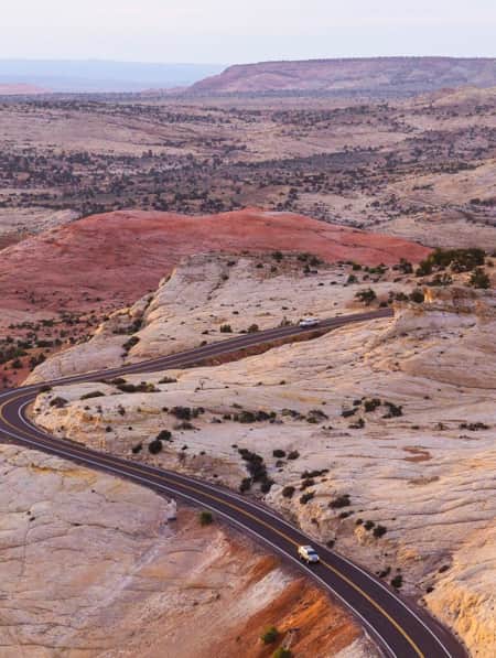
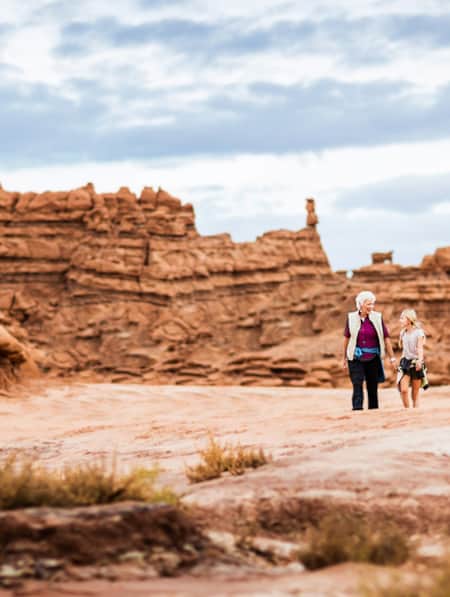
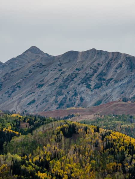
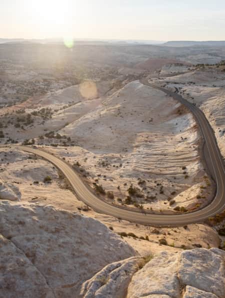
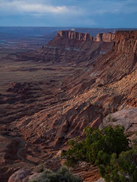
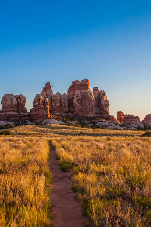
Driving down Indian Creek Corridor Scenic Byway (S.R. 211), en route to The Needles District of Canyonlands National Park, I kept having to pull over to admire the scenery. I was mesmerized as distant clouds shifted and drifted above the mesa tops and buttes. The breaking sun transformed the red rock below and I was captivated by the dancing shadows and light.
I was going to spend a few days exploring The Needles District of Canyonlands, but first, I wanted to explore the byway that leads to the district.
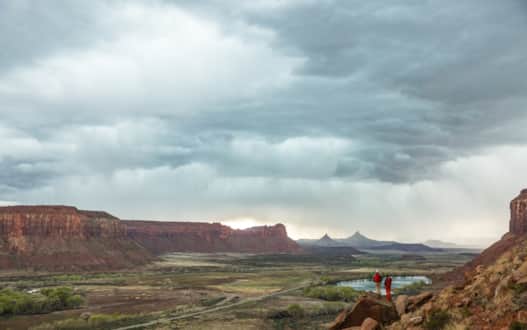
Photo: Andrew Burr
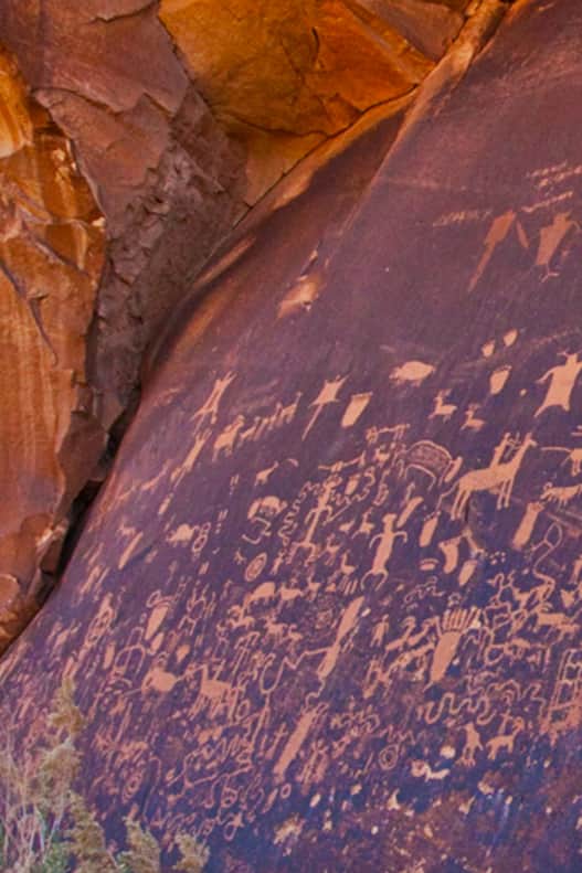
After watching some wild turkeys on the side of the road, I came across Newspaper Rock, a petroglyph panel that of such renown it was listed on the National Register of Historic Places long before either Bears Ears National Monument or Indian Creek added prominence to the remote corner of Utah. The landmark is covered with images of animals, people, ancient symbols and depictions of the natural world painstakingly etched into the rock by peoples from the Fremont, Ute and Ancient Puebloan (Anasazi) Native American tribes. It’s surmised that the perennial natural spring attracted ancients to this distinctive area of Utah.
The sign at the site indicates modern day scholars aren’t quite sure what many of the images mean. As I looked at the panel, I drifted off in thought, wondering who made these designs and what they wanted to communicate.
A Landscape for Conservancy
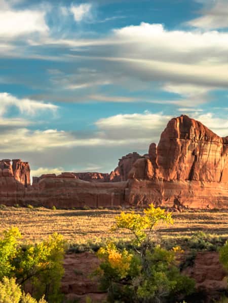
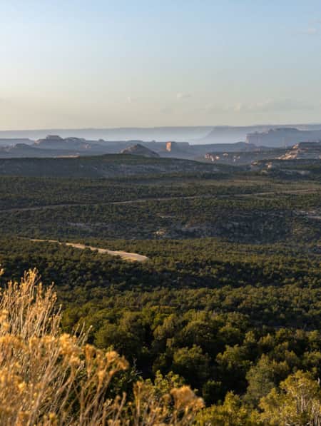
Continuing down the road, I admired the spans of wide open land on both sides of the road. Later I learned that much of this land is The Nature Conservancy’s Dugout Ranch. The ranch contains 5,200 acres of private property and upwards of 300,000 acres of associated public grazing allotments. For travelers on the scenic byway, that means views of rugged western landscapes untouched by development, a place that supports an older way of life.
The landscape I pass through on my drive contains 11 rare plant species and is critical habitat for the threatened Mexican spotted owl. The 5,200-acre private ranch also protects 42 miles of streams and associated riparian and streamside vegetation areas, which is crucial in a region where water is scarce yet wildlife relies upon it. The ranch and Nature Conservancy worked to add wayfinding and basic amenities to trailheads for the popular climbing area.
Two nearby mesa tops — Lavender Mesa and Bridger Jack Mesa — are also relatively untouched “relict areas” which are crucial to research.
“These areas show us what these communities of concern would look like without any impacts from humans,” Bellagamba says.
The ranch is also home to the Canyonlands Research Center, which conducts climate change research, including modeling precipitation and temperature patterns, and land-use evaluations. Interested visitors may rent tent cabins for research and educational activities, and with prior approval for other visits.
Most travelers along Utah's Indian Creek Corridor Scenic Byway will simply appreciate The Nature Conservancy and Canyonlands Research Center’s work to protect the landscape from development that would have dramatically changed the area.
Camping at an Outpost of The Needles District
Further down the road, right outside the gate to The Needles District of Canyonlands National Park, sits another Nature Conservancy property: Needles Outpost. (Contact information next to map, below.) When it went up for sale at auction in 2017, a conservation-minded buyer purchased it and transferred the title to the conservancy, which plans on keeping it the way it is today, with a small store and campground.
Heading inside Needles Outpost, I was greeted by two cats — Oscar and Lucy — and a very friendly shopkeeper. I strolled through the store and checked out its offerings. In addition to running a campground onsite, the Outpost's shop sells snacks, drinks, gas, ice and even rents out card and board games as well as movies by the night.
After grabbing a beverage, I headed back out and, after a little more exploring, found a small Bureau of Land Management campground a bit down the road (more information at Recreation.gov). Settling in at a site, I cooked some pasta and relaxed as the sun went down.
When twilight turned to darkness, I set up a spotting scope and turned my sights towards the heavens, spying the moon and its craters. When it dipped below the horizon, the darkness of night turned even darker, and the clear night made the Milky Way’s multitudinous pinpricks of light shine even brighter.
And then I saw it: Saturn.
The planet's rings were clearly visible in the clear night sky through the scope. I had never seen them before in real life. I was struck with awe by the fact that I was looking at the rings of Saturn from a little BLM campsite in the red rock desert of Utah.
I couldn’t help but feel like one of the tiniest creatures in the universe at that moment. And one of the luckiest to be gazing up at Saturn's rings from a little spot along the Indian Creek Corridor Scenic Byway. Plan your trip today to experience Utah’s natural splendor.

Discover More
-

The All-American Road: Scenic Byway 12
This is 122.863 miles (to be exact) of pure driving bliss. Welcome to Utah’s Scenic Byway 12, a designated All-American Road.
-
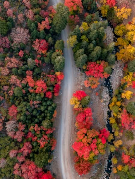
See the Fall Leaves Near Utah's National Parks
Sure, any of Utah’s Mighty 5 national parks are spectacular year round — covered in snow, peppered with spring wildflowers, and baked in sunshine. But find them exponentially special when the changing fall leaves are in juxtaposition to the immaculate red rock cliffs.
-
Tooele? Tuilla? The Fascinating History of this Utah Town
While the town of Tooele has a fascinating story to its name, the best part about one of Utah’s original counties is its history.
-
Explore Antelope Island's Fielding Garr Ranch
Volunteers Beth and Dennis Simonsen show visitors around the historic Fielding Garr Ranch complex on Antelope Island State Park in Northern Utah.
-
Moonscapes, Marscapes and More
If you want to know what Mars looks like — then the dramatic terrain of Capitol Reef National Park and the surrounding lands are a good place to start.
-
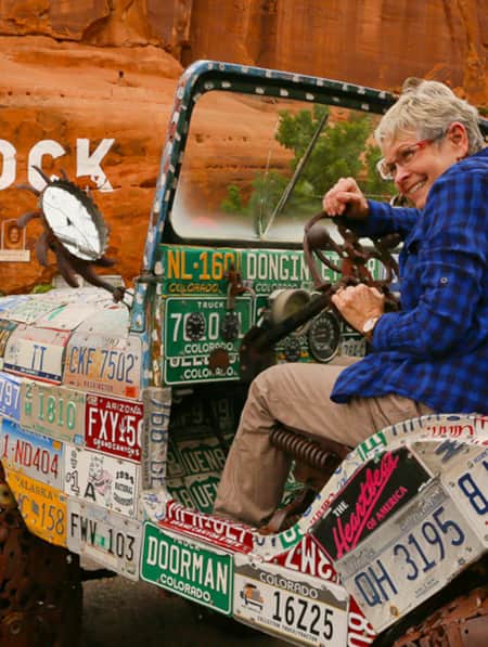
Hole N'' the Rock
Your road trip in Moab might call for a stopover at the famous Hole N” The Rock.
-
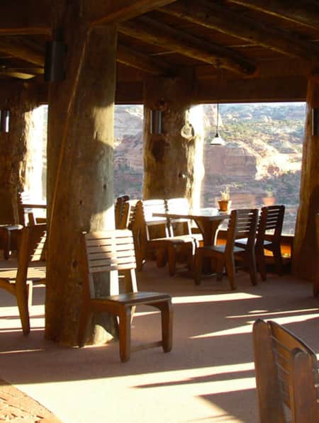
Kiva Koffeehouse
Kiva Koffeehouse is a welcome stop for fresh food and espresso tucked on a hillside down a dirt driveway near milepost 73 on the scenic byway.
-
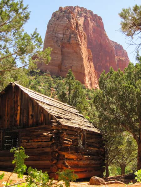
A Visitor's Guide to Zion's Kolob Canyons
In the Kolob Canyons section of Zion National Park, you’ll find a scenic wonderland with an adventure for everyone. Learn more about this unforgettable attraction and plan a visit.
-
11 Utah Scenic Byways for Leaf Peeping
Explore 11 Scenic Drives in Utah for some serious leaf peeping. Utah is one of the best places to see fall foliage, visit great attractions, events and festivals.
-
Ancient Pictographs, Petroglyphs and Timeless Mysteries
Exploring Horseshoe Canyon isn’t for everyone. First of all, the effort to get there is an adventure in itself, but those efforts make the reward — namely, the chance to see up close some of the most significant pictograph panels in North America — even more noteworthy.
-
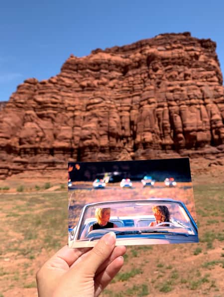
Movies Filmed in Utah: Plotting a Cinematic Drive-Through
Follow a Germany-based film enthusiast on an extended road trip to discover the rich history of Utah cinematography.
-
Year-round Vibrance on the Nebo Loop Byway
A National Scenic Byway that Enchants at High Elevations, by Road or Trail
-
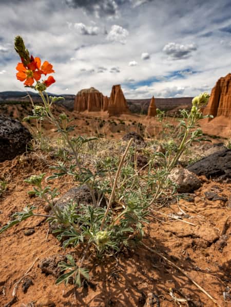
Serenity Found in Torrey and Capitol Reef’s Cathedral Valley District
Taking Southern Utah’s remote, less-traveled path in Capitol Reef's Cathedral Valley District to nurture your body, mind and spirit.
-
Utah’s Unexpected Pit Stops
Here are 11 mini-adventures to check off your list next time you’re road-tripping through Utah.
-
Why You Should Ditch I-15 on Your Way to Zion
If you’re not in a rush to get to Zion National Park from Northern Utah, consider taking a long, meandering route that features historic sites, adventure breaks and out-of-this-world scenery. Hop off I-15 and take Highway 89 and four nearby scenic byways to see and do as much as you possibly can on your way to Zion.
-
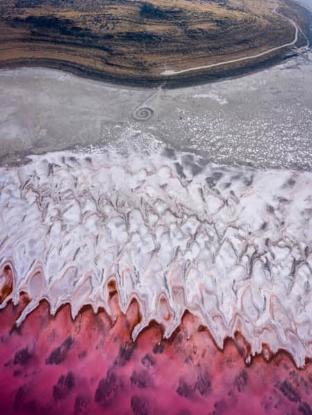
The Spiral Jetty, Utah’s Most Iconic Land Art Sculpture, Keeps Drawing a Crowd
In April 1970, it took six days, 625 man-hours, 292 truck-hours, $9,000, and 6,500 tons of basalt, limestone and mud for Robert Smithson to construct the Spiral Jetty. His work still stands today. Visit and be inspired by this iconic piece of Utah's land art.
-
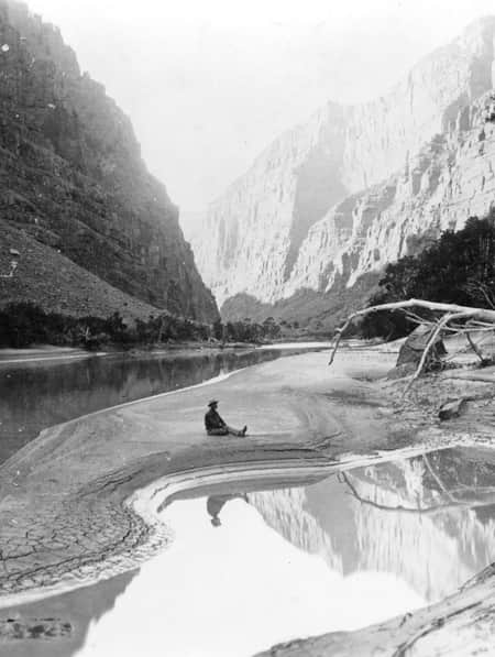
Chasing John Wesley Powell: Six Places to Explore Utah's Green and Colorado Rivers
One hundred and fifty years ago a one-armed Civil War veteran set off with nine mountain men on a scientific expedition to map one of the last blank spaces left on the U.S. map: The Green and Colorado rivers. Much of the river remains wild today. Follow Powell's journey here.
-
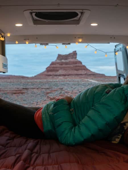
A Van Lifer’s Guide to Responsible Travel in Southern Utah
When Utah’s dirt roads are calling you, it’s time to plan your van life road trip. Here’s what you need to know to travel safely, support Utah’s rural communities, and help preserve the delicate desert landscapes.
-
Winter Road Trip: Where to Stay, Hike and Eat When Traveling from Capitol Reef to Bryce Canyon
Need winter break ideas? Take a road trip from Capitol Reef to Bryce Canyon and enjoy the best of Utah landscapes during its quiet season.
-
Touring the Dinosaur Diamond Prehistoric Highway
Discover dinosaurs in Utah. The Dinosaur Diamond Prehistoric Highway is one of the best places to see dinosaurs in Utah.
-
An Adventure Guide to Harts Draw Road
Winding up into the Abajo Mountains of southeastern Utah and down into sprawling red rock canyons, the 18-mile Harts Draw Road offers the perfect mixture of snow and sand, scenery and solitude.
-
An Old Favorite Fishing Hole at the Flaming Gorge Reservoir
Visit Utah columnist Dan Potts takes us to his "secret" fishing hole on Utah's Flaming Gorge Reservoir, one of the world's most diverse fisheries set among the brilliant red rock walls of Red Canyon in the easternmost corner of the state. Along the way, Dan takes us through some of his favorite landscapes on the drive to and from Salt Lake City.
-
Arrive by Train
Follow author Tim Sullivan and his eight-year-old daughter as they travel by train, bus and bike on a "pilgrimage" to Golden Spike National Historic Site.
-
Be Prepared for the Southern Utah Backcountry
Prepare for a trip out into Utah's rugged red rock backcountry by learning as much as possible about the area before heading out. Stop by a ranger station to educate yourself and pick up necessary permits. Always practice good backcountry ethics and proper safety techniques for a safe and enjoyable adventure.
-
Bear Lake for History Buffs: Top 6 Don't-Miss Sites
Bear Lake’s charms are pretty apparent for anyone interested in the outdoors, water sports, cute small towns or fresh-picked raspberries. But beyond a lovely azure freshwater lake surrounded by cool hiking trails and berry stands, the area has a few special historic sites that you might miss if you didn’t know better.