Sand Pipes, Craters & Dunes: Southern Utah’s Geology is More than Just Arches

If you were asked to name the most striking geologic formations in Southern Utah, your answer might be Delicate Arch or the tangerine-colored hoodoos at Bryce Canyon. Or maybe the skyscraping walls of Zion Canyon. There’s no doubt these dramatic sites draw visitors from around the world. But as one of the most geology-rich states in the U.S., Utah has many less-famous geologic treasures that are often overlooked.
Fisher Towers
Outdoor enthusiasts flock to Moab to see Arches and Canyonlands national parks, but just a few miles away is one of the most photographed scenes in Utah: Fisher Towers framed by the La Sal Mountains. These monolithic sandstone pinnacles are the remnants of a floodplain that was deposited from the Rocky Mountains about 225 million years ago. Erosion gradually wore away the softer layers of sandstone, leaving the more resistant rock that makes up the towers. The tallest of the towers, the Titan, stands 900 feet high and is said to be the largest freestanding rock tower in the U.S.
Huntley Ingalls, part of the first climbing team to ascend the Titan, described Fisher Towers as “a pink, red and orange skyscraper city.” One of the most striking things about the spires is their drapery-like appearance, created when rainwater drained down the sandstone over millions of years and left vertical gulleys.
Even today, erosion and weathering processes continue to chisel away at Fisher Towers. Evidence of their fragility came in 2014 when a 40-foot tower capped by a rock that resembled the head of a snake, called the Cobra, toppled over after a heavy rainstorm.
You can wander among the tall spires by taking the 4.6-mile (out-and-back) Fisher Towers Trail, which winds along the base of the towers. Fisher Towers is a world-famous climbing destination, so hikers should be cautious of falling rock near popular climbing routes.

Upheaval Dome
Imagine riding across the Utah desert on horseback and suddenly finding yourself at the edge of a 1,000-foot drop-off. The first explorers to reach the rim of Upheaval Dome must have come to a jolting halt. Smack dab in the middle of the sandstone rock layers is a colossal crater about three miles wide.
Upheaval Dome sits on top of a high mesa called Island in the Sky in Canyonlands National Park. Known as a geologic anomaly, the dome deviates significantly from other structures in the surrounding area. Throughout the Island in the Sky District, rock formations appear in a layered structure, evidence that they were uniformly exposed as the Colorado and Green Rivers cut through the mesa. But at Upheaval Dome, this geologic pattern is suddenly disrupted, and rocks that were once buried underground are now exposed at the surface. But the real intrigue of Upheaval Dome lies in the enigma of its origin.
Upheaval Dome was first studied about 100 years ago; in the decades that followed, geologists debated two theories about the structure’s origin. According to the first theory, the crater resulted from a meteorite impact during the Jurassic Period. The resulting explosion caused the rocks at the bottom of the crater to push upward to fill in the hole left by the blast.
The second explanation is how Upheaval Dome got its name: the salt dome theory. Millions of years ago, the Colorado Plateau was covered by a shallow sea. As the climate became drier, the seas dried up and left behind a thick layer of salt. Because salt is viscous over geologic timescales, it eventually flowed upward into the rock layers above, creating a structural dome.
A turning point came in 2008, when German researchers discovered “shocked quartz” in the brown-colored layer around the rim of the crater. Shocked quartz—sand grains that have a deformed structure caused by intense pressure—can only form as the result of an impact event or nuclear explosion. The meteorite impact theory became widely accepted as the correct one, although some scientists still support the salt dome idea. Moab resident Nathaniel Clark, a former ranger at Island in the Sky, says, “We now know so much about the geology of this landscape, but I kind of like that there’s this huge hole in the ground here that’s still a mystery.”
The Upheaval Dome Trail leads to two overlooks of the crater (.8 miles and 1.8 miles roundtrip). On the way, you’ll pass a spur trail that leads to the Syncline Loop, a challenging 8-mile hike in rugged terrain. According to park rangers, more people require rescue on the Syncline Loop than in any other place in Canyonlands National Park. Exercise extreme caution if attempting this hike.

Raplee Ridge
Heading towards Monument Valley on U.S. Route 163, you get a front-row seat for one of the most striking geologic features in the southwest. On the south side of the highway is a multi-colored formation with rock layers in a V-shaped pattern. Raplee Ridge is a fold in the earth’s crust caused by tectonic stresses that pushed the rock layers upward, leaving a ridge that slopes downward to the San Juan River. Although commonly called Raplee Anticline, geologists say the ridge is technically a monocline, due to its step-like folds where the rock layers bend in one direction.
The triangular pattern of the ridge’s sandstone layers resembles the zig-zag geometric design often seen in Navajo blankets and rugs. The best time to see Raplee Ridge is during golden hour just before sunset, when the sun’s low angle lights up the side of the formation facing the highway. (Read: Finding Winter Solitude in Bluff)

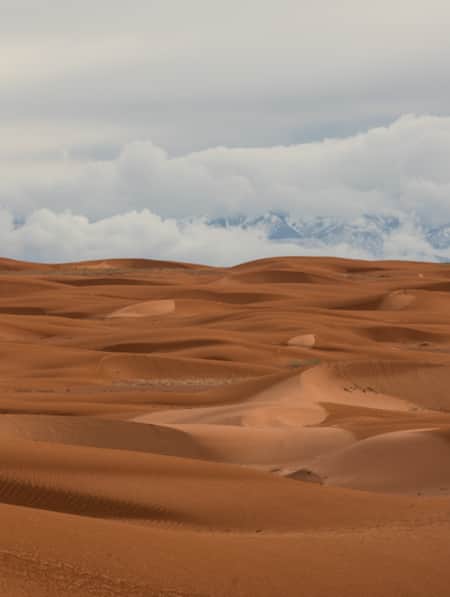
Coral Pink Sand Dunes
Sand dunes probably aren’t on the list of geologic features most people expect to find in Southern Utah. But just 20 miles from the town of Kanab lies more than 3,000 acres of pink-colored dunes at Coral Pink Sand Dunes State Park. Formed when the Navajo Sandstone (the most prominent rock layer in Southern Utah) eroded over millions of years, the dunes are constantly on the move, shifting as much as 50 feet per year. The pink color comes from hematite, the same mineral that gives rust its reddish color.
Park visitors can experience the dunes via hiking, sand-sledding (you can rent sleds at the visitor center) and ATV riding. It’s also a popular spot for photographers wishing to capture dramatic sunsets against the backdrop of the dunes. Roam Outdoor Adventure Co. and Coral Pink ATV Tours offer guided trips that include ATV/UTV tours and sand surfing.

Kodachrome Basin State Park
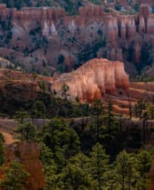
Bryce Canyon National Park sees more than two million visitors each year, but only a fraction of them visit nearby Kodachrome Basin State Park. What they’re missing out on is seeing a geologic rarity: sand pipes. These massive freestanding rock spires are believed to the solidified remains of sediment that once filled ancient geysers. More than 60 sand pipes have been identified within the park, ranging from smaller ones less than 10 feet tall to the 172-foot-high Chimney Rock.
Kodachrome Basin got its name after a National Geographic Society expedition photographed the area in the late 1940s. They found the area’s colorful features to be so photogenic that they named it after Kodak’s once-popular color slide film. You’ll find several hiking trails here, including the Angel’s Palace Trail, a 1.5-mile loop hike that provides good views of the sand pipes from a high ledge.

The Waterpocket Fold
Sometimes called the “backbone of Capitol Reef National Park,” the Waterpocket Fold stretches for about 100 miles from the park’s northern boundary south to Lake Powell. This gigantic warp in the earth’s crust is a classic example of a monocline, a single (mono) fold in an area of otherwise horizontal rock strata. The formation got its name from the many potholes, or waterpockets, that temporarily hold water after significant rain and snow events. Early settlers referred to the Waterpocket Fold as “the reef,” because it acted as a barrier to travel, just like an ocean reef.
Within the walls of the Waterpocket Fold, erosion has created a labyrinth of slot canyons, potholes and Swiss cheese-like holes in the sandstone. Several hiking routes in Capitol Reef cut through the Fold, including Grand Wash and Capitol Gorge. Taking a short walk on one of these trails allows you to get a closeup look at the inner canyons. Both of these routes follow washes, which are prone to flash flooding during monsoon season. Stop at the visitor center to check weather conditions before proceeding on these hikes. (Read: A Guided Adventure for Everyone in Utah's National Parks)

Bonus Site: Cathedral Valley Loop (Off-Road Route)
Much of Capitol Reef National Park is accessible from Utah State Route 24 and the paved Scenic Drive. But in the far north section of the park lies Cathedral Valley, a remote desert that includes several unique geologic sites. (Read: Serenity Found in Torrey and Capitol Reef’s Cathedral Valley District)
The 58-mile unpaved route through Cathedral Valley requires high-clearance 4WD vehicles and includes fording the Fremont River at the beginning of the trip. Due to the area’s remote location and road conditions that can change rapidly, guided trips are recommended. Full-day trips are available with Capitol Reef Outfitters in Torrey. For experienced off-road drivers who wish to do a self-guided tour, Thousand Lakes RV Park offers jeep rentals.
Below are some of the features you’ll spot along the loop.

Bentonite Hills
If you frequent social media, you’ve probably seen photos of the Bentonite Hills. These huge mounds are made of bentonite clay formed during the Jurassic Period when mud and volcanic ash were deposited in swamps and lakes. Minerals in the clay, including hematite and manganese, give the hills a colorful banded appearance in shades of brown, red, gray and green. Colors are most visible around sunset (note that many of the photos on social media are highly saturated). No trails exist through the Bentonite Hills. The fragile surface is easily damaged by footprints and tire tracks. Visitors must stay on roads and limit walking to firm areas and wash bottoms.

Gypsum Sinkhole
At nearly 50 feet in diameter and 200 feet deep, this deep hole developed when groundwater dissolved a buried gypsum plug. The void left by the gypsum then collapsed under the weight of rock layers above. There is no barrier fence around the formation. Visitors should stay away from the edge of the sinkhole as the rocks are very unstable and could collapse at any time.

Temple of the Sun and Moon
Composed of the fine grains of the Entrada Sandstone, the Temple of the Sun and Moon are a striking example of erosion creating works of art. These two monumental formations are impressive not only due to their size, but also because they stand in stark contrast to the surrounding flat landscape. The freestanding Temple of the Sun towers more than 400 feet above the ground.

Glass Mountain
Sitting in the shadow of the Temple of the Sun and Moon is a rounded pile of rock that seems to shimmer in the sunlight. About 165 million years ago, a crystalline variety of the mineral gypsum, called selenite, was deposited throughout this region when ancient seas evaporated. At Glass Mountain, these gypsum crystals have formed a mound that stands 15 feet high. While the rock is beautiful, visitors are reminded that collecting of any kind is prohibited in all national parks.


A Day at the Factory
See Factory Butte like never before with hyper-detailed panorama photography.

How to Conquer the Heat: Family Guide to Visiting Moab in the Summer
For a successful summer day, your family can start with early morning adventures and end with a refreshing rafting trip in the evening.
Highlights
- Salt Lake City
- Moab
- Arches National Park
- Colorado River
- Moab Giants Dinosaur Museum
- Green River
Iconic Classics Southeast
Three days on the open roads of Southeastern Utah is just enough for a taste of two of its most iconic national parks — Arches and Canyonlands — and a few things in between.
Highlights
- Delicate Arch
- Dead Horse Point State Park
- Moab Dining
- Explore Southeastern Utah
Denver to Moab: A High-Octane Weekend Road Trip
Start planning your road trip from Denver to Moab with three days of mountain biking, hiking, skydiving, rafting and experiencing the best of Moab.
Highlights
- Colorado River Rafting
- Moab Mountain Biking
- Skydive Moab
- World-Renowned Mountain Biking

Stories To Inspire Your Travel
-

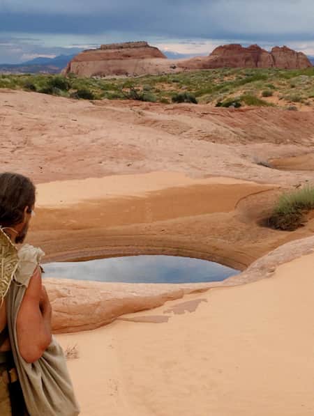
Permit of Solitude in Robbers Roost
Local guide Christopher Hagedorn leads a group through Robbers Roost in Southern Utah, where wind, water and time has left a primitive maze of canyons.
-
15 Non-Technical Slot Canyons
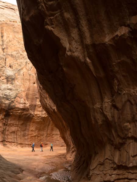
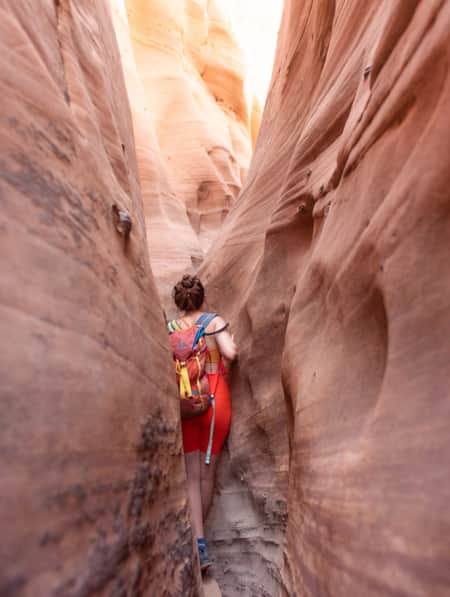
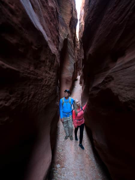
You don’t have to be Spider-Man to explore some of the best slot canyons Utah has to offer. You just need to be ready for an adventure in tight spaces with huge photographic rewards
-
Serenity Found in Torrey and Capitol Reef’s Cathedral Valley District
Taking Southern Utah’s remote, less-traveled path in Capitol Reef's Cathedral Valley District to nurture your body, mind and spirit.
-
Moonscapes, Marscapes and More
If you want to know what Mars looks like — then the dramatic terrain of Capitol Reef National Park and the surrounding lands are a good place to start.
-
11 More Utah Winter Experiences Outside the Ski Resorts
No matter your level of adventure, you will find good reason to save some time for a day away from the resort.
-
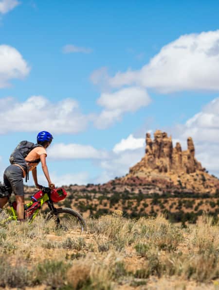
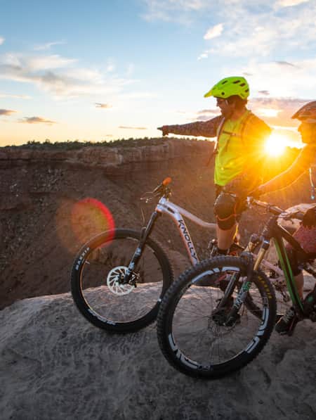
Knobby Tired Nomads: Bikepacking the Utah High Country
If you’re into bikepacking, Utah is a place you’ll want to check out. Read about a self-supported tour of Utah’s backcountry here, and start planning your trip.
-
A Matter of Geological Consent
A billion years of geological history surrounds Salt Lake City, where a modern landscape reflects ancient constraints.
-
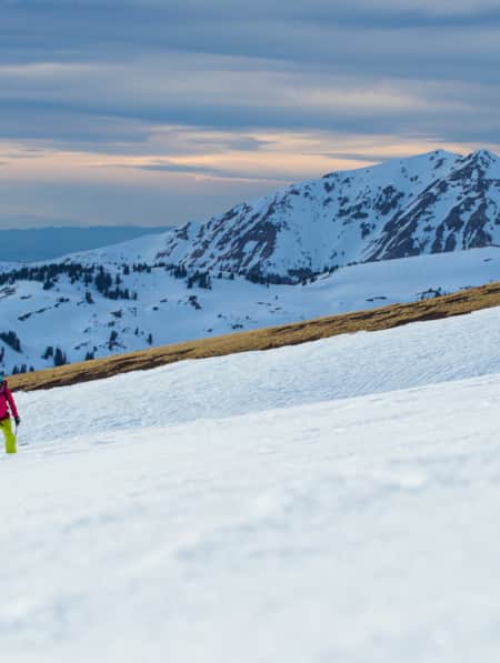
Explore the Tushars on Snowshoe
Ready to experience snowshoeing in Utah? Eagle Point is a Utah favorite location. Check out this snowshoe excursion then plan yours today for fun and adventure.
-
Northern Utah Adventure Gateway Towns
Looking for outdoor adventures in The Beehive State? These northern Utah cities are perfect spots to set up base camp. Start planning today!
-
Utah’s Unexpected Pit Stops
Here are 11 mini-adventures to check off your list next time you’re road-tripping through Utah.
-
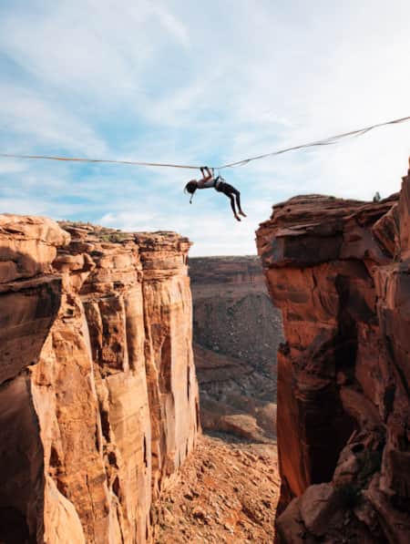
Walking The Line Between Risk and Responsibility
Why a Hawaii-based highliner and influencer hasn't returned to Utah — yet.
-
In Search of Robbers Roost
Robbers Roost Utah, one of the infamous hideouts of Butch Cassidy and his Wild Bunch, is not easy to find even with directions from the locals. Explore Utah.
-
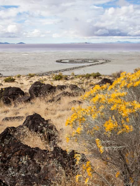
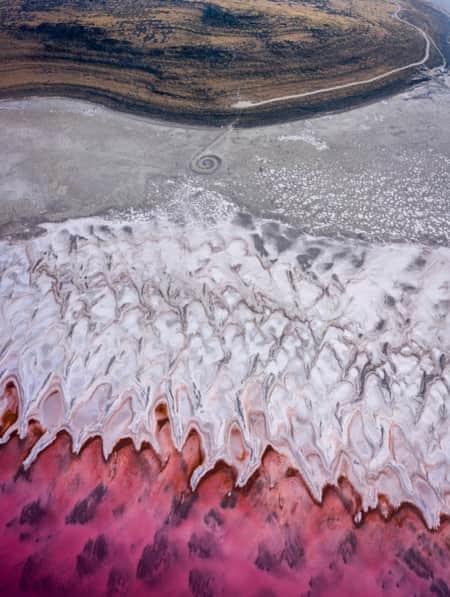
The Spiral Jetty, Utah’s Most Iconic Land Art Sculpture, Keeps Drawing a Crowd
In April 1970, it took six days, 625 man-hours, 292 truck-hours, $9,000, and 6,500 tons of basalt, limestone and mud for Robert Smithson to construct the Spiral Jetty. His work still stands today. Visit and be inspired by this iconic piece of Utah's land art.
-
Chasing Old West Outlaws on the Cassidy Trail
The Cassidy Trail wasn’t just the filming location for an iconic Western movie, it’s steeped in history. Once you find this hidden trailhead, you’ll be surrounded by breathtaking scenery and Wild West legend.
-
Bikepacking through Time in the San Rafael Swell
We're miles away from civilization here in southeastern Utah’s San Rafael Swell, and we carry everything we need on our bikes. This is the type of adventure I've longed for, a trip that reminds us of our self-worth, resilience, and how little we actually need to survive.
-
15 Must-Do Adventures in Kanab
Looking for fun things to do in Kanab? Check out our list of the 15 must-do adventures in Kanab and start planning your visit today.
-
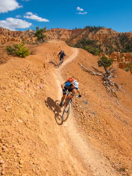
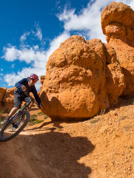
Seven Must-Ride Mountain Biking Trails in Utah
To help you plan a Utah mountain biking trip, we've assembled a list of seven of Utah’s best mountain biking trails followed by a roundup of Utah’s best fat-tire destinations.
-
11 Family-Friendly Activities Near SLC
From roller coasters to ski slopes, discover 11 fun family activities in and around Salt Lake City.
-
Mission to Mars: Riding Gooseberry Mesa
You haven’t truly ridden a mountain bike until you’ve visited the stunning slickrock of Gooseberry Mesa. Learn more about this spectacular Utah trail.
-
Planning Your Big Snow Trip
Let’s plan a powder ski trip to Utah and even help you save some time and money while you’re there. Just answer these three questions: Who? When? How much?
-
Like a BOSS (Boulder Outdoor Survival School)
Have a couple of weeks? Learn to survive in the wild. Hard work? Most definitely. Sign up for challenging survival education Utah's great outdoors.
-
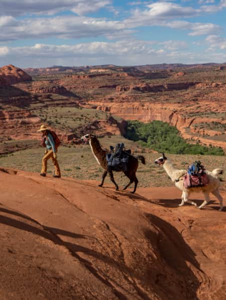
Llama Trekking Through Canyon Country
Reconnect with yourself, history and Utah's landscape on a guided llama trek through canyon country.
-
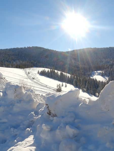
Beyond the Lake
From snowmobiling to skiing, snowshoeing to sledding and fishing, Bear Lake in the winter is everything you’ll want from your next winter vacation.
-
Chasing Waterfalls in Utah Valley
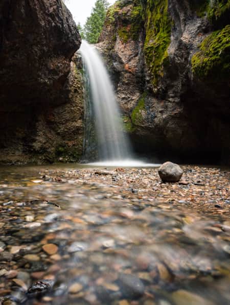
Waterfalls are one of nature’s most spectacular shows, and Utah Valley offers more viewable waterfalls than any other Utah area. Even more enticing? They’re a quick road trip and easy hike away from the Wasatch Front. Check out the 8 best waterfalls in Utah Valley and prepare to be amazed.
-
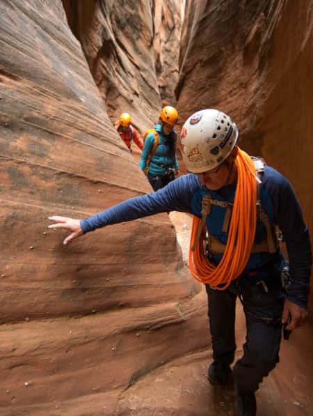
How to Canyoneer Safely
Whether you’re a newbie or a seasoned canyoneer, here are six expert tips for your next canyoneering adventure.