Snow Meets Desert in the Bears Ears Backcountry
A solo sojourn through a lesser-known corner of Utah’s red rock country.

Utah’s arid, southerly quadrant offers a surreal and entirely different experience than Northern Utah snow-covered mountains. But just outside of charmingly rural Monticello, adventure seekers can embark on a solitude-filled winter quest.
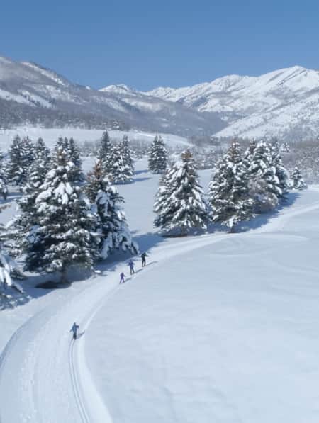
As I made my way up the incline, the only sounds I heard were my breath and the swish-swish of my skis cutting through the fresh snow. Mature aspens, ponderosa pine and gambel oak cluster along the mountainsides to my left, the sweeping valley sprawls down to my right.
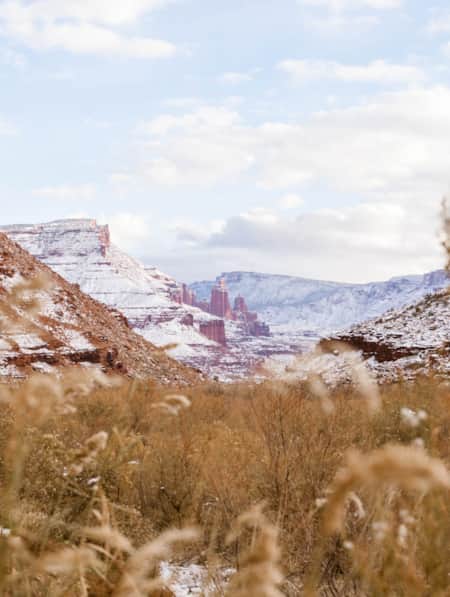
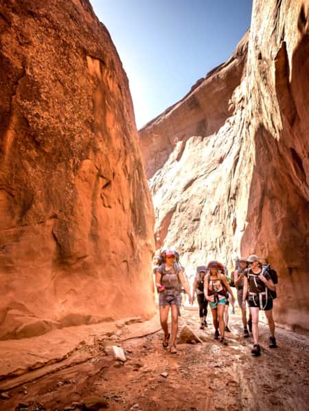
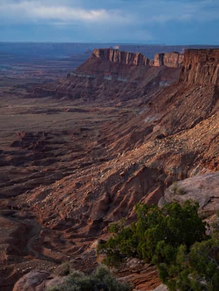
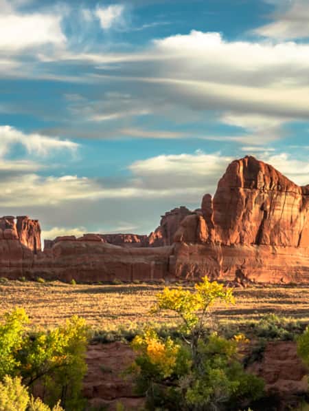
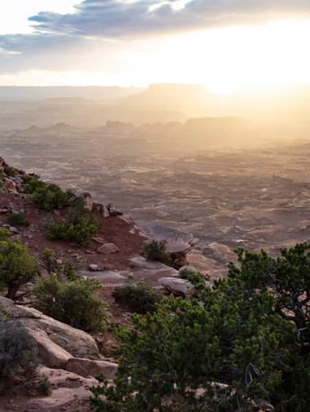
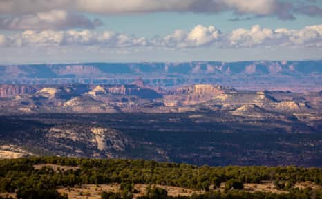
I crested the rise and stopped to catch my breath while taking in the breathtaking view in front of me: an inert sea of burnt orange-hued sandstone spires, cliffs, arroyos and mesas making up the Indian Creek Recreation Area and Canyonlands National Park.
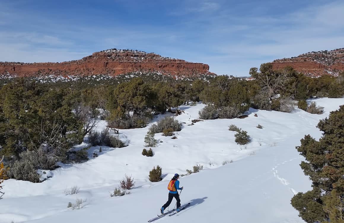
I was traversing slopes in the Abajo Mountains, a relatively small range located in southeastern Utah’s Manti-La Sal National Forest just west of Monticello. Though the Abajos proximity to red rock desert isn’t singular in Utah — views of Cedar Breaks National Monument can be seen from Brian Head Resort and the La Sal Mountains loom large over Moab — the Abajos’ lack of development and crowds is unique. And, as I realized over two restorative winter days, they serve as an ideal backdrop for an adventurous solo getaway. (Read: How To Visit Southern Utah in Winter)
"I crested the rise and stopped to catch my breath while taking in the breathtaking view in front of me: an inert sea of burnt orange-hued sandstone spires, cliffs, arroyos and mesas..."
The Abajos’ lack of development and crowds is unique.
A red rock view in the Abajos.
Setting Out
I began my off-the-beaten-path Southern Utah sojourn in Monticello, a small town of about 2,500 people located 55 miles south of bustling Moab along Highway 191. “Except for Pioneer Day when everyone comes home, Monticello is never really busy,” says Melinda Redd, jewelry artist and co-owner of the town’s beautifully curated Jackalope Trading Company.
Indeed. Moab’s Main Street vibrated with traffic and activity when I passed through it in late winter en route to Monticello. The pace in Monticello was notably more relaxed, with plenty of come-as-you-are, down-home allure.
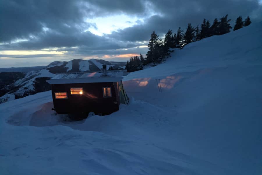
I spent my first night in Monticello in a tiny home placed in the Abajo Mountains by Roam Industry, a local outdoor adventure outfitter and guiding service owned by Dustin and Natalie Randall. (Read: Why You Should Hire a Backcountry Skiing Guide)
The couple, who met when they were both students at Brigham Young University, opened Roam out of their garage in 2014. A year later, they moved the shop to its current commercial location. Fueled by homemade scones, pour-over coffee and an intimate knowledge of the surrounding wilderness (Dustin grew up on a cattle ranch just outside of town; Natalie is the executive director of the Utah Tourism Industry Association), Roam has become the center of Monticello’s burgeoning outdoors-embracing culture. (Watch: The Voices of Bears Ears: The High Desert Adventurer)
After checking in and renting skis at Roam, I drove a couple of miles east of Main Street to the Hart’s Draw Winter Trailhead. My car remained the only one parked at the trailhead as I shouldered my pack and started out on the two-mile ski up to the 9,000-feet-above sea-level Buckboard Campground where the Roam tiny home resides for the winter.
As I ascended the snow-covered road, I noted the wide swaths cut through evergreens on the mountain sides above me. The Blue Mountain Ski Resort opened in the Abajos in the mid-1950s, operating a Poma lift and a T-bar on a handful of still-visible ski runs. The resort closed in 1990 and the Forest Service removed the lifts and small lodge soon after.
Now, experienced backcountry skiers regularly tick the Abajos’ former lift-served slopes off their Utah adventure bucket lists on their way to Roam’s Bothy Wagon, a tricked-out camper parked high in the Abajos at 10,300 feet. (Check out the Utah Avalanche Center’s website for the Abajos Mountains forecast). But these mountains also have plenty of rolling, low-angle slopes ideal for risk-averse cross-country skiers like me. (Read: 4 Tips to Prepare for Utah's Winter Backcountry)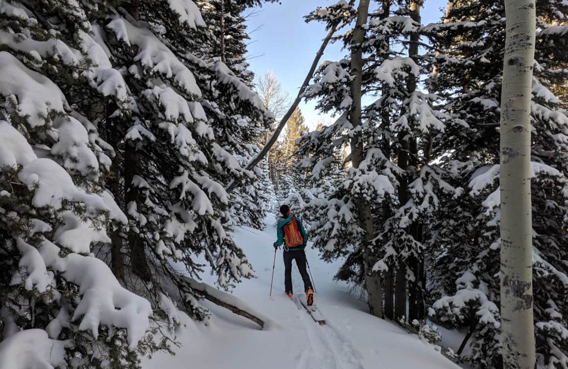
Traversing the Abajos backcountry.
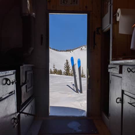
The tiny homes are much less rustic and more cozy than the average backcountry hut.
Views from a leisurely twilight ski.
Tiny Home, Away From Home
When I arrive and open the door of the tiny home, I am pleasantly surprised to see how much less rustic and more cozy it is than the backcountry huts and yurts where I’ve stayed previously.
After rolling out my sleeping bag in the loft — decorated with shabby chic Boho throw pillows — and melting some snow, I return outside for a leisurely twilight ski through the surrounding rolling hills. Later, after dinner and a cup of tea, I drift off to the sound of the wind and snow tapping the windows.
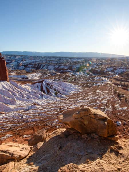
In the morning, I gazed out the window and smiled – three inches of snow fell overnight and just a few remnants of the previous night’s storm clouds drift across the sky. After coffee and a bowl of oatmeal, I pulled on my boots and headed out, intent on reaching the Hart’s Draw Canyonlands Overlook before the sun baked the fresh snow. I kicked and glided easily to the overlook where I took a moment to snap a few pictures and marveled at the juxtaposition of my wintery, high-alpine surroundings against the red rock desert below. I made the easy ski back over the ridgeline to my lodgings where I cleaned up, packed up and skied back to my car. There I made a quick change from ski clothes to hiking attire in preparation for the next leg of my solo adventure.
"In the morning, I gazed out the window and smiled – three inches of snow fell overnight and just a few remnants of the previous night’s storm clouds drift across the sky."
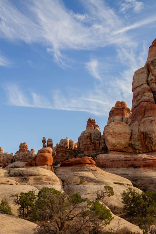
Needles District in Canyonlands National Park
Photo: Rosie Serago
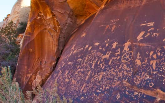
Newspaper Rock State Historic Monument
Photo: Matt Morgan
Red Rocks and Ranchers
Just over 14 miles north of Monticello along Highway 191, an enormous, beehive-like stone pinnacle fittingly marks the turn off onto state Route 211 — the route leading to the Indian Creek Recreation Area (which is within Bears Ears National Monument) and, beyond, to Canyonlands National Park.
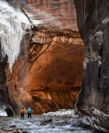
Though Indian Creek’s prolific splitter cracks — so-called for how they appear to vertically bisect the area’s ochre-hued cliffs — are scaled by rock climbers from around the world, the Indian Creek corridor holds plenty of appeal for the less-skilled explorer.
I descended Highway 211 into Indian Creek where I pulled into the parking lot at Newspaper Rock, a 200-square-foot Wingate sandstone wall covered by hundreds of figures carved in the stone more than 2,000 years ago. Again, mine is the only car in the parking lot while the temperature was about 15 degrees warmer there than it was up in the Abajos.
I spent some time poking around near the panel and then crossed the road to walk along the creek for a bit before returning to the still-empty parking area and continuing along my way.
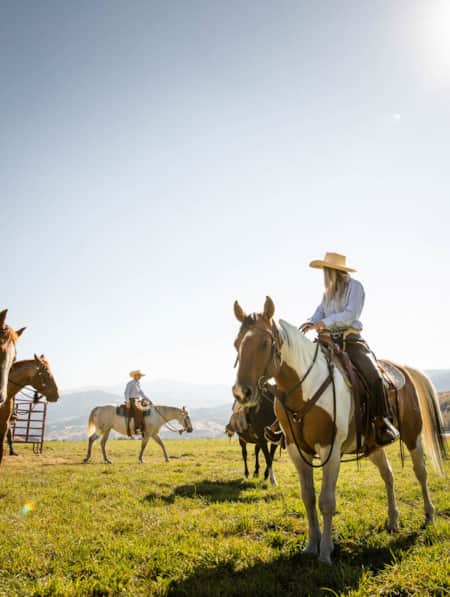
The landscape opened up as I approached Dugout Ranch, a private, working ranch owned by The Nature Conservancy. The landscape here is straight out of a Maynard Dixon painting (Read: A Detour Worth Taking: Viewing Art in the Maynard Dixon Landscape). And then, as if on cue, I turned a corner to see a pair of Stetson-clad men on horseback — and one razor-focused border collie — shepherding a small herd of cows and calves across the road. I gave one of the cowboys an enthusiastic wave as I passed, to which I received a courteous nod in return.
After driving about 15 more miles, I arrived at Canyonlands’ Needles District Visitor Center — and the end of Highway 211 (Read: Touring the Indian Creek Corridor Scenic Byway). This southwest corner of Canyonlands was named for the hundreds of spires dominating the landscape. Outside of the visitor center, I chatted with a ranger about nearby hikes. I chose the Cave Spring trail, an easy, hour-ish hike to a historic cowboy camp that required climbing two cool, old ladders. I also stopped at Roadside Ruin, a 10-minute walk to one of the park’s best-preserved ancient Puebloan ruins.
The golden hour set the landscape afire as I returned to the visitor center and made the drive back to Monticello. The cows I passed earlier in the day are still close to the road, but were now settled and paired securely behind the fence. A reassuring scene as I looked forward to a hot shower, meal and the return to my real life.
What's Nearby
-
Abajo Loop Scenic Backway
The 37-mile-long Abajo Loop, beginning north of Monticello, squiggles through the Abajo Mountains and then bends south in North Canyon. After passing Horsehead Peak, the narrow dirt road descends to Blanding. The scenic drive, open in summer and fall, is passable to most vehicles, but high clearance is recommended. Expect hiking trails, starry campsites and views to distant horizons.
-
Frontier Museum
The town of Monticello dates back to 1887, when ranchers and farmers first settled the area. Explore the town’s pioneer past by stepping into the free Frontier Museum next to the Southeast Utah Welcome Center on South Main Street. The museum, housed in an old barn, details how settlers dug irrigation ditches for fields of wheat, oats, and potatoes, and ran cattle on the sloping Great Sage Plain east of town.
-
Harts Draw Road
Harts Draw Road, Monticello’s best scenic drive, twists across the northern flank of the Abajo Mountains from the Welcome Center to state route 211. After 10 miles, the 43-mile road passes the Harts Draw-Canyonlands Overlook with spacious vistas of Shay Mountain, the La Sal Mountains, and the corrugated Needles District in Canyonlands National Park. Visit in the fall for the best views of golden groves of aspen that ignite the hillsides.
-
Newspaper Rock
Newspaper Rock, a State Historical Monument, whispers 2,000 years of silent stone stories carved into a dark sandstone panel in Indian Creek, a unit of Bears Ears National Monument. These petroglyphs, one of Utah’s largest and best-preserved sites, were created by Native Americans from the ancient Archaic and Fremont cultures to the historic Utes.
Discover More
-

6 Steps to a Family MTB Trip on Canyonlands' White Rim
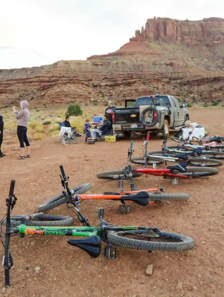
Want to take the family mountain biking on the White Rim Trail? Tackle 100 miles of biking and three days of backcountry camping in Canyonlands with the kids.
-
A Short Hike to Wilson Arch
Wilson Arch is an elegant sandstone feature that sits along Highway 191 south of Moab on BLM land. The short hike is free.
-
A Winter’s Desert: Visiting Southern Utah in the Slow Months
Experiencing the peace of canyon country in the winter is an attraction of its own.
-
Across a Snow-Covered Desert
Follow this itinerary for a week-long winter road trip across the snow-covered desert of Southeastern Utah.
-
AndShe’sDopeToo: Giving Roots To Adventure
Retreats and rendezvous where women find their footing outdoors and discover the unexpected.
-
Be Prepared for the Southern Utah Backcountry
Prepare for a trip out into Utah's rugged red rock backcountry by learning as much as possible about the area before heading out. Stop by a ranger station to educate yourself and pick up necessary permits. Always practice good backcountry ethics and proper safety techniques for a safe and enjoyable adventure.
-
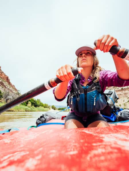
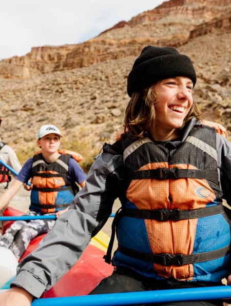
Bridesmaids Gone Boating
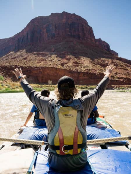
If you and your bride tribe are more outdoorsy than indoorsy, consider booking a whitewater rafting trip in southern Utah instead of club night at a casino. Half-day, full-day, and multi-day river trips are easy to plan and are great for groups of all sizes and abilities.
-
Dog-Friendly Utah: The Road to Mighty
Want to bring your furry friend on your next vacation? Utah is home to several great dog-friendly national parks and other fun destinations. Check it out and plan your trip!
-
Filmed in Utah: 7 Itineraries Through Hollywood's Most Iconic Settings
While Utah's striking scenery makes it a go-to for filmmakers, the state is equally a must-visit for road-trippers and outdoor adventurers. Here are a few film and television-themed trips and tips to consider for your Utah visit.
-
Find a Winter Refresh in a Utah State Park
The best Utah state parks will entice you with ice fishing, white sand and snow-dusted scenery. Take a winter break to refresh with a visit to a few of these places.
-
Fisher Towers River Rafting
Join Bob Wassom, and a few others, as they raft down the Fisher Towers stretch of water disproving any idea or stereotype suggesting disabilities hinder outdoor recreation.
-
How to Slow Travel in Utah
Avoid the mad scramble and consider slow travel as a better approach to your Utah trip.
-
It’s About Time We All Unplugged
In Utah, you can find far-flung places to reset, wellness resorts that promote digital detox, and destinations where you can swap screen time for much-needed adventure time.
-
See the Fall Leaves Near Utah's National Parks
Sure, any of Utah’s Mighty 5 national parks are spectacular year round — covered in snow, peppered with spring wildflowers, and baked in sunshine. But find them exponentially special when the changing fall leaves are in juxtaposition to the immaculate red rock cliffs.
-
Seven Must-Ride Mountain Biking Trails in Utah
To help you plan a Utah mountain biking trip, we've assembled a list of seven of Utah’s best mountain biking trails followed by a roundup of Utah’s best fat-tire destinations.
-
Soil Sleuth: Protecting Utah's Living Landscapes
Visit Utah writer Kristen Pope met Dr. Jayne Belnap, one of the world’s top experts on biological soil crusts, to learn about the importance of biocrusts to Utah's desert landscapes, and how to protect them.
-
Supporting Women Entrepreneurs While Traveling in Utah
Women entrepreneurs in Utah have been particularly successful at honing their expertise. Find out about women-owned businesses you can support while adventuring in Utah.
-
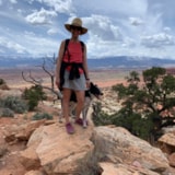
The Freedom of Wild Places
Clutching my hat with both hands, the wind roared and whipped by as I stood atop a rugged red rock formation, gazing out into the vastness of The Needles district of Canyonlands National Park.
-
Touring Utah with the State’s Most Well Known Women Writers
The diversity and beauty found in Utah has often been captured by women. Here are the places that seven of Utah’s most well known women writers knew and loved most.
-
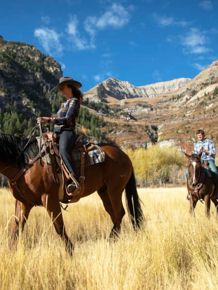
Utah’s Best Western Ranch Resorts
From five-star mountain luxury and whiskey tastings to rugged canyon hideaways, find your perfect Wild West escape.
-
Walking The Line Between Risk and Responsibility
Why a Hawaii-based highliner and influencer hasn't returned to Utah — yet.
-
Why Your Kids Need a Utah Trip
Discover where adventure and learning converge across iconic rivers and ancient canyons.
-
Winter in Southeastern Utah: Arches and Canyonlands
Want to avoid the Utah national park crowds? Plan a winter Southeastern Utah trip. Experience more peace, quiet and solitude.
-
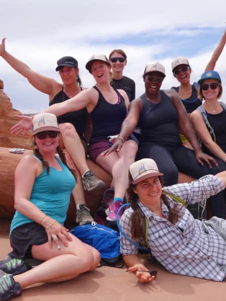
Women in the Wild: Transformation and the Outdoors
Paula Colman joins a weekend retreat for women in Moab, Utah, that has an eye-catching mission: Build your tribe. Connect with your inner spirit. Transform body, mind and spirit around the theme: “Ignite the Flame Within.” Follow along as she seeks her authentic self and learn how to find your own Tribe.
-
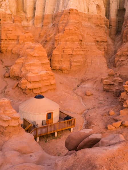
Yurt Camping in Utah: How To Have a Wintertime Yurt Excursion
Whether you’re glamping or choosing a simpler option, yurt camping in Utah during the wintertime is a fun, unique experience you won’t want to miss out on.