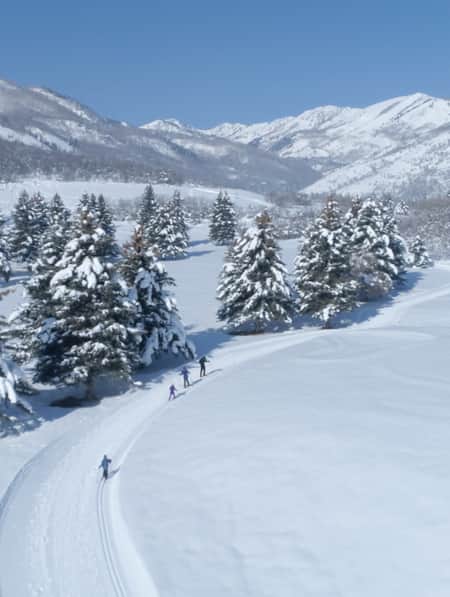
A First-ever Camping Trip on BLM Lands
Putting our fears aside, we tried something new. And… loved it (gasp).

Approximately 380 days ago, I happily moved to Utah after growing up in the eastern United States. I migrated from the rolling hills of Dolly Parton’s homeland to the rocky mountains and canyons of Butch Cassidy’s hide-outs. With this move came quite a bit of newness: cultures, landscapes, dinosaurs (dead, of course), salt, snow (growing on me), desert heat (big fan), desert plants, and best of all, the outdoor playground of my dreams.
The opportunities Utah provides you/me/us to be wild, to be engulfed in the limitlessness of wilderness, are unending. Marinate a moment on the beauty of the West, the rarity of Utah.
In trying to fully embrace this outdoor playground, I started researching public lands, the lands managed by the Bureau of Land Management (BLM), and furthermore, recreating within them. Here, there are miles and miles, ocean-widths, of federally managed lands for us to respectfully explore. I don’t take for granted what a gift this is. Though for me and my new-to-Utah-ness, it felt like a daunting gift.
Eventually, the time was right. My husband, Andrew and I decided to seize the opportunity of being diligent in our research of recreating on public lands (what, when, where and how), pack up the car and play where the deer and the dinosaurs roam(ed) in Vernal, Utah. Our first-ever camping trip on BLM lands awaits, sprinkled with some recreating, as well as enjoying local businesses in the Vernal-area as much as possible along the way.
Photo: Sara Hobbs
Day One
Morning
After arriving in Vernal from our Salt Lake City trek (a 3 hour drive), first-thing-first, the foods! We could have purchased our groceries in Salt Lake, but recently I’ve learned the value of supporting the communities you visit. We decided to purchase our groceries in town to give some extra love to Vernal.
With groceries in tow, Andrew and I drove down Vernal’s Main Street, soaking up the charm and admiring the town’s ability to preserve it. History. Essence. Structure. All of it. Just as our hungriness evolved into hangriness, we sat down for lunch at the Dinosaur Brew Haus. This place, perfect for a vibing Friday night hangout, means business about its burgers. The juicy burgers made me a jolly Sara.

Photo: Sara Hobbs
Early-afternoon
More than satisfied, and more than ready to figure out this public land phenomenon, we rushed to pick up bike rentals from a local shop, Grail Cycle and Skate. This was one of those moments where you plan to just walk in, swipe a card and walk out with your rental in hand, but we found a little more. One of the owners, Josh, gave us fruitful conversation, tips for the trail, some common ground and a tune up for our bike. We left pumped for our late afternoon ride, as well as excited to brand our water bottles with our free stickers Josh gifted us to represent the shop.
We made one final, important stop to the BLM’s Vernal Field Office (VFO) before heading to our campsite, which was conveniently closeby. In the few months prior to our trip, I spoke over the phone with Amber Koski, assistant field office manager, a few times about being newbies in recreating on public lands, asked for tips and recommendations on where to camp and so on. Her suggestions were gems. You can read many of her suggestions, as well as additional tips, in How-to Camp on BLM Land.
At VFO, post-introduction, the team was excited for our trip and happy we decided to stop by for more information. Rene Arce, chief of recreation and heritage resources, overflowed with helpful advice, such as fire restrictions, BLM land management terminology and explanations, georeferenced mapping applications (such as Avenza) that scans QR codes printed on many of the office’s maps and opens a map that can be used offline, a reinforcement of the great need for water in the desert and some of his favorite local restaurants to try along our way. He also shook up our “day two” itinerary in the best of ways; we would now be camping in a different location for our second night.

Photo: Sara Hobbs
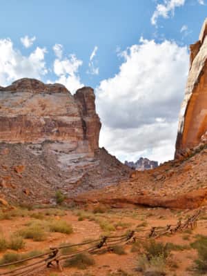
Late-afternoon
Onward. To the campsite! At this point, I am exploding with curiosity. I’ve looked at this location a thousand times on Google Earth, done my exhaustive amount of research and here we are. Doing it.
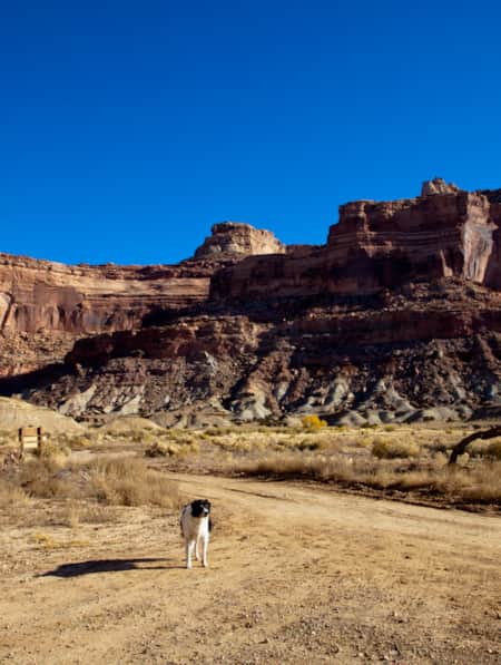
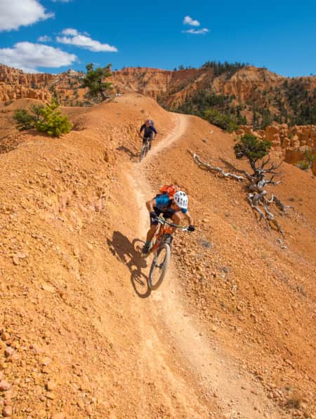
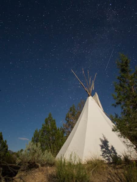
We arrived at McCoy Flats Trailhead, a trail system created and managed by BLM. Our plan was to camp just off the road (yes, the road!) near the trailhead and bike one or two of the trails. As we drove a little past the trailhead in search of a pre-existing fire ring and previously camped location (matted grasses and well-trafficked dirt from former travelers is usually obvious), we found the spot. If possible, we wanted to limit our impact on our surroundings and camp where someone else had too. Success. In addition to the solitude, the being-in-the-middle-of-nowhere thing and the surrounding rolling hills and mesas, one of the best parts was the free part. Twenty-ish minutes later, our tent was up and we were on our bikes ready to recreate.
The McCoy Flats Trailhead offers 35 miles of interconnecting loops for riders of all skill levels. We’re unashamedly beginners, rode the “easy” trails and loved it. We completed the linked trails, Combo (two miles) and Milk and Cookies Loop (5.8 miles). After the ride, the sun was no longer welcome by our famished selves, but there’s a sheltered, shaded area with picnic tables at the trailhead that beckoned a post-ride sit and follow-up. As soon as our stomachs quietly thundered for some local eats, we agreed we were happy to oblige.
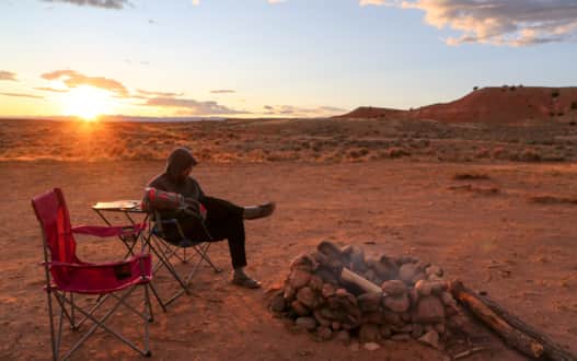
Photo: Sara Hobbs
Evening
Our dinner was served in town at Plaza Mexicana. At least 98% of the people we chatted with earlier in the day recommended this place for eats. We would’ve been crazy not to try it. Do we regret it? Nope. The colorful and uniquely decorated plaza won our hearts with massive servings and got a silent, “We’ll be back” from our satisfied selves as we walked out the door.
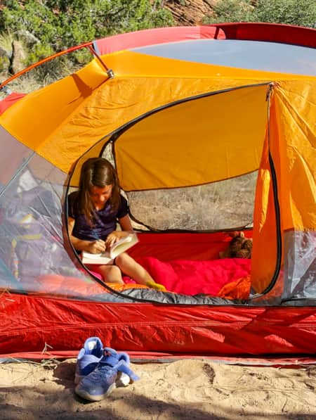
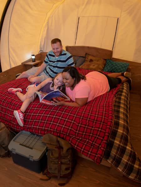
After a short drive back to our place of peace, our campsite, we made a small campfire for s’mores and warmth, cozied up, and read our books, while savoring the tail-end of golden hour. Oh, did I mention there wasn’t another person in sight? Yeah, I’m more-than-liking this kind of camping. The sun sets, and next, Zzzzz.
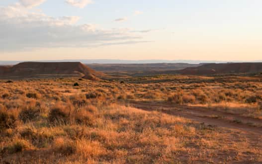
Photo: Sara Hobbs
Day Two
Morning
With a sunrise wake up call, we packed up camp and mozied back into town for some more recommended local eats at Betty’s Cafe. My husband and I are small-town, born and raised kind of people and so Betty’s was the perfect start to our morning. One “Howdy there!,” exchange of small talk, a cowboy hat, a few regular customers with no need to remind the server of their order, plus fresh, strong coffee, plate-sized pancakes, bacon, eggs, biscuits and jam are just a few highlights from our meal. The only thing I didn’t like about Betty’s is I don’t get to eat there every Saturday morning, practically speaking.

Photo: Sara Hobbs
Early-afternoon
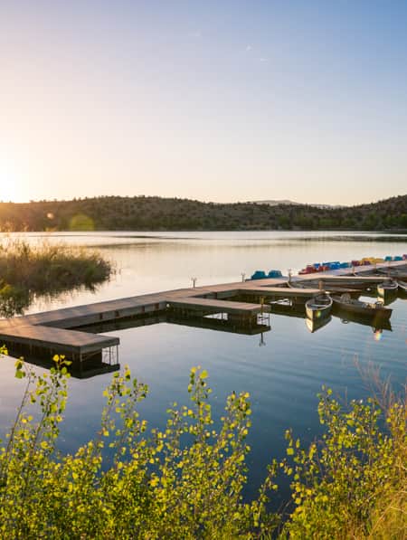
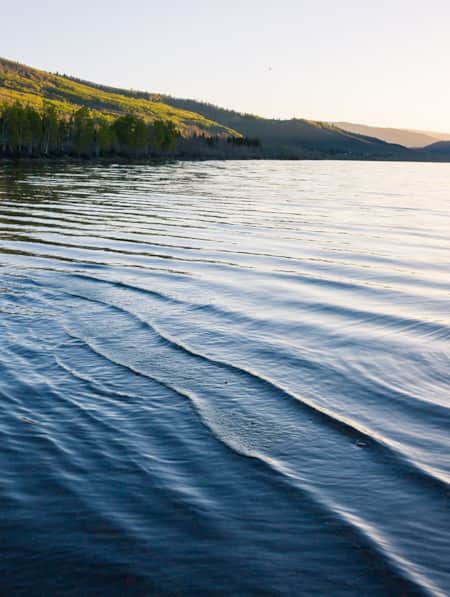
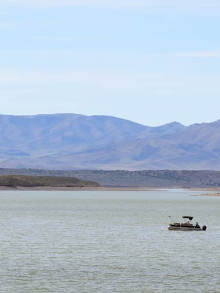
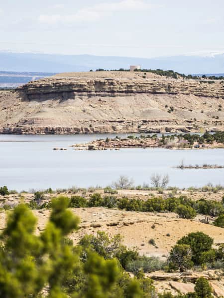
Our scenic drive out of town headed toward Red Fleet State Park was slow, but the good kind of slow. As I read various signs along the road explaining what prehistoric creatures walked, stomped or swam across this landscape, I thought “OK. You got me, Vernal. This is a special place.” At Red Fleet, a less-populated, just as beautiful and smaller version of Lake Powell, we rented a kayak for two right on-site and set off in the reservoir.
About an hour passed on the water and our arms were ready for a rest; we pulled our kayak onto the bank of a large, red rock, known as the reservoir’s Dinosaur Trackway. If you don’t have access to a kayak (or a boat of some kind), you can also reach this location via hike. (Read: "Following the Dinosaur Tracks of Red Fleet State Park"). On the rock, there was a sign educating us of the legitimate dinosaur fossils all around us. Oh my gosh-aurus?! Andrew was oddly calm about the tracks; that’s his nature about most things, but I think it’s safe to say, I fangirled over some fossil feet. As I placed my hand atop where a dinosaur once stood, breathed and ruled, I paused. This moment, forever unforgotten.
Following our discovery, I had many questions about the tracks, dinosaur’s existence and extinction, theories and so on to ask Andrew back in the kayak. As a history buff, teacher and great explainer of all things, he overflowed with knowledge. The conversations continued to the car and down the road headed to McConkie Ranch.

Photo: Sara Hobbs
Late-afternoon
Our curiosity of the past didn’t end with the dinosaurs, but continued on with peering into the painted stories of the native peoples of Utah. The McConkie Ranch Petroglyphs (also known as Dry Fork Canyon Petroglyphs), were an easter egg on our trip. These petroglyphs are located on private land, but are open to the public. The accessible and well preserved panels cover 200 feet of cliff face and my husband and I delighted in the mystery of their interpretation. This was my first time seeing ancient panels. Another moment, forever unforgotten.
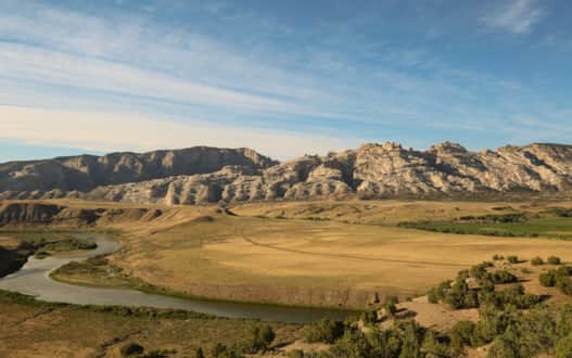
Photo: Sara Hobbs
Evening
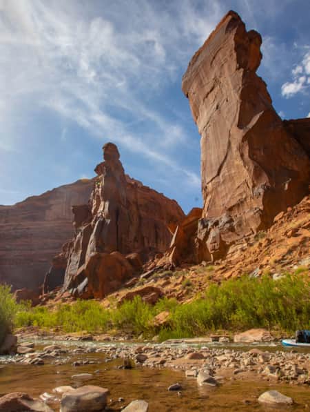
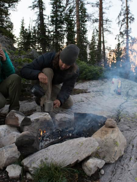
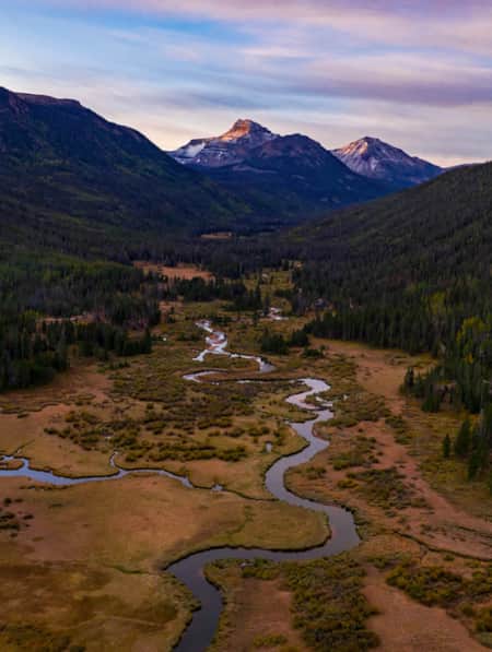
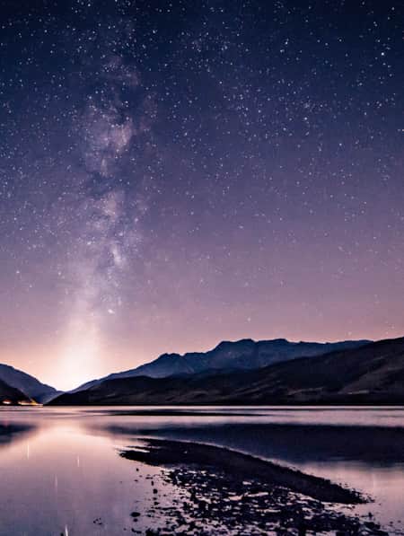
Camping on BLM land, take-two, awaits in Jensen. To get there, we headed twenty minutes east of Vernal, on US-40, crossed the bridge (covering the Green River), and took the first left onto Escalante Ranch Road. This road led into acres of isolated BLM land. Andrew and I drove about 3 miles in before we found our spot overlooking the Green River corridor and looking up into Split Mountain and beyond. (Watch: "Guided Rafting Through the Gates of Lodore"). Beauty, incomparable. We saw one guy nearby and respectfully set up camp two-ish miles away. We figured that was far enough (ha). The joy of open space was on display — the complete solitude of public lands.
After a day full of new perspectives and learnings, I had one timeless lesson to reflect on: When camping, make sure your fire is completely extinguished. As we prepared for bed, we poured water over the logs and kicked dirt over the embers. Shortly after, we noticed the wind caused the fire to re-light. When camping, make sure you stay aware and take fire safety seriously as part of doing your part to protect these beautiful places and keep all inhabitants and visitors safe. That's the Utah Forever way.

Photo: Sara Hobbs
Day Three
Morning
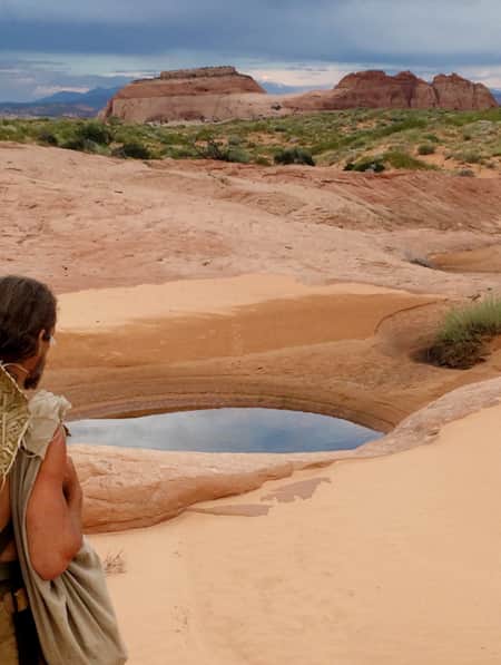
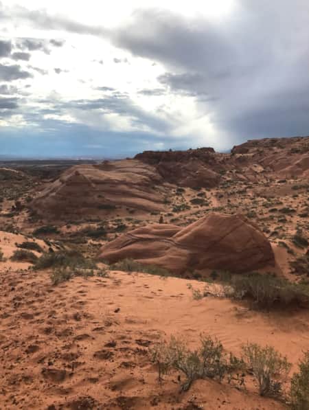
For our final hurrah, we visited Fantasy Canyon. Managed by BLM, this unique and incredibly isolated 10 acre long canyon consists of fantastical, delicate erosional features. The land managers encourage travelers to interact with the canyon’s composition (sandstone, siltstone and shale) as though walking through nature’s china shop, so, very carefully. As we studied the unique aspects of the canyon, we let our minds imagine what shapes and scenes played out before us, from a witch’s head with her warty long nose, to a dog with its tongue out, panting for water. Our actions resembled a childhood game of looking for shapes in the clouds. It never feels wrong to feel like a kid again.
Eventually the desert heat took its toll on us, so we gently said goodbye to the canyon of fantasies and decided to take the long way back to Salt Lake and cut through Ouray National Wildlife Refuge. If you look at a map, you’ll realize this trajectory of ours wasn’t the most efficient in regards of time, but we were in no hurry, and seeing any landscape twice was no mistake.

Photo: Sara Hobbs
Early-afternoon
As we passed back through Vernal, we grabbed lunch at Vernal Brewing Company. This craft beer brewery and gastropub, serves up comfort food and local favorites. As I engulfed my quite-comforting burger at our outdoor garden-side table, I learned that the healthy greens growing next to me were the brewery’s own organic garden, where it grows vegetables for its kitchen and hops for the brewery. If you’re a fun-fact kind of person, all of the brewery’s spent grain, the barley left over after brewing, is used to feed local livestock. Neat place, eh?
After lunch and our long and scenic detour, we turned into the Ouray National Wildlife Refuge, which lies along the Green River in the Uinta Basin. The refuge was established as a sanctuary for migratory birds, but now displays a beautiful variety of habitats and wildlife thriving under its management. As we drove the road-side tour, I decided that if I was a bird, I’d migrate here.

Photo: Sara Hobbs
Late-afternoon
At no surprise, the drive back to Salt Lake was filled with ponder. Andrew and I tried something new — something daunting –– and gained the confidence we needed to try it again. There is no shame in beginning. And today, and everyday, I urge thee to recreate and celebrate the art of doing something new.
Try camping on BLM lands, check!
Note: Because of the timing of this trip (July 2020) we decided to eat at more local restaurants than usual on a camping trip to support the Vernal community. As part of our world’s COVID-19 story, we’ve learned to come together, give when able and to lean into the motto, “A little goes a long way.”
How to Camp on Utah’s BLM Lands
Read these insights and tips gathered from a novice’s first-ever camping trip on BLM and public lands to gain the confidence you need to recreate happily and respectfully on Utah’s public lands.
Discover More
-

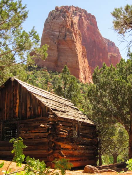
A Visitor's Guide to Zion's Kolob Canyons
In the Kolob Canyons section of Zion National Park, you’ll find a scenic wonderland with an adventure for everyone. Learn more about this unforgettable attraction and plan a visit.
-
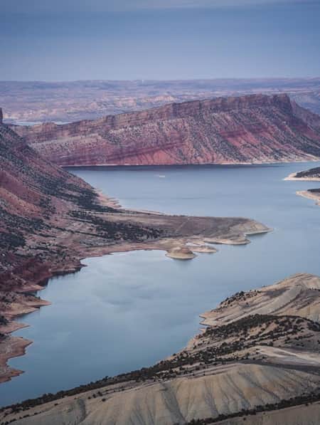
An Old Favorite Fishing Hole at the Flaming Gorge Reservoir
Visit Utah columnist Dan Potts takes us to his "secret" fishing hole on Utah's Flaming Gorge Reservoir, one of the world's most diverse fisheries set among the brilliant red rock walls of Red Canyon in the easternmost corner of the state. Along the way, Dan takes us through some of his favorite landscapes on the drive to and from Salt Lake City.
-
Backpacking in Canyonlands National Park
Canyonlands National Park offers a spectrum of backpacking opportunities — from short trips at designated backcountry campsites to longer, adventurous trips that require extensive planning and desert canyon navigational knowledge.
-
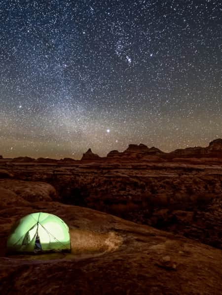
Backpacking the High Uintas Wilderness [VIDEO]
Field notes — plus a short film — on backpacking the High Uintas Wilderness. Pursue solitude, extended moments of introspection, cutthroat trout and the Milky Way.
-
Dog-Friendly Utah: The Road to Mighty
Want to bring your furry friend on your next vacation? Utah is home to several great dog-friendly national parks and other fun destinations. Check it out and plan your trip!
-
Enjoying the Simple Pleasures of Lake Life on Palisade Reservoir
Utah’s beautiful Palisade Reservoir is an oasis of serene water in the central part of the state, a perfect getaway for paddling, fishing, swimming and camping.
-
Escalante River Canyon Trail
Located in the Grand Staircase-Escalante National Monument, the Escalante River Canyon river trail winds and knots its way east and south.
-
Exploring Utah's Little Sahara
Little Sahara Recreation Area is an unforgettable destination for sand dunes in Utah and ATV, camping, hiking, and sand-boarding enthusiasts.
-
Field Notes: Backpacking With Children
Author Tim Sullivan shares his tips and tricks on backpacking with his young children.
-
Find a Winter Refresh in a Utah State Park
The best Utah state parks will entice you with ice fishing, white sand and snow-dusted scenery. Take a winter break to refresh with a visit to a few of these places.
-
Fishing Fish Lake
The largest natural mountain lake in Utah, Fish Lake sits at more than 8,800 feet of elevation, which makes for pleasant weather all summer long. Located near Richfield, Utah, the lake has everything you need for a relaxing summer getaway.
-
How to Backcountry Camp Responsibly
Four tips on how to camp more thoughtfully and responsibly in Utah's backcountry.
-
How to Camp on Utah’s BLM Lands
Read these insights and tips gathered from a novice’s first-ever camping trip on BLM and public lands to gain the confidence you need to recreate happily and respectfully on Utah’s public lands.
-
How to Take a Kayak & Camping Trip at Yuba State Park
Pristine sandy beaches, warm water temperatures all summer long and serene mountain views make Yuba State Park an appealing destination for campers and kayakers in sunny Central Utah.
-
How to Visit Utah’s Most-Visited Forest
The Wasatch Front mountain range offers endless amounts of recreational activity. Learning how to visit responsibly will enhance your overall experience.
-
Knobby Tired Nomads: Bikepacking the Utah High Country
If you’re into bikepacking, Utah is a place you’ll want to check out. Read about a self-supported tour of Utah’s backcountry here, and start planning your trip.
-
Like a BOSS (Boulder Outdoor Survival School)
Have a couple of weeks? Learn to survive in the wild. Hard work? Most definitely. Sign up for challenging survival education Utah's great outdoors.
-
Looking Up: Dark Skies of Heber Valley
A trio of state parks in Heber Valley offer stellar views of the Utah night sky. Come stargaze here.
-
Meet the Fremonts: Unearthing an Ancient Civilization
Did you know that interstate highway construction created Fremont Indian State Park? Visit the park and Museum for a peek into Utah’s past, plus hiking and ATV trails.
-
The Return to Robbers Roost
Are you intrigued by the old American West legend involving Robbers Roost? Want to find an alleged hideout of the infamous Butch Cassidy and Gang? Explore Utah.
-
The Story of Starvation Reservoir
Sprawling waters and local legends at Fred Hayes State Park at Starvation.
-
Utah’s Scenery Offers A Backdrop for Inclusive Family Camping
While Utah is known for its amazing outdoors, it also has resources that ensure that families and individuals of all abilities can access these places.
-
Walking The Line Between Risk and Responsibility
Why a Hawaii-based highliner and influencer hasn't returned to Utah — yet.
-
Wild Heber: Close-to-Home Adventure
Just 45 minutes from Salt Lake City, Heber Valley’s state parks and national forest lands offer a world of adventure. Hike, bike, camp, kayak, watch wildlife and reel in blue-ribbon trout while learning about nature and how to protect it.
-
Women in the Wild: Transformation and the Outdoors
Paula Colman joins a weekend retreat for women in Moab, Utah, that has an eye-catching mission: Build your tribe. Connect with your inner spirit. Transform body, mind and spirit around the theme: “Ignite the Flame Within.” Follow along as she seeks her authentic self and learn how to find your own Tribe.