Chasing John Wesley Powell: 6 Places to Explore Utah's Green and Colorado Rivers

One hundred and fifty years ago in, May, 1869, a one-armed Civil War veteran set off with nine mountain men on a scientific expedition to map one of the last blank spaces left on the U.S. map: The Green and Colorado Rivers through what would become known as the Grand Canyon.
John Wesley Powell’s 1,000-mile, three-month adventure, officially called the Powell Geographic Expedition, started in Wyoming and ended in Arizona. But the heart of it went through Utah and its jaw-dropping wilderness — through what would become Flaming Gorge National Recreation Area, Dinosaur National Monument, Canyonlands National Park and Lake Powell.
Certainly, some of the scenery and route has changed since the May 24, 1869, trip (which Powell repeated in 1871): dams were built, altering the rivers and flooding the canyons he explored. But much of the route remains protected, ensuring a rugged and wild adventure for those following in Powell’s wake.
Here are key segments of his trip and what they offer today:
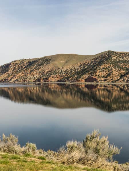
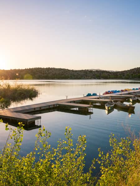
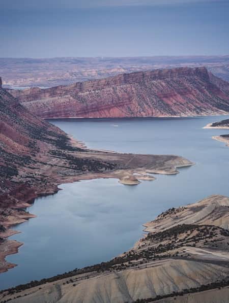
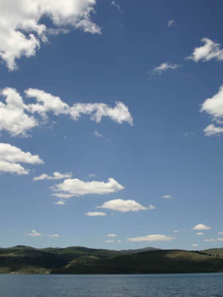
Flaming Gorge National Recreation Area
This national recreation area’s famed crystal-clear, trout-stuffed water and year-round destination for everything from boating to snowmobiling earned its name from Powell and his men.
They entered modern-day Utah about 60 miles and three days after they put in. Wowed by the reflection of the sun off the brilliant red gorge that looked like it was aflame from a distance, they called the canyon Flaming Gorge.
Today, canyons near that famed gorge — including Horseshoe, Kingfisher, Hideout and Red look much the same as in pre-dam days.
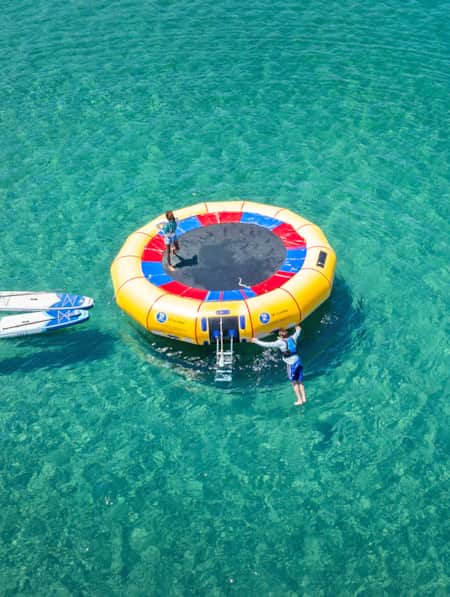
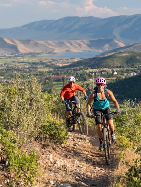
With its 375 miles of shoreline, more than 600 camping and picnic sites and 100 miles of trails for hiking and mountain biking, the reservoir and surrounding recreation area provide an endless number of activities: paddleboarding, kayaking, scuba diving, waterskiing, backpacking, cross-country skiing.
Below the dam to Little Hole, the Green River is called “The Aquarium” with its earned reputation as a premier trout fishing stream. The 7-mile Little Hole National Recreation Trail parallels the river and provides access for fly-fishing and hiking.
Lodore Canyon
This was the first major canyon of the expedition and it proved challenging: One of the boats was lost along with 2,000 pounds of equipment and food. Someone on the trip also named the canyon Lodore, perhaps after an Englishman’s poem.
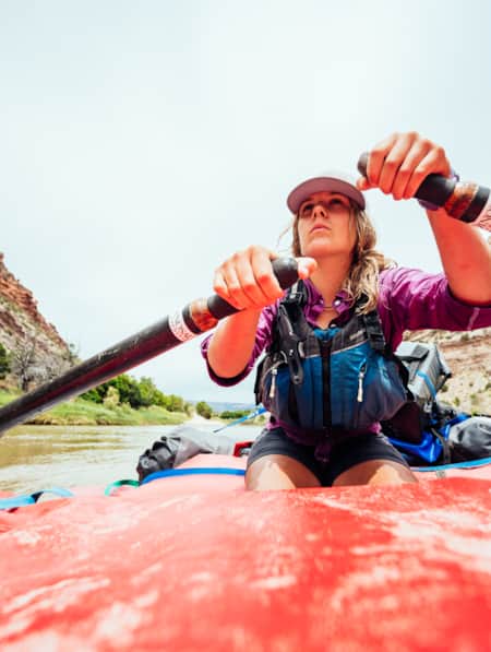
This portion of the Green River through the Dinosaur National Monument area offers what some river rats consider the best trip along the Powell route. (Read: Remote Adventure on the Green River.) The river is different because the flows are regulated by Flaming Gorge Dam, which allows a longer river season. Still, the views remain much the same, since access to most of the surrounding land is gained only by the river and permits are limited.
The Gates of Lodore provides a striking entrance to the canyon, as blood-red sandstone walls rise abruptly from the water. A river trip also features Echo Park, where the Green meets the free-flowing Yampa River at the face of the massive Steamboat Rock, along with side trips to petroglyphs.
Dinosaur National Monument protects the river and surrounding area and offers opportunities to learn about the giant reptiles that used to call this place home.
"As Ashley and his party were wrecked here, and as we have lost one of our boats, we adopt the name Disaster Falls for the scene of so much peril and loss."
– John Wesley Powell
Desolation Canyon
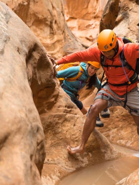
The Green River winds through this virtually untouched gorge for about 80 miles, carving the Tavaputs Plateau in half deeper in some spots than the Grand Canyon. The plateau is one of the largest roadless areas in the American west, ensuring the area is nearly as wild as it was in Powell’s day. (Read: Lost and Found in Desolation Canyon.)
The river boasts over 60 riffles and rapids with views of canyon walls deposited by long-ago streams and lakes, including the Lighthouse Rock perched on top of what looks like steps made for a giant, and Queen Nefertiti Rock named for its regal Egyptian appearance.
Paddlers love the canyon for its clean, sandy beaches near cottonwood groves. And there are plenty of hikes in side canyons — to Fremont rock art and a ranch where Butch Cassidy’s Wild Bunch slept.
BLM permits are required to float the 84 miles from Sand Wash to Swaseys Beach. Hiking and camping permits from the Ute Tribe are also required to access reservation land.
"...[T]he river is very rapid and many lateral canyons enter on either side....crags and tower-shaped peaks are seen everywhere, and away above them, long lines of broken cliffs; and above and beyond the cliffs are pine forests, of which we obtain occasional glimpses as we look up through a vista of rocks....We are minded to call this the Canyon of Desolation."
– John Wesley Powell
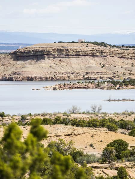
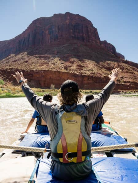
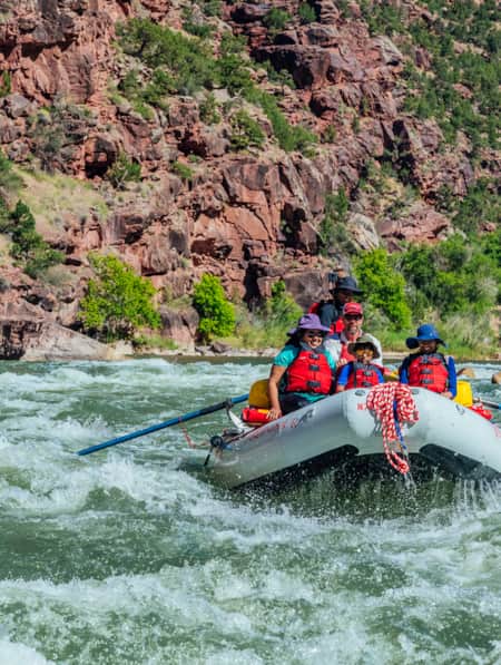
Cataract Canyon
This canyon sits 3 miles below where the Green and Colorado rivers meet (called the Confluence) — and it bedeviled the Powell crew. The rapids appeared so dangerous, the crew spent days portaging their boats past cataract after cataract.
Today, a large sign warns paddlers of “hazardous rapids” as they enter Cataract Canyon and the free-flowing Colorado River. Some 400 miles away from the dam that impounds the Green River and 180 miles from another on the Colorado, this segment of the river provides the most powerful white water in the country. It boasts 30 big rapids including The Big Drop, where the river drops over 30 feet in less than a mile.
Boaters and paddlers can get permits through Canyonlands National Park, which manages the canyon. Cataract itself is 14 miles, but river trips are usually about 48 miles, starting upstream on the Green or Colorado and ending on Lake Powell.
For those who don’t want to travel via river, there’s still plenty to do in the surrounding national park, from taking in breathtaking vistas in the park’s Island in the Sky district on its paved scenic drive, to hiking or four-wheeling in The Needles district, or serious backcountry trekking in the remote section called The Maze. The park’s day-use Horseshoe Canyon contains some of the most significant rock art in North America and is accessible via a 7-mile hike.
"God help the poor wretch that is caught in the canon during highwater."
– Jack Sumner, member of the Powell expedition
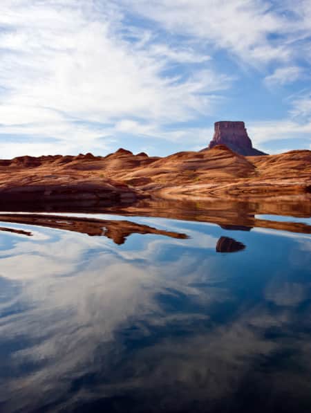
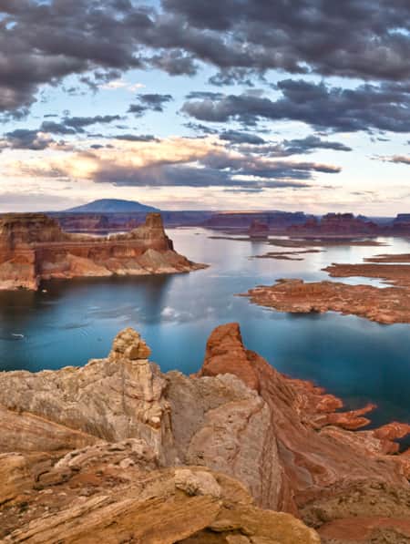
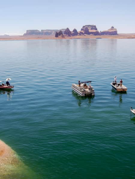
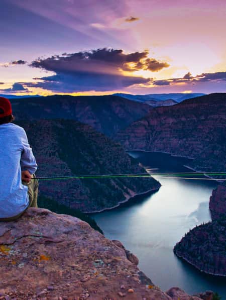
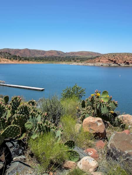
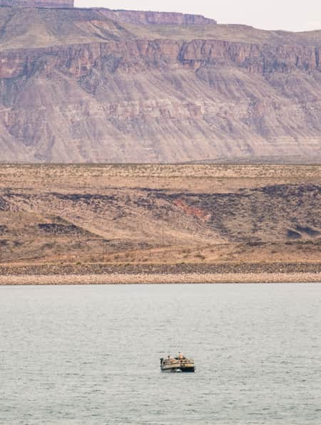
Lake Powell
Powell described Glen Canyon as a “land of beauty and glory” and named it for its many glens and alcoves near the river. About 100 years later, the canyon was flooded by the Glen Canyon Dam on the Colorado River, forming a lake named for the one-armed explorer.
With 2,000 miles of shoreline, Lake Powell offers up boating, kayaking and fishing galore against rugged red rock canyons and mesas.
For visitors seeking more solace than the lake’s annual 3 million visitors provide, the surrounding Glen Canyon National Recreation Area offers plenty of hikes including multi-day backpacking trips, as well as mountain biking.
And Rainbow Bridge National Monument, reached via boat or hike on the Navajo Nation by permit only, is one of the world’s largest natural bridges and is considered sacred by some American Indian tribes. It’s been labeled a Dark Sky Sanctuary for its out-of-this-world views (try counting 15,000 stars).
"We have met nothing to compare with it before."
– George Bradley, member of the Powell expedition
Grand Canyon
About 900 hundred miles and three months after they launched their boats, Powell and the crew reached what he later named the Grand Canyon. Launched from a base camp in Kanab, theirs was the first recorded passage of white men through the entirety of what Powell called “the great unknown,” though Grand Canyon has been inhabited for 12,000 years.
It was in Utah where Powell created the first preliminary map of the Grand Canyon region —in a tent in Kanab where he had set up a Colorado River Expeditions headquarters from 1870-1878.
Today, the canyon is one of the Seven Wonders of the World. It contains 277 miles of the Colorado River and is up to 18 miles wide. Most of the 5 million annual visitors come for the majestic views of its fantastic shapes and colors — red, buff, green, pink, slate and violet.
Those who venture below the rim can hike and camp in the backcountry (with permits), take a mule ride down to the bottom or raft part of the mighty river that carved the canyon 5 to 6 million years ago. Whitewater trips last from 3 days to 3 weeks.
"The limestone of this canyon is often polished, and makes a beautiful marble. Sometimes the rocks are of many colors — white, gray, pink and purple, with saffron hints."
– John Wesley Powell

Discover More
-

Get to Know Echo State Park
Situated at 5,560 feet above sea level, just north of Park City, lies Echo State Park. Watersports are king here, and whether you kayak, paddleboard, or boat, it’s a perfect place to get out on the water.
-
Flaming Gorge: Boating and Paddling Paradise
Do you know that Flaming Gorge is one of the best boating lakes in Utah? Read all about this stunning body of water and plan a trip!
-
The Story of Starvation Reservoir
Sprawling waters and local legends at Fred Hayes State Park at Starvation.
-
Kayak and Stand Up Paddleboard Lake Powell
Slip into the mighty Lake Powell with a personal, self-propelled watercraft and have a whole different experience than the boats flying down the lake.
-
How to Take a Kayak & Camping Trip at Yuba State Park
Pristine sandy beaches, warm water temperatures all summer long and serene mountain views make Yuba State Park an appealing destination for campers and kayakers in sunny Central Utah.
-
Enjoying the Simple Pleasures of Lake Life on Palisade Reservoir
Utah’s beautiful Palisade Reservoir is an oasis of serene water in the central part of the state, a perfect getaway for paddling, fishing, swimming and camping.
-
Lake Powell Trash Boat
Attention good samaritans: Sign up for the Trash Tracker, a houseboat on Lake Powell, and help clean up the debris that has collected on the lake’s shores.
-
How to Find a Guided Outdoors Experience
You might not be a pro climber, camper or explorer, but Utah’s diverse collection of outdoor guides has all of the expertise you need to have an adventure worth getting stoked about.
-
Lakeside Near Torrey: Three Ways
Take a trip to this trio of Capitol Reef-area reservoirs where you can swim, fish, kayak and cool-off.
-
Paddling the Caribbean-Blue Waters of Bear Lake
At nearly 6,000 feet of elevation, temperatures at Bear Lake stay cool in the summer, making the basin a welcome respite from the heat and a great destination to enjoy water sports in a serene mountain setting.
-
Wild Heber: Close-to-Home Adventure
Just 45 minutes from Salt Lake City, Heber Valley’s state parks and national forest lands offer a world of adventure. Hike, bike, camp, kayak, watch wildlife and reel in blue-ribbon trout while learning about nature and how to protect it.
-
An Old Favorite Fishing Hole at the Flaming Gorge Reservoir
Visit Utah columnist Dan Potts takes us to his "secret" fishing hole on Utah's Flaming Gorge Reservoir, one of the world's most diverse fisheries set among the brilliant red rock walls of Red Canyon in the easternmost corner of the state. Along the way, Dan takes us through some of his favorite landscapes on the drive to and from Salt Lake City.
-
Angling Secrets: How and Where to Catch Fish on Lake Powell
Read expect advice on when and where in Lake Powell to get the prized fish you're chasing.
-
Bear Lake Monster Winterfest
It all started decades ago with the “Cisco Disco” and has grown to include a polar plunge, chili cookoff and winter festival known as the Bear Lake Monster Winterfest.
-
The Most Scenic Trophy Trout Destination
Flaming Gorge, Utah is one of the world’s best places to fish for trout. Awe-inspiring scenery and abundant fish attract anglers from all over. Check it out!
-
6 Surprising Activities That Take Place at The Homestead Crater
From soaking to scuba diving, this hot spring has a lot to offer.
-
Fisher Towers River Rafting
Join Bob Wassom, and a few others, as they raft down the Fisher Towers stretch of water disproving any idea or stereotype suggesting disabilities hinder outdoor recreation.
-
Bridesmaids Gone Boating
If you and your bride tribe are more outdoorsy than indoorsy, consider booking a whitewater rafting trip in southern Utah instead of club night at a casino. Half-day, full-day, and multi-day river trips are easy to plan and are great for groups of all sizes and abilities.
-
5 Reasons to Hire a Guide to Run Utah’s Rivers
While we eat and splash in the river to escape the early morning heat, the four guides will wash the dishes, break down camp, load our bags on the rafts and discretely stow the toilet.
-
How to Slow Travel in Utah
Avoid the mad scramble and consider slow travel as a better approach to your Utah trip.
-
What to Wear on a River Rafting Trip
There are a variety of Utah river trips to be had, from rafting the Green River’s whitewater, to leisurely floating the Colorado. Here's your packing list.
-
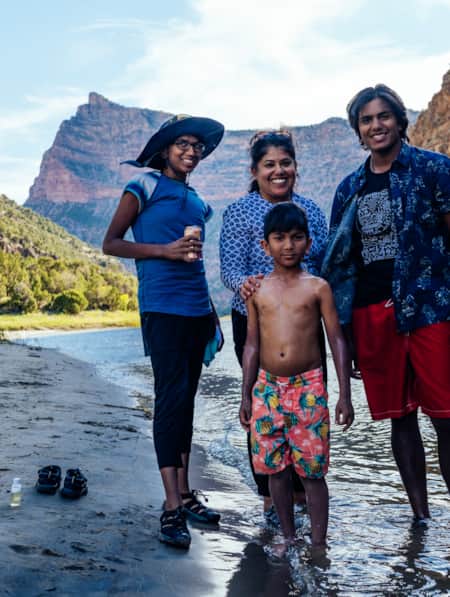
Two Trips, Two Worlds, Two Years Apart: Returning to Raft in Dinosaur National Monument
Nushin and her family of four returned to Utah's Dinosaurland for the "best four days ever!" of guided rafting on the Green River. Explore their journey today!
-
Paddle Among Red Rocks and Waterfalls at Gunlock Reservoir State Park
Pack up your gear and head out to Gunlock Reservoir near St. George. Bring your SUP, kayaks, jet skis and power boats for a day full of watersport excitement.
-
Panguitch Lake's Literal "Big Fish"
People have been traveling to fish at Panguitch Lake for a long time. Legend has it this popular high mountain fishery in Southern Utah was named by the Paiute people who once frequented the area and it translates to mean “big fish.”
-
How to Have the Perfect Weekend on the Water at Quail Creek State Park
Just 15 miles north of St. George and even closer to the town of Hurricane, Quail Creek State Park offers warm water and mild weather year round. There’s plenty to do out on the water, and the gorgeous setting is sure to impress.