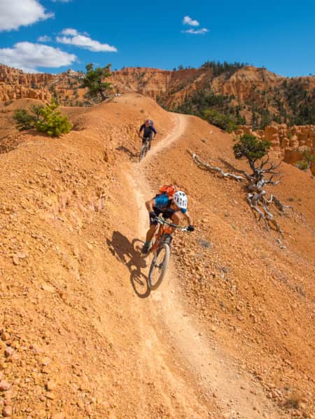
Mission to Mars: Riding Gooseberry Mesa
Nestled between Zion National Park and Hurricane in Southern Utah, Gooseberry Mesa is an absolute classic mountain biking trail. Sweeping desert vistas and fun slickrock singletrack make this trail a must-do for riders who love varietal terrain. Good times are in store for riders regardless of which loop they choose
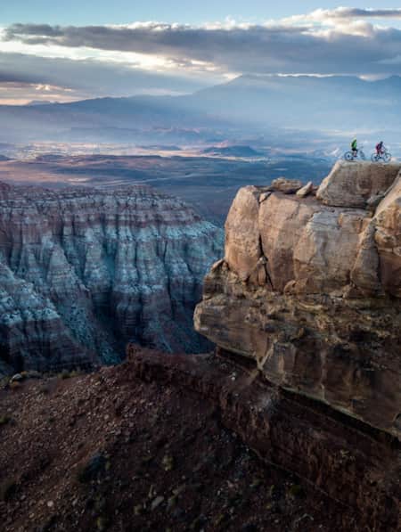
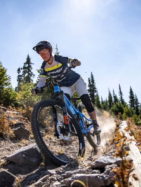
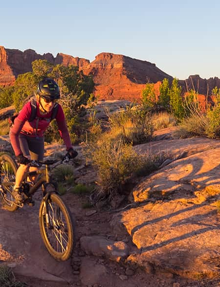
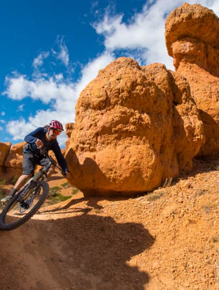
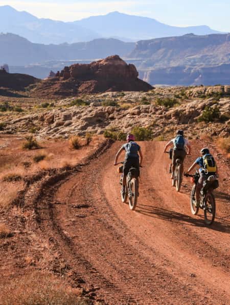
View from the North Rim Trail.
Photo: Sandra Salvas
We may as well have been on Mars. Far away from any semblance of civilization and surrounded by a seemingly endless horizon of dramatic desert landscape, we had the place to ourselves. Is there anything so liberating as escaping the masses to quietly commune with nature in a vast expanse of stunningly beautiful desolate terrain? Granted, it was a Wednesday afternoon in the middle of July with temperatures soaring into the triple digits, but still. We were there to take a tour of the legendary Gooseberry Mesa mountain biking trail system near Hurricane, Utah.
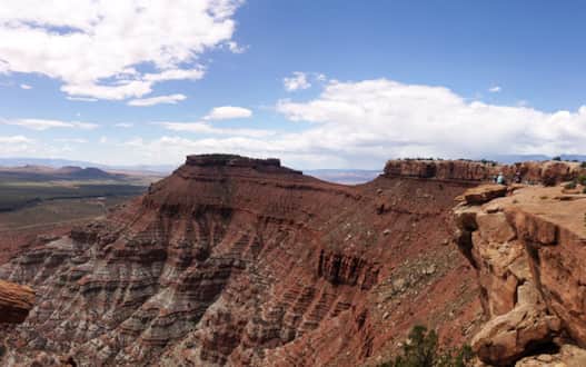
Let’s set our stage: Massive exposed shelves reveal 240 million years of erosion and a departed ocean that left shoreline deposits and formed the hardened Shinarump conglomerate, which formed the cap of Gooseberry Mesa. Rising further, the bygone forest left behind petrified wood, which can be found lying on the mesa surface. Wavy bands of red sandstone mold the Moenkopi Formation that experienced riders familiarly know as slickrock. Swirls of piñons and junipers pepper the trails, while California condors circle above. A cottontail rabbit darts across the path. We peer closely at the rock as we spin by to see the sunbathing lizards. Stop for a quiet rest, a deer might make an appearance. Mind the cacti. Crashing is even less fun if you land in the prickly Claret Cup Cactus.
Crashing? It’s possible. These trails are not for everyone, as most are considered intermediate to advanced level riding.
"Far away from any semblance of civilization and surrounded by a seemingly endless horizon of dramatic desert landscape..."
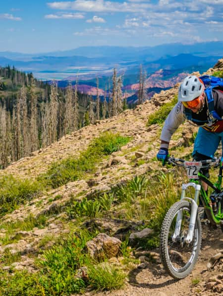
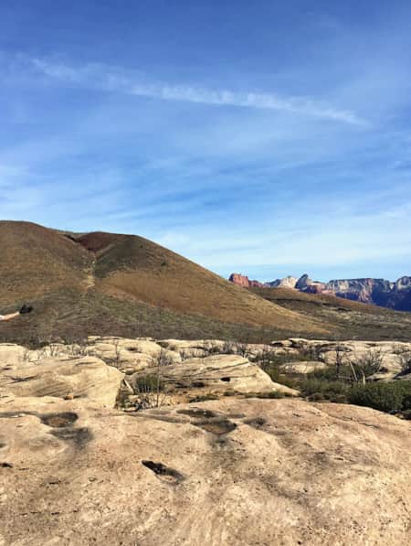
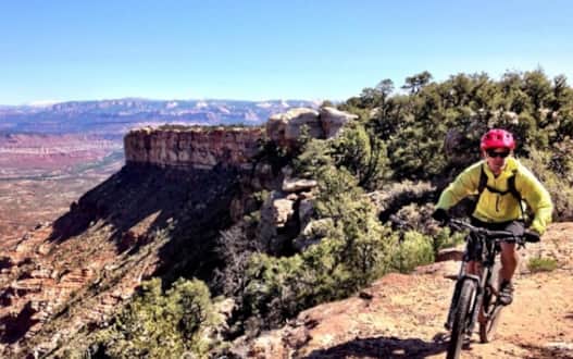
View from the point, start of the South Rim trail.
This is a first-rate, looping trail system that allows for a variety of course options. If you ride the entire Big Loop Trail counterclockwise, you’ll complete just over 13 miles of intermediate and advanced technical riding connecting both the North Rim and South Rim sections. Alternatively, you can choose your own adventure by riding a combination of the trails to customize your mileage and difficulty preferences. Although both the Point and Overlook vantage points are out-and-back trails, they are absolutely worth the extra effort.
The trails are marked fairly well and easy to follow in most places, but cairns can always be missed. Some of the routes are marked with white paint spots to designate the trail. However, because you can ride in either direction, it’s important to use your navigational skills because it’s too easy to get turned around and the trailscapes can start to look homogenous real quick if you get lost.
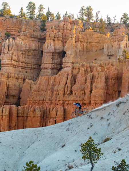
The summer's mid-day heat made each pedal rotation a little more work, but the cache of Gooseberry Mesa is that it features roller coaster slickrock singletrack grandeur in lieu of lengthy ascents and descents, allowing riders to whistle while they work. The South Rim and Hidden Canyon loop is considered advanced technical and inspires a few come-to-Jesus moments along the way. Good thing it’s always an option to hop off your bike and walk the iffy sections that are close to the cliff side. The 1.8-mile North Rim is more suitable for intermediate riders and features short, steep climbs with no shortage of jaw-dropping vistas.
If you’re unsure of your ability, have a go at the moderate Practice Trail. It will give you a good idea of what’s in store. It’s also a great warm-up for the longer trails. Overall, no matter which trail you choose, Gooseberry Mesa is a classic trail that will reward you with epic views and darn good fun. Add it to your itinerary if you plan to ride in the area!

Discover More
-

3 Utah Bikepacking Routes for Beginners to Intermediates
Find a route for your next Utah bikepacking trip that promises immersion in history, culture and ridiculous scenic beauty.
-
6 Steps to a Family MTB Trip on Canyonlands' White Rim
Want to take the family mountain biking on the White Rim Trail? Tackle 100 miles of biking and three days of backcountry camping in Canyonlands with the kids.
-
A Family Bike Tour of Salt Lake’s East Canyon
East Canyon has always been a path for travelers, from the Donner Party to Brigham Young to the Pony Express. In this modern-day tale of travel, a family of three takes on East Canyon by bicycle for a weekend camping trip. They discover historical markers, swimming spots, and lots of ice cream.
-
A Guided Ride on the Rolling Slickrock of Gooseberry Mesa
Utah resident and tour guide Katharina Merchant shares her "backyard" mountain biking
-
A High Elevation Southern Utah Mountain Bike Adventure
Mountain biking in Southern Utah usually inspires visions of red rock destinations such as Moab and St. George. But as the heat of summer kicks in and the triple digit temps become more frequent, heading south to ride may seem out of reach. Fear not my friend, as there are some riding destinations within Southern Utah, where the elevation will keep you cool.
-
A Local’s Guide to Logan: Northern Utah’s Outdoor Adventure College Town
Logan is teeming with some of the best arts, food and outdoor adventure opportunities in the state. Whether you’re passing through or just looking for new places to explore, here are some of the best ways to experience Logan.
-
A Quick and Dirty Guide to Brian Head Area Mountain Biking
Whether you’re visiting the area for Brian Head’s seemingly endless bike options or making it part of a multi-stop Southern Utah adventure (Cedar Breaks National Monument is just five miles away), it’s a must-see for bikers of all abilities. Here’s what you need to know to get started.
-
Bikepacking Across the Aquarius Plateau
A 5-night bikepacking trail has opened up a beautiful swath of the Southern Utah landscape. Following trails from Brian Head to Boulder, riders can experience long days in the saddle, and then recuperate in backcountry huts stocked with creature comforts.
-
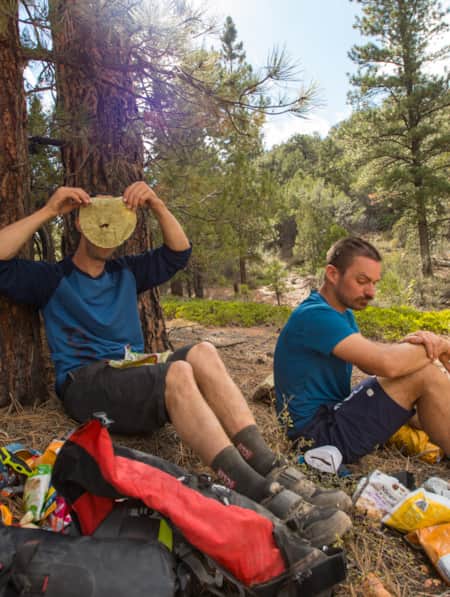
Bikepacking through Time in the San Rafael Swell
We're miles away from civilization here in southeastern Utah’s San Rafael Swell, and we carry everything we need on our bikes. This is the type of adventure I've longed for, a trip that reminds us of our self-worth, resilience, and how little we actually need to survive.
-
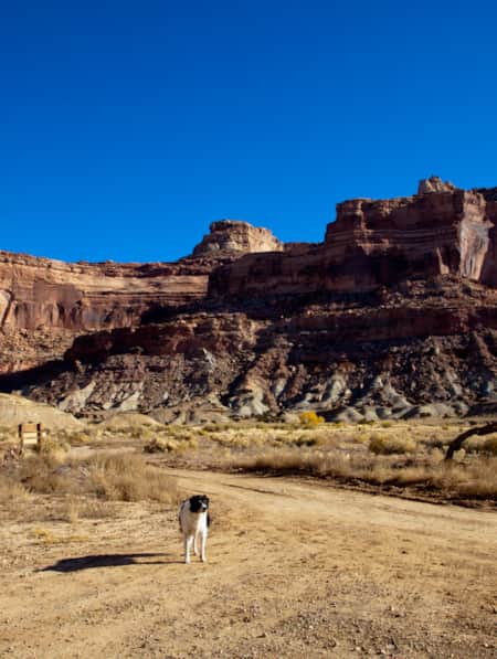
Dog-Friendly Utah: The Road to Mighty
Want to bring your furry friend on your next vacation? Utah is home to several great dog-friendly national parks and other fun destinations. Check it out and plan your trip!
-
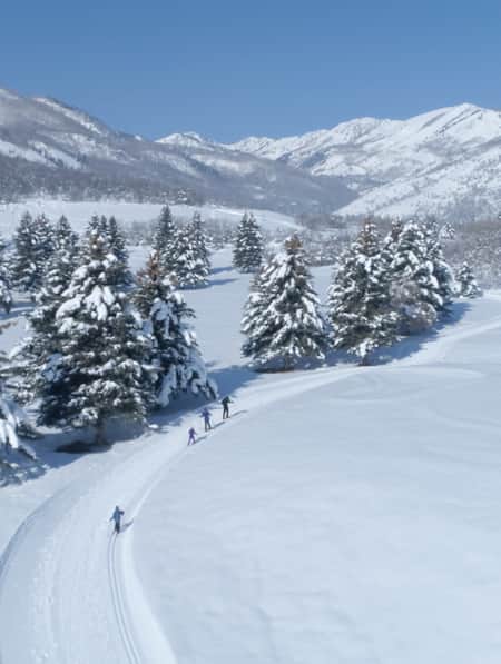
Find a Winter Refresh in a Utah State Park
The best Utah state parks will entice you with ice fishing, white sand and snow-dusted scenery. Take a winter break to refresh with a visit to a few of these places.
-
How to Bikepack: Pro Tips for Planning a Multi-day Backcountry Ride
Want to learn how to bikepack? Check out these tips and bikepacking gear list from veteran rider Kurt Gensheimer and plan your own Utah bikepacking trip!
-
Knobby Tired Nomads: Bikepacking the Utah High Country
If you’re into bikepacking, Utah is a place you’ll want to check out. Read about a self-supported tour of Utah’s backcountry here, and start planning your trip.
-
Moab's Singletrack Renaissance
Moab isn’t just for burly Slickrock riders anymore. In the last few years, local groups have established dozens of miles of new mountain bike trails.
-
Mountain Biking the Wood Hill Trail System
Luke’s Loop is one of several options in the Wood Hill trail system in central Utah, a favorite for locals and those just passing through.
-
Ramble On: An Insider's Guide to Beaver County
Ramblers, also known as Beaver County, is an outdoor playground. From winter to summer, check out the top 10 things to see and do in Ramblers.
-
Ridin' Greater Zion
Southeastern Utah might be the state’s hidden gem of mountain biking. Learn about the top mountain biking trails in this area and plan a getaway you’ll never forget.
-
Seven Must-Ride Mountain Biking Trails in Utah
To help you plan a Utah mountain biking trip, we've assembled a list of seven of Utah’s best mountain biking trails followed by a roundup of Utah’s best fat-tire destinations.
-
Spreading the Joy of Adaptive Recreation
Meet three National Ability Center staffers who live outdoor adventuring.
-
The Complete Winter Camping Packing List for Staying Warm in Southern Utah
For most travelers, Southern Utah winters prevent comfortable camping, and occasional snowfall can make outdoor adventure a little more challenging. With a little extra planning, good layers, and the right equipment, however, you can enjoy Utah's national parks in the solitude of winter.
-
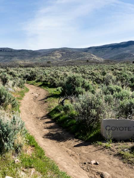
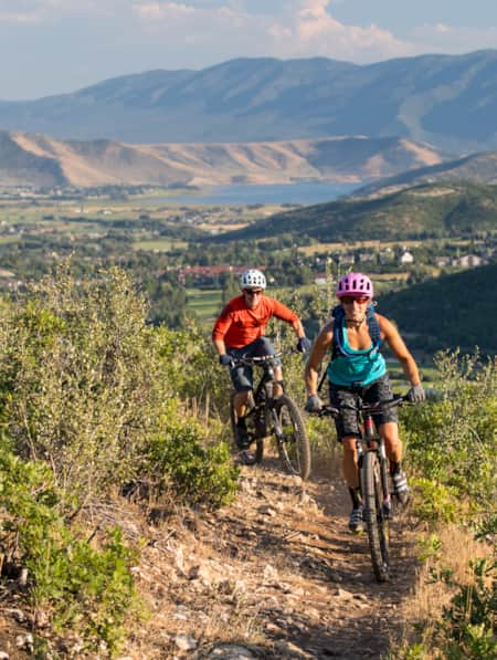
The Coyote Canyon Loop
An easy 20-minute trip south from Park City, the Coyote Canyon Trail is a gorgeous 20-mile loop that undulates through the sprawling expanses of Heber Valley and showcases some of its best features along the way.
-
Top 5 Rules of the Ride: How to Mountain Bike Responsibly on Utah Trails
Mountain biking is one of Utah’s most popular activities enjoyed by riders of all ages and skill levels. Be able to fly down that flow trail by, first, understanding and respecting the rules of the ride.
-
Utah's Outdoors Are Wide Open for All Abilities
Utah’s National Ability Center is known for changing lives through its adaptive recreation programs. Truth is, just setting foot on the center’s 26-acre ranch can feel transformative.
-
Visions of Grandeur: Heaven and Hell on Two Wheels
The story of a women’s bikepacking trip unspoils 250 miles of the majesty of Bear Ears country, including three national monuments, one national recreation area and a national park.
-
Wild Heber: Close-to-Home Adventure
Just 45 minutes from Salt Lake City, Heber Valley’s state parks and national forest lands offer a world of adventure. Hike, bike, camp, kayak, watch wildlife and reel in blue-ribbon trout while learning about nature and how to protect it.