A High Elevation Southern Utah Mountain Bike Adventure
Exploring the Epic Singletrack near Cedar City and the Dixie National Forest

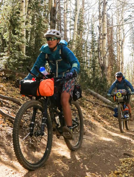
Mountain biking in Utah is nothing short of epic. North to south, east to west, Utah truly is a mountain biking mecca, boasting over 6,000 miles of mountain bike trails within the state. Here, you will find something for every skill level, beginner to extreme, in every season. And, finally, for the home run, the diversity of terrain and sublime landscape in Utah is guaranteed to keep your adrenaline high, smiles wide and it will keep you coming back again and again.
When you think about Utah’s mountain bike destinations, Park City, Moab or St. George might be your first thoughts. These locales are well known in the mountain bike scene, each having a well-earned place on the podium. As a Utah native and badass mountain bike chick who has been adventuring on two-wheels throughout Utah for the last 25 years, I have witnessed Utah “grow up” and become a well-rounded mountain bike destination. (Read: The Hidden Trails of Richfield: A Mountain Biker's Paradise)
For this mountain bike weekend adventure, we begin in Cedar City, located 50 miles north of St. George, 250 miles south of Park City and 280 miles west of Moab. Cedar City conveniently sits along I-15, has an elevation of 5,846 feet and currently boasts over 60 miles (with more on the way) of mountain bike trails. And as an added bonus, the trails here are all less than 10 miles from downtown, some even just a 2-minute pedal from your hotel room.
Pro Tip: It's always helpful to have a solid understanding of the terrain you visit, and even better when that knowledge is augmented by tools to help keep you oriented and safe. If you're visiting from lower elevations, get familiar with our tips for staying healthy as you ascend. A physical map, compass, GPS-enabled device or phone with plenty of battery life and previously loaded with apps and maps is essential to navigation in the remote parts of Utah. Biking in winter? Get some cold-weather gear tips.
"Mountain biking in Utah is nothing short of epic. North to south, east to west, Utah truly is a mountain biking mecca, boasting over 6,000 miles of mountain bike trails within the state."
Cedar City currently boasts over 60 miles (with more on the way) of mountain bike trails.
Brian Head Resort is a great option for lift-accessed downhill riding.
Brian Head is a small, high-elevation ski town that is hopping throughout the winter months and a bit more chill during the warmer off-season months.
R&R
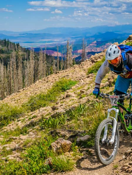
This itinerary ranges in elevation from 5,800 feet to 10,500 feet and is best explored early summer to late fall. All trails are within 30 miles of both Cedar City and Brian Head, both locales make a great basecamp for those seeking more of the creature comforts of home.
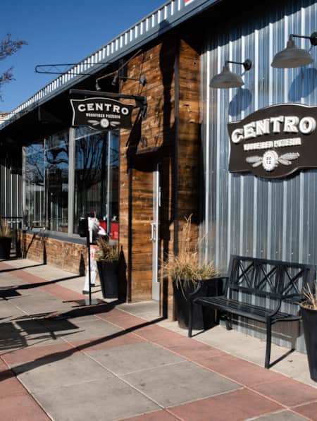
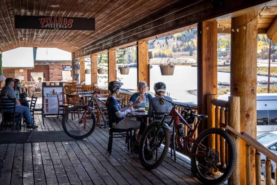
Cedar City has everything from well-known hotel brands to smaller, locally owned properties. Here you will find abundant dining options, shopping and a pretty cool art and cultural scene. Cedar City is home to the Utah Shakespeare Festival (June–October), which is one of the largest Shakespeare festivals in North America, the Southern Utah Museum of Art as well as many small art and cultural venues.
Brian Head is a small, high-elevation (9,800 feet) ski town that is hopping throughout the winter months and a bit more chill during the warmer off-season months after the snow melts. Here you will find two full-service hotels, a variety of condo-style rentals and a couple of restaurants. Brian Head Resort is a great option for lift-accessed downhill riding. The resort is typically open for summer operations June through September.
For those who prefer to wake up to the sights and sounds of nature, camping options here are plentiful. My recommendation is to ride in Cedar City, then head up to the Dixie National Forest to set up camp at one of the three forest service campgrounds (Te-Ah, Spruces, Navajo Lake) near Navajo Lake. If a rustic cabin is more your style, Navajo Lake Lodge is for you. The lodge also has a small general store in case you left the s'more fixins’ or other essentials at home. Additional camping options can be found at Three Peaks Recreation Area, Cedar Canyon or Duck Creek.
"This itinerary ranges in elevation from 5,800 feet to 10,500 feet and is best explored early summer to late fall. All trails are within 30 miles of both Cedar City and Brian Head."
Day 1: Cedar City
Depending on your arrival time you could ride just one or both of these locations.
Ride #1: Iron Hills Trail System, Southview Trailhead
Miles: 6-mile directional loop
Time: 45 minutes
Rating: Intermediate
Trailhead Facilities: Restroom and drinking water
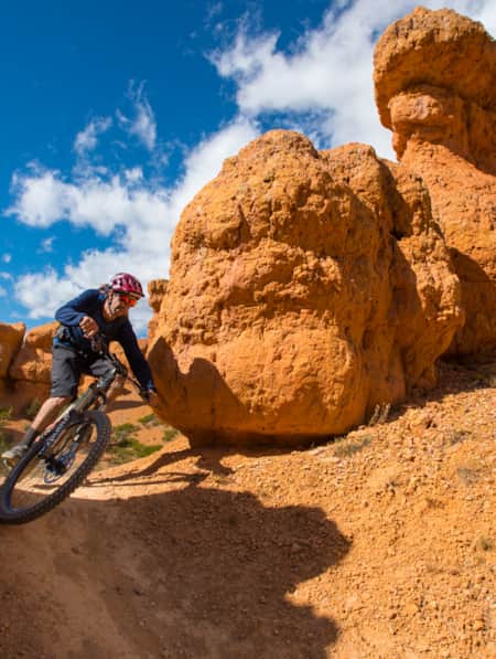
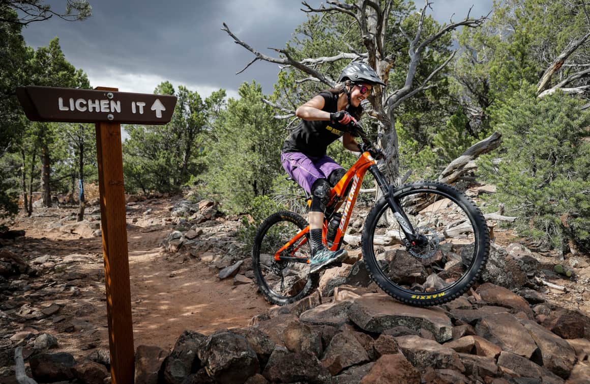
Located less than a mile off of I-15 (exit 57) this stacked-loop trail system offers eight trails, ranging from beginner to advanced. Currently, Iron Hills has a total of 20 miles of riding, with an additional 30+ coming soon. My favorite ride is the 6-mile directional loop connecting Lichen it, Green Hollow, Boulder Dash and Lava Flow. Lichen It and Lava Flow were the original trails built in 2015. The descent starts with Boulder Dash, which features an epic technical rock-built trail over and through some gigantic boulders. Lava Flow is a wide machine-built flow trail with a few rock gardens and optional jumps and drops thrown in to keep your head in the game.
Ride #2: Three Peaks Recreation Area, Mountain Bike Trailhead
Miles: 11-mile cross-country singletrack loop
Time: 1.5-2 hour
Rating: Intermediate
Trailhead Facilities: Restroom and drinking water
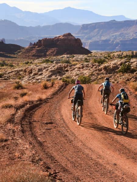
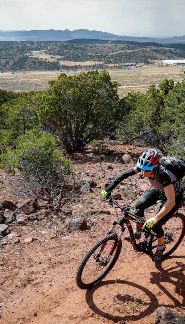
Located 10 miles northwest of Cedar City, Three Peaks is a 6,000-acre Bureau of Land Management (BLM) recreation area that has specific areas for both motorized and non-motorized recreation. There are 27-miles of mountain bike trails in a staked-loop system. The riding here differs from the downhill terrain at Iron Hills, this is fast pedaling, cross-country desert single track. There are many options here, my favorite is an 11-mile clockwise loop linking five trails; Practice Loop – Outlaw – Race Loop – Three Peaks – Big Hole (left/outer loop) – Lost World – Practice Loop.

Day 2: Dixie National Forest and the Markagunt Plateau
Ride #3: Dixie National Forest–Virgin River Rim–Navajo Lake Loop Trailhead
Miles: 11.5 miles — Navajo Lake Loop (counterclockwise); 15.5 Loop + Cascade Falls; shuttle for the 20-mile option between Te-Ah and Strawberry (or 40-mile out and back)
Time: 1.5-2+ hours
Rating: Intermediate to advanced for the longer option
Trailhead Facilities: Restroom
The Virgin River Rim is an epic high elevation (9,100 feet) trail that offers unbelievable views of Zion National Park and of the headwaters of the Virgin River. Point-to-point the trail is 34 miles and can be done in a day with a shuttle or for the pain-seeking endurance junkies as an out and back. Most riders opt to ride sections of the trail from one of four main trailheads. My favorite section of this trail is the 11.5-mile loop that circumnavigates Navajo Lake. If you are a paddleboarder, be sure to pack it, as this high elevation lake makes the perfect après-ride cool-off. Start the ride from the Navajo Lake trailhead, just west of the lake. Head 1/4 mile west to the Te-Ah campground and begin your ride on the Virgin River Rim heading southeast. To make the loop, take a left on the Dike Trail around mile seven. This is a 1.5-mile connector trail that crosses the paved road and then leads to the east side of the lake.
For those looking to explore more miles, continue on the Virgin River Rim Trail, instead of looping back around the lake via the Dike Trail. From this intersection, it’s two miles to the trailhead at Cascade Falls. This combo would bring the mileage up to 15.5.
Few things to consider, the Navajo Lake Loop is the most popular section of this trail. If you are looking for more of a solitude backcountry experience consider doing the 20-mile section between Te-ah and Strawberry Point with a shuttle. Or, if your endurance level is high, opt for the 40 mile out-and-back. Be aware that cell service here is spotty at best. Be sure you are prepared for changing weather, which happens often at high elevations, and carry adequate water and food for the adventure.
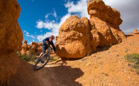
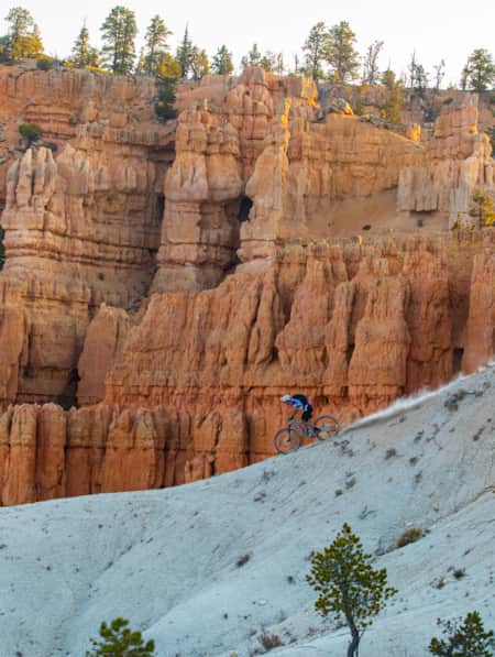
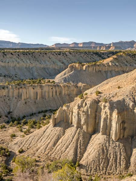
There are three sections of Dixie National Forest in the Bryce Canyon region, where you can expect hoodoos and otherworldly vistas.
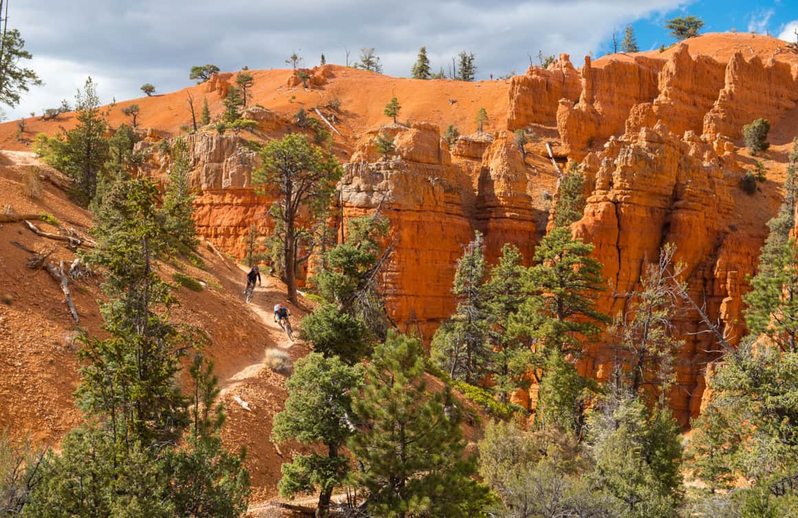
Dixie National Forest stretches for 170 miles across Southern Utah.
Day 3: Dixie National Forest and the Markagunt Plateau
Ride #4: Dixie National Forest, Blowhard Trailhead
Miles: 7 miles, one-way (shuttle strongly recommended)
Time: 1 hour
Rating: Advanced
Trailhead Facilities: Restroom
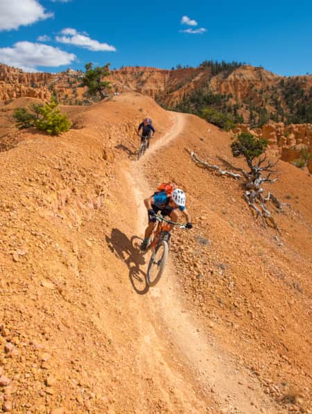
Blowhard is one of the best downhill rides in the area and for good reason. Both the descent and the scenery are unforgettable experiences: this trail drops 3,330 feet in seven miles. The preferred ride option is to incorporate a shuttle, but a few crazy diehards may choose to ride it as an out and back. I personally haven't done this option, or experienced any riders coming up the trail during my ride, but, be warned this is a multi-use trail that is open to both riders and hikers in both directions.
Be sure to allow time for a few photo stops to capture the amazing views along the route.
"Blowhard is one of the best downhill rides in the area and for good reason. Both the descent and the scenery are unforgettable experiences: this trail drops 3,330 feet in seven miles."
Protect the Resource
Here are a couple tips to be mindful and consciously protect the places where we play.
- The trails highlighted here are non-motorized, multi-use trails, which means you could encounter hikers and horses as well as other mountain bikers. Mountain bikers always yield to both horses and hikers no matter what direction you are riding.
- Please help keep the singletrack single by staying on the trail. When yielding to other riders do your best to move out of their way but be conscious of where you are standing. Stay off trails when they are muddy. If your tires are leaving deep ruts and the mud is caking on your tires, it’s best to turn around. See more tips for responsible recreation.

What's Nearby
-
Brian Head Resort
Surrounded by contrasting evergreen spruce and aspen, Brian Head Resort boasts the highest base among Utah's resorts, and is the only ski and snowboard resort to showcase snow-dusted red rock hoodoos from the nearby Cedar Breaks National Monument.
-
Cedar Breaks National Monument
Cedar Breaks National Monument, 23 miles east of Cedar City, offers a stunning red rock amphitheater, scenic hiking and exceptional stargazing.
-
Dixie National Forest
This forest stretches for 170 miles across southern Utah. Visitors can experience its brilliant red spires and cliffs by car or by hiking one of the nature trails in the canyon.
-
Virgin River Rim Trail
The high altitude mountain bike path of the Virgin River Rim Trail runs its course through ancient forests, across alpine meadows, and offers vista after vista. Beginning at the edge of Cedar Mountain, on top of the Markagunt Plateau, the trail meanders 32 miles to the west taking you along the headwaters of the Virgin River before terminating in the heart of Cedar Canyon at Woods Ranch.
Discover More
-

24 Hours in Cedar City
A unique small town, Cedar City is a perfect place to stop on your journey to natural wonders such as Zion National Park and Bryce Canyon National Park.
-
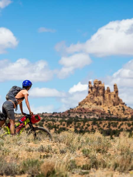
3 Utah Bikepacking Routes for Beginners to Intermediates
Find a route for your next Utah bikepacking trip that promises immersion in history, culture and ridiculous scenic beauty.
-
A Quick and Dirty Guide to Brian Head Area Mountain Biking
Whether you’re visiting the area for Brian Head’s seemingly endless bike options or making it part of a multi-stop Southern Utah adventure (Cedar Breaks National Monument is just five miles away), it’s a must-see for bikers of all abilities. Here’s what you need to know to get started.
-
Best Restaurants In Cedar City
From woodfire-grilled pizzas to authentic southwestern Mexican cuisine, Cedar City has plenty of great restaurants for treating yourself after a day on the trails.
-
Bikepacking Across the Aquarius Plateau
A 5-night bikepacking trail has opened up a beautiful swath of the Southern Utah landscape. Following trails from Brian Head to Boulder, riders can experience long days in the saddle, and then recuperate in backcountry huts stocked with creature comforts.
-
Bikepacking through Time in the San Rafael Swell
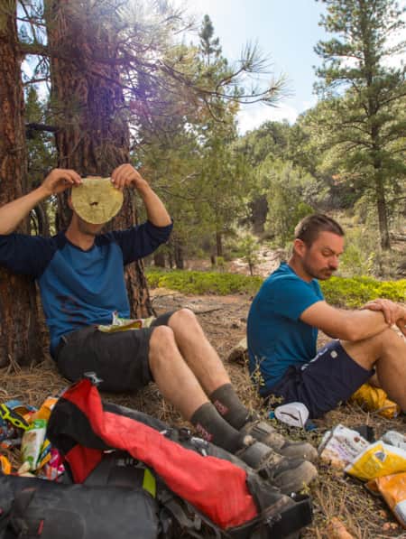
We're miles away from civilization here in southeastern Utah’s San Rafael Swell, and we carry everything we need on our bikes. This is the type of adventure I've longed for, a trip that reminds us of our self-worth, resilience, and how little we actually need to survive.
-
How To Bikepack Utah Like a Girl Boss
Here are the key things you need to know as you start planning your first bikepacking trip.
-
How to Bikepack: Pro Tips for Planning a Multi-day Backcountry Ride
Want to learn how to bikepack? Check out these tips and bikepacking gear list from veteran rider Kurt Gensheimer and plan your own Utah bikepacking trip!
-
Knobby Tired Nomads: Bikepacking the Utah High Country
If you’re into bikepacking, Utah is a place you’ll want to check out. Read about a self-supported tour of Utah’s backcountry here, and start planning your trip.
-
Mountain Biking the Wood Hill Trail System
Luke’s Loop is one of several options in the Wood Hill trail system in central Utah, a favorite for locals and those just passing through.
-
Seven Must-Ride Mountain Biking Trails in Utah
To help you plan a Utah mountain biking trip, we've assembled a list of seven of Utah’s best mountain biking trails followed by a roundup of Utah’s best fat-tire destinations.
-
Visions of Grandeur: Heaven and Hell on Two Wheels
The story of a women’s bikepacking trip unspoils 250 miles of the majesty of Bear Ears country, including three national monuments, one national recreation area and a national park.