Visions of Grandeur: Heaven and Hell on Two Wheels

On a bikepacking trip through cental Utah’s canyon country, my friends and I discovered we each had our own version of hell.
Sandra's emerged on Day Two, in between the Abajo Mountains and State Road 211. At the bottom of a dozen miles of single-track that ended in a series of sandstone drops, we encountered our first significant sand traps of the trip. It didn't matter that these lay along a burbling creek fringed by cottonwood trees with their leaves burning orange and gold. After several long sections of sand so deep it suctioned our tires into its grains and caused our 60-pound bikes to swivel, I heard my normally gleeful, delightfully potty-mouthed friend curse the sand with expletives.
Emily's hell also arrived on Day Two, only it was sparked by the bike she’d borrowed, with no shock in the front or back. Though specially designed for bikepacking, it made her sit bolt upright like the Wicked Witch of the West in “The Wizard of Oz.” You could see her aggravation in the way her shoulders crept toward her ears and her face squished into a squint as she pedaled through the sand.
Natalie's hell wasn’t so easy to decipher. At a late-afternoon snack stop on Day One, she said: "My hell is this. The entire trip.”
And mine reared its ugly head just an hour after our departure.
It engulfed me after we started riding from Natalie and her husband Dustin’s gear shop/outfitter, Roam Industry, in Monticello. In our excitement, we were all practically sprinting. Within 30 minutes, I was starting to feel like crap; my legs burned with lactic acid, the blood shunted away from my arms and my lungs started to sear from a combination of exercise-induced asthma and pedaling the heaviest bike I’d ever ridden.
Even before we hit dirt, I was starting to doubt myself a little, and then, as we rounded corner after corner of road that climbed relentlessly toward Cooley Pass, I began to falter. I’m a seasoned hiker, Nordic skier and cyclist, and I’d been pounding miles of singletrack five days a week in preparation for this trip. But now I started doing the most pathetic thing someone with big cycling dreams can do. I stopped. I dismounted. And I pushed my tank up the road.
Shame wracked me — or maybe it was my plummeting blood sugar. And after one, possibly two minutes, I thought: maybe I bit off too much this time. Maybe I can’t DO this.
At just that moment, Natalie — part guide, part all-around badass and executive director of the Utah Tourism Industry Association — transformed into a dirt-riding Mother Teresa. “Sure you can! Look at you!” she said. (Oh, yeah. A has-been. I mean a never-was, I thought). We alternately walked and pedaled for what seemed like miles, and then it appeared: Cooley Pass and the road beyond it. All it took from there was three miles of downhill coasting with a cool October wind blowing on my face to make me smile.
Good thing, because who in her right mind would let a little shame, physical agony and embarrassment keep her from exploring the route that was planned? It wove 250 miles through three national monuments, one national recreation area, one national park and a patchwork of United States Forest Service and Bureau of Land Management lands. It would take us through tunnels of sandstone, to the edge of yawning canyons, past ancient petroglyphs and down to the Colorado River. And best of all, it connected to the brand new Western Wildlands Bikepacking Route, which starts at the border of Canada and ends at Mexico, snaking through some of the most beautiful and fascinating parts of Utah.
"The region we were about to ride into is a bucket list for many travelers, but bikepacking offers a whole different world of opportunities. "
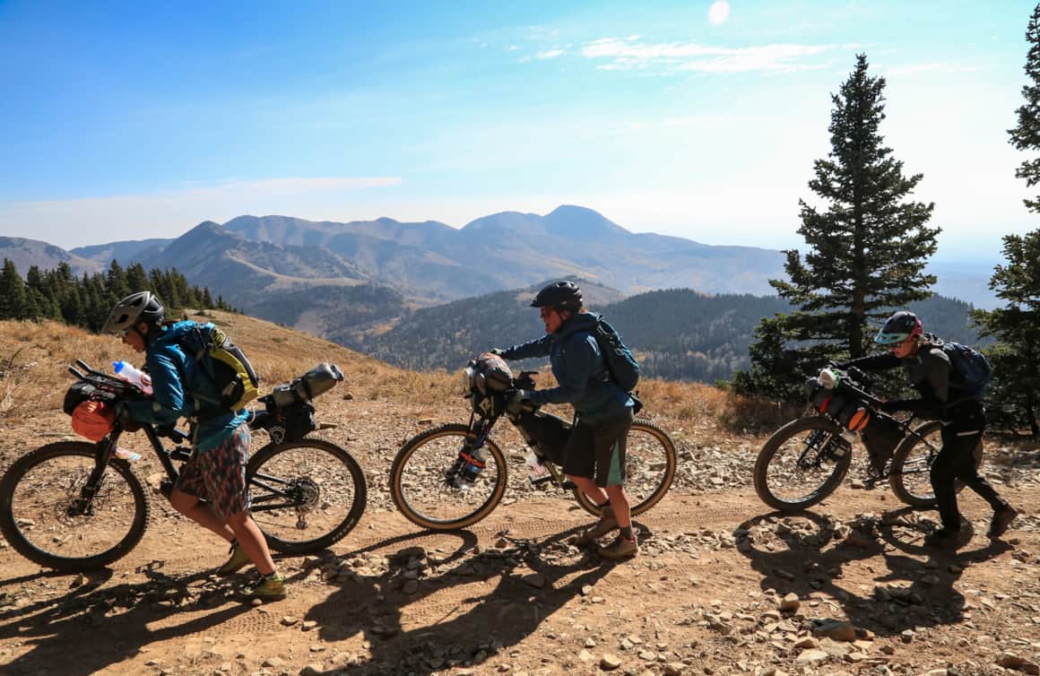
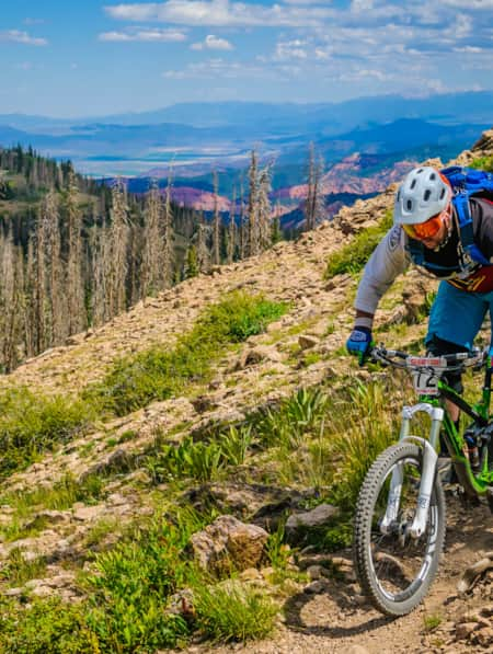
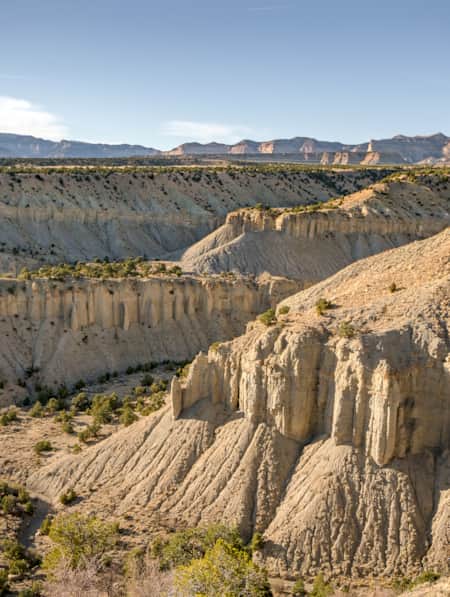
Shay Ridge reaches an elevation of 11,000 feet
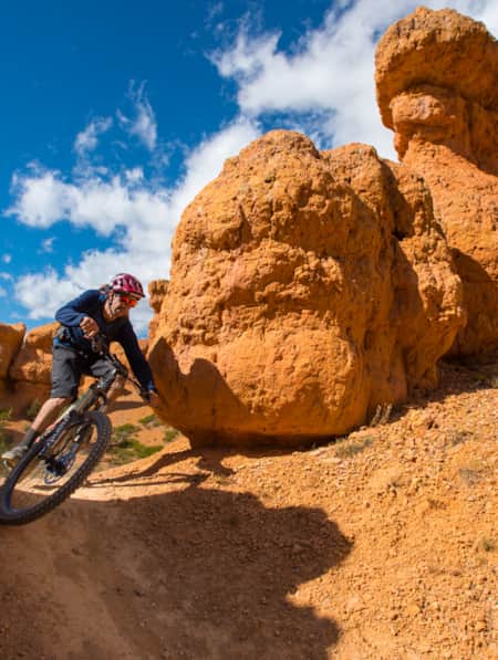
Don't forget a multi-tool for roadside repairs
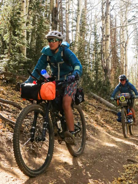
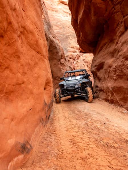
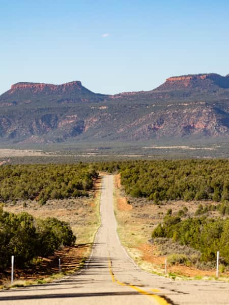
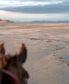
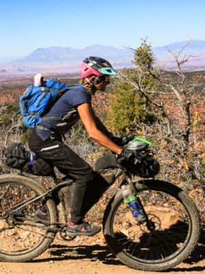
Riding the empty roads of Bears Ears
The Lure of Empty Dirt Roads
We would not let my weakness slow us, that’s who. Never mind that before we embarked, we didn’t really know each other. I mean, I knew Sandra Salvas and Emily Hefel, and Sandra knew Natalie Randall and me, but Natalie only knew Sandra and Emily only knew me. Yet we’d joined together out of a shared love for cycling and a wish to truly social distance in month six of the COVID-19 pandemic. We were lured by the empty dirt roads we’d travel, by the isolated campsites we’d find, by the promise of mystical, arch-littered canyons. And by the tantalizing thought of escaping the current political climate, the immediacy of the virus and a deep desire to explore a vast swath of central Utah by our favorite mode of transportation: bikes.
Enter Natalie’s suggestion to ride part of the 700-mile Bears Ears Loops in south-central Utah. The loops are part of the Western Wildlands Bikepacking Route, a 2,700-miler. Bikepacking Roots founder Kurt Refsnider pioneered them, but Natalie says the thrill of bikepacking is that there are always route variations that yield opportunities for everyone to curate their own experience. (Read: "Three Utah Bikepacking Routes for Beginners to Intermediates")
That’s what we were doing: blending singletrack, OHV trail, dirt roads and pavement into an experience that answered our needs for adventure. So in a way, we were curating this trip for ourselves, building on our own wishes. The region we were about to ride into is a bucket list for many travelers, but bikepacking offers a whole different world of opportunities.
By the time we reached our first night’s camp, we’d ridden 27 miles and climbed 3,500 feet by way of pavement, dirt road and OHV road. When we arrived, it was howling wind and there were hardly any flat spots to pitch our tents. What’s more, the flame on our stove kept sputtering out, forcing us to choke down lukewarm packets of Trader Joe’s Madras lentils as the wind screamed louder. Never mind that we’d burned thousands of calories and would burn thousands more in the days to come.
But food wasn’t our priority. Pedaling for visions of grandeur was, and we were about to get one. As the curry burps set in, the sun set, casting an orange glow behind the Bears Ears. They’re so distinctive that in each of the four Native languages spoken in the region, their name is the same. A historic consortium of the Hopi, Navajo, Ute and Zuni nations united in the effort to conserve the Bears Ears cultural landscape, an ongoing challenge. As we stood awestruck in their presence, I knew we were viewing something special. And getting my first glimpse of them by bike made the vision even better.
"The Bears Ears are so distinctive that in each of the four Native languages spoken in the region, their name is the same."

Stop and Smell the Sagebrush
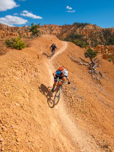
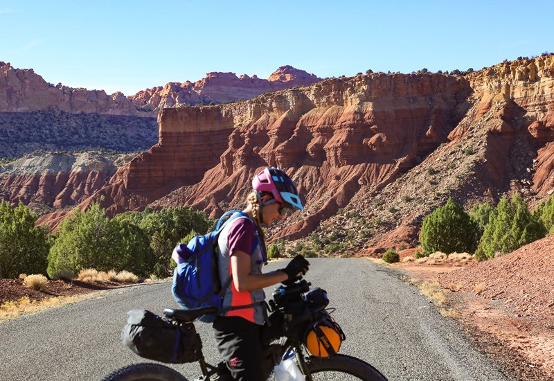
Day Two marked Emily and Sandra’s descents into hell, and my ascent from it. Before dawn we started a 1,500-foot climb from camp to the top of Shay Ridge (elevation 11,000 feet). Thanks to Natalie’s expert instruction about how to secure our gear onto our frames (Can I get a whoop for zip ties?), my front shock absorbed jarring that would have numbed my arms. Not poor Emily, though, who lacked even a dropper post. But her calm stoicism got her through — until the sand traps in Indian Creek en route to the highway.
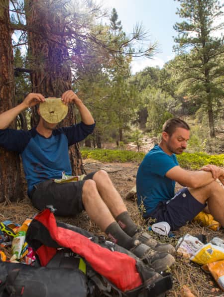
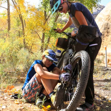
Emily never complains; not in extreme cold, not in extreme heat, not when she’s stuck in a traffic jam and desperately has to pee. She just goes quiet — at least that's what I saw her do on our trip. After hours of wrestling her bike through the sand, we came into a carpet of sagebrush. I could tell she’d had it, so I tried the old “Just stop and smell the sagebrush!” trick. She broke into a smile — right before her bike gearing seized up, a near-impossible fix. As is her way, she sucked it up and coasted the 1/2 mile downhill to where the rest of us sat waiting, and where Natalie was able to make a quick repair since it was her bike. We munched Babybels and Slim Jims; then carried on, heading west.
Thoughts of soaring canyon views beckoned us — as they should have. We were headed to Cathedral Butte, an islet of rock stretching into endless canyon folds and arches in muted greys, blacks and orange, but we wouldn’t see any of this until we woke up in the morning. The hum of a billion stars lulled us into dreamland. When we awoke, we peered down into Salt Creek Canyon. As deafening silence rose to greet us, Natalie pointed out arches and various petroglyph sites that made me want to ditch the bikes and get lost down there. But another day of nothing to do but pedal through little-seen Utah country beckoned us, so we rode on, promising to return with hiking boots and backpacks to explore at length on another day.
"As deafening silence rose to greet us, Natalie pointed out arches and various petroglyph sites that made me want to ditch the bikes and get lost down there."
Roads through the area were built in the late 1800s to help cattlemen move the herds between summer and winter pasture.
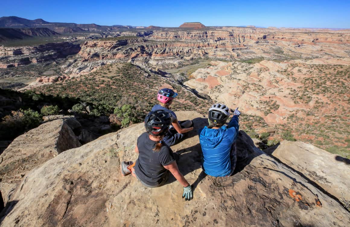
Overlooking Salt Creek Canyon
Undulation. Or: Some Days the Trail Leads Downhill
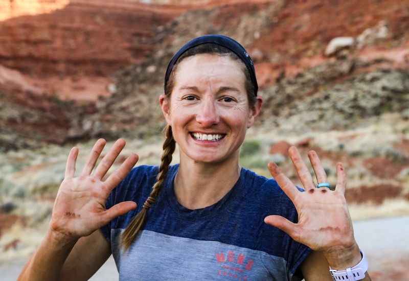
On Day Three, I woke up feeling like the luckiest person alive, knowing that all I had to do for the next few days was ride my bike. My sole responsibilities were hydrating, eating and slathering myself in Coppertone 50. After I’d narrowly survived hell’s flames, I’d promised to maintain a positive mental attitude no matter how steep the roads climbed or how sandy they became. For someone with three kids, this was exceptionally simple, especially because I was with the three most laid-back women I’d ever met. Sandra and I had known each other since we’d both been on the masthead at Skiing magazine, weathering challenges such as trying to be interested in pro skiers. Later, we went to a Rainbow Family gathering, collecting scenes of things like me failing to be accepted into the drum circle ("But we did eat from a dumpster, so that was brave," she says). And we’d been on assignment together as I tried to overcome my fear of exposure (would not and will never happen) and she worked her hardest to make me a mountaineer while also counseling my mental breakdown.
Not once in 72 hours had Sandra and I, or any combination of Natalie, Sandra, Emily and I, had a moment of tension. Which led me to conclude that if hell is a trip marred by conflict, we were in actual heaven.
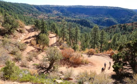
After pulling ourselves away from Cathedral Butte, we were cruising along an old mining road with soaring views back into the country we’d traveled. With time to kill — or so we thought — I asked Natalie for a history lesson. She said the roads through the area were built in the late 1800s to help cattlemen move the herds between summer and winter pasture, and support a variety of other industries, such as timber and mining.
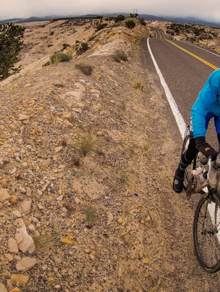
The region is now a patchwork of public lands, owned by the U.S. Forest Service, BLM, Utah State Parks and the National Park Service, as well as the Navajo Nation. In an introduction to bikepacking course Natalie and Dustin teach for the University of Utah, students read about the thorny topic of bikes in wilderness. Fortunately, we could access all kinds of beauty from roads, which we’d ride from this point forward.
Many new wilderness areas are being established in places already impacted by humans. While keeping out motorized access will help preserve these areas, restricting bike travel — one of the fastest-growing outdoor activities — might be pointless if it shuts down access to large tracts of land.
Today’s ride took us from canyon rim down into aspen and cottonwood-cloaked valley. Cold wind washed over us as we blasted through yellow-leafed hallways. At our lunch stop, we braced against tree trunks to stretch, napped briefly on the sun-warmed ground and nibbled summer sausage and Babybels. Then we geared up for yet another climb on our way to our third camp, in a dispersed campsite along the Elk Ridge Scenic Backway. We set up on yet another perch overlooking Bears Ears.
Later, as the nightfall (and the cold) gripped us, Dustin and Natalie’s 3-year-old son, Roman, surprised us with pizza. That’s one of the beauties of the route we’d chosen: you can make all, most or some of it self-supported. Or you can just weave in a little comfort. This was our coldest night so far, and cold dinner could have made it awful. Instead, the pepperoni was greasy and the sodas were syrupy. We slept like rattlesnakes in winter in our sleeping bags, the dirt layer on our bodies offering extra warmth.
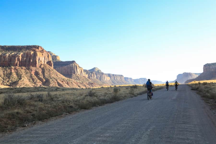
Want to know a bonus to riding a route as undulating as the Western Wildlands? After days of climbing, sometimes you just go down. That was our Day Four — miles of flying through more forest before cruising into a plateau above the Colorado River and down to Hite Marina.
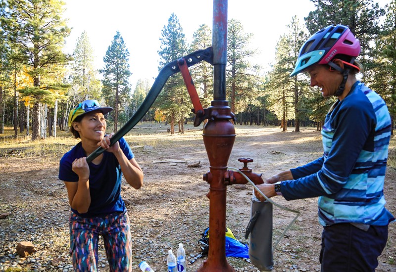
Sandra and Natalie had dropped a gear cache and booked us a night in an RV in Ticaboo. When we rolled in, the caretaker — a crack-up with a gravelly voice named Katie — met us after hours at the little convenience store onsite. We wanted what any right-minded group wants when caked in dirt, undernourished, dehydrated and, technically, “on vacation” — one, maybe several, frosty beers. To our dismay, the store carried none. But glorious Katie delivered, producing a 12-pack of Bud, leading us to ourRV and bidding us a cheerful goodnight.
It seemed to take about seven hours to clean off the dirt caked into the sunscreen I’d smeared on my calves. Two more hours raced by as we detailed our bikes. Four hours later, it was still somehow only 7 p.m., and we cooked some pasta and cracked a few beers. The RV shower melted our muscles, the wine Emily brought complimented the beer and a solid night’s sleep in an actual bed almost prepared me for the palm-sized wolf spider that crawled off my backpack strap onto my neck at Zero Dark Thirty the next morning. Okay, it didn’t prepare me. I screamed. I slapped it to the floor. And we all danced as if on hot coals until we put the poor spider permanently to sleep.
"On Day Three, I woke up feeling like the luckiest person alive, knowing that all I had to do for the next few days was ride my bike."
Strong, Resilient and Tired
Had we gotten cocky by this point? Of course — we’d ridden 150 miles and climbed thousands of feet! Did we know our route? Clearly — we'd studied maps, preprogrammed waypoints and followed the GPS to present success! Did we understand what lay ahead of us, after we climbed out of Hite Crossing onto Highway 95, rode pavement to the turnoff to Bullfrog Marina, passed it and eased onto Cottonwood Wash, which snaked across open desert toward the 10,000-foot-high Henry Mountains, the last unsurveyed range in the lower 48 states?
Uh.
We knew we were strong, both mentally and physically. We knew we were resilient after all we’d pedaled through so far. We knew we’d each faced down a version of our personal hell and were still laughing — even Natalie, who explained hers to me later.
She’d said that her hell was the trip itself. But what she meant was: “I tend to always be racing to the next thing and thinking two steps ahead.” Bikepacking trips allow her to stop thinking, and the days and time become irrelevant, except to make it to a certain campsite or break. “There are times that I literally think of nothing except absorbing the moment and my surroundings,” she says, as she “relearns how to escape society’s noise,” and be okay with herself.
For Natalie, our trip was new on many levels. She’d done all-lady trips before, but never with so many strangers. She’d worried during my first-day meltdown, but once I’d overcome, and we all proved to be the best-ever group of bikepackers, she relaxed, fell into the rhythm and “rode to enjoy.”
With all of us in a similar state, I think it made sense for us to believe nothing but bliss would come our way. But our reckoning was coming. It was The Henrys, when nary a pedal stroke seemed to close the gap between us and them.
Let’s face it: We were tired. We had blazed miles. And when The Henrys appeared no closer, our energy began to lag. Then a red truck came into view, carrying a smiling, waving couple. “You girls alright?!” the driver chirped as we let him pass. We nodded. But a hundred yards on, I offered sheepishly, “Guys. Don’t you think we can ask him for a bump? Just, like, 10 miles or so? Just for a small break?”
You’ve heard of trail angels? Leon and Flora Loucher became our tread angels. Leon loaded our bikes into the back of his truck and we clambered inside the cab. What came next assured us that we’d made the right decision: A barely double- and sometimes single-lane, loose-dirt road climbed and climbed. It was the steepest road I’ve ever seen outside of Nepa, and yet a road with similar maintenance — rocky and rutted. A road that seemed to barely cling to the side of the mountain.
At times I thought if we all looked out the downhill window, the truck would tumble. We didn’t even buckle up, because why, when death was certain? But Leon appeared unfazed, cajoling us with stories of youthful adventures while watching for our reactions in the rearview mirror. Grinning in her heated seat next to him, Flora only flinched once (that I saw). And I only had to get out and walk once, when we came to a corner that required a five-point turn to make. But hours and a few thousand feet later, we pulled into McMillan Campground, and it was all we could do not to hug Flora and Leon. (Thanks, COVID-19. No, really.)

The Biggest Day: When the View Leads to Another Hill to Climb
A famous Instagrammer probably once said that only trips with some amount of difficulty are worth posting. Today was our day to prove it. We drank from the campground spigot and ate our dwindling reserves of tortillas, peanut butter and cheese. Then we bombed from McMillan toward Capitol Reef National Park, the near-last leg of our journey. Each had been better than I ever could have expected. Just as the one to follow would — through Grand Staircase-Escalante National Monument. But my story winds down here, because this is when all the good and all the challenging gelled into one night that felt like it would never end.
So far, Natalie and Sandra had done the bulk of our navigating, and they knew that we’d ride pavement for six miles, crossing through acres of private property. All told, today would be our biggest day, 70 miles. Now, as we hit the intersection of Notom-Bullfrog Road, our energy levels wilted. Slowly we rode, as darkness engulfed us, and barbed wire and private property signs blocked us from potential camps.
Fourteen hours after we’d started riding, we needed to eat supper. So we pulled off the road and heated some of our last remaining water. Tonight was mac-n-cheese night, which I’d anticipated all week. But once again, our trusty stove could muster no real flame. We poured a round of lukewarm water into our foil packages and let it soak for as long as we could stand.
The noodles were hard; the sauce, chalky. I choked down only a few bites before stuffing the remains in my pack. Waves of gouda gagged me as we mounted our bikes under a hazy sky, no stars, no moon.
Soon pavement transitioned to dirt road, and with it, the dreaded tire-sucking sand. It’d materialize before we could see it in the beam of our headlamps. With a jerk we’d be spinning out, leaping off our bikes and pushing them out of our trajectory, a handlebar end augering in.
Now, I admit my heaven and hell trope is a bit heavy-handed. But on this stretch of road, first hell appeared, then heaven. You’d hit sand, fight to pedal, and want to scream, but then your tires would grip on a bit of bedrock and, miraculously, you’d keep going. This near crash-full recovery cycle continued until out of the dust, we saw the sign for Capitol Reef, and a few miles later smelled smoke from a campfire.
Utterly wiped from the longest cycling day of our lives, we pedaled into the campground, full of snoring hikers. Emily and I parked our bikes, pitched our tent, and wormed into our sleeping bags on half-inflated pads. Long before now, she’d stopped needing to talk and so had I.
When the worst moments of our trip had hit us, we’d all known how to handle the moment. In the sand in Indian Creek, it was me shouting, “Badass!” to Sandra as she flew downhill into a shady ravine. With Emily’s mechanical problems, it was Natalie quietly administering a fix. On more than one of the five nights we pedaled into camp after dark, it was Emily not offering cheer when my depletion of calories and good humor made it impossible for me to smile. And with Natalie, it was simply riding alongside one of us playing music on our iPhone, and humming along or listening as the melody drifted behind us.
Now it was the night before the last night of our trip, and despite my exhaustion, I lay awake, thinking. Good endings don’t just happen; they’re built. We’d come so far, and I felt myself changed. As we’d all say later, one of the best parts of our journey was the hours we’d spent just riding, not thinking. Each of us has so much to contemplate: jobs, spouses, kids, our futures. So this riding-without-thinking felt like meditation. But I wondered how we’d feel two days from now, when we wheeled into Boulder.
Above all, I am happy the riding that day wasn’t easy. We left our campsite overlooking Grand Staircase and headed toward our ending. The road climbed enough for me to feel it in the deepest fibers of my quads. Then came the farms — sheep and wooden fences. Then the outskirts of town — houses and American flags. Then a woman sped past Sandra and me on a moped. She caught Emily and Natalie at the first intersection and told them a story she’d heard about four women who had pedaled a long distance. Would we like to come to her house? Would we like a shower?
Why, yes, we said. We sure as hell would.
"Good endings don’t just happen; they’re built. We’d come so far, and I felt myself changed. "
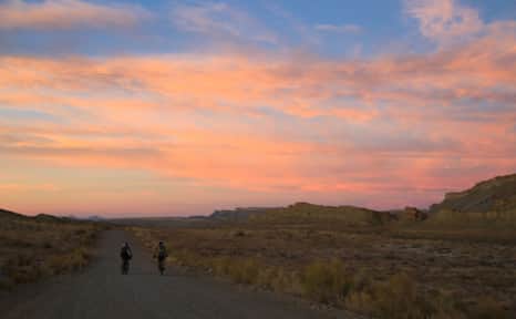
Pedaling into the desert sunset
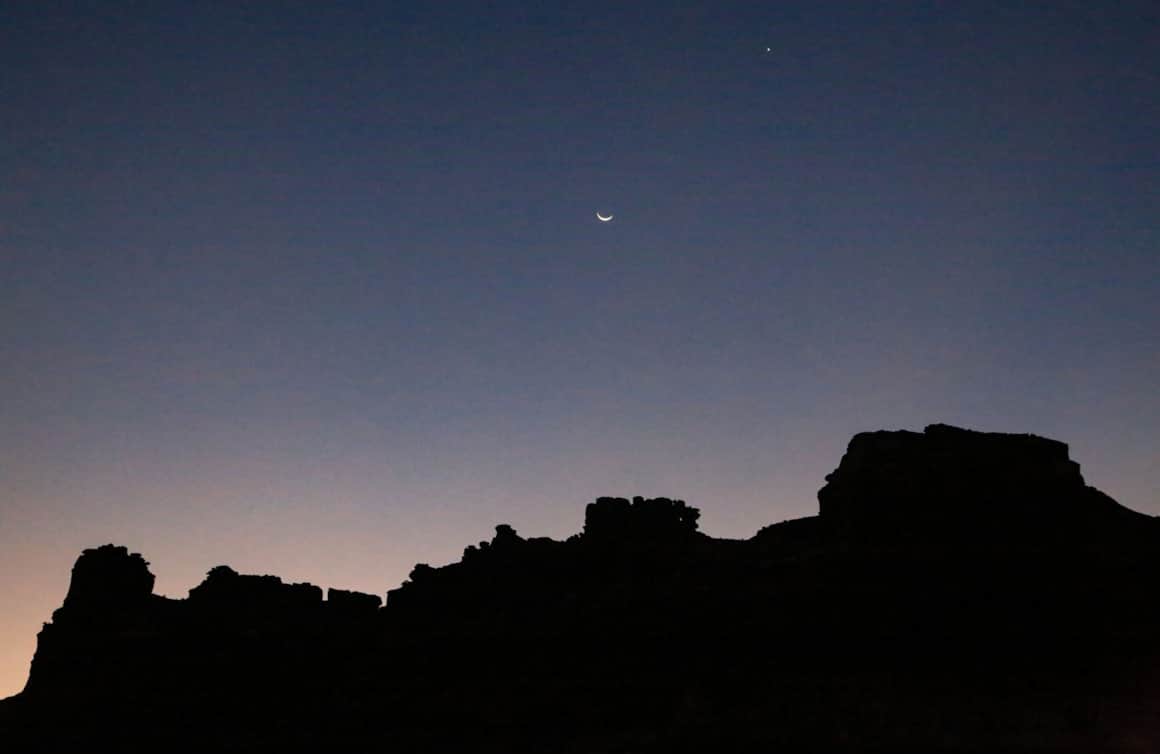
The moon rises over Glen Canyon National Recreation Area near Hite
How To Bikepack Utah Like a Girl Boss
Here are the key things you need to know as you start planning your first bikepacking trip.
What's Nearby
-
Arches National Park
Arches National Park contains more than 2,000 natural arches—the greatest concentration in the country. Find places to stay, itineraries, and weather for Arches, Moab and Canyonlands National Park.
-
Canyonlands National Park
Canyonlands is home to many different types of travel experiences, from sublime solitude in the more remote stretches of the park to moderate hikes through the Needles district to the opportunity to create your own version of one of the West's most photographed landforms, Mesa Arch.
-
Capitol Reef National Park
Even considering Utah’s many impressive national parks and monuments, it is difficult to rival Capitol Reef National Park’s sense of expansiveness, of broad, sweeping vistas, of a tortured, twisted, seemingly endless landscape, or of limitless sky and desert rock.
-
Glen Canyon and Lake Powell
Glen Canyon National Recreation Area offers more than 1.2 million acres of unparalleled opportunities for land- and water-based recreation.
-
Grand Staircase–Escalante National Monument
Grand Staircase-Escalante is a vast and rugged, yet easily accessible national monument.
-
Ticaboo
Visitors looking to get away from crowded national parks to enjoy the beauty of Southern Utah will find an escape in Ticaboo. Boating, fishing, biking, canyoneering, and off-road riding are all popular.
Discover More
-

3 Utah Bikepacking Routes for Beginners to Intermediates
Find a route for your next Utah bikepacking trip that promises immersion in history, culture and ridiculous scenic beauty.
-
A Quick and Dirty Guide to Brian Head Area Mountain Biking
Whether you’re visiting the area for Brian Head’s seemingly endless bike options or making it part of a multi-stop Southern Utah adventure (Cedar Breaks National Monument is just five miles away), it’s a must-see for bikers of all abilities. Here’s what you need to know to get started.
-
Bikepacking Across the Aquarius Plateau
A 5-night bikepacking trail has opened up a beautiful swath of the Southern Utah landscape. Following trails from Brian Head to Boulder, riders can experience long days in the saddle, and then recuperate in backcountry huts stocked with creature comforts.
-
Bikepacking through Time in the San Rafael Swell
We're miles away from civilization here in southeastern Utah’s San Rafael Swell, and we carry everything we need on our bikes. This is the type of adventure I've longed for, a trip that reminds us of our self-worth, resilience, and how little we actually need to survive.
-
Blazing Sandals in North Lake Powell
It’s not unreasonable or out of the ordinary to go UTVing, paddleboarding and canyoneering all in the same day (or weekend) at Lake Powell.
-
Cycling Scenic Byway 12: Escalante to Boulder
Looking for scenic bike rides in Utah? Scenic Byway 12 has all the breathtaking views (and riding) you could ever hope for. Get the scoop and get ready.
-
How to Bikepack: Pro Tips for Planning a Multi-day Backcountry Ride
Want to learn how to bikepack? Check out these tips and bikepacking gear list from veteran rider Kurt Gensheimer and plan your own Utah bikepacking trip!
-
Knobby Tired Nomads: Bikepacking the Utah High Country
If you’re into bikepacking, Utah is a place you’ll want to check out. Read about a self-supported tour of Utah’s backcountry here, and start planning your trip.
-
Mountain Biking the Wood Hill Trail System
Luke’s Loop is one of several options in the Wood Hill trail system in central Utah, a favorite for locals and those just passing through.
-
Roaming Grand Staircase–Escalante
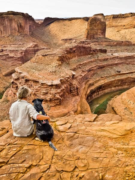
Ace Kvale is a photographer and guide in Boulder, Utah. Whenever possible, he hikes Utah's Grand Staircase–Escalante National Monument with his dog.
-
Seven Must-Ride Mountain Biking Trails in Utah
To help you plan a Utah mountain biking trip, we've assembled a list of seven of Utah’s best mountain biking trails followed by a roundup of Utah’s best fat-tire destinations.
-
The Voices of Bears Ears
Bears Ears National Monument is at the heart of southeastern Utah. These lands are imbued with layers of culture — layers of life. In this four-part video series, meet the locals who connect with the land in their own distinct ways.