How to Summit Three 12,000-Footers in the Tushar Mountains
One of the least known and wildest mountain ranges in Utah, the Tushars is best rambled by foot to fully capture the engulfing silence, distant vistas and glimpses of wildlife this alpine world has to offer.

The only way you can experience the beauty of this mountain world is by foot, following trails to rarefied summits and sleeping beneath starry skies (Read: "An Insider's Guide to Hiking in the Tushars"). The Tushars, easily reached from Beaver and I-15 in Beaver County — also known as Ramblers — is a world apart and only accessible after snowmelt from July through September (Read: “Ramble On: An Insider's Guide to Beaver County”). The hikes — all in remote areas with limited reception, resources and wayfinding — are a good fit for experienced hikers.
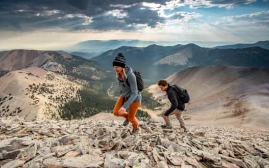
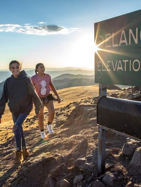
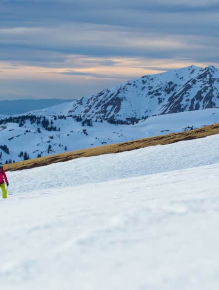
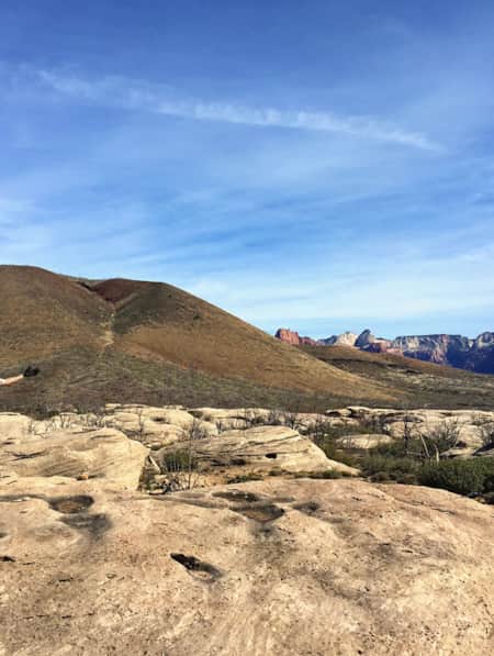
Hikers climbing Delano Peak.
Photo: Jay Dash Photography
Climbing Delano Peak
Delano Peak, the 12,169-foot high point of the Tushars, is the most popular of the range’s three 12,000-foot peaks with its gentle western slope. Beginning from Delano Peak Trailhead (38.367515, -112.395610) on FR 123, the trail climbs 1.5 miles up the peak’s wide west ridge, gaining 1,500 feet to a sign on the rocky summit and a register where you can leave your autograph.
Start from a small pullout on the right side of the road and follow a closed road marked #224 which quickly becomes a singletrack trail that meanders up wildflower-strewn meadows. Delano Peak’s trail and summit offer spacious views across central Utah. If you look northwest you’ll see Mount Belknap and Mount Baldy.
This broad swathe of alpine tundra in the Tushars offers the perfect terrain for the largest herd of shaggy, white mountain goats in Utah. Transplanted in 1986, the healthy herd of 200 to 300 animals thrives on the grassy slopes of Mount Delano and neighboring Mount Holly. You can bring a lightweight pair of binoculars or a spotting scope to get up close and personal with the goats but keep your distance since they’re wild.
To extend your hike, traverse the range crest south for another 1.5 miles to 11,985-foot Mount Holly. Then descend its west slope to the Skyline Trail and a gorgeous hike back to FR 123. You can set up your tent for the night just down the road at Big John Flat, the range’s iconic primitive camping area.
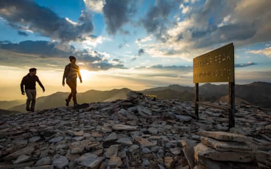
Hikers reaching the summit of Mount Belknap.
Photo: Jay Dash Photography
Climbing Mount Belknap
If you’re day-hiking the triple Tushar 12ers, drive north on the narrow dirt road from Big John Flat to climb elegant Mount Belknap and its twin Mount Baldy, sometimes called Baldy Peak. It’s best to climb both peaks on the same day rather than doing them separately since it’s a big day with lots of elevation gain to do just Baldy. Park about 10 miles north of the junction of state Route 153 and FR 123 at a sharp switchback and opposite the Bullion Pasture Trailhead before the road begins descending east.
The usual route up Mount Belknap ascends a trail up the southeast ridge for 1.5 miles and gains 1,400 feet of elevation. From the trailhead (38.403867, -112.398909), follow a faint mining track that switchbacks north up the wide ridge and then contours around the west side of a rounded knoll to a saddle. Finish by scrambling up broken rock on the ridge and south face to the dramatic summit and a large sign that announces you’re atop Mount Belknap.
You can sign into the waterproof register and enjoy the view. Scattered across the summit are windbreaks erected by previous climbers, the rusty remnants of a cast-iron stove and the crumpled stone walls of a heliograph station used in the late 1800s.
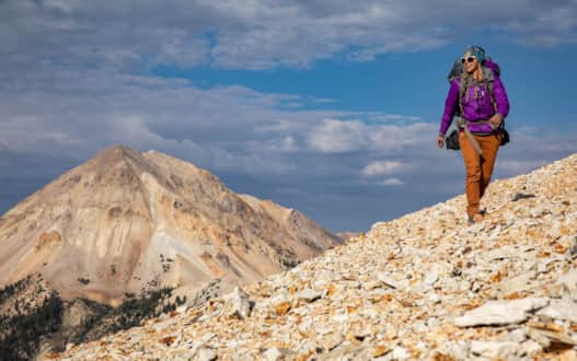
Hiker traversing to Mount Baldy.
Photo: Jay Dash Photography
Traversing to Mount Baldy
While there are 23 Utah peaks with the word “Baldy” in their name, 12,122-foot Mount Baldy in the Tushars is the highest and best looking of the bunch. It’s best to combine an ascent of Baldy with Belknap for a two-peak day, although there is a loop trek from Blue Lake nestled in the valley below that’s just as gorgeous but has more elevation gain.
From Mount Belknap’s summit, follow the airy southwest ridge that connects the peaks for two miles. The ridgeline trail loses almost 900 feet and then gains it all back on steep loose scree in the last half-mile. Expect great summit views from the top of old Baldy from hazy Nevada ranges in the west to white domes at Capitol Reef National Park to the east.
After catching your breath, plunge back down the ridge and stroll up and over Belknap. Descend down its southeast ridge to the trailhead on FR 123 for a stout seven-mile day with 4,350 feet of elevation gain. You’ve earned a hot meal and cold beer back at camp.
"The only way you can experience the beauty of this mountain world is by foot, following trails to rarefied summits and sleeping beneath starry skies."

Backpacking the Skyline Trail
If you want to ramble through more of the Tushar Mountains and climb its three highest peaks, load up your backpack and hit the Skyline Trail. The 23-mile-long footpath, which includes 8.3 miles of the officially designated Skyline National Recreation Trail, offers some of Utah’s best mountain scenery as it twists below the western crest of the skyscraping range and provides access to Delano Peak, Mount Belknap and Mount Baldy (Read: "How to Day Hike Three Different Sections of the Scenic 23-Mile Skyline Trail"). Plan on a two- or three-day trek to hike about half of the trail and scramble up the peaks. Arrange a car shuttle or leave vehicles at trailheads at each end to avoid having to hike back on FR 123.
Start from the Big John Flat Trailhead (38.359050, -112.393059) on FR 123 and hike about a mile northwest on the Skyline Trail to Sheepherder Flats. Stash your pack and hike east through meadows and open forest to the Delano Peak Trailhead on the road. Scramble up the out-and-back trail to Delano’s rounded summit and then descend back to your pack. Hike the trail for another easy five miles and set up camp west of Mud Lake.
The next day, after a restful night under the stars, follow the Skyline Trail down through dense woods and below a scree field to Blue Lake, a shining pond tucked below Mount Belknap and Mount Baldy. Look for a flat campsite on the northeast side of the lake.
While you can climb a steep, loose gully for over a thousand feet from Blue Lake to the saddle between Baldy and Belknap, it’s easier to do the two peaks from the start of the Belknap Trail on FR 123. Shoulder your pack early and hike up the Skyline Trail to the trailhead at the road. Stash the packs in your second vehicle and scamper up Mount Belknap’s southeast ridge to its summit.
Grab a drink of water and follow the two-mile ridge to Mount Baldy and return back over Belknap and down to your pack. Whew, a long day — 10 miles of hiking and almost 6,000 feet of elevation gain.
What's Nearby
-
Beaver
Beaver, with a population of 3,000, is a gateway to gorgeous landscapes, rivers and streams, miles of hiking and mountain biking trails, breathtaking scenic drives, haunted ghost towns, and plenty of peace and quiet.
-
Bryce Canyon National Park
An alpine forest with as many red rock hoodoos as trees. At dawn and dusk, mule deer graze the forested plateau along the road into Bryce Canyon.
-
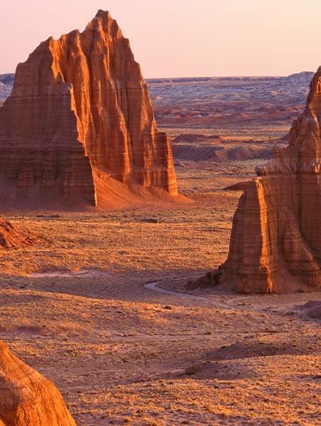
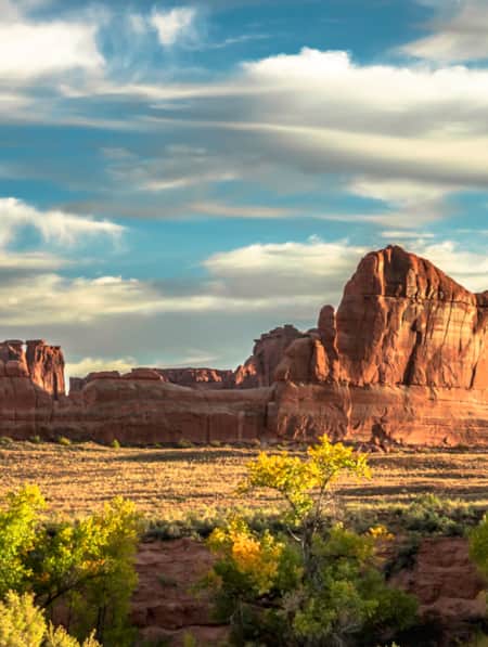
Capitol Reef National Park
Even considering Utah’s many impressive national parks and monuments, it is difficult to rival Capitol Reef National Park’s sense of expansiveness, of broad, sweeping vistas, of a tortured, twisted, seemingly endless landscape, or of limitless sky and desert rock.
-
Eagle Point
Escape the crowds and enjoy an intimate, family-friendly skiing experience on Utah’s third-highest mountain range at Eagle Point Resort in Beaver, Utah.
-
Fishlake National Forest
This is a paradise known for its beautiful aspen forests, sundry scenic drives, trails, elk hunting, and mackinaw and rainbow trout fishing. Recreational opportunities include scenic drives, mountain biking, snowmobiling, hiking, camping and OHV use.
-
Panguitch
Panguitch, Utah, captures the enduring pioneer spirit of Utah with its welcoming rural charm and strong sense of heritage.
Discover More
-

15 Must-Do Adventures in Kanab
Looking for fun things to do in Kanab? Check out our list of the 15 must-do adventures in Kanab and start planning your visit today.
-
8 Elevated Ski Experiences That are Uniquely Utah
If you dream of the possibility of hitting six resorts in one day or carving your own lines from snow-covered summits served by helicopters, then this listicle is made for you.
-
An Insider's Guide to Hiking in the Tushars
One of Utah’s best-kept hiking secrets, the Tushar Mountains deliver sun-dappled trails, wildflower-sprinkled meadows, shaggy mountain goats and forever views from rocky summits. Check out these six choice Tushar trails and make plans to discover Utah’s third-highest mountain range.
-
Beyond the Lake
From snowmobiling to skiing, snowshoeing to sledding and fishing, Bear Lake in the winter is everything you’ll want from your next winter vacation.
-
Dog-friendly Utah: Northern
Explore the top dog-friendly places to hike and explore in the Northern Utah, including state parks, national forests and a bird refuge.
-
Dog-Friendly Utah: The Road to Mighty
Want to bring your furry friend on your next vacation? Utah is home to several great dog-friendly national parks and other fun destinations. Check it out and plan your trip!
-
Eating Up Mount Timpanogos
Learn about the Utah farms near Mt. Timpanogos that produce luscious lettuce and artisan cheese. Make your own plans to “eat up” Mt. Timpanogos!
-
Elevate Your Hiking with Mindfulness
Incorporating simple mindfulness techniques into your next hike can take the edge off anxiety and enhance your overall well being.
-
Escalante River Canyon Trail
Located in the Grand Staircase-Escalante National Monument, the Escalante River Canyon river trail winds and knots its way east and south.
-
Everything in its Right Place
Bring your snowboard on your Brighton Ski Resort trip. Visit the six terrain parks – with new designs each week – to add some exhilaration to your ski vacation.
-
Explore the Tushars on Snowshoe
Ready to experience snowshoeing in Utah? Eagle Point is a Utah favorite location. Check out this snowshoe excursion then plan yours today for fun and adventure.
-
Explore the Tushars on Snowshoe
Ready to experience snowshoeing in Utah? Eagle Point is a Utah favorite location. Check out this snowshoe excursion then plan yours today for fun and adventure.
-
Exploring Mule Canyon: House on Fire and Cave Tower
Driving the up the dusty, terracotta-colored road toward Mule Canyon in Cedar Mesa, you get a sense that this is a special place, though you might not be able to put a finger on why.
-
Exploring Utah's Little Sahara
Little Sahara Recreation Area is an unforgettable destination for sand dunes in Utah and ATV, camping, hiking, and sand-boarding enthusiasts.
-
Following the Dinosaur Tracks of Red Fleet
Explore Red Fleet State Park's cleverly built trail that crosses sandy washes, ribs of exposed stone and a dinosaur trackway.
-
Get to Know Echo State Park
Situated at 5,560 feet above sea level, just north of Park City, lies Echo State Park. Watersports are king here, and whether you kayak, paddleboard, or boat, it’s a perfect place to get out on the water.
-
Hiking Southern Utah with Younger Children: Tips for Family Friendly Adventure
Find safety tips, side activities and kid-friendly hikes in Utah with our special guide to hiking Southern Utah with children. Read now!
-
Hiking the Desert in Capitol Reef National Park
-
Ice and rock, snow and splendor: Winter in Southern Utah
Come along on a five-day expedition to see Southern Utah’s wintry face, explore national parks, ski its mountains and find ways to play in the snow.
-
Ridin' Greater Zion
Southeastern Utah might be the state’s hidden gem of mountain biking. Learn about the top mountain biking trails in this area and plan a getaway you’ll never forget.
-
See the Fall Leaves Near Utah's National Parks
Sure, any of Utah’s Mighty 5 national parks are spectacular year round — covered in snow, peppered with spring wildflowers, and baked in sunshine. But find them exponentially special when the changing fall leaves are in juxtaposition to the immaculate red rock cliffs.
-
Seven Must-Ride Mountain Biking Trails in Utah
To help you plan a Utah mountain biking trip, we've assembled a list of seven of Utah’s best mountain biking trails followed by a roundup of Utah’s best fat-tire destinations.
-
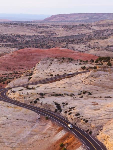
The All-American Road: Scenic Byway 12
This is 122.863 miles (to be exact) of pure driving bliss. Welcome to Utah’s Scenic Byway 12, a designated All-American Road.
-
Utah’s Factory-to-Slope Culture
Utah’s gear scene benefits from being able to use its backyard as a testing ground, making the complete ski and snowboard cycle uniquely Utah
-
Winter in the Bryce Canyon Area: Hiking, Cross-Country Skiing and Snowmobiling
Learn more about why Bryce Canyon and the surrounding areas are the perfect place for winter hiking, cross-country skiing and snowmobiling.