11 Utah Scenic Byways for Leaf Peeping
Explore the best scenic drives in Utah for fall foliage paired with unexpected adventure.

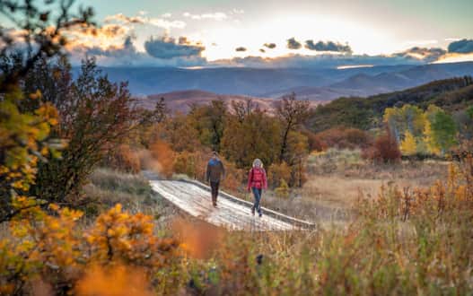
The lure of fall foliage is no secret. Bursts of saturated yellow and fiery red demand your eye and call you to the open road. With forecasting apps and digital foliage maps, terms like peaking and peeping are common language among travelers with a craving for visual fall flavor.
But when it comes to Utah's fall foliage, travelers pursue the leaf peeping road-less-traveled. Often overlooked for New England or the Smoky Mountains, Utah’s wide array of forests and state and national parks — each located at different elevations and receiving varying amounts of rainfall — make for a diverse foliage spectacle. Utah’s geography creates a multitude of peak viewing times throughout the state, so you can come early or late in the season and still spot breathtaking colors courtesy of the canyon maples, quaking aspens, scrub oaks, Douglas hawthorns, serviceberries and more.
If you don’t have your fall foliage map handy, a good gauge is to assume that the colors begin in the highest elevations (such as atop the Wasatch Plateau and Guardsman Pass) in mid-September and wrap in early-October across most of the state. The season beckons for long weekend drives on Utah’s scenic byways (or scenic backways), and taking in views as you make your way to the trailhead. Find something pumpkin flavored, fill your apple cider canteen, button up your flannel and hit the open road for some awe inspiring leaf peeping.
"Find something pumpkin flavored, fill your apple cider canteen, button up your flannel and hit the open road."
Pair with Jurassic Dinosaur Bones
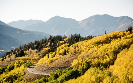
Energy Loop: Huntington and Eccles Canyons National Scenic Byway (S.R. 96, S.R. 31)
Interested in the best lesser-known terrain of Utah?
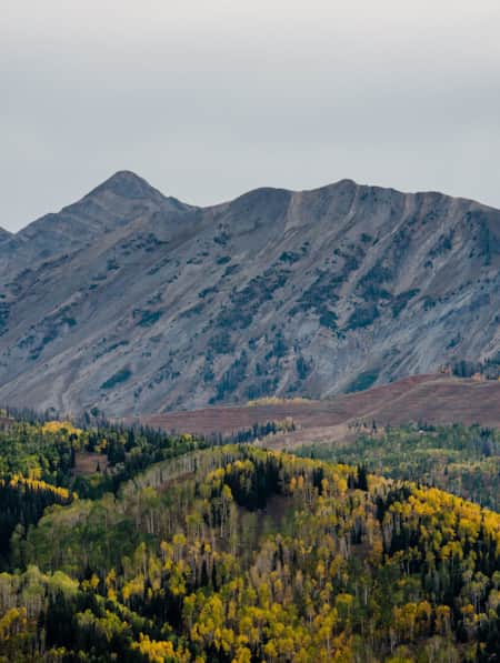
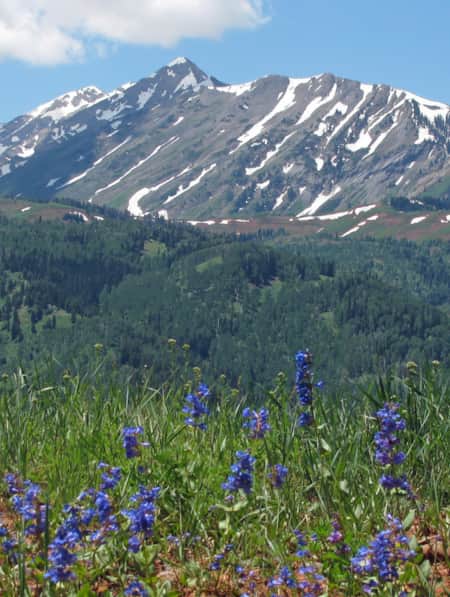
Cutting through the heart of Utah, the Energy Loop: Huntington and Eccles Canyons National Scenic Byway in the Manti-La Sal National Forest captures the best of Utah’s high-alpine experience (think 10,000 feet high) as it meanders over the Wasatch Plateau among contrasting fields of yellow aspens and deep green conifers. Once a common thoroughfare for first generation coal miners and railroaders, this route affords 360-degree views of Mount Nebo and the San Rafael Swell, known as the Little Grand Canyon.
If the weather is cooperating, take a brisk dive in a sparkling reservoir and continue on to Utah’s Castle Country to check out an active dinosaur quarry. The Cleveland-Lloyd Dinosaur Quarry preserves the most concentrated collection of Jurassic dinosaur bones on earth. More than 12,000 bones have been excavated, and several thousand more still remain. Learn more about this drive.
Manti-La Sal National Forest
Photo: Will Pattiz
Pair with the World’s Heaviest Organism
Fish Lake Scenic Byway (S.R. 25)
This byway, Fishlake National Forest, is an often-missed oasis featuring three mountain ranges broken up by desert canyons.
Approaching from the east on Fish Lake Scenic Byway, you’ll pass the forest’s prize jewel, Fish Lake, which is known for its recreational bliss and yellow-blazen aspen forests. Seize the opportunity for a scenic drive in Utah to see the leaves change on an aspen clone known as Pando, which is believed to be the heaviest organism ever found at nearly 13 million pounds. Pando is located about 1 mile southwest of Fish Lake on state Route 25. If you want to pair your drive with mountain biking, hiking, camping, or fishing for eager-to-bite mackinaw and rainbow trout, make sure to add this spot your autumn itineraries bucket list. Learn more about the Fishlake Loop.
Fishlake National Forest
Photo: Courtesy of More Than Just A Forest
Pair with a Miraculously Resilient Landscape
Utah’s Patchwork Parkway National Scenic Byway (S.R. 143), Markagunt High Plateau Scenic Byway (S.R. 14) and Cedar Breaks Scenic Byway (S.R. 148)
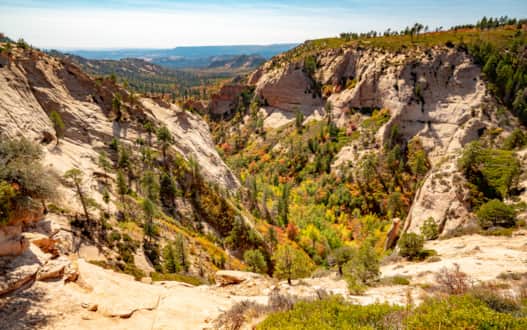
The high-elevation and densely forested area of Southern Utah offers a particularly unique leaf peeping experience this fall. Along Utah's Patchwork National Scenic Byway, you will see maples and aspens, golden and fiery red, rising triumphantly as you journey up to a 10,000-foot plateau. Remarkably, this area connects three scenic byways and features the outstanding Cedar Breaks National Monument — the topmost rise of the geological Grand Staircase.
Known as Southern Utah’s Fall Color Loop, begin your loop in Parowan at the start of Utah’s Patchwork Parkway National Scenic Byway (S.R. 143), weaving through a patchwork of historic towns, geological formations, wildlife habitat and recreational opportunities. The pink cliffs of the Paunsaugunt Plateau glitter in the distance as an ancient lava field sprinkled with aspen trees line the road. Continue as long as you like, but at some point turn (or make your way back to) the junction of S.R. 143 and S.R. 148, which becomes the Cedar Breaks Scenic Byway as you head south. Along this journey you will encounter the large, natural amphitheater of Cedar Breaks, which creates a supreme backdrop for fall leaves. To finish the loop, turn west back towards Cedar City at the junction of S.R. 14. You’re now on your third scenic byway: the Markagunt High Plateau Scenic Byway. Don’t forget to stop at the Zion Overlook or Wood Ranch for your fall-themed picnic feast.
A view of Utah's Patchwork Parkway, Scenic Byway 143.
Photo: Mike Saemisch
Pair with Certified Stargazing
Ogden River Scenic Byway (S.R. 39)
Heading east from Ogden, it’s incredible how dense and varied the foliage gets along this scenic drive within minutes from the metropolitan area. Most color-seekers will travel along the Ogden River Scenic Byway for 44 miles to the eastern boundary of the Wasatch-Cache National Forest at the Monte Cristo Campground. This jaunt passes through narrow canyons, an expansive and beautiful valley, and some fine mountain meadows and forest.
An optional side-trip includes the 9-mile (one way) Trappers Loop Road, which begets marvelous leaf peeping views of the northern Wasatch Front. Come back to the Ogden River Scenic Byway and continue eastward. You’ll drive to the lovely towns of Huntsville and Eden — both have great options for eating if you’re not feeling up for a picnic. If you drive until sunset, consider having dinner and setting up camp so you can behold some stargazing at North Fork Park, a certified International Dark Sky Park. After a day of energizing golden hues, relax those eyes and prepare for a celestial feast. Learn more about this route.
East Fork Trail in the Ogden Valley.
Photo: Jay Dash
Pair with a Bird’s-eye View
Big Cottonwood Canyon Scenic Byway (S.R. 190) and Little Cottonwood Canyon Scenic Byway (S.R. 210)
The glacially carved Big Cottonwood Canyon, home to Brighton Ski Resort and Solitude Mountain Resort, offers immaculate alpine scenery. There are plenty of hiking, biking and picnicking opportunities to take in the views. You can head straight to Brighton at the top of the canyon or take a number of stops along the way. Expand the drive up Big Cottonwood Canyon by continuing to Guardsman’s Pass — located 15 miles up the canyon — which crosses the range and drops you into Park City and Heber Valley.
And Little Cottonwood Canyon is just as much a site as its big sister to the north. It takes the name “little” because it is smaller and more narrow due to its nature as a river-carved canyon (as opposed to glacier-carved) making its trails and vistas all that steeper and more extreme. With few pull-offs to take in the views, get out of the car and head up to a high alpine lake. If hiking isn’t on your agenda, take advantage of a unique opportunity to leaf-peep from a bird’s-eye view. At Snowbird Ski & Summer Resort, take the Aerial Tram to the top of Hidden Peak.
Both canyons offer similar flora and fauna and rock formations. Hike along babbling creeks through pines, navigate your way through aspen groves to high alpine lakes, and scramble your way to a peak to enjoy stunning vistas of the reds, oranges and greens in the canyons below.
A scenic drive through Guardsman Pass is a perfect October activity.
Photo: Austen Diamond
Pair with the Caribbean of the Rockies
Logan Canyon National Scenic Byway (U.S. Route 89)
This scenic drive in Utah is a great route for taking in the season of harvest. Traveling through Cache Valley, this agricultural area has undeveloped terrain, old farms and the painterly aesthetic of the harvest season. From Logan, the 41-mile scenic byway runs alongside the Logan River until it peaks at an elevation of 7,800 feet at a vista overlooking the turquoise waters of Bear Lake — often nicknamed “the Caribbean of the Rockies” — before descending into Garden City.
About a one hour drive each way, much of the trip looks onto limestone cliffs, with aspens, maples and more ablaze in a multitude of hues. This fall foliage paradise is set with the backdrop of evergreens and the deep blue waters of the area’s many lakes and reservoirs.
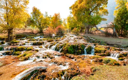
Great stops along the way include Old Ephraim’s Grave, Rick’s Spring, Tony Grove Lake, and Bear Lake Viewpoint. Or hit the trail for a 5-mile hike to a unique limestone formation known as Wind Cave.
The Logan Canyon National Scenic Byway is a great route for taking in the season of harvest.
Photo: Bear Lake Visitors Bureau
Pair with Cascading Waterfalls
Provo Canyon Scenic Byway (U.S. Route 189)
Only 45 minutes from downtown Salt Lake City or Provo, this area’s rugged alpine canyons are brimming with golden aspens and crimson-colored maple that give way to stunning views of Mount Timpanogos and other glacier-carved peaks. The Provo Canyon Scenic Byway connects the beautiful Heber and Utah valleys through Provo Canyon.
A locals’ favorite, it’s worth adding the Alpine Loop (S.R. 92) through American Fork Canyon to your itinerary. Lush vegetation characterizes this route, which is also marked with popular family-friendly attractions (and is also a cyclists' favorite). Time permitting, stop off for a tour of Timpanogos Cave National Monument and Sundance Mountain Resort. If you’re wanting to pair your fall photographs with a waterfall, try a hike to Bridal Veil Falls, Stewart Falls or Cascade Springs.
Alpine Loop Provo Canyon
Photo: Utah Office of Tourism
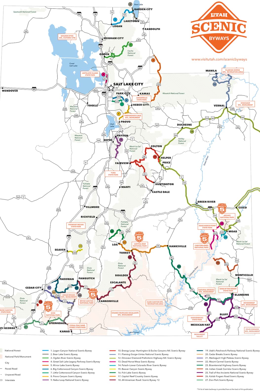
Utah Scenic Byways Map (Click to expand)
Utah's Scenic Byways
In total, Utah’s distinct topography provides the surface for 28 scenic byways, which add up to hundreds of miles of vivid travel experiences wherein the road trip is as memorable as the destination. All of Utah’s scenic byways are explorative journeys filled with trailheads, scenic overlooks, museums, local flavors and vibrant communities where you can stop for the night or hook up your RV.
Discover More
-

10 Top Stops Along the National Pioneer Mormon Heritage Area
Here are 10 of the best stops along Utah's Mormon Pioneer National Heritage Area’s backroads and byways. Explore rich Mormon historic sites, awe-inspiring canyons and mountains and unforgettable outdoor adventures.
-
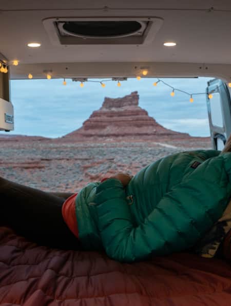
A Van Lifer’s Guide to Responsible Travel in Southern Utah
When Utah’s dirt roads are calling you, it’s time to plan your van life road trip. Here’s what you need to know to travel safely, support Utah’s rural communities, and help preserve the delicate desert landscapes.
-
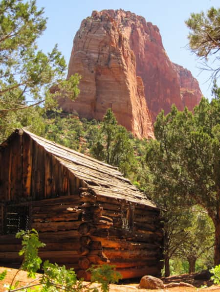
A Visitor's Guide to Zion's Kolob Canyons
In the Kolob Canyons section of Zion National Park, you’ll find a scenic wonderland with an adventure for everyone. Learn more about this unforgettable attraction and plan a visit.
-
An Adventure Guide to Harts Draw Road
Winding up into the Abajo Mountains of southeastern Utah and down into sprawling red rock canyons, the 18-mile Harts Draw Road offers the perfect mixture of snow and sand, scenery and solitude.
-
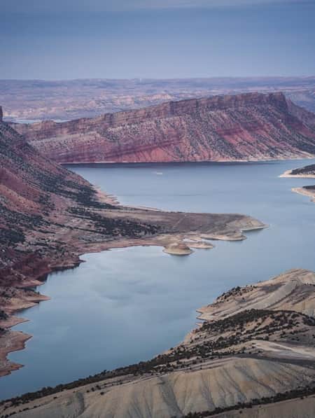
An Old Favorite Fishing Hole at the Flaming Gorge Reservoir
Visit Utah columnist Dan Potts takes us to his "secret" fishing hole on Utah's Flaming Gorge Reservoir, one of the world's most diverse fisheries set among the brilliant red rock walls of Red Canyon in the easternmost corner of the state. Along the way, Dan takes us through some of his favorite landscapes on the drive to and from Salt Lake City.
-
Ancient Pictographs, Petroglyphs and Timeless Mysteries
Exploring Horseshoe Canyon isn’t for everyone. First of all, the effort to get there is an adventure in itself, but those efforts make the reward — namely, the chance to see up close some of the most significant pictograph panels in North America — even more noteworthy.
-
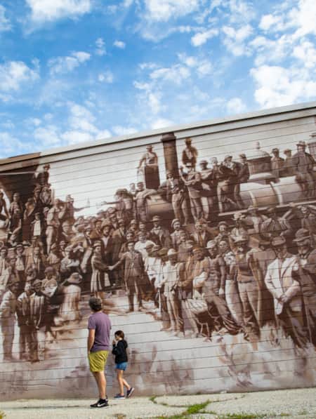
Arrive by Train
Follow author Tim Sullivan and his eight-year-old daughter as they travel by train, bus and bike on a "pilgrimage" to Golden Spike National Historic Site.
-
Be Prepared for the Southern Utah Backcountry
Prepare for a trip out into Utah's rugged red rock backcountry by learning as much as possible about the area before heading out. Stop by a ranger station to educate yourself and pick up necessary permits. Always practice good backcountry ethics and proper safety techniques for a safe and enjoyable adventure.
-
Bear Lake for History Buffs: Top 6 Don't-Miss Sites
Bear Lake’s charms are pretty apparent for anyone interested in the outdoors, water sports, cute small towns or fresh-picked raspberries. But beyond a lovely azure freshwater lake surrounded by cool hiking trails and berry stands, the area has a few special historic sites that you might miss if you didn’t know better.
-
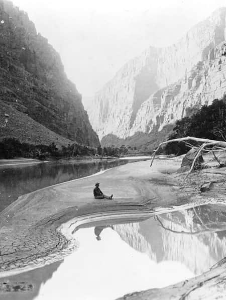
Chasing John Wesley Powell: Six Places to Explore Utah's Green and Colorado Rivers
One hundred and fifty years ago a one-armed Civil War veteran set off with nine mountain men on a scientific expedition to map one of the last blank spaces left on the U.S. map: The Green and Colorado rivers. Much of the river remains wild today. Follow Powell's journey here.
-
Explore Antelope Island's Fielding Garr Ranch
Volunteers Beth and Dennis Simonsen show visitors around the historic Fielding Garr Ranch complex on Antelope Island State Park in Northern Utah.
-
Hole N'' the Rock
Your road trip in Moab might call for a stopover at the famous Hole N” The Rock.
-
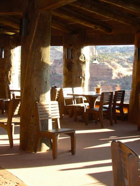
Kiva Koffeehouse
Kiva Koffeehouse is a welcome stop for fresh food and espresso tucked on a hillside down a dirt driveway near milepost 73 on the scenic byway.
-
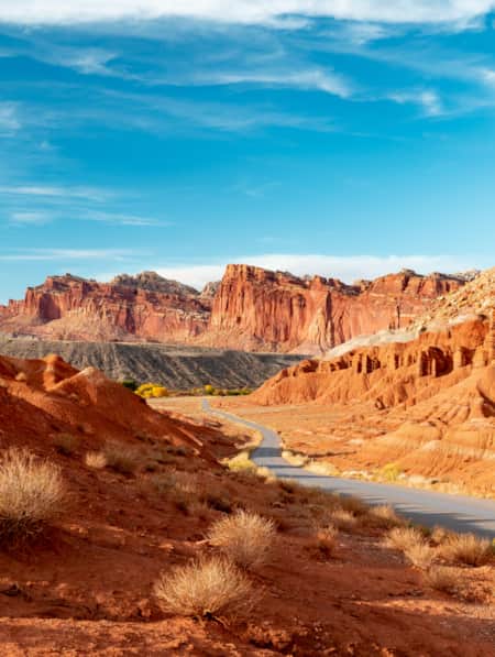
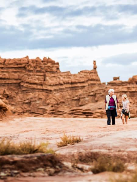
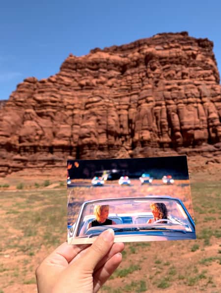
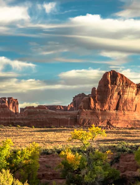
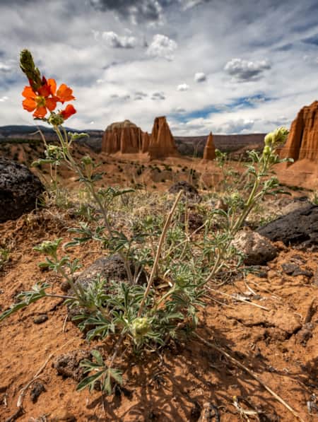
Moonscapes, Marscapes and More
If you want to know what Mars looks like — then the dramatic terrain of Capitol Reef National Park and the surrounding lands are a good place to start.
-
Movies Filmed in Utah: Plotting a Cinematic Drive-Through
Follow a Germany-based film enthusiast on an extended road trip to discover the rich history of Utah cinematography.
-
See the Fall Leaves Near Utah's National Parks
Sure, any of Utah’s Mighty 5 national parks are spectacular year round — covered in snow, peppered with spring wildflowers, and baked in sunshine. But find them exponentially special when the changing fall leaves are in juxtaposition to the immaculate red rock cliffs.
-
Serenity Found in Torrey and Capitol Reef’s Cathedral Valley District
Taking Southern Utah’s remote, less-traveled path in Capitol Reef's Cathedral Valley District to nurture your body, mind and spirit.
-
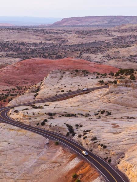
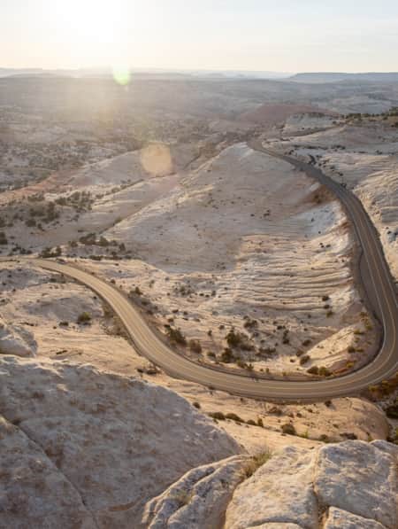
The All-American Road: Scenic Byway 12
This is 122.863 miles (to be exact) of pure driving bliss. Welcome to Utah’s Scenic Byway 12, a designated All-American Road.
-
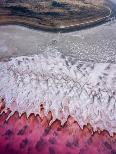
The Spiral Jetty, Utah’s Most Iconic Land Art Sculpture, Keeps Drawing a Crowd
In April 1970, it took six days, 625 man-hours, 292 truck-hours, $9,000, and 6,500 tons of basalt, limestone and mud for Robert Smithson to construct the Spiral Jetty. His work still stands today. Visit and be inspired by this iconic piece of Utah's land art.
-
Tooele? Tuilla? The Fascinating History of this Utah Town
While the town of Tooele has a fascinating story to its name, the best part about one of Utah’s original counties is its history.
-
Touring the Dinosaur Diamond Prehistoric Highway
Discover dinosaurs in Utah. The Dinosaur Diamond Prehistoric Highway is one of the best places to see dinosaurs in Utah.
-
Utah’s Unexpected Pit Stops
Here are 11 mini-adventures to check off your list next time you’re road-tripping through Utah.
-
Why You Should Ditch I-15 on Your Way to Zion
If you’re not in a rush to get to Zion National Park from Northern Utah, consider taking a long, meandering route that features historic sites, adventure breaks and out-of-this-world scenery. Hop off I-15 and take Highway 89 and four nearby scenic byways to see and do as much as you possibly can on your way to Zion.
-
Winter Road Trip: Where to Stay, Hike and Eat When Traveling from Capitol Reef to Bryce Canyon
Need winter break ideas? Take a road trip from Capitol Reef to Bryce Canyon and enjoy the best of Utah landscapes during its quiet season.
-
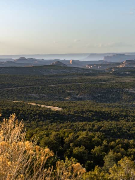
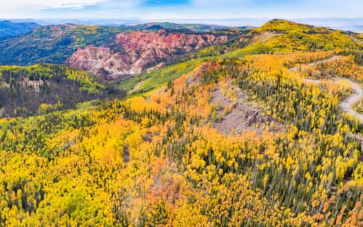
Year-round Vibrance on the Nebo Loop Byway
A National Scenic Byway that Enchants at High Elevations, by Road or Trail