Utah at 15 mph
A family bicycle tour of the wild southwest
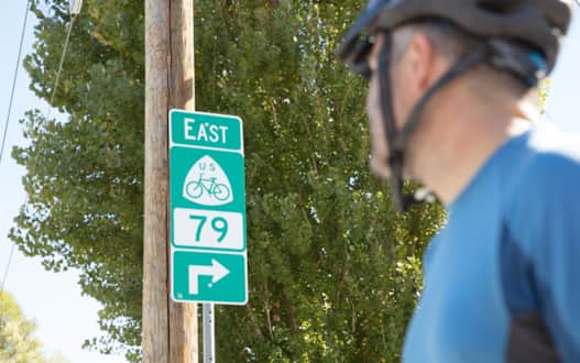
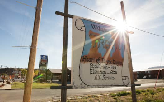
The highway sign looks — different. Entering the town of Milford from the west, Utah state Route 21 presents a collection of expected wayfinding signs under the street trees and power lines of the west desert community. There are the standard beehive-shaped state route numbers, directions to the hospital, park, and other desert communities of Beaver and Delta — even an advertisement for a motel.
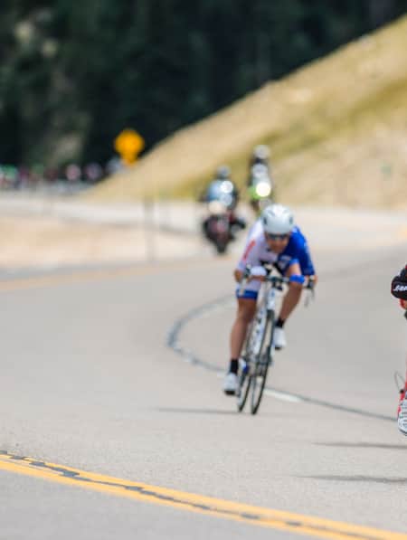
But this one is green, with white shapes around, on the bottom, a “79” and, on the top, a bicycle. I’d never seen anything like it before, in Utah or anywhere else. It’s a welcome sight, because we are riding bikes. And, having seen no other bicycles, either real or on signs, in the last 20 miles of riding, it gives me the sense that I’m not completely crazy for road biking with my family on this lonely Great Basin desert highway.
This is one of the goals of the U.S. Bicycle Route System in Utah (USBRS). The sign is a marker for the USBRS, which completed one of its first segments in the West across Utah. The system’s objective is to create a parallel world of green bike routes alongside the blue highways put in place a hundred years earlier all over America. In many places — like here — the signs are the only physical piece of the route. In Milford, the Utah Department of Transportation had just installed them a few weeks earlier. Yet they announce that, at least on these highways, cyclists are welcome to ride the byways and backroads of the back-of-beyond the same as any auto tourer.
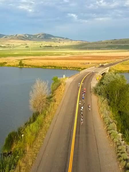
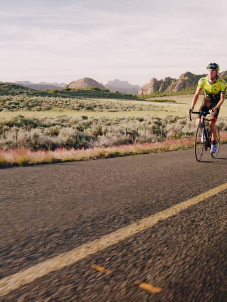
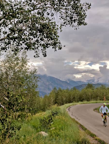
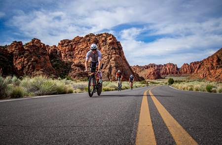
The USBRS is why we’re here on vacation. We want to check out Utah’s piece of this cross-country bike route system. The state’s southern segment is a series of highways starting at the Nevada border near Great Basin National Park and running to Colorado about two-thirds of the way down the state. These bike routes, 79 and 70 in official USBRS numbering, wind their way through our state’s deserts, canyons, plateaus, hoodoos, mesas, mountains, sand dunes and staircases. This route is also part of the Adventure Cycling Association’s “Western Express.”
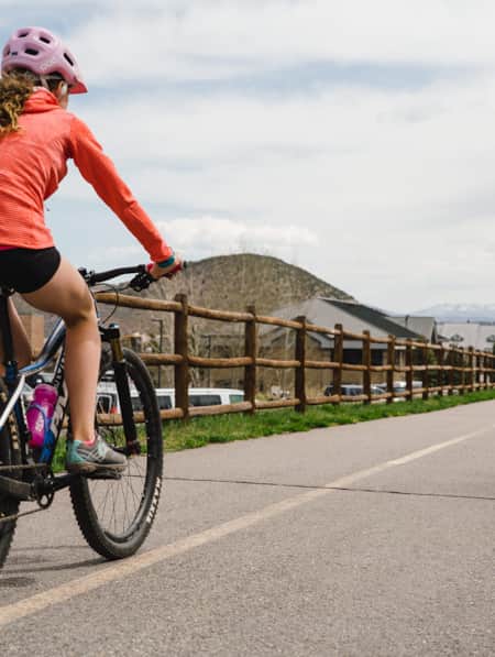
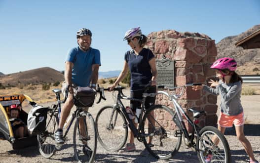
I decided to do a sampler tour of Southern Utah’s USBRS route, targeting two different rides in the west desert and further on in Bryce Canyon country. And by bringing my family, I decided to test the USBRS’s mission to eventually build bikeways suitable to all bicyclists. My wife, Erin, and two kids, Juliet, 6, and Teague, just shy of 4, were on the trip with bikes, a bike trailer and a support vehicle called a sag wagon to help carry the load. We hoped the fifty miles we’d ride would be just the beginning to unlocking a new way to see Utah.
"We hoped the fifty miles we’d ride would be just the beginning to unlocking a new way to see Utah."
Slow Travel Through the Back of Beyond
This is a different kind of traveling. On bike tours you typically move between 10 and 15 miles per hour. So our introduction to Milford is the rolling credits of an old movie rather than a cold open. There is enough time to size up the town as we descend into it, eyeing the lines of the silos, the trees and an immobile train ahead of the Mineral Mountains beyond (Read: Weaving Through Granite Mazes in the Mineral Mountains of Beaver County). The sounds are the wind, the whiz of our tires, our pedals pushing the drivetrain, and more wind. Unlike on the previous night’s drive south from Salt Lake City, the kids aren’t watching movies. If they say anything from their seats behind us, we can’t even really hear them.
Erin has just returned from a week-long trip of bike touring in France with her father. I had been arguing that if you take away the wine and castles and quintuple the distance between towns, it’s not much different than pedaling through the Great Basin. But it is these details that she is pointing out as we cycle into Milford with the kids.
In the towns throughout the Loire Valley, she is recounting, traffic all stopped for the cyclists as they rode into the towns they saw families and people of all ages riding bikes, as travelers immersed in a bike culture.
Milford is in Beaver County — also known as Ramblers — and is just beginning to see adventure cyclists like ourselves (Read: Ramble On: An Insider's Guide to Beaver County). As we pull into town in search of lunch, we find a local cafe, which has a long menu of Chinese and American style food. As we eat Kung Pao chicken, we get the story of the place: the Yee family had migrated to Milford in the 1940s and started a Chinese restaurant near the train station called the Hong Kong Café; after a while it moved to the building we were in and passed through a series of owners.
The cafe embodies the history of the town: Milford is one of the few towns to survive in the rugged environment of the Great Basin. It survived by doing what it needed to do to get by. Founded as a farm town, it turned to the railroad when times got tough, lending the town its unique character.
After lunch, as we ride through town, we see these layers of history: the fading signs on the sides of the buildings — an old ad for ZCMI (a defunct department store), the Spudnut Café, Hotel Atkin; the Hotel Milford, a gorgeous early-20th-century-modern three-story brick building with a huge cornice curving around the corner it sits on. Erin stops and looks in and finds that the comfy-looking furniture is still in it. A bike traveler riding through town, looking around, talking to people, can piece this impression together in a way that is difficult for someone in a car.
***
Our day had begun in Beaver six hours earlier, where we stayed at the Butch Cassidy Inn. We had pulled in late the night before, our car overpacked with stuff we had the slightest chance of needing. I had been to (and through) Beaver dozens of times but had never thought of it as a place to begin an adventure. Yet it was this new mode of travel that led us here, and the next morning we ventured into the far-off blue-gray desert and drove westward to begin our ride.
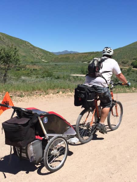
The challenge of adventure cycling with small children was the central crux of this trip. We had brought a fleet of cycles and other cycle-related vehicles with us: besides Erin and my cyclocross type bikes, we brought Juliet’s bike, Teague’s strider bike, a tag-along bike attachment and a bike trailer to hook onto one of the adult bikes.
The kids had no idea what they were getting into but gave us the benefit of the doubt. Still, they had lots of questions.
“Where’s the beaver?” wondered Teague as we drove under I-15.
They are equally curious about Frisco, the ghost town where we launched the day’s ride. Initially, they want no part of anything called a “ghost town,” figuring it’s some kind of village of evil spirits. I remember having the same thought when I was a kid. The fact that ghost towns are simply empty towns was disappointing.
Frisco is about 15 miles west of Milford and actually has some unsavory history. It had been one of the wildest mining towns in the west. Discovery of silver in the nearby San Francisco Mine had slapped together a town with 23 saloons and a populace so violent that a murder occurred once a day. A sheriff was called to enforce law and order but the mine’s production soon declined and the town emptied.
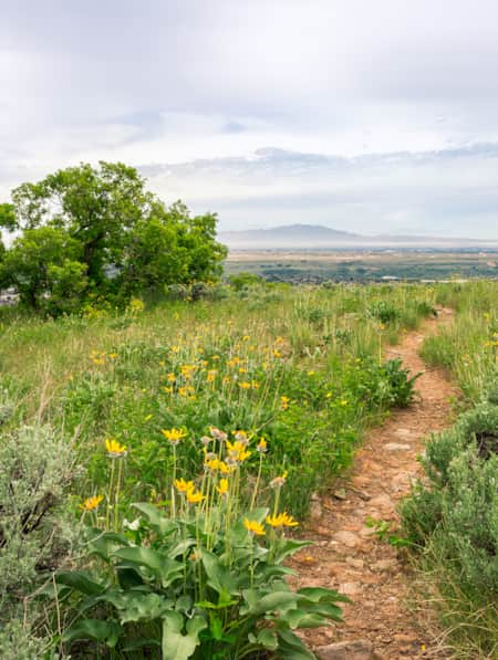
We spent a while poking around the old stone kilns in the dry juniper-covered hills before getting on our bikes. Looking down from the pass, with Milford a green dot in the middle of the valley, and Minersville nestled into the next range beyond, we could see how our ride fit neatly into the traverse of one basin and range unit of this vast landscape. It seemed a respectable day’s travel.
As our ride began we rolled downhill, the four of us wobbling downhill in a line of cycle craft, imagining us moving along the happy green line of the national bike route.
The Challenges of Adventure Cycling
Later that afternoon, the riding isn’t so easy. As Milford thins out to pasture on the way to Minersville, it is easier to feel the black map line of the highway than the green bikeway that guided us earlier.
There are the inherent difficulties of bike touring. We stop at the side of the road in a nasty patch of goatheads, the notorious thorns (we would wake up the next day to a flat on Erin’s bike). We enjoyed a glide downhill from Frisco, but we now have to ride on a steepening slope up the other side of the valley. And, the wind, previously running gently across us, is now a head-on force.
But we are also required to compete with the traditional users of the highways — the autos. Traffic is heavier and faster. The driver of an RV towing a Land Cruiser refuses to give us a lane of deference and lays down on the horn for good measure as he speeds by.
This is where the USBRS has a ways to go, especially if it wants to attract casual riders of all abilities and ages. By the time we end the day in Minersville, I am a solo rider; Erin and the kids had waved the white flag and hopped in our support vehicle.
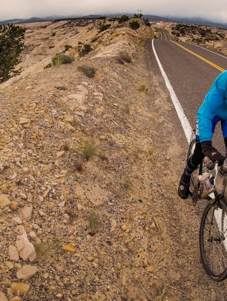
Staying the night an hour away in Cedar City, we continue in the car on U.S. Bicycle Route 79 — but in the car, the Utah state Route 130 moniker is more apt.
Something Unusual Among the Hoodoos of Red Canyon
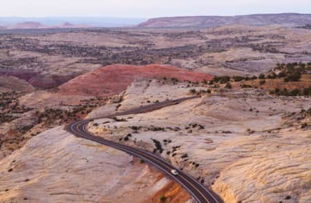
The next morning shows us what a promising future of the U.S. Bike Route system could look like. We begin the day by driving up Cedar Canyon and into the plateaus of the Dixie National Forest before dropping down to the Sevier River Valley — all the while following Utah’s U.S. Bicycle Route, which becomes Route 70 as Utah state Route 12 turns east south of Panguitch. With all the elevation gain, all family members are relieved we are not pedaling on this section.
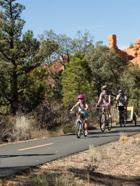
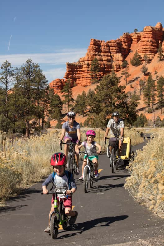
The family does celebrate where we do begin our ride: Today we’d avoid the honking and blow-bys by riding on the separated path that runs up Red Canyon, the parade of carmine hoodoos marching up to the plateau whose other side held Bryce Canyon National Park.
The kids are excited to be wheeling around on their own. We stage the day’s ride at the Thunder Mountain Trailhead and are scarcely ready when Teague takes his Strider bike and jumps out to the lead. Juliet follows, pedaling her bike up the trail, which provides a nice separation from the traffic, incredible views and a relatively easy grade.
As we are almost to the top of Red Canyon, in a segment that curves through the Ponderosa pine trees, we pass a couple riding down the canyon. Their bikes hold panniers and camping gear — and they tell us they are from Ukraine and are bike touring around southwest Utah. They began the trip in St. George.
“We wanted something unusual,” the man says.
He seems to have found something unusual within the USBRS, but we discuss how it needn’t be unique: If other segments of Utah’s U.S. Bicycle Route could achieve this type of separated path, we’d start to really have something. If they could get one of these things through the confines of Red Canyon, it could happen just about anywhere else.
At the top of the canyon, the trail continues along the plateau until the junction with the road leading into Bryce Canyon. It is jarring re-joining the roadway and competing for space with two-ton pickups. And yet it is hard to complain about the 1,000-foot descent on the other side, down through the familiar hoodoos, the payoff for our climb in the morning.
"The kids are excited to be wheeling around on their own. We stage the day’s ride at the Thunder Mountain Trailhead and are scarcely ready when Teague takes his Strider bike and jumps out to the lead."

All Drinks $1.00
We end the day — and the trip — at the bottom of the hill, in the town of Tropic. Riding into the town along Highway 12, I notice how much it has changed from the last time I went through, decades earlier. A new cafe, restaurants and accommodations have sprouted along the town’s handsome Main Street.
At the Bryce Pioneer Village, a group of cabins and motel rooms at the eastern edge of town where enormous cottonwoods shade the lower reaches of Bryce Creek, kids speak French in the hot tub and signs say Toutes Les Boissons $1.00. We eat dinner at Showdowns, the on-site restaurant.
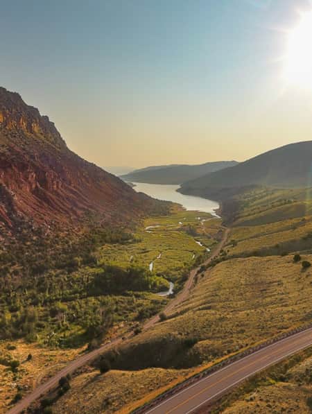
It is tempting to keep going — after all, eastward continues Highway 12, one of Utah’s most scenic travel corridors that runs through the gamut of the state’s landscapes: the sandstone layers of the Grand Staircase, the massive plateau of Boulder Mountain, the white dome and red outcroppings of Capitol Reef National Park. If there ever is a route to bike tour in Utah, it is Highway 12. From there the U.S. Bicycle Route takes on other storied Utah highways — S.R. 24, U.S. 95, U.S. 191, and then east to the Colorado border. It would take several extra days and nights, but it would surely be worth it.
I think the kids felt the same way. In the morning, on our way to breakfast down the street, they insist on riding their bikes there.

More Information
-

Cycling
There are many good reasons why Utah is world famous for its bike riding, both cycling and mountain. View maps and information, trails, resources and recommendations.
-
The All-American Road: Scenic Byway 12
This is 122.863 miles (to be exact) of pure driving bliss. Welcome to Utah’s Scenic Byway 12, a designated All-American Road.
-
U.S. Bicycle Route System in Utah
Scenic, mostly low-traffic roads make Utah bike tours unforgettable. Learn about the U.S. Bicycle Route through Utah and other great touring routes.

Discover More
-
Cedar City to Cedar City 90-Mile Cycling Loop
The 90-mile Cedar City loop is one of Utah’s most challenging and scenic bike routes. Learn all about the route and plan your ride today!
-
Tour de Farmtown: A City Slicker’s Guide to Cycling Cache Valley
Northern Utah's Cache Valley is small enough that you can cross its width and strike out six to seven farm towns in a single afternoon. At each point on the compass, there’s a new community to explore, all with rich pioneer histories. Perched in the north are the cow-dotted hills of Clarkston and Richmond. Ride to the center of the valley, and you’ll find yourself looping around the Bear River with a stellar view of the Wellsvilles and an occasional pelican or sand crane flapping overhead.
-
Discovering Box Elder & Bear River Valley
A father shares his bikepacking journey with his daughter through Northern Utah’s Bear River Valley
-
AndShesDopeToo's Insider's Guide to Ogden
AndShesDopeToo is a worldwide adventure community of women run by Jennifer and Taylor Killian from Ogden, Utah. This insider's guide video highlights their unparalleled access to both the outdoors and the city's "fun counterculture vibe" at the foot of the mighty Wasatch Mountains.
-
Adaptive Cycling in Colorful Cache Valley
Bob Wassom revisits his roots using adaptive cycling on an e-trike, through Cache Valley, Utah; a ride full of color, variety, scenery and history.
-
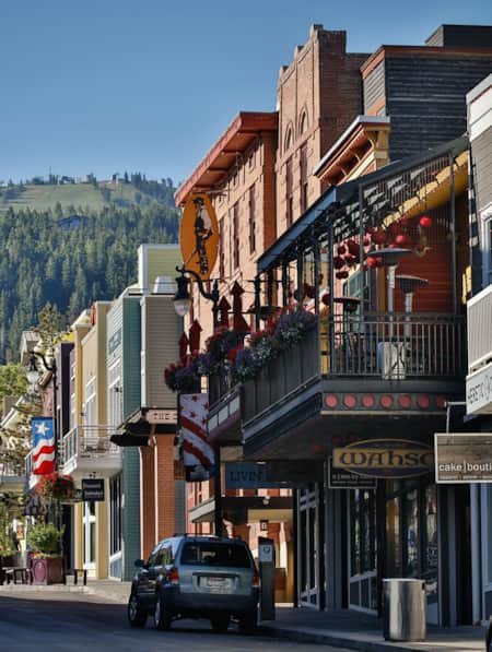
A Classy Warm-Weather Weekend in Park City
When it comes to spending time in Park City — Utah’s snow sports —mecca I prefer the sunny, urbane side of mountain life. Happily, there’s plenty of fun to be had for those who are looking to experience the “city” side of Park City, sans snow.
-
10 Routes Chosen by Utah Cyclists
We reached out to cycling experts and enthusiasts — in some cases to people who literally wrote the book on cycling in Utah — to get a feel for some of Utah's best road cycling routes.
-
Taking Your Family Adventure Cycling
Want to know how to go bike touring with kids? Check out our guide to family adventure cycling in Utah and plan your trip today!
-
A Biking Guide to the Historic Union Pacific Rail Trail
Winding 28 miles through Northern Utah’s Summit County, the Historic Union Pacific Rail Trail travels through some of the state’s most scenic terrain, from the storybook streets of Park City to rolling farmland and wildlife-rich wetlands near Silver Creek Canyon.
-
A Family Bike Tour of Salt Lake’s East Canyon
East Canyon has always been a path for travelers, from the Donner Party to Brigham Young to the Pony Express. In this modern-day tale of travel, a family of three takes on East Canyon by bicycle for a weekend camping trip. They discover historical markers, swimming spots, and lots of ice cream.
-
Cycling Zion: Earning the Descent
Watch Utah cyclist TJ Eisenhart climb Zion National Park’s Kolob Terrace Road. It’s a one-of-a-kind ride that transitions from red rock desert to green valley plateaus.
-
Cycling Scenic Byway 12: Escalante to Boulder
Looking for scenic bike rides in Utah? Scenic Byway 12 has all the breathtaking views (and riding) you could ever hope for. Get the scoop and get ready.
-
Cycling the Centennial Trail
The Centennial Trail forms a loop around Ogden, Utah, linking together the greenbelts along the Ogden and Weber rivers. Along the way, this network of trails brings cyclists to some of Ogden’s main attractions and provides a unique way to build a custom tour with stops at various points of interest.
-
Cycling the Alpine Loop
A local’s favorite for fall splendor, the Alpine Scenic Loop offers a narrow, windy road with lush vegetation and outstanding vistas.
-
Utah's Outdoors Are Wide Open for All Abilities
Utah’s National Ability Center is known for changing lives through its adaptive recreation programs. Truth is, just setting foot on the center’s 26-acre ranch can feel transformative.
-
Spreading the Joy of Adaptive Recreation
Meet three National Ability Center staffers who live outdoor adventuring.
-
Insider's Guide to Salt Lake City Neighborhoods
Check out these neighborhoods on your next trip to Salt Lake City
-
E-Biking Utah’s National Parks
A Mighty 5 e-bike guide to rides in Zion and beyond.
-
Riding With TJ Eisenhart
In 2016, pro cyclist and Utah native TJ Eisenhart had a breakout performance at the Larry H. Miller Tour of Utah, finishing 7th overall in the general classification as part of the BMC Racing Team and being recognized as a Fan Favorite.