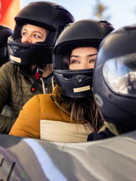
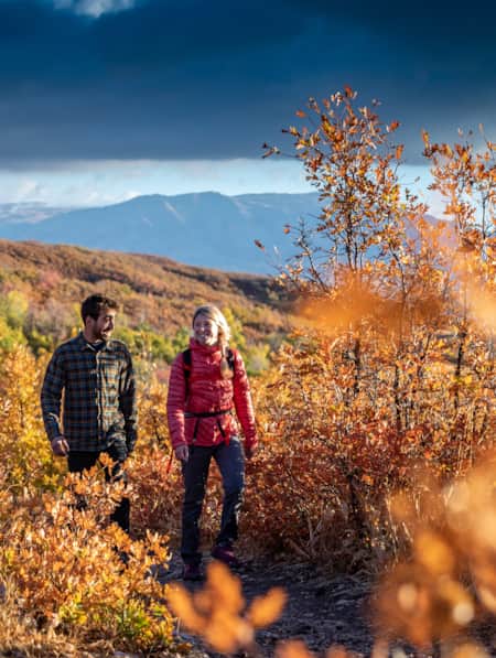
Erkundung von Dinosaur National Monument & Flammende Schlucht
Entdecken Sie beeindruckende Fossilien, aufregende Flussausflüge und prächtige rote Felsenschluchten.
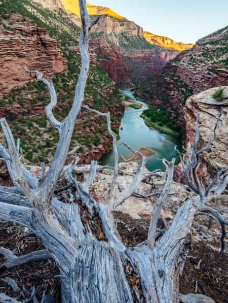
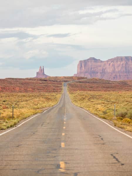
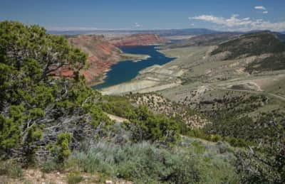
Der Green River fließt 730 Meilen von seinen Quellflüssen in den Wind River Mountains von Wyoming bis zum Zusammenfluss mit dem Colorado River In Canyonlands National Park Während sich der Fluss durch die Schluchten und die Wüste des nordöstlichen Utah schlängelt, verbindet er Dinosaur National Monument Und Flaming Gorge National Recreation Area und bietet Besuchern eine Fülle familienfreundlicher Freizeitmöglichkeiten wie Paddeln, Wandern, Angeln und Zelten.
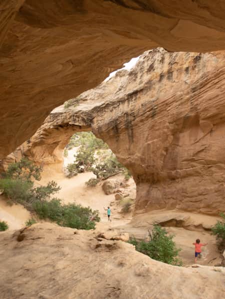
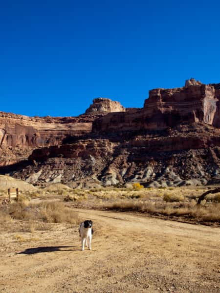
Dinosaur National Monument
Wenn Sie an Dinosaur National Monument Als Erstes denkt man natürlich an Dinosaurier. Sogar der Stempel für die Jahreskarte hat die Form eines Dinosauriers! Doch trotz des Namens sind Dinosaurier nur der Anfang des Erlebnisses hier. Der Westernautor Wallace Stegner schrieb einst über den Dinosaurierpark: „Der Dinosauriersteinbruch, der dem Monument seinen Namen gab, ist nichts anderes als der Vorgarten des Parks.“ Stegner hatte Recht, und es gibt viel zu entdecken im „Hinterhof“ des Dinosaurierparks.
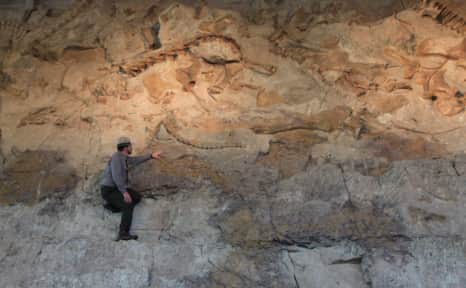
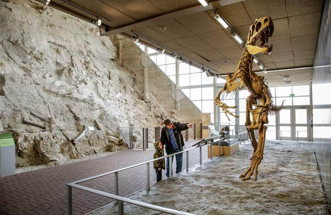
Es lässt sich nicht leugnen, dass Dinosaurier der Grund dafür sind, dass viele Besucher hierherkommen; Uinta-Becken ist weltweit bekannt für seinen Reichtum an Dinosaurierfossilien Und es gibt keinen besseren Ort, um die Knochen und Fossilien dieser prähistorischen Giganten aus nächster Nähe zu betrachten, als im Steinbruch-Ausstellungshalle Beginnen Sie Ihr Abenteuer im Besucherzentrum, wo Ausstellungen und ein Kurzfilm Sie in die Geologie und Geschichte des Monuments einführen. Anschließend geht es hinaus auf den Fossilienpfad, wo Knochen und Fossilien im Gestein freigelegt sind, genau so, wie sie vor über 100 Jahren gefunden wurden. Die 1,9 Kilometer lange Wanderung ist eine großartige Möglichkeit, Kinder für die Paläontologie zu begeistern und ihre natürliche Neugierde für Dinosaurier mit wissenschaftlichen Erkenntnissen zu verbinden. (Lesen Sie: Die wahre Geschichte hinter dem Dinosaurier-Steinbruch)
Vom Besucherzentrum bringt Sie ein kostenloser Shuttlebus zur Steinbruch-Ausstellungshalle. Hier beginnt das Dinosaurier-Abenteuer so richtig. Kinder und Eltern werden gleichermaßen von der beeindruckenden Knochenwand begeistert sein, die über 1.500 Fossilien umfasst, die noch in einer freigelegten Schicht der Morrison-Formation eingebettet sind. Diese Knochen sind die authentischen Skelettreste von Arten aus dem späten Jura, wie Allosaurus, Stegosaurus und Diplodocus.
Dinosaur National Monument
Dinosaur National Monument
Die Tour der Tilted Rocks
Diese 16 Kilometer lange Wanderung beginnt in der Nähe des Besucherzentrums am Steinbruch. Panoramastraße entlang der Cub Creek Road Der Weg bietet Zugang zu Wanderwegen, Felszeichnungen und Piktogrammen, historischen Stätten und malerischen Ausblicken auf die Geologie des Monuments. Besorgen Sie sich unbedingt vor Ihrer Wanderung einen Reiseführer für die Cub Creek Road.
An der ersten Haltestelle gelangt man nach einem kurzen Spaziergang vom Parkplatz zu einer kleinen Nische, die vermutlich eine der ältesten menschlichen Siedlungsstätten des Monuments ist. Swelter Shelter Petroglyphen Es handelt sich um eine Felsbildgruppe mit Petroglyphen (in den Fels geritzten Zeichnungen) und Piktogrammen (Felsmalereien) aus der Fremont-Kultur, die das Gebiet vor etwa 1000 Jahren bewohnte. Der Legende nach erhielt der Swelter Shelter seinen Namen von den Forschern, die die Stätte ausgruben, da sie in der brütenden Sommerhitze arbeiteten.
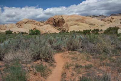
Etwa eine Meile weiter befindet sich der Ausgangspunkt für den Wanderweg Pfad der Stille Diese 5,1 Kilometer lange Wanderung bietet Ihnen ein hautnahes Erlebnis der Wüstenlandschaft und ihrer Geologie. Sie wandern durch schiefe Gesteinsschichten, über glatte Felsen und entlang eines saisonalen Bachbetts. Einige Abschnitte des Weges sind steil und felsig und erfordern Kletterei, um weiterzukommen. Sie können aber so weit gehen, wie Sie möchten, und jederzeit umkehren.
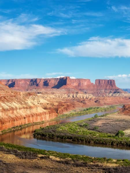
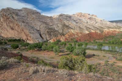
In einer weiteren Meile erreichen Sie die Abzweigung nach Campingplatz Split Mountain Einer der landschaftlich schönsten Campingplätze in der Region. Direkt am Ufer des Flusses gelegen, bieten die Stellplätze einen atemberaubenden Blick auf die rot-orangefarbenen, schräg gestellten Gesteinsschichten. Selbst wenn Sie nicht campen, ist die farbenfrohe Felsformation am Split Mountain ein absolutes Muss. Hier wurden einst ebene Gesteinsschichten vor Millionen von Jahren durch geologische Kräfte dramatisch nach oben gewölbt. Auf der steilen Abfahrt zum Campingplatz bietet ein Aussichtspunkt einen Panoramablick auf den Fluss und die Felsen. Die Bootsrampe am Split Mountain ist der Ausstiegspunkt für Boote. Rafting-Touren auf dem Green River einschließlich täglicher Ausflüge durch die Split Mountain Gorge und Mehrtägige Touren durch den Lodore Canyon Die
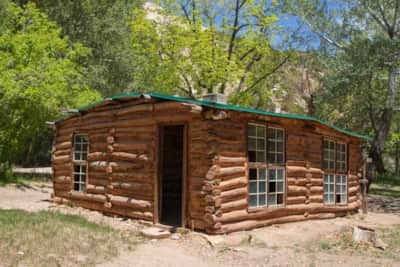
Acht Meilen vom Besucherzentrum entfernt endet die asphaltierte Straße, und die Cub Creek Road führt zwei Meilen lang als Schotterstraße weiter bis zum historischen Gebäude. Josie Morris Hütte Josie wurde 1874 in Arkansas geboren. Als sie drei Jahre alt war, zog ihre Familie nach Westen. 1913, da sie kein Geld für ein Grundstück hatte, beschloss sie, sich am Cub Creek niederzulassen. Sie baute mehrere Hütten und hielt Rinder, Schweine und Hühner. Während der Prohibition braute sie Aprikosenbrand und Traubenkirschwein. Josie starb 1965, nachdem sie über 50 Jahre lang ein autarkes Leben in ihrer Hütte geführt hatte. Nehmen Sie sich Zeit, das Grundstück zu erkunden und sich vorzustellen, wie Josies Leben ohne moderne Annehmlichkeiten gewesen sein muss. Zwei kurze Wanderwege führen von hier zum Hog Canyon und Box Canyon Beide Wege sind leicht zu begehen und bieten schattige Abschnitte mit Bäumen.
Island Park Road
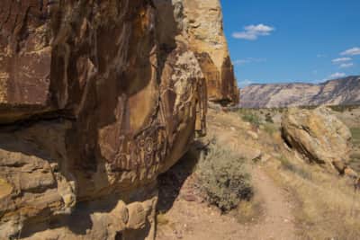
Dinosaur National Monument umfasst kilometerlange Schotter- und Feldwege, die die Möglichkeit bieten, abgelegene Schluchten und malerische Aussichtspunkte zu erkunden. Obwohl für viele dieser Strecken Allradfahrzeuge erforderlich sind, Island Park Road Die Strecke ist oft für Autos geeignet (obwohl eine gewisse Bodenfreiheit empfohlen wird). Die Hauptattraktion auf dieser Route ist das beeindruckende Felsbildtafel von McKee Springs etwa 22 Meilen vom Quarry Visitor Center und 12 Meilen die Island Park Road hinunter.
Die über einen kurzen Rundweg erreichbaren Felsbildtafeln sind bekannt für ihre großen, menschenähnlichen Figuren, die in die Sandsteinklippen gemeißelt sind. Im Besucherzentrum sollten Sie sich nach der Wegbeschreibung und dem aktuellen Zustand der Island Park Road erkundigen, da die Strecke bei Regen und im Winter unpassierbar sein kann.
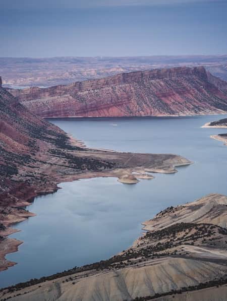
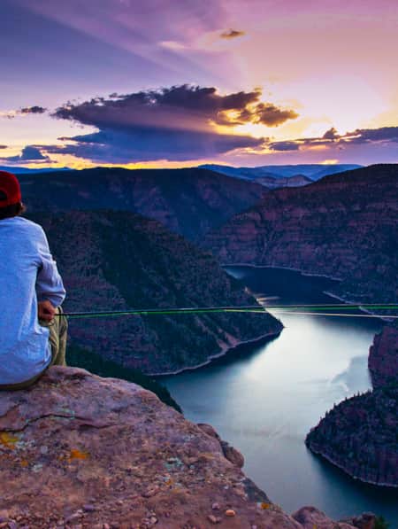
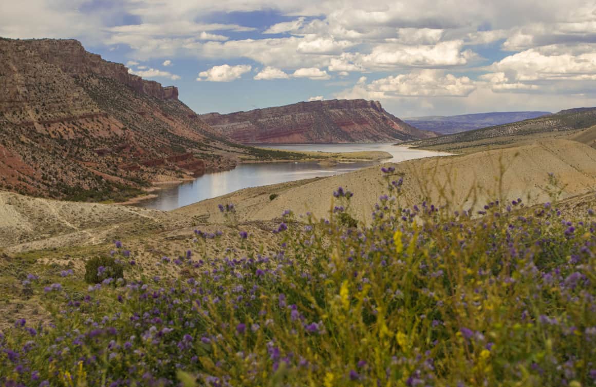
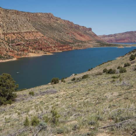
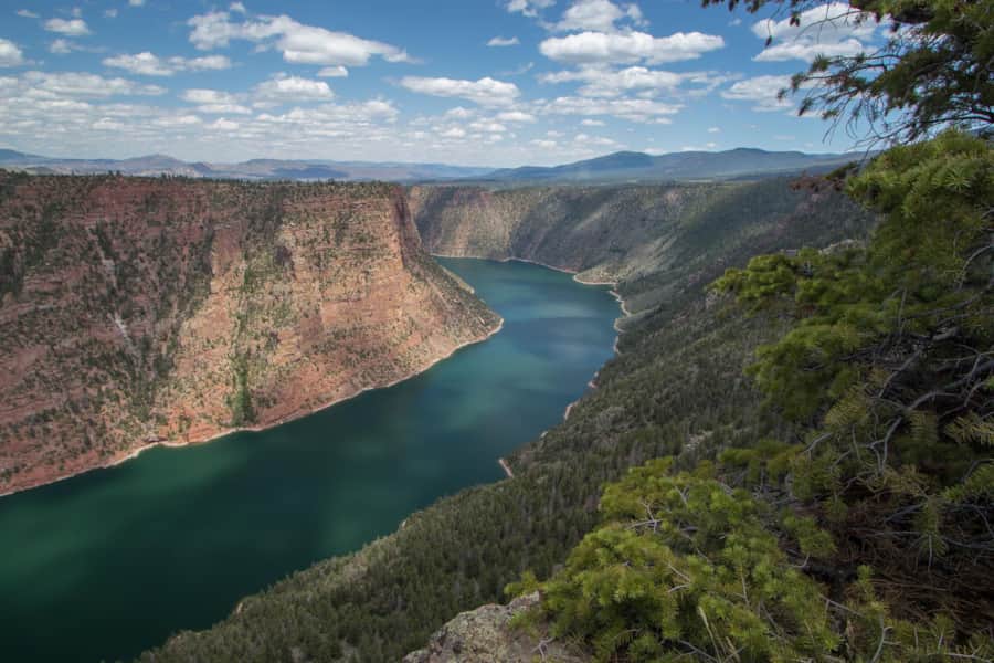
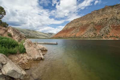
Flaming Gorge National Recreation Area
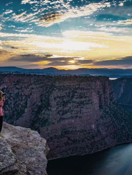
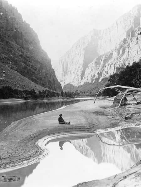
Als der Geologe und Entdecker John Wesley Powell 1869 auf seiner berühmten Expedition in die Uinta Mountains den Green River hinunterfuhr, war er von den Farben des Canyons überwältigt (Lesen Sie: Auf den Spuren von John Wesley Powell: 6 Orte, die es zu erkunden gilt: Green River und Colorado River In seinem Tagebuch schrieb er: „Der Green River mündet durch eine leuchtend rote, aufleuchtende Schlucht in das Gebirge. Wir nennen sie Flaming Gorge.“ Trotz anfänglicher Versuche einiger, den Namen zu ändern, wurde Powells Bezeichnung für das Gebiet schließlich offiziell.
Der Flaming-Gorge-Staudamm und der dazugehörige Stausee wurden 1964 fertiggestellt, um die südwestlichen Bundesstaaten mit Wasserspeicherung und Wasserkraft zu versorgen. Mit der Schaffung von Flaming Gorge National Recreation Area Im Jahr 1968 eröffneten sich zahlreiche neue Freizeitmöglichkeiten in einer spektakulären Kulisse aus roten Felswänden und weiten blauen Gewässern.
„Die Flaming Gorge ist der Ort, wo Abenteuer auf natürliche Schönheit trifft“, sagt Jordynn Hewitt, Tourismusentwicklungsassistentin im Bezirk Daggett. „Ihre weltberühmten Forellengewässer, die ruhigen Buchten und die weiten Ausblicke auf die Schlucht ermöglichen es den Besuchern, sich mit der Natur zu verbinden, egal ob sie Nervenkitzel oder Ruhe suchen.“
„Flaming Gorge ist der Ort, wo Abenteuer auf natürliche Schönheit trifft. Die weltberühmten Forellengewässer, die ruhigen Buchten und die weiten Ausblicke auf die Schlucht ermöglichen es den Menschen, sich mit der Natur zu verbinden, egal ob sie Nervenkitzel oder Ruhe suchen.“
– Jordynn Hewitt
Aussichtspunkt Sheep Creek
Bootsrampe Sheep Creek
Aussichtspunkt Red Canyon
Genießen Sie die Aussicht auf der Flaming Gorge-Uintas National Scenic Byway
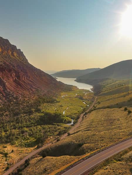
Der Flaming Gorge-Uintas National Scenic Byway Die Strecke führt durch bewaldete Landschaften, vorbei an farbenprächtigen geologischen Formationen und bietet atemberaubende Ausblicke auf den Flaming Gorge Reservoir. Die Nebenstraße verläuft von Vernal auf dem US Highway 191 nach Norden in Richtung Wyoming und umfasst das Gebiet des Flaming Gorge Dam und die Stadt Dutch John. Der westliche Abzweig der Nebenstraße folgt der Route 44 zur Stadt Manila und führt zum Red Canyon und Sheep Creek Gebiete. Für eine längere Reise können Sie die gesamte Nebenstraße als Rundweg befahren und dabei über einen 16 Kilometer langen Abschnitt der I-80 östlich von Green River, Wyoming, anschließen.
Unter all den atemberaubenden Ausblicken in Utah ist das Panorama am Red Canyon Overlook ein absolutes Muss. Vom Red Canyon Visitor Center führt ein kurzer Spaziergang zu Aussichtspunkten an einer Klippe, die 427 Meter tief zum Fluss abfällt. Wer Höhenangst hat, kann die Aussicht auch durch die großen Fenster im Besucherzentrum genießen. Fotografen zieht es das ganze Jahr über zum Red Canyon, um ikonische Fotos dieser Szenerie zu machen.
Für einen längeren Aufenthalt in der Gegend, Red Canyon Lodge Die Lodge bietet voll ausgestattete Hütten und gehobene Gastronomie inmitten eines Waldes an einem privaten See. In den Sommermonaten gibt es einen kostenlosen Kinderangelteich, in dem junge Angler Regenbogen- und Bachforellen angeln und diese wieder freilassen können.
Fahren Sie die malerische 13-Meilen-Strecke. Geologische Schleife Sheep Creek Die Straße schlängelt sich durch Felsformationen und veranschaulicht die geologische Geschichte von Sheep Creek. Sie folgt der Uinta-Verwerfung am Nordrand der Uinta Mountains und zeigt dramatisch gefaltete und geneigte Gesteinsschichten. Mit etwas Glück kann man zwischen den Felsspitzen sogar Rocky-Mountain-Dickhornschafe entdecken. Nahe dem Geologischen Rundweg (EX_cd9e028f562545aba9fa5ff37f62a2e3__ 44 bietet der Aussichtspunkt Sheep Creek Overlook einen Panoramablick auf die Sheep Creek Bay und die farbenprächtigen Sandsteinklippen aus 150 Metern Höhe über dem Stausee.
Im Herbst ist der Aufstieg der Kokanee-Lachse im Sheep Creek ein besonderes Erlebnis für Naturliebhaber. Diese Binnenlachsart lebt ausschließlich im Süßwasser. Jeden Herbst wandern sie vom Stausee zu Bächen wie dem Sheep Creek, um zu laichen, und färben sich dabei leuchtend rot, bedingt durch die Pigmente ihrer Nahrung. Der Aufstieg der Kokanee-Lachse dauert in der Regel nur wenige Wochen, von Mitte bis Ende September. Die besten Beobachtungsplätze befinden sich an den Brücken nahe dem Beginn des Geologic Loop.
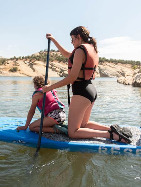
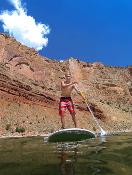
Erkunden Sie Fluss und Stausee mit dem Paddelboot oder lassen Sie sich treiben.
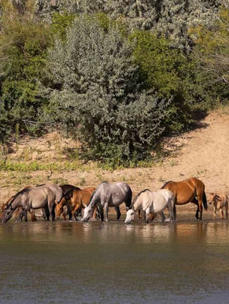
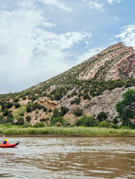
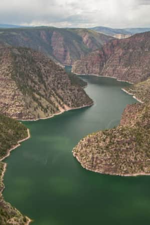
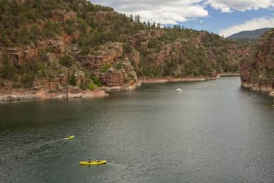
Mit seinen 580 Kilometern Uferlinie bietet der Flaming Gorge Stausee unzählige Möglichkeiten für Wassersport. Erkunden Sie die ruhigen Abschnitte des Stausees mit einem aufblasbaren Kajak oder Stand-Up-Paddleboard. Wer es etwas spritziger mag, kann die elf Kilometer lange Strecke zwischen dem Flaming Gorge Damm und dem Stausee mit dem Kajak oder Raft befahren. Erholungsgebiet Little Hole Sie paddeln durch Stromschnellen der Klasse II mit Namen wie Diving Board und Mother-in-law und gleiten durch ruhigere Abschnitte, die es Ihnen ermöglichen, sich zu entspannen und die Landschaft zu genießen. Dutch John Resort bietet Kajak-, Floß- und Stand-Up-Paddleboard-Verleih sowie Transport- und Einsetzdienste an. Wenn Sie lieber mit einem Guide unterwegs sein möchten, Dinosaurier-Fluss-Expeditionen Führt von Ende Mai bis Anfang September täglich Fahrten durch diesen Abschnitt der Green River durch. Wenn Sie eine größere Strecke zurücklegen möchten, Flaming Gorge Resort Und Cedar Springs Marina Mieten Sie Motorboote, die sich perfekt eignen, um die Buchten und Strände des Stausees zu erkunden.
Fischen in erstklassigen Gewässern
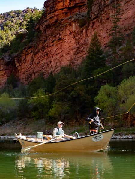
Mit seinen kühlen, tiefen Gewässern und regulierten Strömungen ist der Flaming Gorge für seine Rekordfänge auf Landes- und Weltebene bekannt und zählt damit zu den beliebtesten Angelgewässern im Westen (Weiterlesen: Angeln in der Flammenden Schlucht Die vielfältigen Fischbestände umfassen kapitale Seeforellen, Regenbogenforellen und Kokanee-Lachse. Der Stausee ist 146 Kilometer lang und hat über 580 Kilometer Uferlinie. Unterhalb des Flaming-Gorge-Staudamms, der Wasserfluss und -temperatur beeinflusst, gilt das Gebiet als eines der besten Flussabflussgewässer des Landes mit Forellenbeständen von bis zu 13.000 Fischen pro Kilometer.
Wenn Sie Ihr Erlebnis zu einem unvergesslichen Erlebnis machen möchten, unternehmen Sie eine geführte Angeltour mit einem der lokale Ausstatter Egal ob Sie sich für Fliegenfischen oder traditionelles Angeln interessieren, die Guides verfügen über Spezialkenntnisse der örtlichen Gewässer und des Fischverhaltens und können Sie zu den besten Angelplätzen bringen.

Aktivitäten
-
Angeln in der Flammenden Schlucht
Menschen aus aller Welt reisen nach Flaming Gorge National Recreation Area, um dort rekordverdächtige Forellen und Kokanee-Lachse zu angeln.
-
Paddeln im Flaming Gorge Reservoir
Der Flaming Gorge Reservoir ist 91 Meilen lang und hat über 360 Meilen Uferlinie – ideal für Erkundungstouren mit dem Paddel. Eine Kanu-, Kajak- oder Stand-Up-Paddleboard-Tour auf dem tiefblauen Wasser verspricht ein unvergessliches Erlebnis.
-
Radfahren in der Flaming Gorge und darüber hinaus
Eine Reise durch die Zeit: Dinosaur National Monument zur malerischen Flaming Gorge
-
Camping in der Flammenden Schlucht
Zahlreiche Campingplätze sind über das gesamte Gebiet verstreut.
Geschichten, die Sie zu Ihren Reisen inspirieren
-

Ein altbekannter Angelplatz am Flaming Gorge Reservoir
Unser Kolumnist Dan Potts nimmt uns mit zu seinem „geheimen“ Angelplatz am Flaming Gorge Reservoir, einem der fischreichsten Gewässer der Welt, eingebettet in die leuchtend roten Felswände des Red Canyon im äußersten Osten Kaliforniens. Auf dem Weg dorthin und zurück zeigt uns Dan einige seiner Lieblingslandschaften.
-
Dinosaurland Top 5
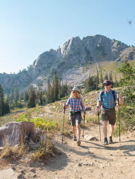
Vernal, Utah, ist ein Abenteuer-Basislager zum Besten des östlichen Utah. Der Landkreis um den Landkreis Dinosaurland bietet vielfältige Möglichkeiten zur Erholung im Freien und zur Erforschung der Naturgeschichte in drei State Parks sowie unzählige Ausgangspunkte für Wanderwege zum Ashley National Forest.
-
8 sonnige Ausflugsziele in versteckten Orten im Norden von Spanien
Sie bevorzugen Reiseziele abseits der Touristenpfade? Dann besuchen Sie diese Ackerstädte, Wüstenorte und Bergwiesen für Outdoor-Abenteuer und den Charme der Hauptstraßen.
-
Vernal: Ihr unkompliziertes Reiseziel für Outdoor-Abenteuer
Vernal ist berühmt für seine Dinosaurierfossilien, aber dieses "Dinosaurierland" bietet auch einfachen Zugang zu einer Vielzahl von Outdoor-Abenteuern, vom Rafting und Stand-Up-Paddling bis zum Klettern.
-
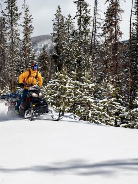
Warum Schneemobilfahren im unwegsamen Gelände eine unvergessliche Art ist, die Uinta Mountains zu erleben
Die Uinta Mountains liegen etwa 160 Kilometer östlich von [Ort einfügen] und nur wenige Minuten von [Ort einfügen] im Osten von [Ort einfügen] entfernt. Sie zählen zu den beliebtesten Schneemobilgebieten des Bundesstaates.
-
Auf dem Canyonrandweg hinaus (und zurück)
Flaming Gorge ist ein noch unentdecktes Reiseziel, das auf mehr Reiselisten stehen sollte: Es bietet spektakuläre Tierbeobachtungen, eine Landschaft wie aus dem Bilderbuch und jede Menge Outdoor-Abenteuer.
-
Vernal Equinox: Eine neue Saison in Vernal, Utah
Entdecken Sie den wachsenden Abenteueraußenposten in einer geologisch faszinierenden Ecke des östlichen Utah.
-
Auf den Spuren der Gesetzlosen
Cowboys und Dinosaurier – das verbindet man nicht unbedingt miteinander. Doch in Dinosaur im Nordosten von Kalifornien haben sie eines gemeinsam: eine atemberaubende Landschaft als Kulisse. Diese Landschaft und die bewegte Geschichte machen Dinosaur zu einem absoluten Muss für jeden Besucher.
-
11 weitere Wintererlebnisse außerhalb der Skigebiete
Ganz gleich, wie abenteuerlustig Sie sind, Sie werden einen guten Grund finden, sich etwas Zeit für einen Tag außerhalb des Resorts zu nehmen.
-
Ihr Reiseführer zu den Nationalen Wildtierreservaten von Utah
Dieser Leitfaden enthält alles Wissenswerte über die Nationalen Wildtierreservate von Utah, einschließlich Besucheraktivitäten, Vogelbeobachtung und den besten Campingplätzen.
-
10 von Utah Radfahrern ausgewählte Routen
Wir haben uns an Radsportexperten und -begeisterte gewandt – in einigen Fällen an Leute, die buchstäblich das Standardwerk über Radfahren in Utah geschrieben haben –, um ein Gefühl für einige der besten Rennradstrecken in Utah zu bekommen.
-
Eine Tour durch die malerischen Nebenstraßen von Sheep Creek und Spirit Lake (Flaming Gorge National Recreation Area)
Erkunden Sie die abgelegenen Wege des Sheep Creek innerhalb des Sheep Creek. Erleben Sie atemberaubende Landschaften, Felsformationen und Wildtiere.
-
8 Utah Wanderungen zur Laubfärbung und Naturschönheit
Wenn sich die Blätter verfärben, erstrahlen Autoreisen durch die Berge und Wälder von Utah in einem neuen, farbenfrohen Glanz. Anders als die vielbesuchten Gegenden an der Ostküste sind die Herbstfarben und Wanderwege von Utah unter den meisten Laubfröschen weniger bekannt.
-
Flaming Gorge: Ein Paradies für Bootsfahrer und Paddler
Wussten Sie, dass der Flaming Gorge See einer der besten Seen zum Bootfahren in [EX_9a4ba6ba061e4f07aa2b92ff758b80f4__] ist? Lesen Sie alles über dieses atemberaubende Gewässer und planen Sie einen Ausflug!
-
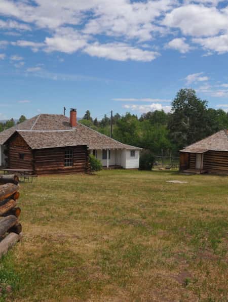
Erkunden Sie ein Pioniergehöft in der Nähe der Flaming Gorge
Im Herzen von Flaming Gorge National Recreation Area liegt die Swett Ranch, ein Zeugnis der Selbstversorgung und des Einfallsreichtums der Pioniere von Utah, die die vergangene Ära der Siedler repräsentiert, und ein historischer Ort, den sich niemand entgehen lassen sollte, der sich für das Leben der Pioniere interessiert.
-
Auf den Spuren von John Wesley Powell: Sechs Orte, die es zu erkunden gilt – die Flüsse Green und Colorado
Vor 150 Jahren brach ein einarmiger Bürgerkriegsveteran mit neun Trappern zu einer wissenschaftlichen Expedition auf, um eines der letzten unerforschten Gebiete auf der US-Landkarte zu kartieren: die Flüsse Green und Colorado. Große Teile des Flusses sind bis heute unberührt. Verfolgen Sie Powells Reise hier.
-
Hundefreundlich Utah: Der Weg zu Mächtig
Möchten Sie Ihren vierbeinigen Freund mit in den nächsten Urlaub nehmen? Utah bietet zahlreiche tolle, hundefreundliche Nationalparks und andere attraktive Reiseziele. Schauen Sie vorbei und planen Sie Ihre Reise!
-
Ein Leitfaden zu den vielen Gesichtern von Utah's Green River
Der mächtige Fluss schlängelt sich über 1175 Kilometer durch eine dramatische und abwechslungsreiche Landschaft aus Bergen, Schluchten und Wüste. Ob Sie nur ein paar Stunden oder mehrere Wochen Zeit haben – erleben Sie die Vielfalt dieses Flusses selbst, indem Sie aufs Wasser gehen.
-
Geführte Raftingtour durch die Tore von Lodore
Erkunden Sie geführte Rafting-Expeditionen durch die Gates of Lodore, eine der begehrtesten Wildwasser-Rafting-Touren von Utah mit Dinosaur River Expeditions.
-
Wo man in diesem Frühjahr in Utah angeln kann
Wir haben Ihre Empfehlungen für Angelplätze im Norden und Süden für diesen Frühling.
-
Ein Roadtrip, der das Leben bereichert
Begeben Sie sich mit Aaron Millar, dem Moderator des Podcasts „The Armchair Explorer“, auf eine Abenteuerreise durch Utah – inklusive Audio-Postkarten unterwegs.
-
Das landschaftlich reizvollste Reiseziel für kapitale Forellen.
Die Flaming Gorge (EX_b58769416fb84e2fb8b83c74a91583b0__) ist einer der besten Angelplätze der Welt für Forellen. Atemberaubende Landschaften und ein reicher Fischbestand locken Angler aus aller Welt an. Unbedingt ausprobieren!