Uinta Basin
Top Activities
-
Cross-Country & Skate Skiing
Here, semi-arid summers give way to achingly beautiful winters. You won’t find any of Utah's major ski resorts nearby but adventure is abundant in this region. Cross-country skiing in the surrounding mountains or trekking across the rolling planes on skate-skis are great ways to spend a winter day in the Uinta Basin.
-
Fantasy Canyon
Peculiar stone structures have been intricately carved by weathering and erosion at Fantasy Canyon. Take a short 0.6 mile loop trail to explore this miniature canyon up close. Located near Vernal, you’ll be following oil service roads where navigation can get tricky, so be sure to bring a map.
-
Fishing the Duchesne River
Many creeks and tributaries trickle down from the foothills of the Uinta Mountain and flow into the Duchesne River. This is a favorite spot among both beginner and experienced anglers. Mountain whitefish and cutthroat, rainbow and brown trout are common catches. Stay mindful to avoid crossing into private property.
-
Fishing the Green River
The Green River, fed by the Duchesne River and its tributaries, arcs in from Colorado on the northeastern side and slices the Uinta Basin in half. Anglers catch mostly brown trout on this stretch of the river. Although bites may be a bit few and far between, this is where the river’s largest fish can be found.
-
McCoy Flats
The desert highlands on the northern edge of the Uinta Basin, just west of Vernal, are home to pronghorn, wind and the mountain bike track network of McCoy Flats. This non-motorized trail complex with up to 35 miles of interconnecting paths holds something for all abilities.
-
Utah Film Trail
Northeastern Utah has long been the place for experiencing the unknown, including aliens, ghosts, dinosaurs and more. The otherworldly landscapes of the Uintah Basin have been dubbed UFO Valley. This fascination has sparked many television shows to document the area's paranormal activity as seen on "Ghost Adventures" (2008), "Expedition X" (2020), "The Secret of Skinwalker Ranch" (2020), and "Mystery at Blind Frog Ranch" (2021).
What's Nearby
-

Dinosaur National Monument
Northeastern Utah’s dinosaur legacy comes to life at Dinosaur National Monument, where geological and climatic forces have tilted, warped, and eroded the earth’s crust to reveal a treasure trove of fossils.
-
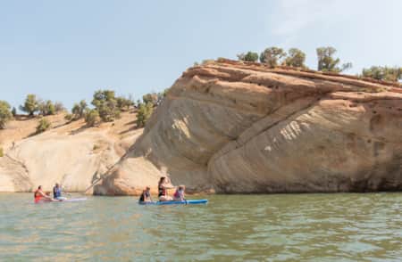
Flaming Gorge National Recreation Area
With more than 200,000 acres of land and water, Flaming Gorge is a scenic playground for boating, waterskiing, windsurfing, camping and backpacking in addition to some of the best fishing in the west.
-
Fort Duchesne
Fort Duchesne is in the heart of the Northern Ute Tribe's protected Tribal Lands in the Uinta Basin.
-
Red Fleet State Park
Known as “Little Lake Powell,” Red Fleet State Park offers fishing, hiking, camping, biking and more in a gorgeous sandstone lake setting. Plan a trip!
-
Starvation State Park
There is a bridge along U.S. Highway 40 when driving between Heber City and Vernal that takes you over Starvation Reservoir. As you pass above, you can’t help but notice the stunningly blue waters of the lake framed in the unique canyon country of northeastern Utah.
-
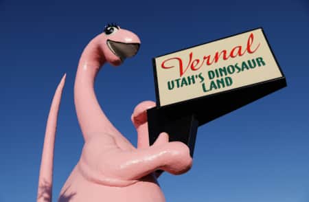
Vernal
Enjoy a family adventure in Vernal, UT, with a list of hotels and fun things to do with kids in the area.


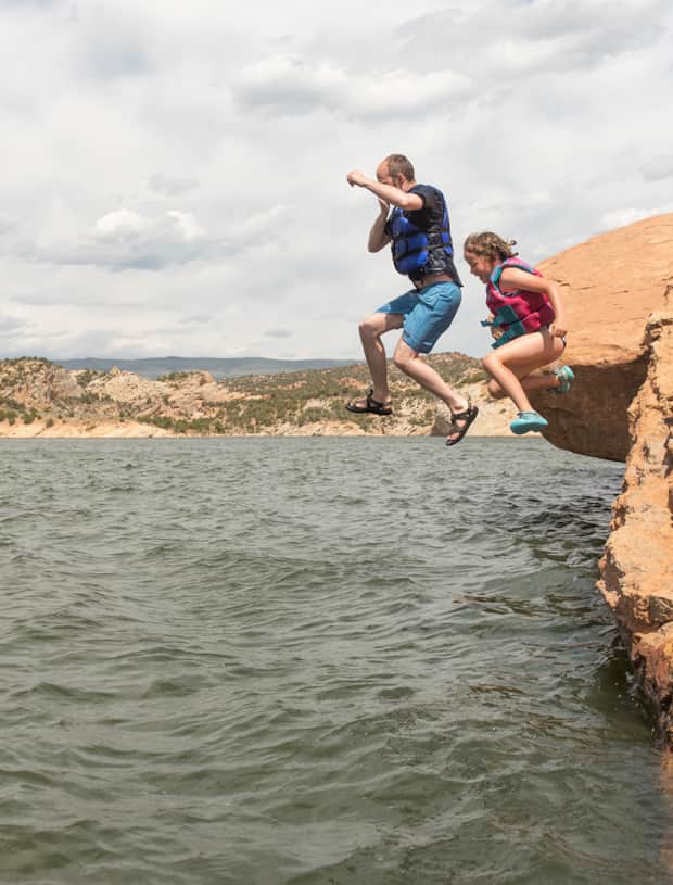
Sandstone Spires & Swimming Holes
Walk the paths of dinosaurs and descend through 200 million years of geologic history in this six-day road trip from Vernal to Kodachrome Basin. It’s a kid-friendly desert drive in search of dino tracks, slot canyons and swimming,
Highlights
- Dinosaur Tracks in Vernal
- Crystal Geyser in Green River
- Hoodoos & Slots of Goblin Valley
- The Red Cliffs of Capitol Reef
- The White Cliffs of Grand Staircase
- Sandstone Spires in Kodachrome Basin