The Petroglyphs of Comb Ridge
A 120-Mile Long Monocline Pockmarked with History

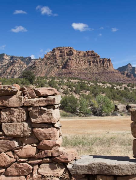
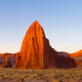
Comb Ridge
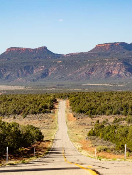
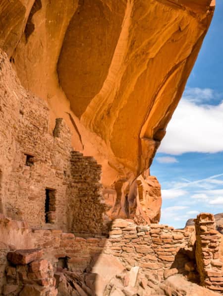
The Comb Ridge, a 120-mile-long, north to south-trending monocline or uplifted ridge, defines southeastern Utah’s red rock landscape and the southern area of Bears Ears National Monument. Tilted sandstone formations form a rugged escarpment on the west side of the ridge, while the angled east side is a maze of canyons, cliffs and domes with springs, seeps and pools of precious water. The ancient Ancestral Puebloans lived here over 1,000 years ago, building cliff dwellings, granaries for storing seed corn and creating galleries of exquisite petroglyphs on varnished sandstone walls.

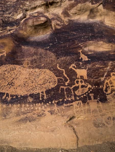
The Procession Panel
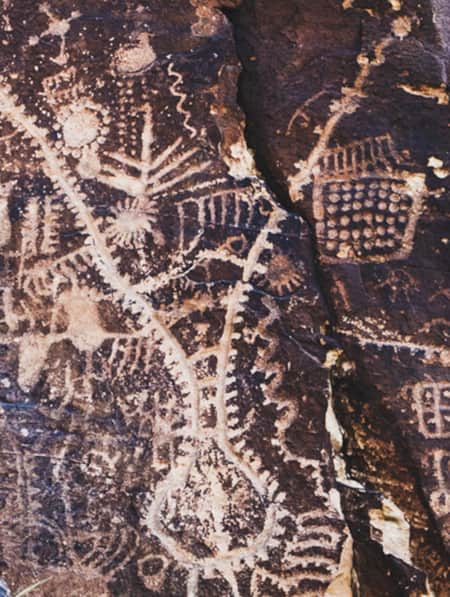
The panel depicts three snaking lines of 179 human-like figures, marching in single file and converging on a great circle. The petroglyphs, engraved into the rock surface by ancient artists, also include images of deer, bighorn sheep, elk and geometric shapes. The small human figures appear to be led by a few larger ones carrying hooked staffs and wearing headdresses, perhaps shamans who interacted with the spirit world and its animal helpers
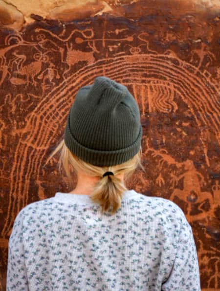
What Do Petroglyphs Mean?
We ask the petroglyphs, found in almost every canyon in Comb Ridge, what they mean and what they meant to the Ancestral Puebloan people that once lived here, but there are no answers. Their meanings were lost long ago, so now we bring our own interpretation to this great outdoor art museum.
That’s the beauty of petroglyphs — there is no definitive explanation for it. All we know is that these mysterious images at this sacred place allow us to glimpse the mind and thoughts of an ancient Native American culture. The petroglyphs reflect their lives, depict their culture and clothing, show clan symbols and migrations, and relate the supernatural journeys their shamans or medicine men made to other worlds. Sitting on a boulder before the Procession Panel, I feel the people that lived here and the holiness of this special place.
"Comb Ridge is rough desert country with no established trails. Respect the petroglyphs and archeological sites. They are an important part of our human and national heritage and can be fragile."


How to Get There From Butler Wash
The 30-mile middle section of Comb Ridge, beginning six miles west of Bluff, is one of the best places in southeastern Utah to see petroglyphs. Over 50 side canyons, carved by flash floods, slice through white Navajo Sandstone on the east side of the ridge and drain into broad Butler Wash.
The graded dirt Butler Wash Road, starting from U.S. 163, heads north up the valley, providing access to many petroglyph panels and ancient structures. Trailheads and trails to the better-known petroglyphs are along the road, but the Bureau of Land Management leaves them unmarked to protect the fragile archaeological sites from increased visitation and vandalism. Plenty of free primitive campsites scatter alongside the road.
Petroglyph Sites
The Procession Panel (reached by a 1.4-mile cross-country hike) and the nearby Wolfman Panel in Lower Butler Wash are the best-known petroglyph sites at Comb Ridge, but you’ll have to work a little to see them. Stop by the BLM offices in Blanding or Monticello for directions and information on how to appropriately visit. (Read: How to Visit Rock Imagery Sites Like an Archaeologist)
Many other sites hide in Comb Ridge’s canyons, so it’s best to lace up your boots, plan ahead, pack carefully and start exploring. Petroglyphs are found near many ancient sites, including Double Stack Ruin, Monarch Cave Ruins, Split Level Ruins, Fishmouth Cave and Butler Wash Ruins. The easily accessible Sand Island Petroglyph Site, located west of Bluff on the San Juan River, also displays hundreds of petroglyphs. One shows a possible mammoth while others depict Kokopelli, legendary flute player of the Southwest.
Protecting Petroglyphs
Respect the petroglyphs and archeological sites. They are an important part of our human and national heritage and can be fragile. Follow Leave No Trace principles so future hikers have the same experience and sense of discovery that you do.
The Petroglyphs Code
Follow these guidelines from the Petroglyphs Code to protect and preserve these amazing petroglyph panels:
- Don’t touch petroglyphs or pictographs. Oil from your hands degrades the rock surface.
- Don’t disturb petroglyph sites or nearby structures. Picking up pieces of pottery or digging in soil disturbs the area and leads to erosion.
- Don’t make fires near these sites.
- Don’t enhance the petroglyphs with chalk, liquid, or paint.
- Don’t make rubbings, molds or castings of petroglyphs.
- Don’t carve, chisel, scratch, engrave, spray paint or write on petroglyph panels. This not only mars the petroglyphs but is a federal crime.
- Don’t try to remove or take petroglyphs from cliffs or boulders. It is vandalism and a federal crime, with stiff penalties including fines and imprisonment.
- Do enjoy the ancient petroglyphs, take lots of photos, act responsibly and help preserve our prehistoric legacy and heritage.
Trip Planning & Logistics
The petroglyph sites and dwellings are west of Butler Wash Road, which runs along the eastern edge of Comb Ridge from U.S. 163 just west of Bluff to state route 95 west of Blanding. The dirt road is usually smooth and passable to passenger cars, although washes may be bumpy and the road is impassable after snow and rain. Check with the BLM office for current road conditions. Visit recreation.gov to obtain a hiking permit for the Comb Ridge and surrounding area. (Read: Bicentennial Highway 95: A Historic Utah Road Trip)
Know Before You Go
- Comb Ridge is rough desert country with no established trails. Only experienced backcountry hikers with good route-finding skills should attempt to find the petroglyph panels.
- Make sure your pack is filled with essential safety gear, including extra clothes, food, water and an emergency shelter.
- Comb Ridge is hot during the summer, so bring at least a gallon of water per person per day, and wear a hat and sunscreen for protection.
Discover More
-

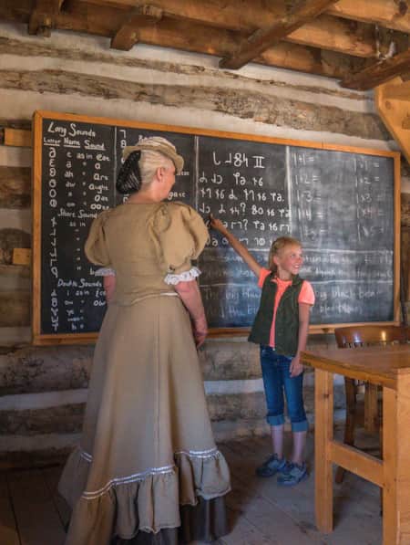
Historical Sites in Utah
Explore Utah's fascinating past with our guide to historical sites and hidden gems. Uncover pioneer and indigenous stories at these Utah heritage hot spots.
-
Ancient Pictographs, Petroglyphs and Timeless Mysteries
Exploring Horseshoe Canyon isn’t for everyone. First of all, the effort to get there is an adventure in itself, but those efforts make the reward — namely, the chance to see up close some of the most significant pictograph panels in North America — even more noteworthy.
-
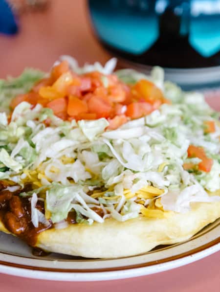
Navajo: Fry Bread, Tacos, Pizza
Despite its troubling origins, Navajo fry bread is an inspired food of the nation’s people, and it can be found in many forms with various names around the southwest.
-
Utah’s Unexpected Pit Stops
Here are 11 mini-adventures to check off your list next time you’re road-tripping through Utah.
-
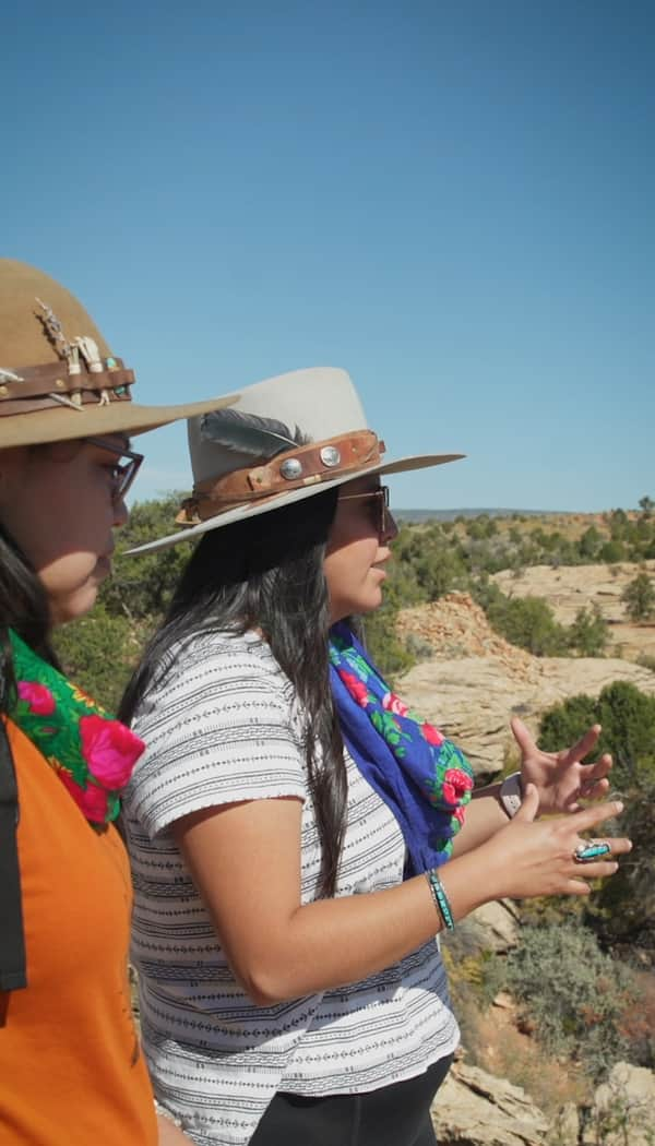
The Voices of Bears Ears
Bears Ears National Monument is at the heart of southeastern Utah. These lands are imbued with layers of culture — layers of life. In this four-part video series, meet the locals who connect with the land in their own distinct ways.
-
The History of River House (and How to Experience It Today)
The River House Site, nestled into the west side of Comb Ridge, is home to an array of pictographs as well as a kiva and several one- and two-story rooms.
-
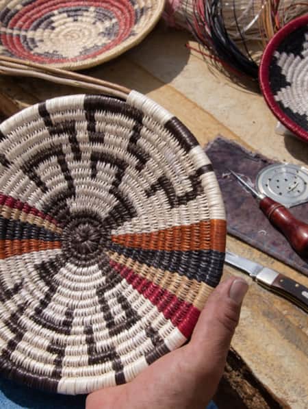
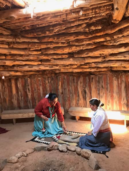
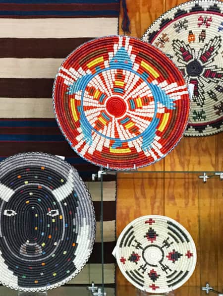
The Navajo Basketmakers
Meet the Navajo artists behind this labor intensive and traditional practice.
-
Touring Utah with the State’s Most Well Known Women Writers
The diversity and beauty found in Utah has often been captured by women. Here are the places that seven of Utah’s most well known women writers knew and loved most.
-
Hike Among Traces of the Ancients at the Mysterious Parowan Gap
See an impressive number of panels covered in petroglyphs. Some people believe that the Gap was considered a special place at certain times.
-
San Juan and the Trail of the Ancients
At almost 8,000 square miles, San Juan is Utah's largest county, nearly the size of New Jersey. Between the Needles district of Canyonlands and Four Corners there are vast lands of incredible wilderness, national forest, the Monument Valley Navajo Tribal Park and beautiful rivers and...
-
Spirits in the Rock
Spectacular pictograph panels, ingenious cliff-hanging architecture and the mysteries of Range Creek Canyon’s first inhabitants, the Fremont.
-
The 46 Miles of Nine Mile Canyon
Follow Nine Mile Canyon Road into the rugged and remote Book Cliffs, where messages from the ancients interface with settlers of the West and modern ways of thinking.
-
How to Visit Rock Imagery Sites Like an Archaeologist
There are untold thousands of rock imagery sites across Utah, and hundreds of thousands of archaeological sites of every stripe. Learn how to explore these sites with the respect and deference they deserve.
-
Wintertime Storytelling With Shoshone Tribal Elders
We’re shining a spotlight on elders from the Northwestern Band of the Shoshone Nation who keep tribal history alive through the stories traditionally told and retold in winter months.
-
Nourished by the Land: A Shoshone Perspective
Darren Parry learned from his grandmother about the plants, places and worldview that sustained their Shoshone ancestors.
-
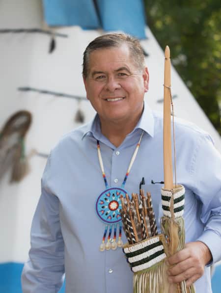
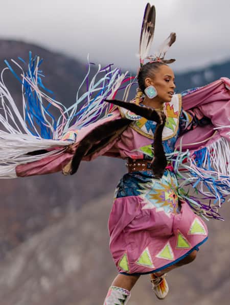
Hoop by Hoop with Patrick Willie
A Navajo storyteller found his purpose in hoop dancing. Now he’s using his platform to amplify the Native voices of a younger generation.
-
Why Your Kids Need a Utah Trip
Discover where adventure and learning converge across iconic rivers and ancient canyons.
-
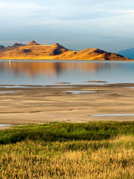
Great Salt Lake Needs Your Visit
While you visit this mysterious natural wonder, you can also help save it.
-
A Navajo Artist Finds Her Beat and Shares It
Rhonda "Honey" Duvall is a leader in Salt Lake City’s Navajo community, elevating the presence of indigenous culture through music and dance.
-
Exploring the Cultural Vistas of Cedar City
Visitors expect to find stunning views, yet sophisticated cultural offerings continue to surprise art lovers as they discover this rural outpost.
-
Exploring the Native American Village at This Is The Place Heritage Park
This Salt Lake City cultural spot offers visitors a chance to experience the deep history of Native traditions.
-
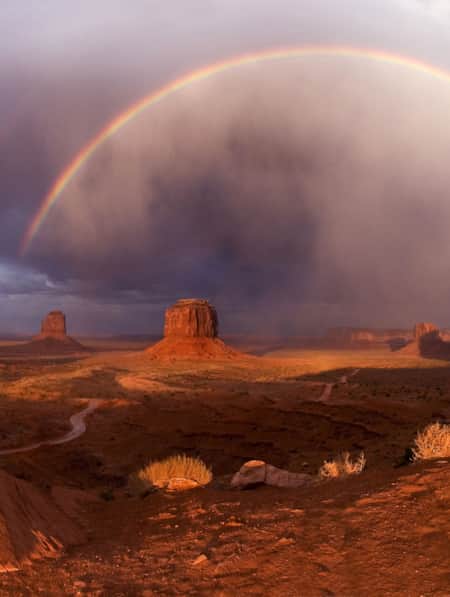
The Story of Monument Valley Navajo Tribal Park
Ancient erosion and modern cinema joined forces to elevate Monument Valley to one of the world's most iconic places to visit — but it's also the sacred home of the Navajo people. Learn more about the history, size and scenes that define the Monument Valley Utah experience.
-
Twin Rocks Trading Post
A must stop! The shop has museum-quality ancient art as well as handcrafted Native American and Southwest art.
-
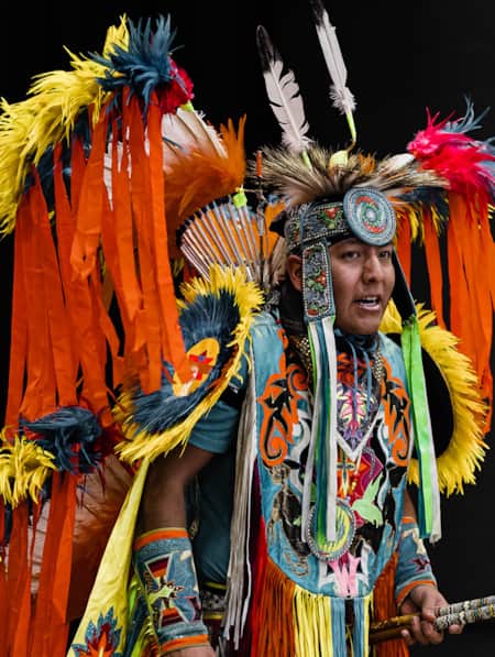
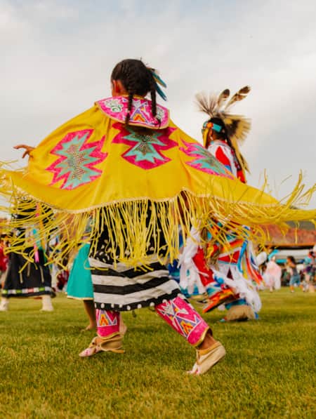
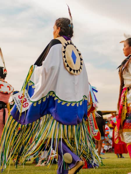
How to Attend a Powwow with Respect
Attending a powwow can be a very meaningful endeavor. Here are five tips to help you prepare.
-
Heritage and History: Exploring Native and Settler History in a Town Known for Celebrations
You may know Cedar City for its lineup of lively Festival City events, but the area offers many stories to be explored about the region’s Native and settler history.