View Millions of Years of Geologic History in an Afternoon
Unlock new levels of understanding about the land you are traveling through, around and on by learning about the geology in Utah.

Utah is a geologist’s playground. The diversity of formations and the ability to see them fully makes the state a perfect place to learn about geological concepts. Many rock formations are so accessible that you can touch layers that span millions of years in the course of an afternoon. Knowing just a few details about the geology of this land — from dinosaur fossils to hoodoos, from giant pillars caused by Jurassic-era earthquakes to a monocline Waterpocket Fold — can make a family road trip illuminating and inspiring.
Luckily on this drive, we had resident geologist Carl Hoiland (aka "dad") along for the ride. My husband earned a doctorate from Stanford University in geology, and works as a geothermal geologist all over the world as well as many areas in Utah. (For more details on the drive, see the companion itinerary: "Sandstone Spires & Swimming Holes")
"Many rock formations are so accessible that you can touch layers that span millions of years in the course of an afternoon. "

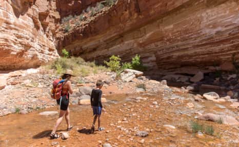
Jurassic Fossils
Locations: Jensen’s Dinosaur National Monument and and Vernal’s Red Fleet State Park
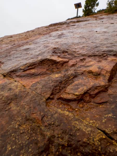
Vernal is "Dinosaurland." Colorful giant replicas along Main Street are playful, but venture just a mile or two beyond the city and you can see the actual bones, footprints and preservations of these Jurassic-era reptiles.
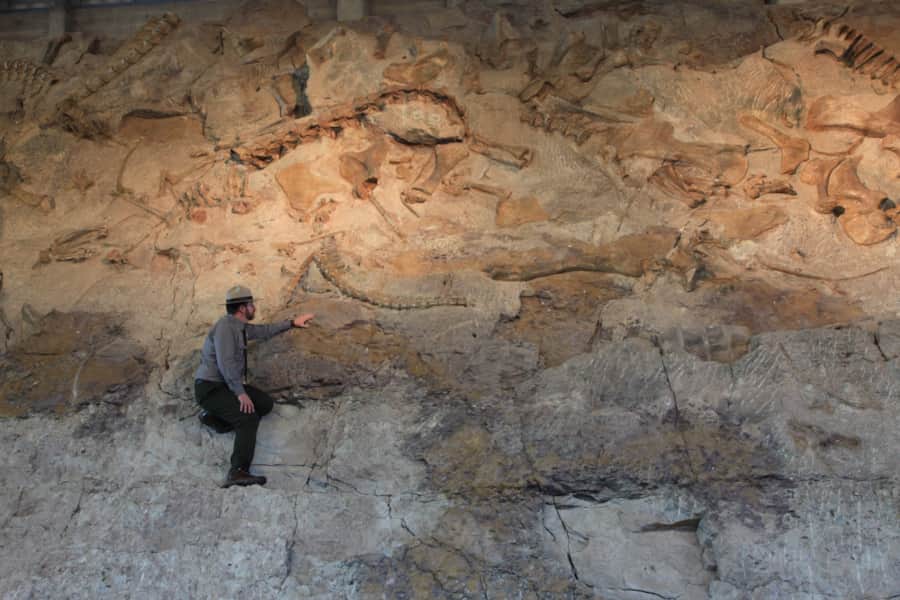
The nearby Green and Yampa rivers expose rock layers spanning nearly 800 million years of earth history (worth a drive in their own right). Yet the most famous of the local rock layers is the Morrison Formation, which contains one of the richest depositories of dinosaur bones and fossils in the country.
This layer was deposited over roughly 600,000 square miles in the western United States, but now the majority of it is either covered by younger strata or has been eroded away. That’s what makes locations such as Vernal, where it outcrops vividly with so little vegetative cover, an exceptional treasure.
The quarry at Dinosaur National Monument, one of the most famous in North America, was discovered in 1909. When dinosaurs roamed here more than 150 million years ago, the landscape was full of rivers. That means many of the dinosaur bones, along with ancient crocodile and tortoise bones, were sorted and carried by water to collect at the site of the quarry. Researchers here have unearthed about 300 full skeletons from 14 species of dinosaurs, but many times more likely remain hidden in the area.
Red Fleet State Park
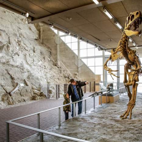
Dinosaur National Monument
Dinosaur National Monument
Coal Cliffs and Hoodoos
Locations: Helper, Book Cliffs, Green River and the San Rafael Swell
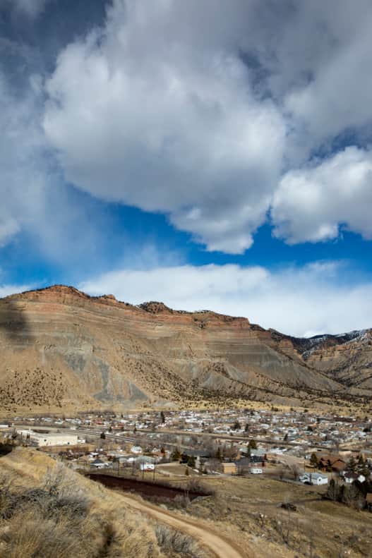
Driving through the Ashley National Forest and coming upon the city of Helper, I observe the mountains the city backs up to. Much of Helper’s history is based on the coal mining industry. The mountains are rich in coal, which represents the now-compacted accumulations of ancient carbon-rich material — read: ancient peat bogs or wetlands. The coal throughout the region offered an important boon to industrial-era economic growth for more than a century.
It’s notable that underground fires within these coal seams have transformed the overlying rock layers through the intense heat of combustion. Near Helper, for example, roadcuts expose spectacular examples of pyrometamorphism in which underground coal fires once heated the overlying rock to the point of melting. The minerals identified within these melted rocks suggest they were heated to more than 2000 °F!
On the way to Green River, the Book Cliffs stand like proud giants reaching into the sky. The flat stratigraphy of these mountains are like pages of a book detailing the ancient history of the land. My eyes are drawn to certain layers, imagining what creatures must have scurried through the then unconsolidated deposits, each layer representing a different snapshot in time from the upper Cretaceous period on up through millions of years. I see from the car windows that the valley floor on which this highway is built was once as high as the cliffs, but over time, the overlying strata have slowly eroded away. The tops of the cliffs have the strongest rocks as their very top layer, providing temporary reprieve to their inevitable erosion.
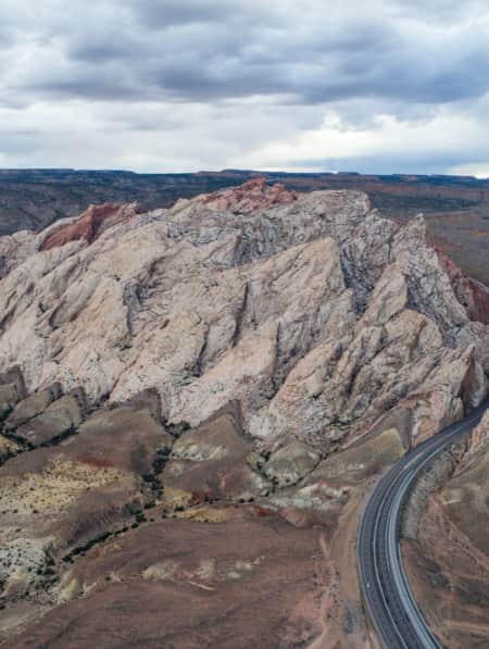
Out the other window, the tilted sandstone flanks of the San Rafael Swell are visible. It’s an area of land that buckled and folded in response to tectonic collisions further west. The land was pushed upwards as it was pushed inward. The otherwise flat-lying rocks, such as those in Book Cliffs, are here turned upwards into the sky where they have been entirely eroded to expose deeper, older layers. This particular phenomenon is called an anticline.
Picture a cookie that’s just come out of the oven and when the baker pushes it with a spatula, the middle of the cookie rises up, while the outer edges of the cookie sort of flank around that middle. Almost like an ocean reef, an especially strong sandstone layer is seen sloping upwards around the edges of the Swell, like walls of a fortress, jutting upwards in resistance. Most prominent among these resistant flanks is Temple Mountain, which is known for its rich deposits of uranium, and local folklore tells stories of Marie Curie visiting more than a century ago as she studied radioactivity.
Goblin Valley visitors often question how these rock formations came to be here in the middle of this vast desert. The hoodoos were once a horizontal layer of Entrada Sandstone, which fractured into angular blocks. Over millions of years due to erosion, the rectangular blocks were weathered out and rounded. Because some of the layers are mudstone, and thus more susceptible to being worn down more quickly, varying widths are visible within a single hoodoo, making some formations much thinner toward the bottom. (Read: Goblin Valley: Exploring the Land of Mushroom Rocks)
Book Cliffs in Helper
Photo: Andrew Burr

Rock Folds and Spires
Locations: Capitol Reef National Park and Cannonville’s Kodachrome Basin State Park
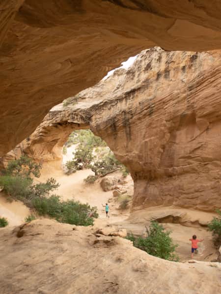
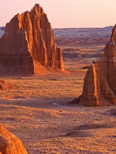
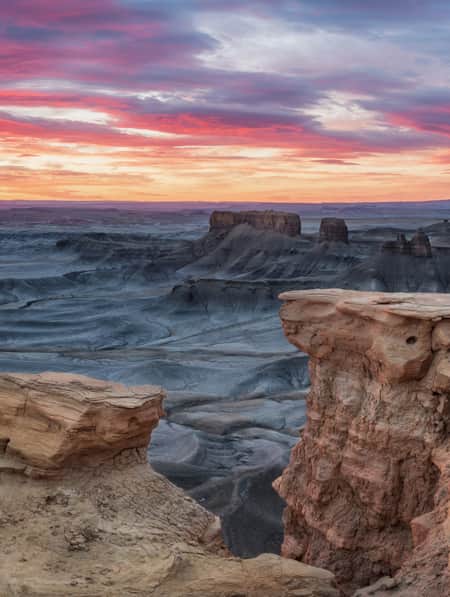
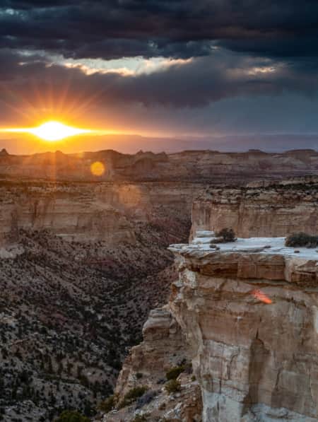
Instead of the “birthday cake” rock layers you see in the Book Cliffs, Capitol Reef looks different. That’s because of a geological feature called the Waterpocket Fold, a 100-mile section of rock that’s labeled a monocline. Due to movement along a fault, one side of the rocks have been uplifted. In Capitol Reef, the rocks on the west side are 7,000 feet higher than the rocks on the east. The ongoing erosion here exposes a colorful sandstone layer and forms deep red cliffs, arches, twisting canyons and massive domes that make this area so unique.
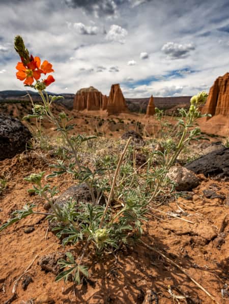
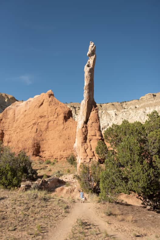
About 40 miles southwest of Escalante is another fascinating and rare spot of earth called Kodachrome Basin, a small state park that contains some unique and fascinating geology. Visitors driving into the park will notice giant pillars of rock that appear as if they were shoved up from the earth and frozen in time. These sedimentary pipes are thought to be records of ancient earthquakes, formed when temblors caused so much pressure in the rock layers below the earth’s crust that a slurry of sand was pushed upwards into a rock column that solidified in place. Faults in this area are thought to have been active in the Jurassic period, so the dinosaurs would have felt these temblors and perhaps been surprised by the earth moving around them.
It doesn’t take vast geological knowledge to recognize that Utah is a rich and ancient landscape formed over millions of years. However, just knowing a few key concepts can be like a key to unlocking new levels of understanding about the land you’re traveling through, around and on. The more you understand about a place and its history, the more it seems a miracle just to witness it. In this way, real-life geology changes us and offers new perspectives.
Kodachrome Basin State Park
Photo: Clark Goldsberry
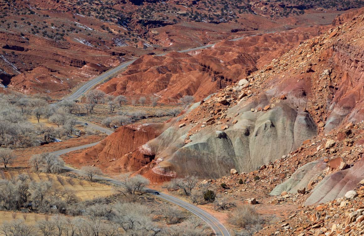
Capitol Reef National Park
A Family Drive Through Utah’s Quiet Places
A vacation where reservoirs and rocks, sagebrush and fossils provide wisdom along the way.
Sandstone Spires & Swimming Holes
Walk the paths of dinosaurs and descend through 200 million years of geologic history in this six-day road trip from Vernal to Kodachrome Basin. It’s a kid-friendly desert drive in search of dino tracks, slot canyons and swimming,
Highlights
- Dinosaur Tracks in Vernal
- Crystal Geyser in Green River
- Hoodoos & Slots of Goblin Valley
- The Red Cliffs of Capitol Reef
- The White Cliffs of Grand Staircase
- Sandstone Spires in Kodachrome Basin

What's Nearby
-
Ashley National Forest
Elevations in the Ashley National Forest range from 6,000 feet to over 13,500 feet. The crown jewel of this forest is Flaming Gorge National Recreation Area.
-
Flaming Gorge National Recreation Area
With more than 200,000 acres of land and water, Flaming Gorge is a scenic playground for boating, waterskiing, windsurfing, camping and backpacking in addition to some of the best fishing in the west.
-
Red Fleet State Park
Known as “Little Lake Powell,” Red Fleet State Park offers fishing, hiking, camping, biking and more in a gorgeous sandstone lake setting. Plan a trip!
-
Steinaker State Park
Utah’s Steinaker State Park offers outdoor action for everybody. Swim in the reservoir, camp, bike, paddle, wakeboard, ride ATVs and more! Check it out now.
Discover More
-

A Grand Tour of the San Rafael Swell
This grand tour goes into the heart of Utah's Swell from north to south, connecting the uplift’s spectacular views with playful slot-canyon hikes, bike excursions, dinosaur bones, and soft-serve cones in town.
-
Dinosaurland Top 5
Vernal, Utah, is an adventure base camp to the best of eastern Utah. Uintah County around Vernal — called Dinosaurland — is home to diverse outdoor recreation and natural history at three state parks, Dinosaur National Monument and countless trailheads to the Ashley National Forest.
-
Following the Dinosaur Tracks of Red Fleet
Explore Red Fleet State Park's cleverly built trail that crosses sandy washes, ribs of exposed stone and a dinosaur trackway.
-
Hiking the Desert in Capitol Reef National Park
-
Searching for Dinosaur Bones in Capitol Reef Country
The Hanksville-Burpee Dinosaur Quarry dates back to the Jurassic Period and is approximately 150 feet wide by 600 feet long. Hundreds of dinosaur bones have been discovered here, including those of the Stegosaurus, Brontosaurus and Brachiosaurus.
-
Serenity Found in Torrey and Capitol Reef’s Cathedral Valley District
Taking Southern Utah’s remote, less-traveled path in Capitol Reef's Cathedral Valley District to nurture your body, mind and spirit.
-
The Ultimate Guide to Dinosaur Discovery While on a Trip to Utah
Add a little dinosaur discovery to your Utah itinerary. Explore state-of-the-art museums and monuments for unforgettable prehistoric adventures.
-
The Underrated Trails Within the San Rafael Swell
Utah's San Rafael Swell features a vast landscape of winding gorges carved deep by rivers, and you'll find multi-colored sandstone mountains and mysterious slot canyons. Here's a quick guide to some of the best trails to explore the region.
-
The Undiscovered San Rafael Swell
Circle back to the San Rafael Swell, a gem of public lands in Central Utah you may have missed on your last visit through some of Southern Utah's Mighty 5® national parks. The Little Grand Canyon of the San Rafael Swell is a stunning panorama from above, and an incredible adventure within.
-
Touring the Dinosaur Diamond Prehistoric Highway
Discover dinosaurs in Utah. The Dinosaur Diamond Prehistoric Highway is one of the best places to see dinosaurs in Utah.
-
Vernal Equinox: A New Season in Vernal, Utah
Discover the growing adventure outpost in a geologically fascinating corner of eastern Utah.
-
Winter Road Trip: Where to Stay, Hike and Eat When Traveling from Capitol Reef to Bryce Canyon
Need winter break ideas? Take a road trip from Capitol Reef to Bryce Canyon and enjoy the best of Utah landscapes during its quiet season.