Conquering the Deep Canyon Trail
A steep and beautiful hike in the Wellsville Mountains

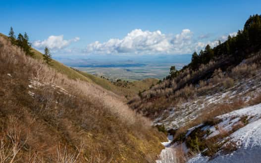
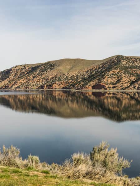
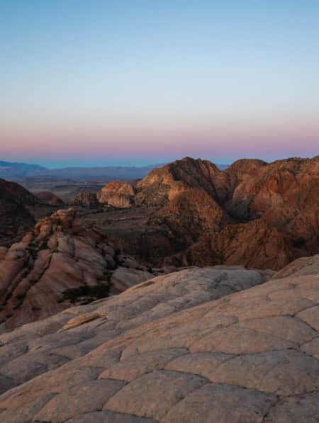
The views make the challenging hike worth it.
Photo: Emily Sierra
Trail Guide
Difficulty: Very Challenging
Distance and elevation gain: 3 miles and 3,300 feet
Trail type: Some bushwacking, but mostly even terrain with some hills to climb
Multi-use: No
Dogs: Yes, but must be on-leash.
Fees: No
Seasonality: Late Summer, Fall
Bathroom: No
Where to park: There’s a small parking area at the trailhead.
Trailhead GPS coordinates: 41.713677, -112.016682
In late summer, hiking up the Deep Canyon Trail can feel more like bushwhacking. In fact, at first glance, the sprawling undergrowth looks like a scene plucked from Jurassic Park, a glance to the sky offers a reminder that you’re not in a prehistoric era — you won’t see any pterodactyls, but you’ll likely spot a hawk soaring overhead.
Utah’s Wellsville Mountains are some of the steepest in the country, a distinction you won’t soon forget as you tackle the Deep Canyon Trail, a three-mile trek whose elevation gain — 3,300 feet — makes it a formidable outing. This northern section of the Wasatch Range between Brigham City and Logan is just three or four miles wide at its base but stays above 8,000 feet for its entire 20-mile length, which means the peaks drop off steeply on either side.
As Utah became more populated over the years, the rugged Wellsvilles were in danger of being overgrazed. Eventually, Congress created the 23,750-acre Wellsville Mountain Wilderness Area, which now protects most of the range from being grazed. It also means the Wellsvilles are exceptionally quiet: No motorized use (including bikes) is allowed within the boundaries of the wilderness area.
The Deep Canyon Trail is particularly quiet, even for a wilderness area. Bird watchers and backcountry skiers make use of the region, but for the most part, the Deep Canyon trailhead is often empty. Pull up on a weekday, and you’ll likely have this lungbuster workout all to yourself.
A Challenging Trek
From the lush bigtooth maple forest at the trailhead, it’s hard to see what all the fuss is about up high. This is doubly true during the summer, when you’ll want to get a pre-dawn start in order to make it above treeline and get back down before regular summer storms roll in.
Whatever time of day you start this hike, you won’t have much time to think about the view until much later: After dipping slightly into the forest, the challenge begins in earnest. The Deep Canyon Trail gains just under 3,000 feet in elevation in the three miles between the trailhead and the saddle at 8,120 feet, which means you’ll be climbing steadily the whole time.
Fortunately, the trail provides plenty of opportunities for a quick break to catch your breath as you ascend toward the saddle. The trail heads west for about a mile, then crosses gorgeous, wide-open meadows dotted with aptly named firecracker penstemons and wild roses in early summer. Then you’ll cross a dry stream, and from here, the forest gives way to delicate aspen trees.
The trail sometimes feels almost impossibly steep, but it’s a solidly class I hike the entire way, meaning you won’t need to do any scrambling. When you get to the base of the switchbacks, grab a drink and get ready for one last push — you’re almost to the saddle! Don’t worry if you still need to catch your breath a few times on your way to the top; the sweeping views of the Cache Valley behind you are a great excuse to stop occasionally.
North or South?
You’ll know you’ve reached the saddle at the top of Deep Canyon when the distinctive Saddle Rock comes into view. This is your decision point: Are the panoramic views of the valley below enough, or will you continue on to bag Mendon Peak, one of the steepest peaks in North America?
Once you’ve taken in your fill of valley views (of both the Cache and Salt Lake valleys) and the unique Bear River oxbow, choose a direction and continue your journey. Heading either north or south will both get you higher up.
Head north to get to Peak 8585, also known locally as Hawk Watch Peak. The later in the season you do this one, the better, especially if you’re into wildlife, as hawk migration season is at its peak in September and October. Don’t forget the binoculars to help you hone in on the birds of prey that catch thermals and flock past the summit.
For a longer Wellsville tour, head south from the saddle instead. About two miles of moderate hiking along the ridgeline, along with two more summits, Mendon Peak and Scout Peak, will take you to Stewart Pass (look for a tall cairn). Another 2.5 challenging miles (not to mention a summit of Wellsville Cone) will bring you to the summit of 11,101-foot Box Elder Peak, the highest point in the Wellsville Range.
How to Get Back
From your high point, you can either head back down the Deep Canyon Trail (a word of warning: It’s just as hard on your knees on the way down as it was on your lungs on the way up) or opt for the Coldwater Canyon descent, which leaves from Stewart Pass. If you plan to take the latter route, make sure you’ve got a shuttle vehicle at the trailhead, because the two trails don’t meet up.
Regardless of your descent, it won’t be long before you forget the adventure of hiking 3,000 feet up and start planning your next visit to the Wellsvilles.
Written by Emma Walker for RootsRated Media in partnership with Utah Office of Tourism.
Discover More
-

15 Must-Do Adventures in Kanab
Looking for fun things to do in Kanab? Check out our list of the 15 must-do adventures in Kanab and start planning your visit today.
-
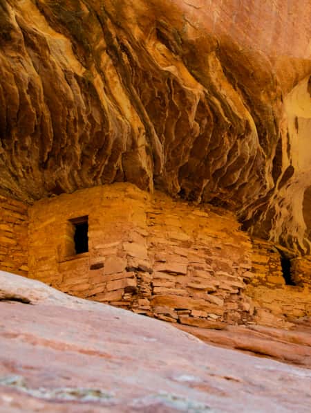
Exploring Mule Canyon: House on Fire and Cave Tower
Driving the up the dusty, terracotta-colored road toward Mule Canyon in Cedar Mesa, you get a sense that this is a special place, though you might not be able to put a finger on why.
-
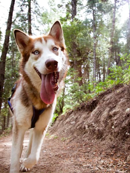
Dog-friendly Utah: Northern
Explore the top dog-friendly places to hike and explore in the Northern Utah, including state parks, national forests and a bird refuge.
-
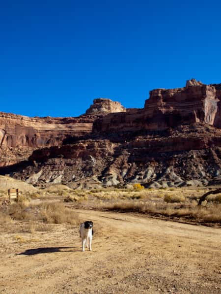
Dog-Friendly Utah: The Road to Mighty
Want to bring your furry friend on your next vacation? Utah is home to several great dog-friendly national parks and other fun destinations. Check it out and plan your trip!
-
Get to Know Echo State Park
Situated at 5,560 feet above sea level, just north of Park City, lies Echo State Park. Watersports are king here, and whether you kayak, paddleboard, or boat, it’s a perfect place to get out on the water.
-
Escalante River Canyon Trail
Located in the Grand Staircase-Escalante National Monument, the Escalante River Canyon river trail winds and knots its way east and south.
-
See the Fall Leaves Near Utah's National Parks
Sure, any of Utah’s Mighty 5 national parks are spectacular year round — covered in snow, peppered with spring wildflowers, and baked in sunshine. But find them exponentially special when the changing fall leaves are in juxtaposition to the immaculate red rock cliffs.
-
12 Family-Friendly Activities Near SLC
From roller coasters to ski slopes, discover 12 fun family activities in and around Salt Lake City.
-
Five Best Hikes In Bear Lake Valley
Follow your Bear Lake hike with a refreshing dip in the lake. Which of these five excellent hiking trails in Bear Lake Valley is your favorite?
-
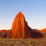
Moonscapes, Marscapes and More
If you want to know what Mars looks like — then the dramatic terrain of Capitol Reef National Park and the surrounding lands are a good place to start.
-
Fishing Fish Lake
The largest natural mountain lake in Utah, Fish Lake sits at more than 8,800 feet of elevation, which makes for pleasant weather all summer long. Located near Richfield, Utah, the lake has everything you need for a relaxing summer getaway.
-
Insider's Guide to Hiking Rainbow Bridge National Monument
From choosing the best season and trail, to understanding logistics and history, here's what you need to know to hike Utah's Rainbow Bridge National Monument located off the south coast of Lake Powell.
-
Introduction to Hiking Utah's High Uintas
Highlights of local hiking trails in the High Uintas include stellar views of sparkling lakes in a lush alpine environment. Get a multi-day pass for your hiking adventure!
-
Best Hikes in St. George During Winter
While Utah's Greater Zion offers a few hundred trails, we’ve highlighted seven of the best hikes in the state's southwestern corner, from deep canyons to high peaks.
-
Hiking Southern Utah with Younger Children: Tips for Family Friendly Adventure
Find safety tips, side activities and kid-friendly hikes in Utah with our special guide to hiking Southern Utah with children. Read now!
-
5 Expert Tips to Prepare for Your Utah National Parks Adventure
If you’re planning to visit Utah national parks for a hike, learn important tips to maximize your experience and keep you and your family safe.
-
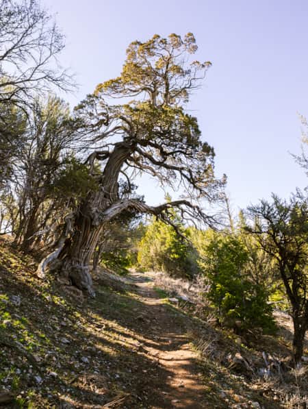
Hiking the Jardine Juniper Trail to the Oldest Rocky Mountain Juniper Tree in the World
Enjoy this scenic hike up Logan Canyon through aspens with mountain vistas along the way to an ancient juniper tree. All abilities are welcome.
-
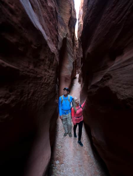
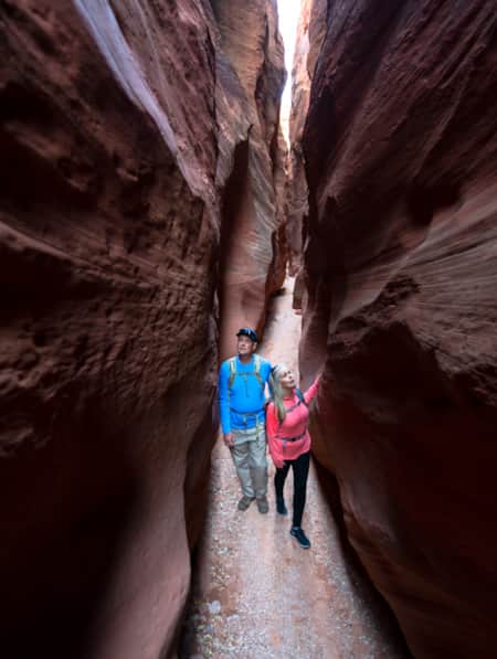
Slot Canyons: A Guided Hike Through Nature's Masterworks
It's said that southwestern Utah offers the highest concentration of slot canyons in the world. Well-prepared visitors can hike right into some of them, but the best experience is with a guide.
-
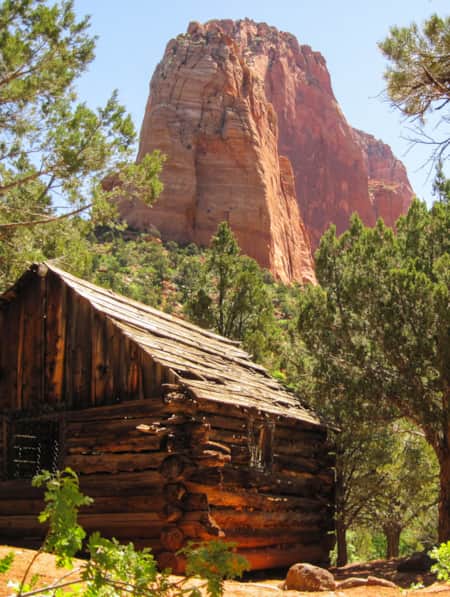
A Visitor's Guide to Zion's Kolob Canyons
In the Kolob Canyons section of Zion National Park, you’ll find a scenic wonderland with an adventure for everyone. Learn more about this unforgettable attraction and plan a visit.
-
Logan Canyon Trail Guide Roundup
Logan Canyon in Logan, Utah beckons all to put on their hiking, biking, or climbing shoes. Here's a list of some of the best places to adventure on your trip through the canyon.
-
Ancient Pictographs, Petroglyphs and Timeless Mysteries
Exploring Horseshoe Canyon isn’t for everyone. First of all, the effort to get there is an adventure in itself, but those efforts make the reward — namely, the chance to see up close some of the most significant pictograph panels in North America — even more noteworthy.
-
Meet the Fremonts: Unearthing an Ancient Civilization
Did you know that interstate highway construction created Fremont Indian State Park? Visit the park and Museum for a peek into Utah’s past, plus hiking and ATV trails.
-
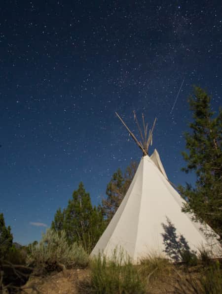
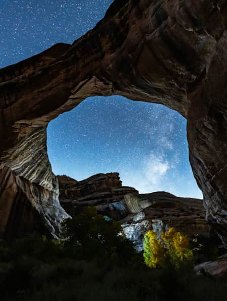
The World's First Dark Sky Park
On March 6, 2007, Natural Bridges National Monument became the first International Dark Sky Park certified by the International Dark-Sky Association. More than 100,000 people visit Natural Bridges each year to check out the stunning bridges and hike in cool canyons, but only a handful of them stay through the night to see the area’s most amazing and unique feature: dark skies and glistening, bright stars.
-
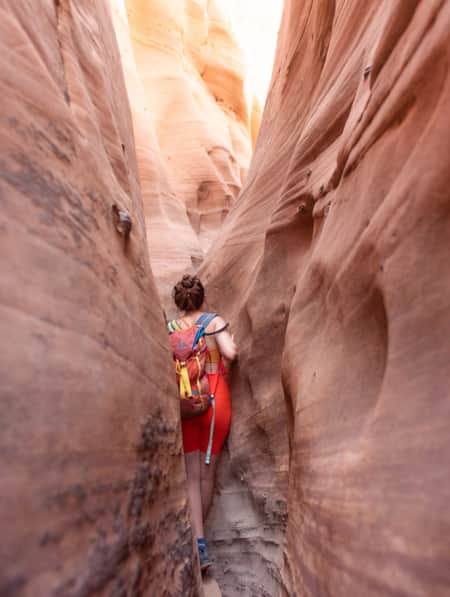
15 Non-Technical Slot Canyons
You don’t have to be Spider-Man to explore some of the best slot canyons Utah has to offer. You just need to be ready for an adventure in tight spaces with huge photographic rewards
-
Elevate Your Hiking with Mindfulness
Incorporating simple mindfulness techniques into your next hike can take the edge off anxiety and enhance your overall well being.