What Hasn’t Been Found
Family heritage and lore converge along the Pony Express National Historical Trail.

I leave my urban enclave and approach the West Desert with authority. My ancestors blazed across this territory on the backs of horses, sometimes newly broken wild mustangs. They were the Egan men, a long way from their Irish homeland, and they ran the mail route of the Pony Express through the most difficult and dangerous stretches. My third-great grandfather, Major Howard Egan, was superintendent of the route from Salt Lake City to Carson City, Nevada. Whether or not the hiring bulletins for Pony Express riders really said “orphans preferred” is a subject of historical debate. I don’t know the answer, but I do know Major Howard Egan was an orphan.
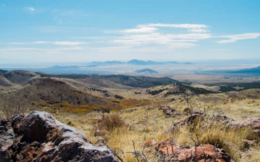
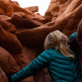
Like clockwork, my sense of authority dissipates each time I steer toward the Juniper-covered Lookout Pass. A 35-minute drive from Tooele, this pass — where the Onaqui and Sheeprock Ranges meet at 6,200 feet above sea level — is the gateway to the West Desert along the Pony Express National Historic Trail, where for a brief time from 1859–1860 a horse-relay system helped mail cross the continent in a matter of days, rather than weeks. The pass offers a vantage point westward as the landscape unfolds in shades of buff and amber against a pale sky. Utah’s West Desert is classic Basin and Range topography. It is like a bowlful of mountains, hundreds of ranges running north to south, resembling gigantic ocean swells in a sagebrush-dotted sea.
Vantage points in these parts always reveal the same thing: This land is uninhabited. It is one of the few wild frontiers left in the world.
Each time I sign my name in the visitor log, I feel my place in history refocused. I feel humbled — humbled like the first time I met a bristlecone pine in Utah’s West Desert, which the National Park Service says are among the oldest living organisms in the world. I remember my dad describing them as being “older than Jesus.” He isn’t exaggerating. The bristlecone pines teach me that the Egan brothers’ pre-telegraph communication service doesn’t even begin to approach archaic. We’re all new to these parts.
* * *
The Egan name is mostly lost to time out here for all those save for West Desert history enthusiasts. These days there’s a different family known around these parts, and they venture across the landscape on a different kind of animal. Meet the Steadmans.
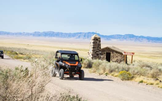
Albert Steadman moved to Tooele more than 70 years ago to open a tire store. What was supposed to be a one-year undertaking turned into a lifetime of desert rambling. His tire store (or Christmas tree-lot in the wintertime) has grown into Steadman’s Recreation Inc., one of the largest dealers of recreational vehicles in the western United States. He’s since passed over the reins to his sons’ Russ and Nolan. Their best selling product today is the side-by-side, a four-wheeler with two front seats, and I was fortunate to find myself sitting sidecar with Russ behind the wheel on an October morning.
"[The West Desert] is like a bowlful of mountains, hundreds of ranges running north to south, resembling gigantic ocean swells in a sagebrush-dotted sea."
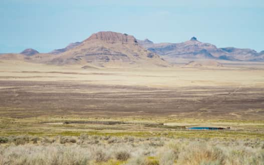
Albert and Russ unload the four-wheelers near the base of Lookout Pass, and we follow the Pony Express Trail toward Simpson Springs, a campground and historic site. To my Pony Express ancestors (and the Native Americans long before them), Simpson Springs was known as one of the most dependable watering points in Utah's West Desert.
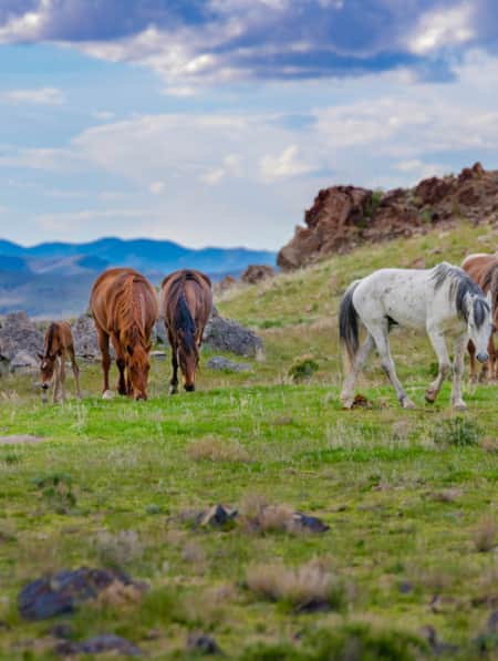
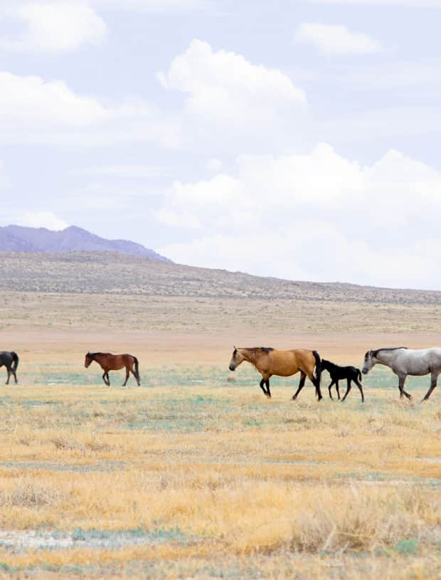
It’s fitting that as we approach, a herd of wild horses greet us, encircled around a man-made watering hole. There are all types of colors and sizes: pintos, dark browns and palominos. The Steadmans have seen wild horses more times than they can count, but they still stop to look. (Read: 5 Best Ways to View Wild Horses in Utah)
We begin discussing our route for the day. I expect the Steadmans to pull out a map, but they agree to feel out their own route within the section of marked trails known as the Prospector OHV Backway Complex. We end up hugging the west shoulder of the Simpson Mountains, and turn up a handful of beckoning roads and ridges.
I quickly learn that when the Steadmans see canyons and mountain ranges they see inlets and outlets, roads into places that bring back memories of times they spent hunting, picnicking or rockhounding. “I think it was around here we saw those mountain lion tracks in the frost,“ recalls Russ, as one such passageway transports him back in time.
Another road leads us up a ridgeline with fall foliage on both sides of the canyon. I’ve never seen anything like it. The pure abundance of desert foliage makes it easy to see where the strained water veins pour through the desert.
Another turn leads us into a charred landscape. We pass through a grove of scrub oak that had been burned so badly or so often that their leaves refuse to grow back, and their skin has been bleached white. We talk about the occasional wildfires in the desert, about a landscape healed — in its own way — from generations of fires.
For the Steadmans, four-wheeling is family touring at its finest. It doesn’t take long to realize it's about personal experience, not an adrenaline rush. It’s a chance to see something — wild horses, old kilns, caves, abandoned Pony Express stations, hot pots, even a curious old dog cemetery — in a way that is more intimate and connected with the landscape than a car offers or can be easily accessed on foot. The wind, sound, dust and bumps are all real and present.
* * *
It’s a summer weekend and this time I’m on an outing with my own family. We opt for two cars: one for my parents and their dog, and another for my brother, my husband and me. The labrador has the whole truck bed to herself. As we pull over at various historical markers we swap stories and Egan family lore. My mom, the bestower of the Egan bloodline, plays chief narrator.
The favorites always involve Major Howard Egan’s interactions with the Goshutes, a Native American tribe. He spoke their language and recorded many encounters in his journal. One time, a Goshute healer sucked a blinding ailment from Howard’s eyes by putting his mouth directly over his eye socket. (It worked!) Another journal entry details how a band of Goshute women taught him to cook and harvest ants. (They tasted alright.)
Our stories are interrupted by a herd of 50 or more wild horses. Two black stallions find themselves in a feral dispute — fighting and racing, and churning up dust, yards away from our car. Our Labrador knows to keep her distance.
It’s somewhere between Simpson Springs and Dugway Pass that I realize the route is hardly less rugged than it was in the Pony Express days, with the exception of an improved dirt road, intermittent plaques and blossomed cities on the perimeters. It still boasts minimal water, settlements, pit stops and people, reminiscent of the time when it was noted on maps as the “Great American Desert,” adding to its infamous reputation for California Gold Rush travelers.
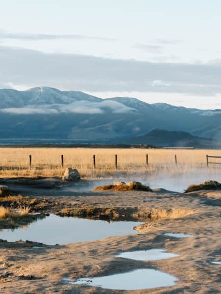
We approach Fish Springs National Wildlife Refuge and the whole environment transforms. It’s an oasis in the desert in the form of more than 10,000 acres of wetlands. It would take a hydrologist attuned to the language of fracture zones and aquifers to explain where the spring flows comes from, but all that the birds — avocets, great blues, ibises, swans, marsh hawks and hundreds more — care about is that it exists. It’s one of the few places you can see a bullfrog in a desert.
"It’s somewhere between Simpson Springs and Dugway Pass that I realize the route is hardly less rugged than it was in the Pony Express days."
Pony Express Trail
Photo: Rosie Gochnour Serago
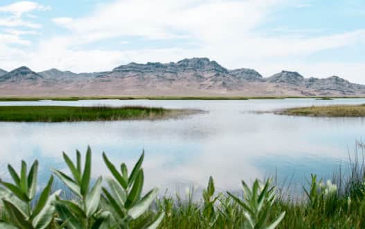
Photo: Rosie Serago
Photo: Rosie Serago
We do some amateur birdwatching and drive the auto tour route, a network of roads built on top of dikes that allows you to see the various pools from different vantage points.
After a picnic lunch we set off for our ultimate goal: the Deep Creek Range. The Deep Creeks or “Deeps” have been an anchor to nomadic peoples for more than 8,500 years due to their abundance of water, pine nuts, game and shelter. They are the rocky guardians of the Deep Creek high country and boast pinion, aspen, grasses, pines, cool streams and the 12,000-foot Ibapah Peak, the fifth-most prominent summit in Utah — and one that nobody’s heard of. We consider the primitive campground set up by the Civilian Conservation Corps near the town of Callao, but decide to disperse camp near the Ibapah trailhead and a flowing stream.
The next day we opt to ramble and explore rather than summit, and enjoy a handful of desert overlooks from the comparative lushness of the green Deeps. By late afternoon, we take off for Gold Hill — our last stop on our West Desert tour before we connect with Wendover and return to Salt Lake City via Interstate 80. Gold Hill is an abandoned mining town that boasted 3,000 people in its heyday. Today, don’t expect to find anything resembling a functioning saloon, pool hall, slot machine or gas station. Or bowling alley — rumor has it one of the off-balance, rectangular corrugated tin buildings was Utah’s first. There are still a handful of permanent residents in Gold Hill, able to survive due to the proximity to Wendover. The phrase “tough as nails” comes to mind.
* * *
You can’t visit the West Desert without noticing an abundance of rabbitbrush, a yellow-flowering plant that grows in patches. It thrives in poor conditions, and can tolerate coarse, alkaline soils. In the species name, Ericameria nauseosa, “nauseosa” refers to the smell given off when the leaves or flowers are crushed. Depending on who you ask, it could be described as pineapple-like or, conversely, a foul, rubbery smell.
This shrub is the perfect emblem for Utah’s West Desert. To some, it’s the wasteland, the remnants of a lake that nobody misses.
For others, it’s a place of awakening.
Its wide-open vistas beckon discovery. The prospect of seeing free-roaming wild horses conjures the same mystique that brought the earliest explorers westward. The captivating frontier, Native American and natural history give definition to the stark landscape.
Of wild places, Terry Tempest Williams said, “When one of us says, ‘Look, there's nothing out there,’ what we are really saying is, ‘I cannot see.’”
There’s no hiding in such a barren landscape, only finding. This desert runs in my blood, and I return to find myself again and again.
Looking for more? Follow the West Desert Ramble itinerary, which brings together spots mentioned in the story and more from the West Desert.
West Desert Ramble & The Pony Express
This itinerary is a three-day adventure along the Pony Express National Historic Trail in Utah's West Desert. Visit Simpson Springs, Fish Springs National Wildlife Refuge, Gold Hill and more.
Highlights
- Camp Floyd State Park Museum
- Fish Springs Wildlife Refuge
- Pony Express National Historic Trail
- Historic Wendover Airfield
Discover More
-

5 Best Ways to View Wild Horses in Utah
There are plenty of opportunities for viewing wild horses in Utah. Here are five things you need to do and plan on to increase the likelihood you will spot these majestic creatures and get the most of your adventure.
-
5 Hot Springs for a Romantic Utah Long Weekend
For those seeking a slice of paradise, the mineral-rich hot springs of Utah are a picture-perfect destination for a romantic getaway built for two.
-
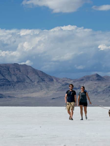
A Quick Guide to the Bonneville Salt Flats
Here's everything you need to know to visit and plan for Salt Lake City's nearby Bonneville Salt Flats.
-
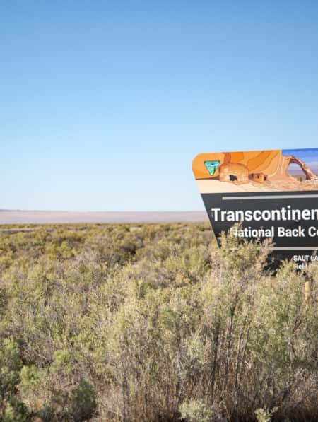
A View From the Past
Follow a historian on a tour of the Transcontinental Railroad Backcountry Byway as he reconstructs forgotten history.
-
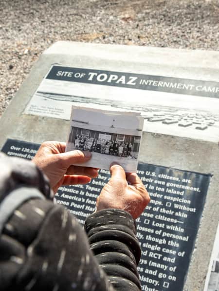
Exploring Delta's Topaz Museum
Delta’s Topaz Museum beautifully enfolds the story of a tragic, often overlooked chapter in U.S. history.
-
Frisco: West Desert Ghost Town
Standing in the Basin and Range topography of Utah's West Desert at ghost town Frisco, you'll feel the solitude of the space
-
How to Take a Kayak & Camping Trip at Yuba State Park
Pristine sandy beaches, warm water temperatures all summer long and serene mountain views make Yuba State Park an appealing destination for campers and kayakers in sunny Central Utah.
-
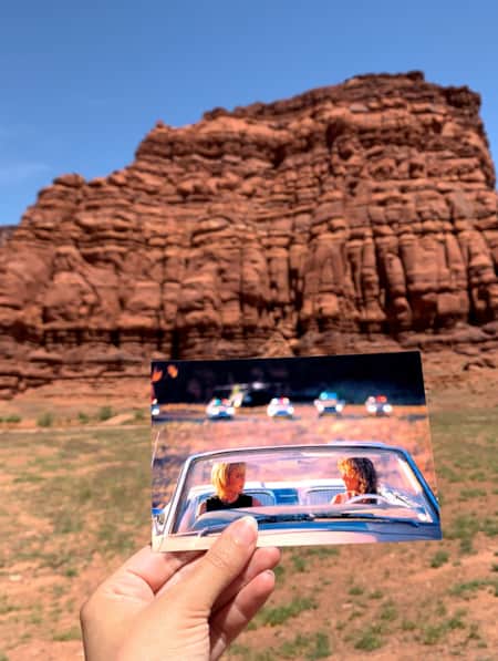
Movies Filmed in Utah: Plotting a Cinematic Drive-Through
Follow a Germany-based film enthusiast on an extended road trip to discover the rich history of Utah cinematography.
-
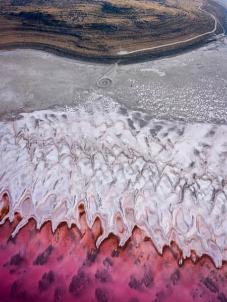
The Spiral Jetty, Utah’s Most Iconic Land Art Sculpture, Keeps Drawing a Crowd
In April 1970, it took six days, 625 man-hours, 292 truck-hours, $9,000, and 6,500 tons of basalt, limestone and mud for Robert Smithson to construct the Spiral Jetty. His work still stands today. Visit and be inspired by this iconic piece of Utah's land art.
-
Video: The Golden Spike Unites a Nation
May 10, 2019, marked 'Spike 150,' the 150th anniversary of the First Transcontinental Railroad. Visit the Golden Spike site in Promontory for a bit of Utah history.