Zion-Mt. Carmel Scenic Drive and Historic Tunnel
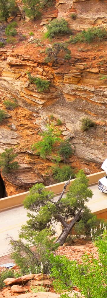
Climbing up the distinctive red asphalt road, you'll pass the Pine Creek Waterfall trail with views of the Great Arch before continuing higher up the winding road. Don't see the Great Arch? To be fair, it's not a true arch yet. Give it a few millions years though.
Soon, you'll pass through a major Utah historical attraction, the famous Zion–Mt. Carmel Tunnel, constructed in the 1920s and still impressive to behold today. The tunnel is over 5,000 feet long and rather narrow, making it a just-barely fit for regular passenger cars in two-way traffic, while larger RVs and trailers need to arrange a special escort to stop two-way traffic and guide them through. (The ‘20s-era engineers were very clever but didn’t anticipate 12-foot-tall RVs on these roads.) The Zion–Mt. Carmel Tunnel does include many windows so passengers can get a brief glimpse of the scenery outside the tunnel’s enclosure — but there is no stopping, and no bicycles, permitted in the tunnel.
Hikes of the East Rim
Beyond the tunnel, beautiful scenic pullouts and overlooks punctuate the drive, and you may as well give in to the temptation to pause at every one. Better still, plan time to hike.
One can’t-miss hike is the Canyon Overlook Trail; its trailhead is immediately east of the tunnel. It includes steps carved into the sandstone, along with some well-packed dirt sections. There’s almost no shade along the way, so you may not want to attempt this walk on a hot day, but any other time, you’ll bask in the airy vistas around you. Even better, you may catch glimpses of adventurous travelers rappelling into Pine Creek slot canyon, part of a half-day canyoneering adventure that descends more than 900 feet. Guides, permits or technical experience required for to canyoneer. Staring in amazement is free. At just one mile in length, Canyon Overlook Trail is family-friendly and great for people who are short on time (or energy) — but keep an eye on the kids as there are some precipitous drops.
Checkerboard Mesa is an exceptionally unique rock formation with a crisscross pattern baked right into it. You can make a two-mile hike to it, or just pause from the drive-up overlook if you’re low on time. But seeing the incredible vertical and horizontal fissures from different perspectives illuminates the dueling forces of nature at work on the distinctive white dome. There are two weathering processes at work here, stratigraphy and climate. Horizontal grooves mark layers of coarse sand deposits made over expansive geologic time while vertical grooves are likely expansion and contraction of the rock surface due to changes in temperature and moisture. Plan two or more hours for the hike up Checkerboard Mesa Canyon to the highpoint, and expect some moderate scrambling. With maps, navigation skills and a lot of time, Checkboard Mesa is a gateway to incredible longer hikes as well.
You can also access Zion National Park’s famed East Rim Trail from this highway, just inside the park’s east entrance booth. (You’ll see a small “Trailhead” sign at the side of the road.) This hike is more challenging, logging about 10 miles total. The scenery is unforgettable and well worth the effort: you’ll check out fresh angles of Checkerboard Mesa, then gradually ascend for five miles through junipers, pinyon pines, shrubs, and ponderosas, topping out at an impressive mesa with rainbow-full views for miles around. While the hiking trail is well maintained, be careful of drop-offs, and bring lots of water.
Along the way to Mount Carmel, you’ll also get a peek into Echo Canyon, a well-known technical slot canyon requiring expertise and gear to navigate, but there’s no harm in looking. This hike lands on many best-hikes lists within both the national park and within Utah as a whole — and given the stiff competition, it’s a high honor.
Regardless of where you hike, consider this: Nature took millions of years to create this sanctuary and it is a place that has been revered by people for hundreds of years. Learn more about respectful visitation of Zion National Park and see the latest alerts for hiking in Zion National Park.
Route and Fees
Travelers arriving from the east from Bryce Canyon National Park will travel the scenic byway. Or if you arrive from the west through the gateway town of Springdale, you'll have the option to explore the byway to extend your visit to Zion National Park. This 26-mile road winds its way eastward through some of the most exceptional terrain in the world. Because the route passes through Zion National Park, you'll need to pay the $30 park entrance fee, but it’s worth every penny.
GPS Coordinates of Zion–Mt. Carmel Tunnel: 37.211029, -112.958323
