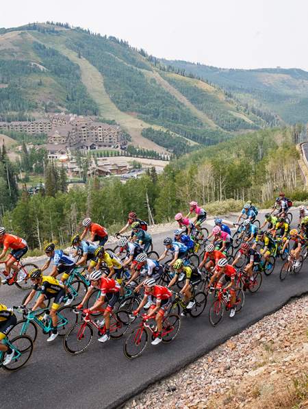
10 Routes Chosen by Utah Cyclists

Utah has so many incredible stretches of roads for your two wheels, it can be tough to decide where to begin — or where to go next. We reached out to cycling experts and enthusiasts — in some cases to people who literally wrote the book on cycling in Utah — to get a feel for some of Utah's best road cycling routes.
1. Journey to Antelope Island
Antelope Island Causeway and the Fielding Garr Ranch | 46.8 miles out-and-back | Map
By Wayne Cottrell, author of "Road Biking in Utah: A Guide to the State's Best Bike Rides"
"This is a 46.8-mile out-and-back ride, starting and finishing at Joseph Holbrook Centennial Park, at 1800 South 2000 West in Syracuse. The route journeys to the Fielding Garr Ranch on Antelope Island, which is effectively at the end of the road, and then returns. Antelope Island is in the Great Salt Lake, which is one of Utah's most famous and prominent natural features. The island is a Utah state park, with rocks, some of the oldest found in the U.S., dating from the Pre-Cambrian Era. The island has been used as a prison, a motion picture setting, and for sheep and horse ranching. Today, some 600 bison populate the island, along with an abundance of mule deer, pronghorn antelope (from which the island gets its name), bighorn sheep, and other mammals.
"The route of the ride is simple: head south on 2000 West to 2700 South. Turn right and head west on 2700 West, and then turn right and head north on 4000 West. At 1700 South, which is state Route 127, turn left. This road leads to the Antelope Island Causeway, which is a 7-mile bridge across the Great Salt Lake to the island ($3 for bicycles). Note that the causeway is just above water level, and has been submerged during extremely rare periods of flooding. Once at the end of the causeway, turn left at the Y intersection (no road signs on the island). After about three-fourths of a mile, turn left again. This 11-mile long road takes you to the highest point of the ride (4,440 feet above sea level) and to Fielding Garr Ranch. (The low point of the ride is on the causeway, which is at 4,200 feet). Loop through the ranch parking lot, perhaps stopping for a visit, and return. You are bound to see bison along the road — maybe even crossing it — on the way to and from the ranch! To get to Syracuse, head north on I-15 to the Antelope Drive exit in Layton. Turn left and head west, toward Antelope Island. At 2000 West, turn left and head south to the park."
2. The All-American Road
Escalante to Boulder, Utah | 54 miles round trip | Map
By the Larry H. Miller Tour of Utah
If you are interested in a unique way to see a lot of beautiful Utah landscape, look no further than this ride down Utah's All-American Road, Scenic Byway 12. This famous state road is consistently found at the top of many travel magazine and internet sites “Most Beautiful Roads” lists. The pros in the Larry H. Miller Tour of Utah ride the entire 130 mile length of the route from Panguitch to Torrey, but we’ve selected this breathtaking slice of the route as one of our favorites. It’s perfect for any type of ride; make it an all-day adventure with friends or head out for the most scenic training ride ever. Utah is legendary among mountain bikers for its slickrock singletrack, but the road cycling here is not to be missed either.
3. Beauty of the Central Wasatch
Provo River to River | Area Trails
By Jim Price, Trails Coordinator, Mountainland Association of Governments
"The River to River Ride is for the slightly more adventurous. It's a 35 mile one-way trip from Vivian Park along the Provo River Trail, connecting to the Murdock Canal Trail at Orem 800 N., following the Murdock for 20 miles to the Jordan River Trail in Lehi, then south next to the Jordan River to Utah Lake. The connection between the Murdock and Provo River was completed this last spring, and we are anticipating completing the last 1-mile gap between the Murdock and the Jordan River trail later this year, so until then this route would require about three-quarter's mile ride on a quiet local road in Thanksgiving Point area.
"There is a one mile diversion on the Murdock in Highland, but it is mostly paved trail and connects through Highland Glen Park. The rest is one-quarter mile of very quiet local street and about one-third mile of sidewalk. It is clearly signed all the way. This is temporary as we are waiting on a right of way agreement between Utah County and the State in order to build a direct connection. There are two steep climbs on this route of about 8 percent grade, but they are short, the longest being about one-tenth of a mile."
4. Escape to the Wasatch Back
Option 1: Ogden Valley: Old Snowbasin Road | Map
From Ogden Mayor Mike Caldwell:
"Old Snowbasin Road is a beautiful winding road through mountain meadows and thick stands of aspen. I've seen moose, deer and elk and the grade allows you to ride a smooth even tempo the entire ride."
Option 2: Peterson Loop (Morgan County) | Map
We're always eager to accept the opportunity to guide you into Morgan County. Mayor Caldwell's recommended Peterson Loop "takes you through a very beautiful agricultural valley with very little traffic, it is also flat and fast. Great for pace lines and group riding."
5. Historic Ogden
Ogden River Parkway | Map
Also recommended by Mayor Caldwell is the Ogden River Parkway (Read:"Cycling the Centennial Trail") . Following a couple of years' hard work and a few million dollars in restoration funding, the Ogden River was cleaned up and converted into an urban oasis, inclusive of a terrific trail system. This flat nature ride is great for families or a warm up before a longer climb into the nearby mountains. When the ride is over, you'll have the best dining, museums, shopping and watering holes of historic downtown Ogden, only a few blocks to the south of the parkway.
6. Best Town in America
Park City to Wolf Creek | Map
Pro cyclist and race director T. Burke Swindlehurst recalls a top bike route he used to take with Levi Leipheimer, a two-time U.S. Champion and top performer in a previous Tour of Utah. The map above varies slightly from the description below.
"My favorite ride would be starting in Park City and going up to Wolf Creek pass and back via Kamas and the road that parallels the Provo river down in Woodland.
Levi and I used to ride that together quite a bit when he'd come into town to prepare for the Tour of Utah. It's stunning and tops at 10,000 feet at the top and has minimal traffic during weekdays. We'd usually return through Kamas and then take the road over through Oakley and up Brown's Canyon to return back to Park City. I think it's around 75 miles round-trip if memory serves."
7. This Is the Place
Emigration Canyon and Big Mountain | Map
When it comes to riding Salt Lake, Gregg Bromka, author of Bicycling Salt Lake City (Falcon Guides) knows them all. When asked for a favorite, he turned to our Emigration Canyon gem (we recommend you take his advice and stop at Ruth's Diner on the way down):
"Of the six paved-road canyons that crease the central Wasatch Range, road cyclists are drawn most to Emigration Canyon. Aptly named, Emigration was the final leg of the Mormon Pioneers' historic trek to the Salt Lake Valley in 1847, led by Brigham Young. With ride-to access from Salt Lake City's foothills, the 8-mile, 1,200-foot climb rises gently then moderately to Little Mountain Summit along a road-side bike lane the entire way.
"It's a casual spin for recreational riders or a heart-thumping time trial for kitted racers. Your just rewards for reaching the top are inspiring views of Little Dell Reservoir overshadowed by Mount Aire and a breezy, mellow glide back down the canyon. If Emigration feels little more than a warm-up, then tack on seven more miles (one-way) to Big Mountain Summit (7,400'). The 1,500-foot climb takes on a "Euro" feel as it switchbacks steeply up the mountain side. To quell your post-ride hunger pangs, stop at Ruth's Diner on the way down Emigration and enjoy puffy, softball-sized biscuits on their creek-side patio."
Emigration Canyon: Make it a Loop
- After Big Mountain, continue on Route 65 (descending) for about 5 miles
- Take a right on Jeremy Ranch Road which is a dirt road. If you hit East Canyon Resort, you went too far.
- When road dead ends at pavement in a subdivision take a right on paved road (Jeremy Road)
- Left on Rasmussen
- Right on Homestead (go under highway)
- Right on Frontage Road up to Summit Park
- Right on Parleys Lane
- Left on I-80 (just for 2 exits and its downhill!)
- Exit East Canyon/Mountain Dell Take a Right on 65
- Left on Emigration Canyon
- [Stop at Ruth's Diner]
- Descend back into town
Note: There are actually multiple ways of experiencing this ride, but they all must pass through the relatively gentle 8-mile climb up Emigration Canyon that starts from the parking lots at the canyon's entrance, just past Hogle Zoo.
The canyon can be accessed from the city with a short but steep burst up Sunnyside Avenue (800 South) to the mouth of the canyon — it's frankly harder than the canyon itself. Beyond the 8-mile ride to the summit of Little Mountain, Big Mountain and loop options await.
8. Flaming Gorge Classic
Explore Part of the Flaming Gorge–Uintas National Scenic Byway | Map
Wayne Cottrell, author of "Road Biking in Utah: A Guide to the State's Best Bike Rides":
"This is a 75.0 mile out-and-back ride in the far northeastern corner of Utah, starting and finishing in the small town of Manila (seat of Daggett County). The turnaround point is the even smaller town of Dutch John. Most of the route is within the Flaming Gorge National Recreation Area (NRA) which may be Utah's most scenic region. The entire ride is at high elevations, ranging from 6,006 feet at the Flaming Gorge Dam to 8,060 feet at Leona Spring (both are along the route). The high altitudes and northerly latitude make summer the best time of the year for the ride, although the cooler temperatures of the late spring and early autumn may offer the most vivid colors.
"The route is simple: Start at Daggett County Centennial Park on 2nd West in Manila (elevation 6,348 feet). The town had a population of just 313 in 2012. From Manila, head east on S.R. 43; turn right on S.R. 44 (stock up for the ride before leaving town). At mile 28, junction to U.S. 191 and head north. At mile 37, leave U.S. 191 and make a loop through the Dutch John settlement. Return to U.S. 191 and ride the reverse route back to Manila. As for the scenery along the way, enter Flaming Gorge NRA at mile 4.7, soon after leaving Manila. Along the side of the highway, you will notice signs that describe the era from which the adjacent rock strata are from, like a journey through time!
"The ride passes by numerous campgrounds, creeks, springs and trailheads, not to mention scenic vistas, and the dense forestation (Ashley National Forest is immediately to the south). Once on U.S. 191, the ride passes by Flaming Gorge Resort, the Firefighters Memorial, and Flaming Gorge Dam (at mile 34). Note that the waters that you see here are at the south end of the reservoir; most of the reservoir is toward the north, in Wyoming. On the other side of the dam flows the Green River, which heads south to the Colorado River."
9. Great Salt Lake
Salt Lake to the Saltair Pavilion | Map (Longer Route from North Salt Lake)
From the team at Visit Utah:
A must-ride for residents and visitors to the Salt Lake area, the straight shot west from downtown Salt Lake follows the grand avenue North Temple to the airport bike path that through multiple gated restricted areas connects to the Salt Lake International Airport and an industrial park. The second half of the ride connects with the North Temple Frontage Road, which runs a parallel course with I-80 toward the Great Salt Lake. Though there's not much of a shoulder, cyclists will frequently have this road to themselves. Get to know the characteristic aroma of the Great Salt Lake then turn back to see the distant city and Wasatch Front.
10. Shades of Mojave
Desert Southwest Ivins by Snow Canyon
From Tara McKee of the Utah Outdoor Recreation Office, part of the Governor's Office of Economic Development, and a first-of-its-kind office in the nation:
"From Southern Utah I have a favorite that begins and ends in Ivins, goes past the beautiful Snow Canyon on the first climb. I recommend riding in the early morning hours during the warmer months of the year. It's called the Veyo Loop and it's just under 39 miles."
Discover More
-

A Biking Guide to the Historic Union Pacific Rail Trail
Winding 28 miles through Northern Utah’s Summit County, the Historic Union Pacific Rail Trail travels through some of the state’s most scenic terrain, from the storybook streets of Park City to rolling farmland and wildlife-rich wetlands near Silver Creek Canyon.
-
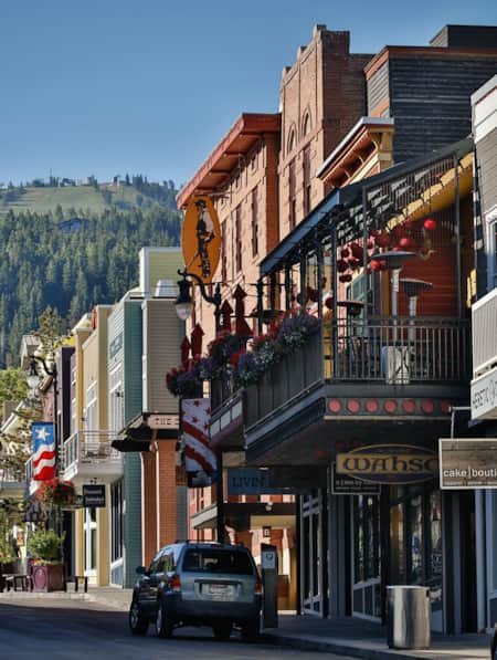
A Classy Warm-Weather Weekend in Park City
When it comes to spending time in Park City — Utah’s snow sports —mecca I prefer the sunny, urbane side of mountain life. Happily, there’s plenty of fun to be had for those who are looking to experience the “city” side of Park City, sans snow.
-
A Family Bike Tour of Salt Lake’s East Canyon
East Canyon has always been a path for travelers, from the Donner Party to Brigham Young to the Pony Express. In this modern-day tale of travel, a family of three takes on East Canyon by bicycle for a weekend camping trip. They discover historical markers, swimming spots, and lots of ice cream.
-
A Local’s Guide to Logan: Northern Utah’s Outdoor Adventure College Town
Logan is teeming with some of the best arts, food and outdoor adventure opportunities in the state. Whether you’re passing through or just looking for new places to explore, here are some of the best ways to experience Logan.
-
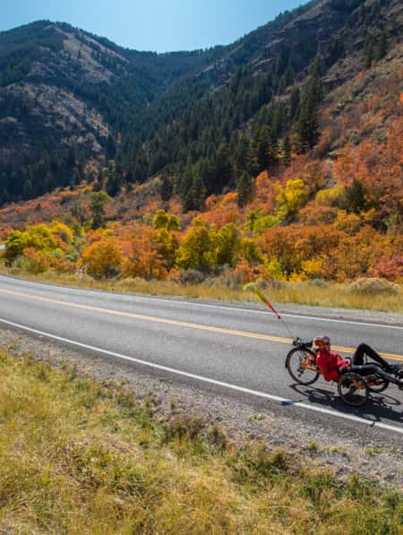
Adaptive Cycling in Colorful Cache Valley
Bob Wassom revisits his roots using adaptive cycling on an e-trike, through Cache Valley, Utah; a ride full of color, variety, scenery and history.
-
AndShesDopeToo's Insider's Guide to Ogden
AndShesDopeToo is a worldwide adventure community of women run by Jennifer and Taylor Killian from Ogden, Utah. This insider's guide video highlights their unparalleled access to both the outdoors and the city's "fun counterculture vibe" at the foot of the mighty Wasatch Mountains.
-
Cedar City to Cedar City 90-Mile Cycling Loop
The 90-mile Cedar City loop is one of Utah’s most challenging and scenic bike routes. Learn all about the route and plan your ride today!
-
Cycling Scenic Byway 12: Escalante to Boulder
Looking for scenic bike rides in Utah? Scenic Byway 12 has all the breathtaking views (and riding) you could ever hope for. Get the scoop and get ready.
-
Cycling the Alpine Loop
Describing one of his favorite sections on the Alpine Loop, professional cyclist TJ Eisenhart says, “You come around a right bend and the whole mountain range seems like it’s giving you a bear hug. It just opens up.”
-
Cycling the Centennial Trail
The Centennial Trail forms a loop around Ogden, Utah, linking together the greenbelts along the Ogden and Weber rivers. Along the way, this network of trails brings cyclists to some of Ogden’s main attractions and provides a unique way to build a custom tour with stops at various points of interest.
-
Cycling Zion: Earning the Descent
Watch Utah cyclist TJ Eisenhart climb Zion National Park’s Kolob Terrace Road. It’s a one-of-a-kind ride that transitions from red rock desert to green valley plateaus.
-
Discovering Box Elder & Bear River Valley
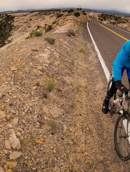
A First-Hand Bikepacking Journey Through Northern Utah’s Bear River Valley
-
Insider's Guide to Salt Lake City Neighborhoods
Check out these neighborhoods on your next trip to Salt Lake City
-
Riding With TJ Eisenhart
In 2016, pro cyclist and Utah native TJ Eisenhart had a breakout performance at the Larry H. Miller Tour of Utah, finishing 7th overall in the general classification as part of the BMC Racing Team and being recognized as a Fan Favorite.
-
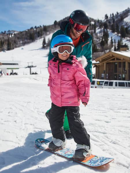
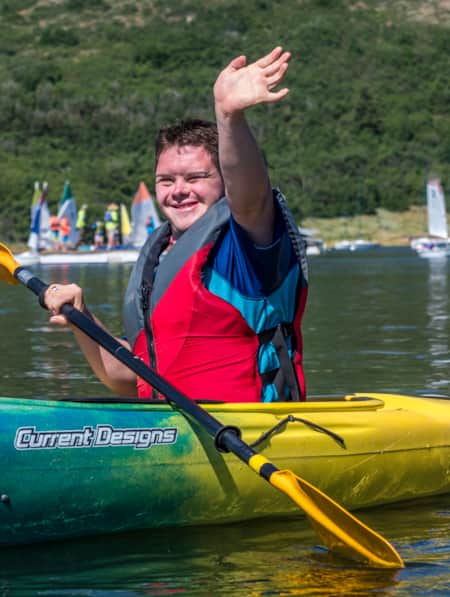
Spreading the Joy of Adaptive Recreation
Meet three National Ability Center staffers who live outdoor adventuring.
-
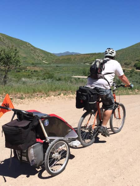
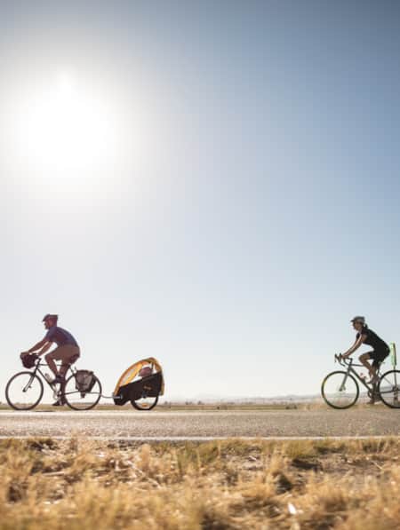
Taking Your Family Adventure Cycling
Want to know how to go bike touring with kids? Check out our guide to family adventure cycling in Utah and plan your trip today!
-
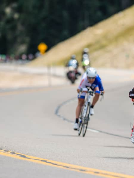
The Tour of Utah: A Most Excellent Adventure
Find your spot at the host venues to see some of the world's best pro-cyclists in action.
-
Tour de Farmtown: A City Slicker’s Guide to Cycling Cache Valley
Northern Utah's Cache Valley is small enough that you can cross its width and strike out six to seven farm towns in a single afternoon. At each point on the compass, there’s a new community to explore, all with rich pioneer histories. Perched in the north are the cow-dotted hills of Clarkston and Richmond. Ride to the center of the valley, and you’ll find yourself looping around the Bear River with a stellar view of the Wellsvilles and an occasional pelican or sand crane flapping overhead.
-
Utah at 15 mph
When it comes to family bike tours, Utah is tough to beat. Learn how to plan a family-friendly bike tour and see what this state has to offer!
-
Utah's Outdoors Are Wide Open for All Abilities
Utah’s National Ability Center is known for changing lives through its adaptive recreation programs. Truth is, just setting foot on the center’s 26-acre ranch can feel transformative.