How to Day Hike Three Different Sections of the Scenic 23-Mile Skyline Trail
As a long day hike or multi-day excursion, this remote trail offers superb hiking, gorgeous scenery and, if you’re lucky, the chance to observe a herd of mountain goats.

The panoramic Tushar Skyline Trail combines the iconic 8.3-mile Skyline National Recreation Trail (#225) with additional sections into 23 miles of twists and rolling paths below the western skyline of the towering Tushar Range, one of Utah’s least known and wildest mountain ranges. You can discover this scenic trail in Beaver County — also known as Ramblers — in southwestern Utah (Read: “Ramble On: An Insider's Guide to Beaver County”).
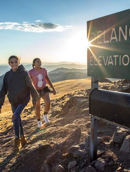
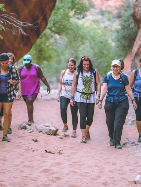
The Skyline Trail traverses broad meadows that can be splotched with seasonal summer wildflowers, threads over wooded ridges, and skirts three 12,000-foot peaks, including 12,169-foot Delano Peak, the highest mountain in southwestern Utah (Read: "How to Summit Three 12,000-footers in the Tushar Mountains"). Besides superb hiking, the remote trail offers gorgeous mountain scenery, plenty of solitude and a huge herd of shaggy mountain goats that thrive on the land above the trees.
The entire 23-mile trail, closed to motorized vehicles, can be day-hiked by a strong party, or done as a two-day backpacking trek with an alpine campsite near the halfway mark. Yet most hikers prefer to do it in shorter day hikes. The Tushar Skyline Trail naturally breaks into three distinct sections that begin from four different trailheads, allowing you to set up a comfortable base camp at one of the designated camping areas near the trailheads.
You can hike point-to-point if you have an extra vehicle for a shuttle, or hike each segment as an out-and-back hike. It’s best to hike the Skyline Trail from south to north, since most of the southern segment is easier than the northern one, which has more elevation gain. (Read: "An Insider's Guide to Hiking in the Tushars")
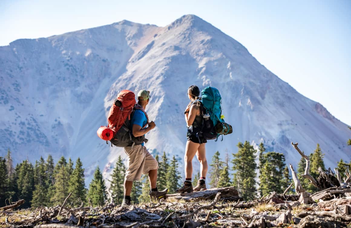
Hikers enjoying the panoramic scenery of Tushar Skyline Trail.
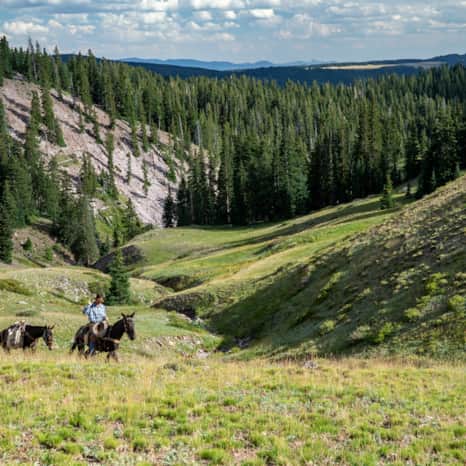
Horseback riding through the Tushar Range.
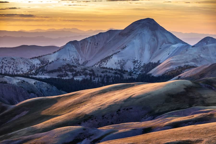
Tushar Mountains during a golden sunset.
To hike the southern section of the Skyline Trail (aka the Skyline National Recreation Trail segment, as designated in 1979), start at 10,200-foot Big Flat Trailhead (GPS: 38.283734, -112.352465), a lonely Forest Service trailhead 0.3 miles east of Utah 153 on FR 514.
The trail’s first nine-mile segment heads north and climbs onto the crest of the Tushar Range, passing through a spruce and fir forest with spacious views east to the Sevier River Valley and west across desert mountain ranges. After contouring across City Creek Peak’s west slopes, the trail descends to Lake Stream Trailhead, a good turn-around point near Puffer Lake, and then climbs over 11,000 feet on Lake Peak.
The last three miles thread below the western flanks of Mount Holly and Delano Peak, dipping across sparkling creeks and crossing open alpine meadows. This trail section is the best place to spot mountain goats grazing across grassy slopes or resting on snowbanks. Bring a spotting scope or binoculars to get up close. The day hike ends at Big John Trailhead (GPS: 38.359050, -112.393037) and some of the best campsites in the Tushars at Big John Flat — though please note these are dispersed or “primitive” sites with pit toilets and no hook ups.
The middle trail section, with mostly easy hiking, runs north for seven miles over high, rolling terrain from Big John Flat Trailhead to a trailhead by Mud Lake (GPS: 38.379826, -112.401506), a shallow tarn near FR 123. From the Big John Flat Trailhead and parking lot on the east side of the gravel road, the trail wades across a couple of creeks, climbs past Sheepherder Flat, and swings past Shelly Baldy Peak, a barren, humped ridge. End the segment in open meadows at Mud Lake.
The final eight-mile section of the Skyline Trail begins at Mud Lake and ends at the Bullion Pasture Trailhead (GPS: 38.403200, -112.398584) at a high saddle. Beginning at 11,000 feet, the trail winds across rolling terrain covered with meadows and scattered clumps of spruce before switchbacking down steep slopes. After crossing a creek, the trail continues to descend below a massive scree field to glistening Blue Lake, a turquoise-colored lake tucked into an alpine cirque dominated by 12,122-foot Mount Baldy to the west and 12,137-foot Mount Belkap at the head of the valley. From the north end of the lake, follow the steep trail up an old road to FR 123 and the Bullion Pasture Trailhead.
"Besides superb hiking, the Skyline Trail offers gorgeous mountain scenery, plenty of solitude and a huge herd of shaggy mountain goats that thrive on the land above the trees."
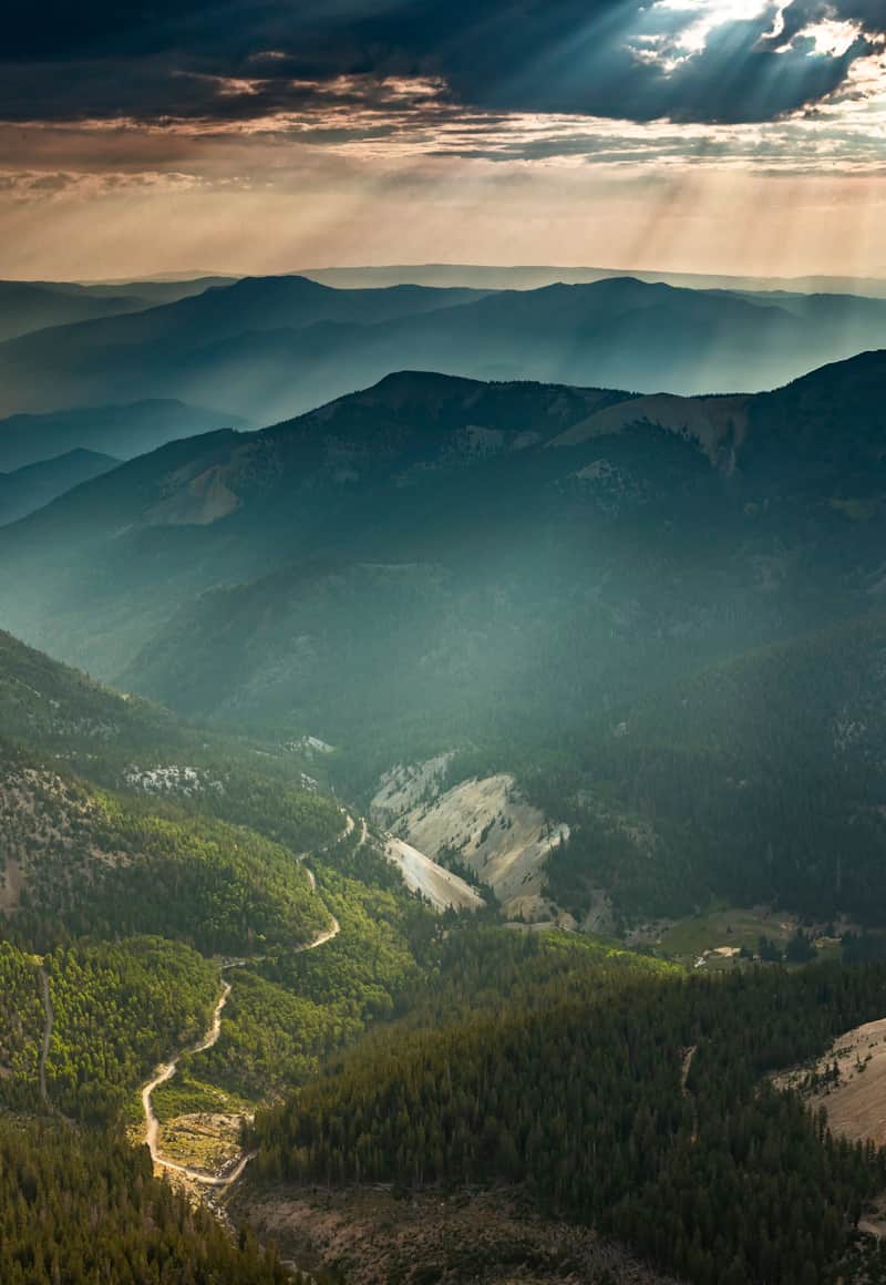
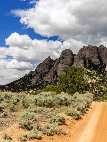
Sun rays peaking through the clouds hovering over the Tushar Range.
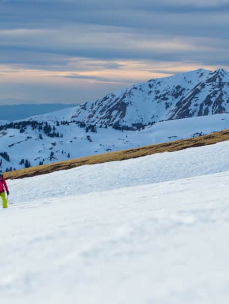
The Skyline Trail has about 3,400 feet of cumulative elevation gain and is best hiked from late June until late October. Heavy snow covers much of the trail through the winter and the deepest drifts do not melt out until June at the earliest. The access road to the northern trailheads is also inaccessible until summer. The trailheads are signed, but you’ll want to use GPS coordinates to find them. Despite the trail’s rugged beauty, not many hikers venture into the Tushar Range, so you’ll need to carry a detailed map and compass to stay on track since parts of the trail may be overgrown and hard to follow.
The four trailheads are easy to reach from Beaver and I-15 by driving east up Utah 153, the Beaver Canyon Scenic Byway. The Big Flat and Lake Stream Trailheads are south of Eagle Point Resort after the highway turns to gravel, while the Big John Flat, Mud Lake, and Bullion Pasture Trailheads are north of the resort on FR 123. This dirt road is often rough and rocky, so a high-clearance vehicle is recommended, especially beyond Big John Flat Trailhead. (Read: “Cycling the Tushars near Beaver.”)
What's Nearby
-
Beaver
Beaver, with a population of 3,000, is a gateway to gorgeous landscapes, rivers and streams, miles of hiking and mountain biking trails, breathtaking scenic drives, haunted ghost towns, and plenty of peace and quiet.
-
Bryce Canyon National Park
An alpine forest with as many red rock hoodoos as trees. At dawn and dusk, mule deer graze the forested plateau along the road into Bryce Canyon.
-
Eagle Point
Escape the crowds and enjoy an intimate, family-friendly skiing experience on Utah’s third-highest mountain range at Eagle Point Resort in Beaver, Utah.
-
Fishlake National Forest
This is a paradise known for its beautiful aspen forests, sundry scenic drives, trails, elk hunting, and mackinaw and rainbow trout fishing. Recreational opportunities include scenic drives, mountain biking, snowmobiling, hiking, camping and OHV use.
-
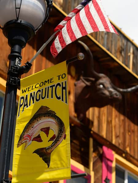
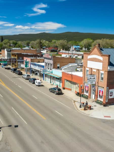
Panguitch
Panguitch, Utah, captures the enduring pioneer spirit of Utah with its welcoming rural charm and strong sense of heritage.
Discover More
-

An Insider's Guide to Hiking in the Tushars
One of Utah’s best-kept hiking secrets, the Tushar Mountains deliver sun-dappled trails, wildflower-sprinkled meadows, shaggy mountain goats and forever views from rocky summits. Check out these six choice Tushar trails and make plans to discover Utah’s third-highest mountain range.
-
Elevate Your Hiking with Mindfulness
Incorporating simple mindfulness techniques into your next hike can take the edge off anxiety and enhance your overall well being.
-
Explore the Tushars on Snowshoe
Ready to experience snowshoeing in Utah? Eagle Point is a Utah favorite location. Check out this snowshoe excursion then plan yours today for fun and adventure.
-
Fishing Fish Lake
The largest natural mountain lake in Utah, Fish Lake sits at more than 8,800 feet of elevation, which makes for pleasant weather all summer long. Located near Richfield, Utah, the lake has everything you need for a relaxing summer getaway.
-
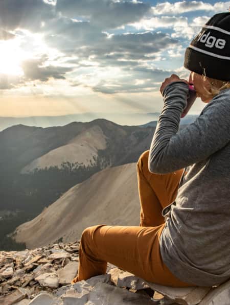
From Sparkles to Sparks: Just Click Your Heels (or Hiking Boots) and Go!
Women embrace adventure differently throughout their lives.
-
Hiking Southern Utah with Younger Children: Tips for Family Friendly Adventure
Find safety tips, side activities and kid-friendly hikes in Utah with our special guide to hiking Southern Utah with children. Read now!
-
How to Summit Three 12,000-footers in the Tushar Mountains
One of the least known and wildest mountain ranges in Utah, the Tushars is best explored by foot to fully capture the engulfing silence, distant vistas and glimpses of wildlife this alpine world has to offer.
-
Panguitch Scene: Kenny Rays and Cowboy's Smokehouse
Travelers through Cedar Breaks, Bryce Canyon and Highway 12 are likely to pass through historic Panguitch. Here you will find a few eclectic food options to fill your belly while taking a break along your travels.
-
The Best Restaurants in Panguitch
From Utah trout (yes, it’s good) to classic burgers, fries, and pizza, Panguitch offers an eclectic mix of flavors and styles for visitors needing to fuel up after their adventures.
-
Weaving Through Granite Mazes in the Mineral Mountains of Beaver County
The Mineral Mountains, one of Utah’s most magnificent but least known natural wonders, offer superb hikes through a rugged granite wonderland of cliffs, domes and valleys. Backcountry trails beckon with the chance to discover precious gemstones, climbing routes and airy summits with expansive views across southwestern Utah.
-
Winter in the Bryce Canyon Area: Hiking, Cross-Country Skiing and Snowmobiling
Learn more about why Bryce Canyon and the surrounding areas are the perfect place for winter hiking, cross-country skiing and snowmobiling.