Dead Horse Point

Dead Horse Point State Park

Dead Horse Point State Park   |  Austen Diamond
  • Weather: Partly Cloudy, 67F

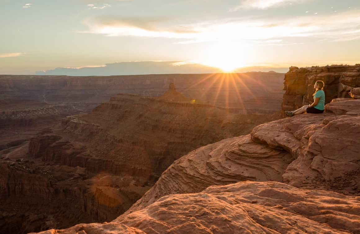
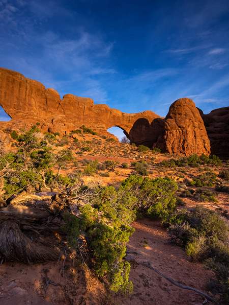
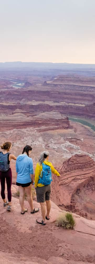
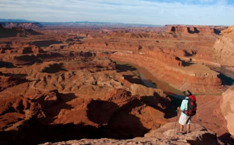
Visitors to Dead Horse Point State Park are in for a treat. Driving to each of the park’s many overlooks reveals a completely different perspective into Utah’s vast canyon country. Some visitors claim Dead Horse Point State Park is even more captivating than the Grand Canyon.

The park is a slender peninsula of land extending off the massive plateau that is home to Canyonlands National Park’s Island in the Sky district. The park sits above the beautiful White Rim Trail in Canyonlands National Park and offers views of Moab, the La Sal Mountains to the south and the Colorado River, 2,000 feet (609 meters) below. According to legend, the area got its name from its use as a natural horse corral around the turn of the century. According to legend, some horses died of exposure on the plateau.

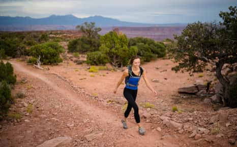
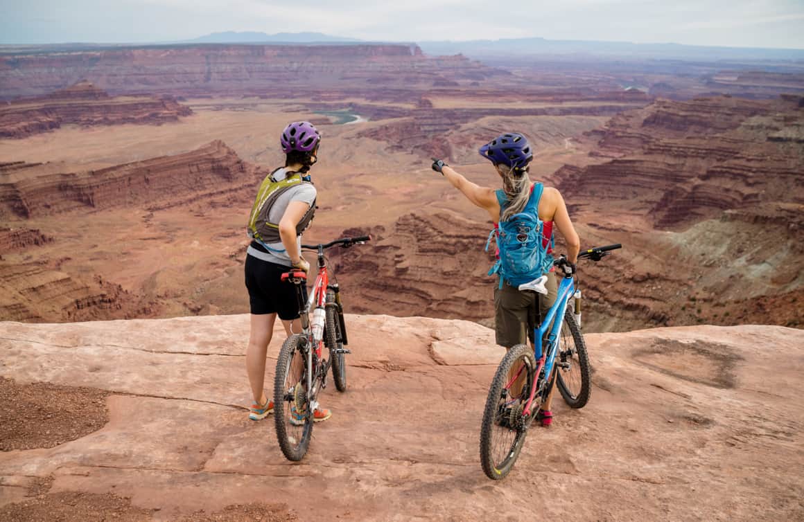
A visitor center and art gallery provides a good primer to the park’s geology and key features visible from the many overlooks. The visitor center parking lot also serves as an excellent starting point to access the 16.6 miles (27 kilometers) of non-motorized single-track mountain biking and eight miles (13 kilometers) of hiking trails that sprawl across the park. Utah State Parks has a PDF map of the trails.

Recommended trails

Things to Do

Where to Stay

Base Camp Moab

Moab is the nearest town to Dead Horse Point State Park and has a variety of options for lodging from tent camping to luxury hotels. Moab is a 45 minute drive from Dead Horse Point State Park and is the best place to book tours of the area. 

The town of Moab has many hotels, vacation house rentals, shops, restaurants and recreational outfitters. It’s busiest in the spring and fall, but stays busy year round even attracting many travelers in the winter months. It’s helpful to plan ahead and book in advance. Visit discovermoab.com for vacation planning tools and other important information.

Things to Do in Moab

Entry Fee & Camping Reservations

Day-use entry fee required, purchase in-person or online. The Annual Utah State Park Pass is accepted for park entry. There are many camping options in and around the park:

  • Kayenta Campground: Located within the park, there are 21 campsites available with restrooms (visitor’s center), picnic tables, fire rings and tent pads. Advance reservations are recommended.
  • Moenkopi Yurts: Located within the park, there are five yurts available for rent that can sleep up to six people each. A grill is available for outside cooking and the yurts have heating and A/C as well as electrical outlets. Advance reservations are recommended.
  • BLM Camping near Dead Horse Point: Sometimes called the Cowboy Campground, there are seven individual campsites (limited to 10 people and two vehicles per site) and toilets, but no water or hook-ups.
  • Basecamp Adventure Lodge: This lodge has seven bedrooms, seven bathrooms, and a fully stocked kitchen. This is a good option for groups and can sleep up to 19 people. They also have tent camping sites to accommodate even more people in a large group. It’s located just east of the park and can be booked online

Travel Tips

  • The park is open year round from 6 a.m. until 10 p.m. daily.
  • WiFi is not available at the visitor center and cell phone signals can be spotty to non-existent.
  • Dogs are allowed at the park and in the campgrounds. Read the traveling with pets guidelines for more information.
  • The visitor center is open daily except Thanksgiving, Christmas and New Year’s Day.
  • Visit Forever Mighty to learn more about responsible travel in Utah.

Weather

In the spring or fall temperatures pleasantly hover in the 70s and low 80s (F) (21-28 C). In January lows dip into the 20s and in July temperatures can skyrocket to more than 100 F (38 C). It does snow in Moab and Canyonlands National Park, but it usually doesn’t stick around for too long. It’s not common to see a heavy snowstorm in March and April, but it does happen. When it rains the slickrock becomes incredibly slippery and tough to navigate, hence its name, so check weather reports before heading out on any adventure and be sure to wear shoes with good traction. It’s always a smart idea to bring a rain jacket, sunscreen, a hat, snacks, a headlamp, first aid kit and more water than you think you’ll need for any activity.
Discover Dead Horse State Park

Recommended mountain biking trails

Dead Horse Point Tour

Intermediate (14.4 miles/23.2 kilometers)

This trail has an elevation gain of 644 feet (196 meters) if you ride it counter-clockwise and has many lookout points. 

White Rim Trail

Intermediate (100.8 miles/162 kilometers)

This is a popular long-distance trail usually done in 3-5 days. Overnight permits are required.  

Amasa Back and Cliffhanger Trail

Difficult (9.1 miles/14.6 kilometers)

The trail has an elevation gain of 1,413 feet (431 meters) and is one of the most popular rides in the Moab region. Getting to the trailhead from the park will take 1.5 hours.

Photo: Moab Travel Council

Photo: Austen Diamond

Recommended hiking trails

Dead Horse Point Rim Loop Trail

Easy/Intermediate (5 miles/8 kilometers)

A loop trail with an elevation gain of 908 feet (276 meters) that leads to eight overlook points.

Great Pyramid Loop Trail 

Intermediate (4.2 miles/6.8 kilometers)

This loop trail has an elevation gain of 291 feet (89 meters) and features canyon views.

Amasa Back and Cliffhanger Trail 

Difficult (8.5 miles/13.7 kilometers)

This loop trail trail has an elevation gain of 1,430 feet (436 meters) and has great valley views and opportunities for bird watching.

Photo: Austen Diamond

Photo: Dead Horse Point State Park

Recommended ATV trails

Gemini Bridges 

Intermediate (13 miles/21 kilometers)

This point-to-point trail has an elevation gain of 1,925 feet (586 meters) that starts on US 191 and ends on US 313 just before the entrance to Dead horse Point State park. 

Hell’s Revenge 

Difficult (9 miles/14.4 kilometers)

The Hell’s Revenge loop trail has an elevation gain of 1,112 feet (339 meters) and features steep climbs, descents and cliff edges.

Fins & Things 

Intermediate (9.5 miles/15.2 kilometers)

This loop trail has an elevation gain of 1,092 feet (332 meters) and features eroded cemented fin-shaped sandstones. 

  • alt text

    7 Days

    History & Hoodoos

    Just the national parks, ma'am. We get it. You're a bucket-lister with a checklist and a pen. We hope it has a lot of ink.

    Camping & Backpacking, Hiking, History and Heritage, Stargazing

    See Itinerary

  • alt text

    6 Days

    Thelma & Louise: A Tribute Road Trip Through the Classic Film’s Utah Settings

    Perfect for fans of the beloved film “Thelma & Louise,” tour the exact places where the movie was shot, and make some memories of your own exploring the beauty of this exquisite desert.

    Arts, Film Tourism, Food and Drink, Ghost Towns, Glamping, Hiking, Scenic Drives/Road Trips, Women's Travel

    See Itinerary

  • alt text

    3 Days

    Iconic Classics Southeast

    Three days on the open roads of Southeastern Utah is just enough for a taste of two of its most iconic national parks — Arches and Canyonlands — and a few things in between.
    ATV and off-road, Guided Experiences, Hiking, Mountain Biking, Scenic Drives/Road Trips, Watersports and Rafting

    See Itinerary

Previous Image Next Image