Venturing Out (and Back) Along the Canyon Rim Trail
Flaming Gorge's most scenic hike

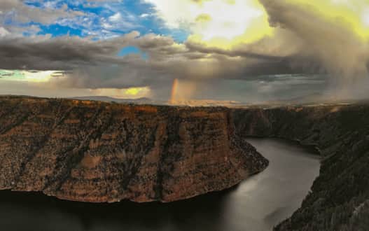
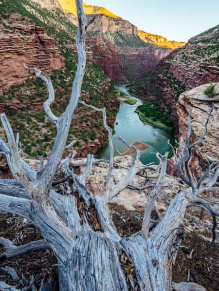
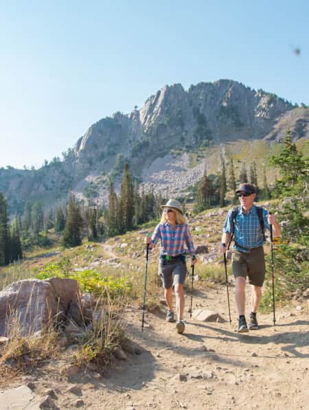
Monsoon weather over Flaming Gorge. The easily accessible Canyon Rim Trail lets visitors take in stunning views without much effort.
Photo: Flaming Gorge Chamber of Commerce | Ryan Kelly
Trail Guide
Difficulty: Easy
Distance and Elevation Gain: 4.5 miles one-way, 227 feet
Trail Type: Wide, dirt with some rocky spots
Multi-Use: Hikers, Mountain Bikers
Dogs Allowed: Yes, on leash in campgrounds, picnic areas, and trailheads at all times.
Fees: None
Seasonality: Spring, Summer, Fall
Restrooms: Yes, at the visitor's center and campgrounds.
Where to park: Visitor Center parking area
Trailhead GPS coordinates: 40.8919, -109.5614
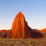
Flaming Gorge National Recreation Area, nestled in the northeast corner of Utah, is aptly named. When the late-afternoon sun hits the crimson cliffs, they illuminate with other-worldly color that has to be seen to be believed — photos simply don’t do it justice. When Major John Wesley Powell and a team of explorers first set eyes upon the walls of the 1,400-foot canyon in 1869, they were so brilliant that they thought they were on fire, and the name “Flaming Gorge” was born.
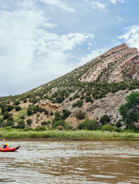
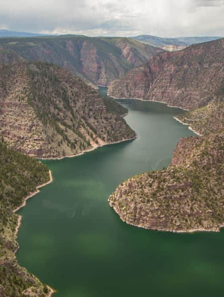
The emerald green reservoir that dominates the landscape is 91 miles long with 360 miles of shoreline, perfect for endless water skiing, kayaking and stand-up paddleboarding. And the fishing is world class. It's a Blue Ribbon area with regular 30-pound lake trouts being hooked every year. Kokanee salmon and smallmouth bass are equally epic. Below the lake on the Green River (also aptly named, reflecting the large amount of limestone in the water), experience rafting and fly-fishing for rainbow and brown trout.
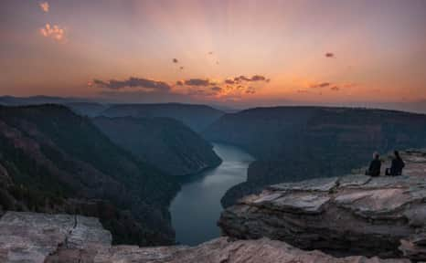
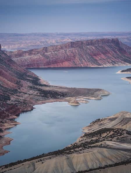
The view near the visitor center at the start of the Canyon Rim Trail.
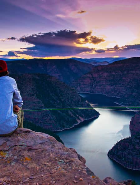
Also nearby is East Green's Lake, a spur of the Canyon Rim Trail.
Where to Start
With all of this available to explore, a good place to get a lay of the land and make a plan is, as always, the visitor center. First off, the lookout that sits cantilevered out above the gorge boasts some of the best views of the whole canyon. Yet it's just an appetizer of the things to come. If you spend a few minutes talking to the enthusiastic rangers, you can get a quick education on the flora and fauna of the area, the ancient people that lived there, and the local geography. Armed with your newfound knowledge, head out for a hike on the Canyon Rim Trail, conveniently starting right outside of the building.
"It sort of feels wrong to score these postcard-worthy views without even breaking a sweat."
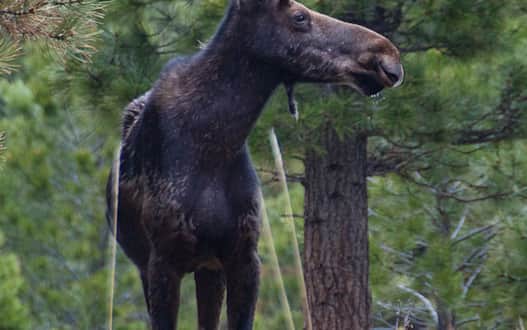
The native flora and fauna of Flaming Gorge: Moose under a ponderosa pine.
Photo: Flaming Gorge Chamber of Commerce | Ryan Kelly
This casual, family-friendly trail is 4.5 miles one-way and links the Red Canyon Visitor Center to the Greendale Overlook on Highway 44. It’s open to both hikers and mountain bikers. The hike itself is mellow despite being at an altitude of 7,400 feet — it only gains a total of 227 feet in elevation. But, what it lacks in physical difficulty, it makes up for with breathtaking views. In fact, it sort of feels wrong to score these postcard-worthy views without even breaking a sweat — it feels like cheating.
The start of the hike follows the south rim of the reservoir. The trail’s informational signs talk about the wildlife and the ecosystem, and various viewpoints somehow manage to rival the vistas back at the visitor center. Keep an eye out for bighorn sheep barely clinging to the precipices in the canyon.
Just past the first mile, the trail turns away from the rim and weaves through meadows of colorful wildflowers and tall, native grasses, and under the shadows of towering, fragrant ponderosa pines.
Deer, moose and elk are frequently spotted along this section, so keep a camera ready. At about 2.5 miles in, there is a small footbridge over Skull Creek (fortunately, not aptly named). This is a perfect place to turn around if you’re looking for a short hike or time is limited.
After you travel 4.5 miles, the trail ends at a lovely picnic area at State Road 44. It’s a good place to stop, have lunch and watch for falcons, red-tailed hawks, American kestrels, ospreys and even bald eagles.
Most people do this hike as an out-and-back, but it could be done as a shuttle if you first park a car at the state Route 44 endpoint and then drive to the visitor's center to start the hike.
If you don’t arrange a shuttle, just head back on the trail the same way you came and catch all the things you missed on the way out.
Discover More
-

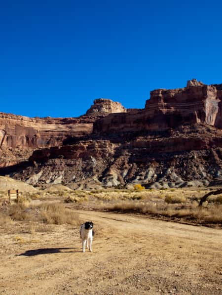
Dog-Friendly Utah: The Road to Mighty
Want to bring your furry friend on your next vacation? Utah is home to several great dog-friendly national parks and other fun destinations. Check it out and plan your trip!
-
Flaming Gorge: Boating and Paddling Paradise
Do you know that Flaming Gorge is one of the best boating lakes in Utah? Read all about this stunning body of water and plan a trip!
-
11 More Utah Winter Experiences Outside the Ski Resorts
No matter your level of adventure, you will find good reason to save some time for a day away from the resort.
-
Dinosaurland Top 5
Vernal, Utah, is an adventure base camp to the best of eastern Utah. Uintah County around Vernal — called Dinosaurland — is home to diverse outdoor recreation and natural history at three state parks, Dinosaur National Monument and countless trailheads to the Ashley National Forest.
-
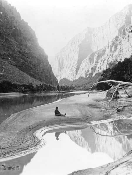
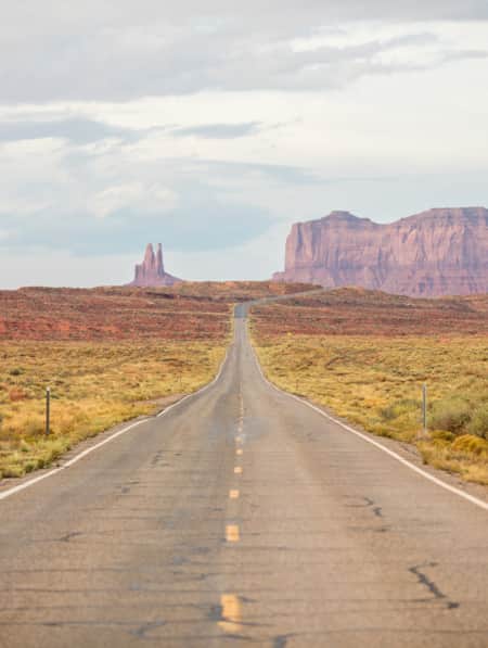
Chasing John Wesley Powell: Six Places to Explore Utah's Green and Colorado Rivers
One hundred and fifty years ago a one-armed Civil War veteran set off with nine mountain men on a scientific expedition to map one of the last blank spaces left on the U.S. map: The Green and Colorado rivers. Much of the river remains wild today. Follow Powell's journey here.
-
Tracing the Outlaw Trail
Cowboys and dinosaurs don’t always come to mind in tandem. At Dinosaur National Monument in northeastern Utah, however, they do share one thing: an incredible landscape as a backdrop. This landscape, as well as some wild history, make Dinosaur a must-visit part of the state.
-
Vernal Equinox: A New Season in Vernal, Utah
Discover the growing adventure outpost in a geologically fascinating corner of eastern Utah.
-
An Old Favorite Fishing Hole at the Flaming Gorge Reservoir
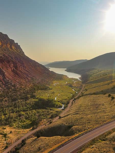
Visit Utah columnist Dan Potts takes us to his "secret" fishing hole on Utah's Flaming Gorge Reservoir, one of the world's most diverse fisheries set among the brilliant red rock walls of Red Canyon in the easternmost corner of the state. Along the way, Dan takes us through some of his favorite landscapes on the drive to and from Salt Lake City.
-
The Most Scenic Trophy Trout Destination
Flaming Gorge, Utah is one of the world’s best places to fish for trout. Awe-inspiring scenery and abundant fish attract anglers from all over. Check it out!
-
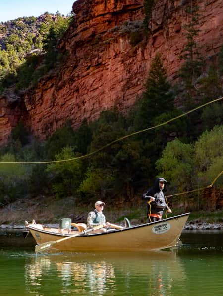
Guided Rafting Through the Gates of Lodore
Explore guided rafting expeditions through the Gates of Lodore, one of Utah's most sought-after whitewater rafting trips with Dinosaur River Expeditions.
-
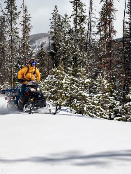
Why Backcountry Snowmobiling Is an Unforgettable Way to Experience the Uinta Mountains
The Uinta Mountains are about 100 miles east of Salt Lake City and just a few minutes from Vernal in Eastern Utah. It's one of the state's top snowmobiling destinations.
-
10 Routes Chosen by Utah Cyclists
We reached out to cycling experts and enthusiasts — in some cases to people who literally wrote the book on cycling in Utah — to get a feel for some of Utah's best road cycling routes.
-
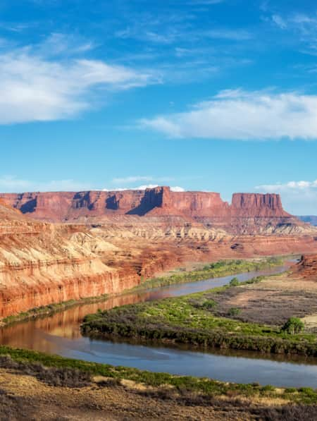
A Guide to the Many Faces of Utah's Green River
The mighty Green River carves a path through a dramatic and varied landscape of mountains, canyons and desert for 730 miles across Utah. Whether you have a few hours or a few weeks, experience the diversity of this river yourself by getting on the water.
-
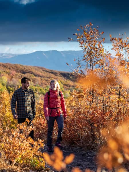
8 Utah Hikes for Leaf Peeping and Natural Splendor
When the leaves change, road trips through Utah’s mountains and forests take on a colorful new glow. Unlike their well-trodden counterparts on the East Coast, Utah’s fall foliage and trails are less well known among the broader leaf-peeping community.
-
A Life Elevated Road Trip
Hit the road with Aaron Millar, host of The Armchair Explorer podcast, as he takes an adventure tour of Utah — complete with audio postcards along the way.
-
Where To Fish in Utah This Spring
We've got your Northern and Southern Utah recommendations for where to fish this spring.
-
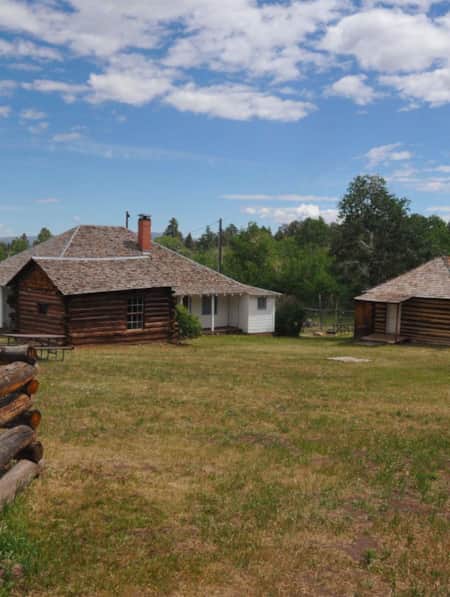
Explore a Pioneer Homestead Near Flaming Gorge
In the heart of Flaming Gorge National Recreation Area, the Swett Ranch is a testament to the self-sufficiency and ingenuity of Utah pioneers, representing the bygone homestead era, and it’s a historic site not to be missed by those interested in pioneer life.
-
8 Sunny-Day Getaways to Tucked-Away Towns in Northern Utah
Prefer off-the-beaten-path destinations? Head to these farm towns, desert gateways and mountain meadows for outdoor adventure and main street charm.
-
Vernal: Your Easy, Outdoor Adventure Destination
Vernal is famous for its dinosaur fossils, but this "Dinosaurland" also offers easy access to a variety of outdoor adventures, from rafting and paddleboarding to rock climbing.
-
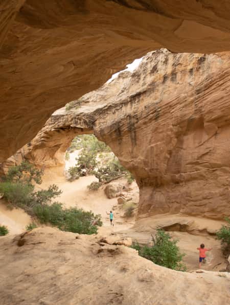
Exploring Dinosaur National Monument and Flaming Gorge
Embark on an unforgettable journey to Dinosaur National Monument, where you'll marvel at ancient fossils and enjoy thrilling river adventures. Then, discover the beauty of Flaming Gorge National Recreation Area, offering endless opportunities for boating, fishing and hiking amidst stunning red rock canyons.
-
Your Guide to Utah’s National Wildlife Refuges
This guide covers all there is to know about Utah's National Wildlife Refuges, including visitor activities, birdwatching and the best spots for camping.
-
Touring the Sheep Creek and Spirit Lake Scenic Backways of Flaming Gorge National Recreation Area
Explore the Utah Sheep Creek backways within the Flaming Gorge National Recreation Area. Experience awe-inspiring scenery, rock formations, and wildlife.