Finding Winter Solitude in Bluff

The first time I visited southeastern Utah in winter, it was a journey of mixed emotions. Due to a variety of work and family circumstances, I was facing my first Christmas alone. As much as I had grown to love hiking in Utah’s red rock canyons, my decision to explore the area in late December was mostly an attempt to “survive the holidays alone.”
My previous trips to canyon country had all been during the height of the busy season. Visiting in winter was going to be a new experience, and part of me wondered whether I was making a big mistake. Should I be heading out to the cold desert when everyone else was celebrating with their families? Or find myself alone on an icy trail, realizing that I was out of my comfort zone?
Thankfully, neither of those scenarios happened. What I found instead was the same stunning landscape I had grown to love in spring and summer, but with a tranquility I hadn’t experienced before. I had already grown to embrace the Utah desert as my sanctuary, the place I could go to disconnect from the stresses of everyday life. But somehow, the winter stillness made me feel more deeply connected to the landscape. The trails were quiet, and the few hikers I did encounter seemed like kindred spirits, as if we were privy to an inside secret.
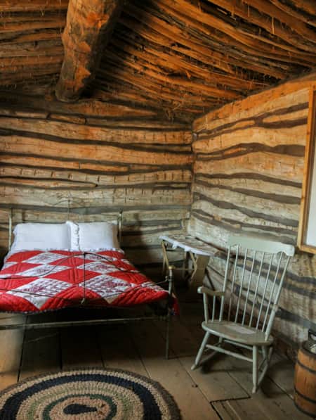
In addition to hiking and photography, I wanted to explore some cultural sites on this trip. So, the town of Bluff seemed like the perfect base from which I could do day trips to several places I wanted to visit. Surrounded by dramatic sandstone bluffs, the town of Bluff holds a significant place in Utah history. Mormon settlers arrived in the late 1800s, drawn by the area’s proximity to the San Juan River. Today, you can visit the restored Bluff Fort Historic Site, including cabins, original wagons and a replica of the Co-op Store.
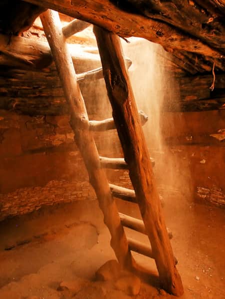
But Bluff’s settlement history started long before the Mormons arrived. Ancestral Puebloans inhabited the area more than 1,000 years ago, and their structures and cliff dwellings are part of what draws both regional and global visitors to the area.


Hovenweep National Monument
Photo: Barry Gutierrez
Hovenweep National Monument
(42 miles from Bluff)
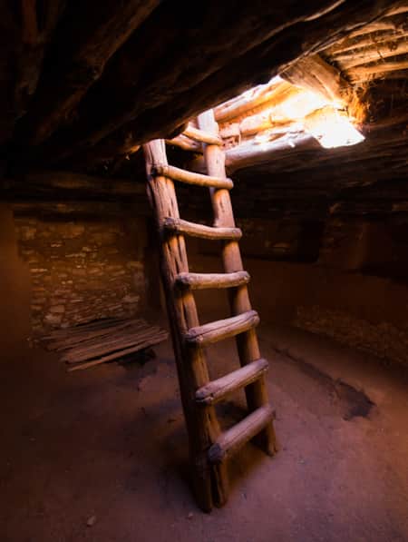
Around 1000 A.D. southeastern Utah was home to the Ancestral Puebloans, who built cliff dwellings and towers throughout the Four Corners area. Many of these structures are in remote locations that require advanced hiking and route-finding skills. At Hovenweep, however, an easy two-mile loop trail takes you through a cluster of ancient towers and structures considered by many to be some of the finest ancient architecture in the Southwest.
The trail around Little Ruin Canyon loops around the rim before dropping down into the canyon and climbing back up the other side. The first thing I noticed as I made my way down the path from the visitor center was the silence. The occasional call of a canyon wren or a tree branch blowing in the breeze were the only sounds. As I stood on the rim looking at the ancient stone structures that dotted the landscape, I felt as if I’d been granted entry to a sacred lair.
Little Ruin Canyon is the centerpiece of the Square Tower group, the largest collection of structures at Hovenweep. One of the most impressive in the Square Tower group, and a highlight of the hike around Little Ruin Canyon, is the grand Hovenweep Castle. Perched precariously on the edge of the canyon rim, this structure consists of a D-shaped tower and attached room blocks. Archeologists suggest that portholes in one of the Castle’s rooms were situated to mark the winter and summer solstices, which may have enabled residents to estimate growing seasons and planting dates.
The second largest structure in the Square Tower group is Twin Towers. These two citadels, one oval and one horseshoe-shaped, have walls so close together they almost touch. According to archeologists, the Twin Towers display some of the most advanced masonry skills of any ancient dwelling in the Southwest.
Be sure to pick up a printed guide in the visitor center to learn about the history of the structures you’ll see on the trail.
Responsible travel tip: Indigenous and other historical and cultural sites are everywhere in Utah, and they are important to modern descendant communities and researchers. Protect these sites by observing and admiring structures, objects, rock imagery and historical inscriptions from a respectful distance. Visitor should also stick to designated trails and read and follow all signage.
Natural Bridges National Monument
(56 miles from Bluff)
Natural Bridges stands out among Utah’s national parks and monuments for two reasons. First, it became the state’s first National Park Service unit in 1908, when President Theodore Roosevelt established the monument. Second, it sits under one of the darkest skies of any national park. The International Dark-Sky Association designated Natural Bridges as the first International Dark Sky Park in 2007.
What draws most people to this park, however, are the three mammoth natural bridges. In fact, one of the bridges—Sipapu—is one of the two largest natural bridges in the world. The three bridges span the channels of White Canyon and its tributary Armstrong Canyon. When ancient streams flowed through these canyons, the relentless force of water against the sandstone triggered the erosion process that created the bridges.
By most accounts, the first white man to see the bridges was Cass Hite, who happened upon them while searching for gold in 1883. He named the bridges the President, the Senator, and the Congressman and began telling people about the “three whoppin’ natural bridges” he had seen.
Word spread, and in 1904 National Geographic magazine publicized the bridges in an article titled Colossal Natural Bridges of Utah. Eventually, the General Land Office gave the bridges their current names: Sipapu, Kachina, and Owachomo, which are the Hopi words for “place of emergence,” “spirits,” and “rock mound.”
All three bridges can be viewed from overlooks along Bridge View Drive, a nine-mile loop that circles through the park. But to appreciate their grandeur, you really need to view them up close. The trails to Kachina and Sipapu involve steeper descents and ladders, so caution is advised during winter when trails may be icy. Although Owachomo Bridge is more easily accessed via a short trail, it’s no less impressive than the others. Only nine feet thick at its narrowest point, the slender arch almost looks like it’s defying gravity.
An interesting sidenote: In the early 1900s, several photos appeared in print showing as many as 11 men on horseback on top of Owachomo Bridge. Had the riders known that the bridge is believed to be nearing its geologic collapse, they might have thought twice about saddling up for that stunt.
Responsible travel tip: Do not climb or stand on the bridges, for safety reasons and also because they hold spiritual significance for Native Americans.


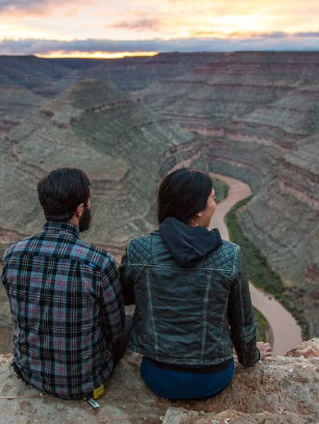
Goosenecks State Park
Photo: Utah State Parks
Goosenecks State Park
(25 miles from Bluff)
The view from the overlook at Goosenecks State Park has a “wow” effect for anyone who visits, but geology enthusiasts have a special appreciation for what lies below the rim. About 1,000 feet beneath the observation point, the San Juan River has carved a deep canyon that snakes around three tight turns called the goosenecks. Geologists consider this to be a prime example of an entrenched meander, and you’d be hard pressed to find a geology textbook that doesn’t include a photo of the San Juan at Goosenecks.
Driving from Bluff to Goosenecks, you can’t help but notice the multi-colored geological feature that dominates the landscape on the south side of Highway 163. Raplee Ridge is a fold in the earth’s crust, called an anticline, caused by tectonic stresses that occurred millions of years ago. The triangular interwoven layers of sandstone create a pattern that many describe as resembling a Navajo blanket. The “golden hour” just before sunset is a perfect time to view this striking formation.

What's Nearby
-

Bluff Fort Historic Site
When you visit this area, you’ll really get a feeling for what life was like as a pioneer. You can walk around the original Bluff Fort, that has been rebuilt and restored through the efforts of the local organization, the Hole in the Rock Foundation.
-
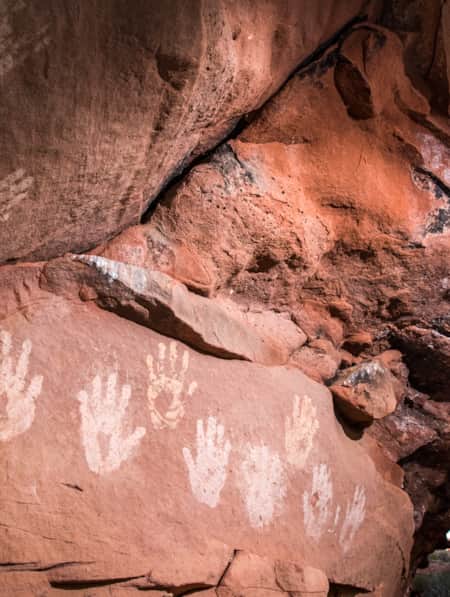
Sand Island Petroglyphs
Handprints, horned animals, hunters and a Kokopelli playing a flute are some of the extraordinary petroglyphs on display at Sand Island, a significant and easily accessible archaeological site located just outside of Bluff, Utah.
-
Four Corners Area
Visit the Four Corners area of Utah and learn about each of the Four Corners states--Arizona, New Mexico, Colorado and Utah. Plan your visit now!
-
Goosenecks State Park
Located north of Mexican Hat, Goosenecks State Park is an easy-to-get-to area with a million-dollar view. The San Juan River begins in the mountains of Colorado and travels to its junction with the Colorado River at Lake Powell.
-
Edge of the Cedars State Park Museum
Edge of the Cedars State Park Museum in Blanding, Utah, is the site of a prehistoric Native American village. Explore history here!
-
Bears Ears National Monument
A pair of towering buttes stand against beautiful scenery. The twin buttes are so distinctive that in each of the native languages of the region their name is the same: Hoon'Naqvut, Shash Jáa, Kwiyagatu Nukavachi, Ansh An Lashokdiwe, or in English: Bears Ears.
-
Blanding
Blanding blends cowboy culture with Native American and prehistoric history. The Edge of the Cedars State Park & Museum features the largest display of Ancestral Puebloan artifacts in the Four Corners region, and the Dinosaur Museum, a federal fossil repository, showcases life-size models, skeletons, and a 250-million-year-old petrified tree.
-
Twin Rocks Trading Post
A must stop! The shop has museum-quality ancient art as well as handcrafted Native American and Southwest art.
-
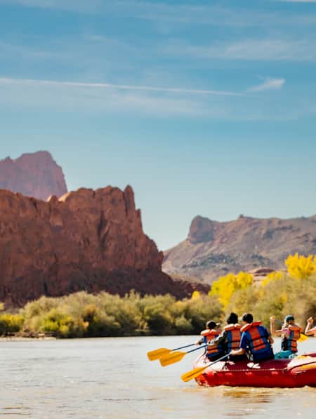
San Juan River
San Juan River rafting in Utah is an experience you won’t forget. Find out how to plan the perfect paddling trip on this scenic river now!


Farther Away From It All
Searching for solitude? Follow this six-day itinerary to find unspoiled wild places, hidden trails, open spaces and perfect peace.
Highlights
- Red Cliffs National Conservation Area
- Under-the-Rim Bryce Canyon
- Monument Valley Navajo Tribal Park
- The Needles District Canyonlands
Stories To Inspire Your Travel
-
The History of River House (and How to Experience It Today)
The River House Site, nestled into the west side of Comb Ridge, is home to an array of pictographs as well as a kiva and several one- and two-story rooms.
-
The Voices of Bears Ears
Bears Ears National Monument is at the heart of southeastern Utah. These lands are imbued with layers of culture — layers of life. In this four-part video series, meet the locals who connect with the land in their own distinct ways.
-
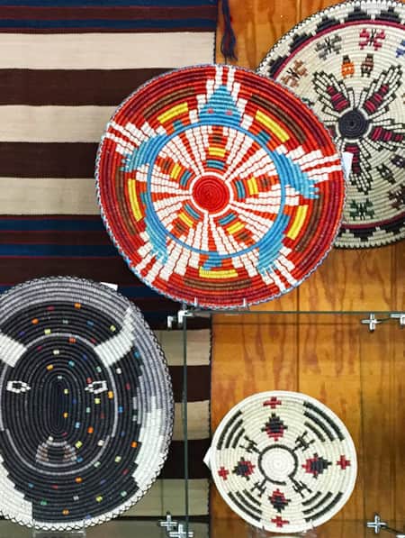
The Navajo Basketmakers
Meet the Navajo artists behind this labor intensive and traditional practice.
