
Lower Calf Creek Falls
What Makes It Great
After picking up the helpful trail map at the onset of the hike, you’ll note nearly a dozen points of interest along the way (as if a 126-foot waterfall wasn’t enough). Along the three miles to the falls, you’ll pass two granaries, beaver dams, and a mighty pictograph on the wall opposite the canyon, to name but a few points. Hike over red rock and through sand, and, if timed in accord with the seasons, see bountiful wildflowers flourishing along the trail — a perfect picture opportunity.
The hike can be long and challenging at times due to deep sand. Because of the nature of the canyon, as you pass around corner after corner, you might get the “Are we there yet?”s, but fret not, the sites along the way, and the majesty of the desert-varnished Navajo sandstone cliff walls are plenty to tide you over until reaching Lower Calf Creek Falls.
The waterfall unto itself is a sight to behold. Streaming down more than 100 feet along mineral-stained sandstone, the water appears to radiate in its clarity. Mists from the long falls sprays revelers and not only helps to make the alcove a cool haven for people but also for the densely-packed greenery.
There is a pool for swimming at the base of the waterfall. During summertime, especially on weekends, the area can resemble a waterpark with families jam-packed into the small space — so keep that in mind as you plan your trip.
After soaking in the water and cooling down, it’s easy to want to have a picnic or a snack and peer at the waterfall for a while before returning back the way you came.
What You’ll Remember
The feeling of craning your neck to view the top of the 126-foot falls; how the cool mist refreshes you after the long, hot hike down the path; your yelp as you dunk yourself into the cold, cold water; how you never wanted to hike back to the car.
Who Is Going To Love It
Kids and dogs will love the swim the most, and you can often hear children giggling and yelling with joy as you approach the falls. But, really, who doesn’t love looking at a majestic waterfall? This trail offers activities everyone will enjoy.
What's Nearby
-

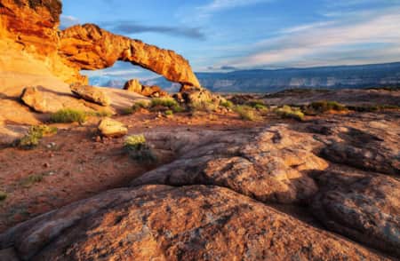
Boulder
Boulder, Utah, is a remote, charming town full of scenic beauty. This gateway to Grand Staircase-Escalante National Monument and Capitol Reef National Park offers relaxation and outdoor adventure.
-
Escalante
Between Capitol Reef and Bryce Canyon national parks and perched on the edge of Grand Staircase–Escalante National Monument, the town of Escalante offers access to some of the most beautiful parts of Southern Utah.
-
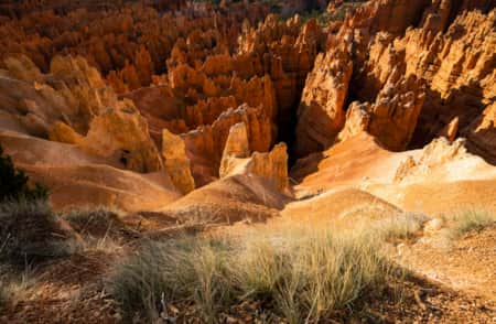
Bryce Canyon National Park
An alpine forest with as many red rock hoodoos as trees. At dawn and dusk, mule deer graze the forested plateau along the road into Bryce Canyon.
Lower Calf Creek Falls Hiking Guide
A spectacular cliff-bound canyon, a perennial stream featuring beaver ponds and abundant trout and a memorable veil of whitewater — one of very few active waterfalls in the Southern Utah desert, plunging into a cold, deep pool — combine to make this trip a must for any hiker visiting the region.
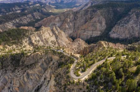
Finding the Trailhead: Calf Creek Campground
The prominently-signed Bureau of Land Management (BLM) Calf Creek Recreation Area is located off of UT 12, 11.4 miles south of the UT 12/Burr Trail Road junction in Boulder, 14.4 miles northeast of Escalante and 1.1 miles north of the Escalante River bridge on UT 12. Follow the paved spur road for about 250 yards below the highway to the day-use parking lot. A small day-use fee is collected by campground hosts at the entrance to the parking lot.
Park at the designated parking lot by the restrooms just before entering the campground (but prepare to park on the narrow UT 12 and hike down into the campground if the parking lot is full).
Follow the signs to the trailhead. Camping is also available for $10 on a first-come first-served basis — it’s recommended that you arrive early on the day you want to camp.
From the day-use parking area adjacent to the picnic site, follow the paved road north through the campground for 0.2 mile, following signs pointing to the trail. Just before the road dips down to ford Calf Creek, the prominently signed trail heads left up the west slopes of the canyon.
Distance, Difficulty, Hike Time
Lower Calf Creek Falls is an easy, out-and-back trail totaling 6.2 miles, round-trip. Hiking time ranges from 3.5 to 4 hours total on a well-constructed path that's moderately sandy in some places. (Be prepared to empty your hiking shoes full of sands when you complete the route.) Please note that there are no facilities along the trail, so plan to use the restrooms at the parking area or in the campground.
Best Time to Hike Lower Calf Creek Falls
Note that this is an extremely popular hike. The best seasons to visit Calf Creek are in the spring and fall — March-June and September-October — but to avoid big crowds, go mid-week. While the hike to the falls in the summer can be quite hot, the cold water is most refreshing then.
Are Dogs Allowed On The Trail?
Dogs are allowed but must be kept on leash. Please remember to pick up after your pet.
Water Availability
This hike can be extremely warm in the summer months. Plan to carry plenty of water. Potable water is available in the campground (April-October). Do not drink creek water.
What to See on the Trail (Other Than the Waterfall)
As you proceed, refer to the brochure provided by the campground hosts as you entered the recreation area. It is keyed to 15 numbered posts along the trail, pointing out the vegetation and geologic features at each and describing the area’s history and prehistory. The brochure will greatly enhance your appreciation and enjoyment of the area.
The wide, sometimes rocky and often sandy trail winds up canyon along the west slopes above Calf Creek, passing through fields of rabbit brush, groves of Gambel oak and woodlands of pinyon and juniper, which provide occasional shade. An active population of beaver has felled most of the cottonwoods along the grass-bordered creek, but they have ignored the abundant water birch fringing the streamside.
