Grand Adventure in the Great Basin
“Gaunt Mountain Ranges and Empty Basins” is not clickbait for many travelers. That’s the headline Roadside Geology of Utah gives to the Basin and Range province. Zooming in, the Great Basin National Heritage Area is remote and rugged territory known as “The Real Land Before Time.” In this five-day itinerary you won’t find many crowds. But take your time and you’ll find this desert geography isn’t so empty after all.
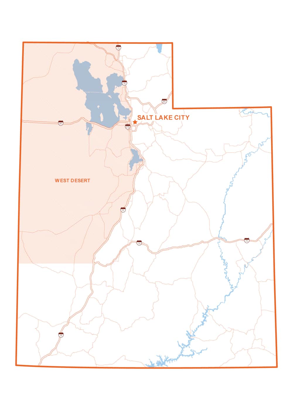
Utah’s Great Basin Territory, spanning Millard County and including the Great Basin National Heritage Area, is a land of grand human and earthly ambition — and of what all that ambition left behind. Isolated mountainisland ranges rise from basins so vast, the atmosphere blurs and mutes the next horizon into a gauzy haze of shadow and light.
After slowing down for exploration and discovery of the area’s towns, museums, and open lands, the imagination quickly fills in the spaces: volcanoes erupt and the liquified earth hardens into formations; a massive, prehistoric lake inundates the valleys; ancestral peoples carve out a wild and sophisticated culture; pioneer settlers put down roots; and dreams of statehood build up monuments.
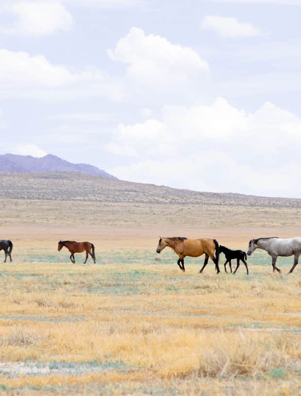
Meanwhile, a stunning national park near the Utah-Nevada border blooms in the desert, wild horses graze among sagebrush, and remembrances of the forceful internment of American citizens during World War II reminds of a shameful past. All of this exists in a stark and atypically beautiful place whose stars shine bright when night falls and pristine dark skies rise.
Start: Drive about 2 hours southwest from Salt Lake City or 2 hours north from Zion or Bryce Canyon National Park.
Hours of driving: 9–12 hours, added time if traveling the unpaved roads to Gandy or remote peaks.
Notes: Easily expand your itinerary — and your range — by bringing a properly registered OHV/ATV. There are hundreds of miles of off-roading across four trail systems. Some destinations are only accessible with a well-equipped ATV. The Great Basin National Heritage Area includes Millard County in Utah and White Pine County in Nevada. At 16,000 square miles, it is larger than several U.S. states. According to the National Park Service, the entire Great Basin covers more than 200,000 square miles. Consider this itinerary an introduction. For additional details on local events, activities and attractions, explore the Great Basin Territory website, courtesy of Millard County.
Welcome to “The Territory”
48 Miles
Imagine for a moment the great state of Deseret. At a size halfway between Texas and Alaska, it would have covered the American West from the Rocky Mountains in Colorado to the Pacific Ocean.
The first glimpses of this land of ambition and remnants arrive in quick succession on Day 1 — you’ll tour a building that stands at the center of a forgotten empire and see fascinating formations from a volcanic past.
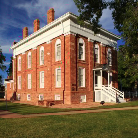
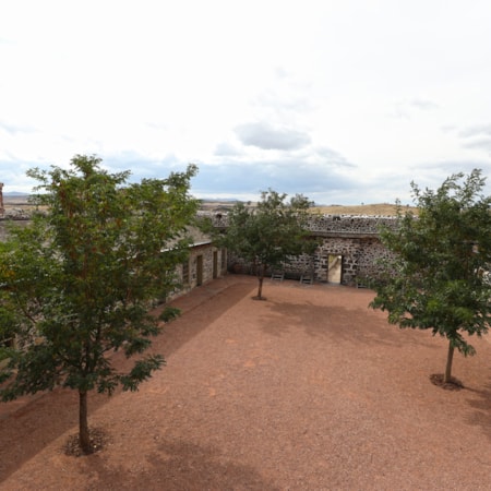
The Territorial Statehouse in Fillmore stands as a reminder of that early pioneer ambition. Time your trip for the weekend after Labor Day to hit the Old Capitol Arts & Living History Festival. Continue your journey exploring the Devil’s Kitchen Petroglyphs Site, lava tubes and flows, and the intriguing Lace Curtain along the back roads of the Pahvant Valley Heritage Trail. “I don’t know if people really realize the volcanic activity that took place thousands of years ago. There were five volcanoes within Millard County that all came up under Lake Bonneville,” Morris says.
Overnight Fillmore or Delta. Camping options in Fishlake National Forest.
Up in the Delta / Base Camp Delta
10 Miles
Days 2 and 3 offer a deeper look with historical stops in and around the small frontier town of Delta before setting out on lonely Highway 50 in pursuit of some of the West’s most far-reaching views — and its tiniest details. Looking out from the end of Sinbad Spring Road, bleached-bone-white and ashen deposits of an ancient lakebed stir up in the wind. Desert juniper warms in the sun. Cracked shale holds time-frozen creatures of ancient seas.
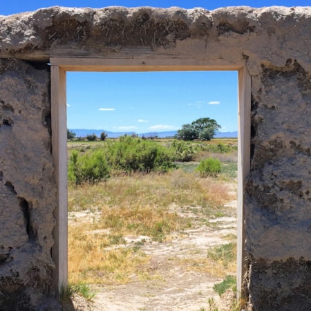
Regional and world history live side-by-side in downtown Delta. At the Great Basin Museum, their proud historical society curates the multitudes of the boundless Great Basin into one compact museum. Next door, the Topaz Museum focuses on the history of the Topaz War Relocation Center, where 11,000 Japanese Americans were incarcerated during World War II in a frightening violation of civil rights. The museum also maintains a large parcel of the original camp. Inquire about responsible visitation rules and tours. Just outside of town, Fort Deseret tells the story of the Mormon pioneer settlers’ defensive effort during conflict with Indigenous Utes during the Black Hawk War of 1865.
Overnight in Delta.
A Soak in the Bathtub with No Drain / Delta to Baker
150 Miles
- U-Dig Fossils Quarry and Sinbad Road
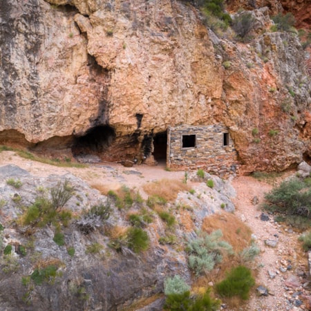
- Stinson Hermit Cabin
- Crystal Ball Cave and Grandy Warm Springs
- Summit Notch Peak
Explore sites left behind, documents of the land’s human past and remnants of the Lake Michigan-sized Lake Bonneville, and to the west, Lake Lahontan, waters that drained away between 14,000 and 15,000 years ago, leaving America’s greatest basin.
Or travel further back in time by unearthing the fossils of 250-million-year-old trilobites at the U-Dig Quarry on Death Canyon Road near Antelope Springs (check ahead — generally open Monday to Saturday, April to October). Continue on Sinbad Road higher into the House Range for astonishing views 60 miles west to Mt. Wheeler. Explore the unpaved Old Highway 50/6 to seek the Stinson Hermit Cabin and watch for wild horses. Or head north for a stop by Gandy Warm Springs or to hit your confirmed appointment at the peculiar Crystal Ball Cave. Wherever you go, just be sure to download your GPS data before traveling, Morris says. Because you won’t be able to download it once you’re out there.
Note: If you have extra time — up to a full day — plenty of fuel, good wayfinding tools, and a pack with provisions, let Notch Peak or Crystal Peak pique your interest.
Reserve a room in Border or Baker, Nevada, or a campsite in Great Basin National Park.
Welcome to Great Basin National Park / Base Camp Great Basin
20 Miles
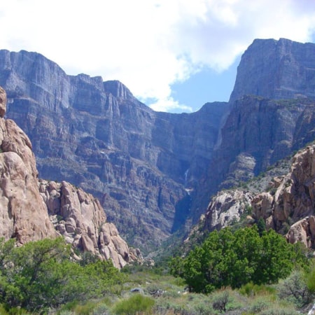
Day 4 comes as a surprise to many visitors, almost from the moment the prominent Snake Range appears on the distant horizon. You’ll spend the day immersed in the remote and scenic Great Basin National Park. Mt. Wheeler is the centerpiece of the park. Its 13,065-foot summit towers more than 7,500 feet over the surrounding basin. It proudly wears a blanket of snow for much of the year.
Hike among alpine lakes and rocky topography formed by the callused hands of glaciers, wind and time. Take the scenic drive nearly 4,000 feet up Wheeler Peak through multiple ecological zones and watch the landscape change. Above 10,000 feet, conditions can seem harsh. Yet bristlecone pines, thousands of years old, stand tough. Beneath it all, the marble-like limestone of Lehman Caves beckons spelunkers — reservations required. Add a day to explore the Baker or Snake Creek drainages. Stay up late — it’s an International Dark Sky Park.
Continue your stay in Border or Baker, Nevada, or in your campsite in Great Basin National Park.
Eastbound and Down / Baker to Beaver to Home
150 Miles
The last day brings a reflective return trip east across the Great Basin for additional views into the region’s heritage. Why reflective? “There's some really cool, exciting things out there. But there's a lot of distance between one and the next,” advises Kevin Morris, the semi-retired tourism director and 44-year veteran of Millard County. You’ll have plenty of time to think about your experiences as you drive. But you’ll come away with a greater sense of the ambitious forces of nature that created the lands and the humans who have called it home. A timeless place so little changed it is known as, “The Real Land Before Time.”
Around 800 years ago, the Indigenous Fremont people established a pit house village near present-day Great Basin National Park. The Fremont’s carved and painted messages persist on naked and varnished rock walls throughout Utah. One theory suggests that drought forced the Fremont to migrate. On the return trip east along state Route 21, the Frisco Charcoal Kilns mark the end of a different era, one of silver mining and smelting. And back near I-15, the beautifully preserved Cove Fort tells the story of mid-19th-century travel and communications. The strategic stopover served pioneer homesteaders, Pony Express riders, and telegraph officials.
Overnight in Beaver (saving time to hit Beaver Creamery), Fillmore or return to your starting point.
West Desert Ramble & The Pony Express
This itinerary is a three-day adventure along the Pony Express National Historic Trail in Utah's West Desert. Visit Simpson Springs, Fish Springs National Wildlife Refuge, Gold Hill and more.
Highlights
- Camp Floyd State Park Museum
- Fish Springs Wildlife Refuge
- Pony Express National Historic Trail
- Historic Wendover Airfield
