Grand Staircase
Location
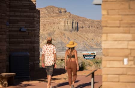
Grand Staircase is the westernmost section of the monument and is most easily accessed from Tropic, Cannonville or Henrieville near Kodachrome Basin State Park on Highway 12 — also known as Scenic Byway 12 — and Kanab or Big Water on U.S. Route 89. Travelers can easily combine trips to Lake Powell via the Wahweap Marina with a stop at the Big Water Visitor Center, known for its fascinating exhibits of the park's rich paleontological record.
Geography and Geology
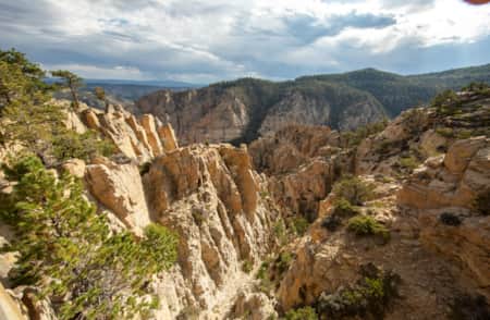
The aptly named “Grand Staircase” marches northward from the North Rim of the Grand Canyon to the 9,000-foot edge of Utah’s High Plateaus. The colorful succession of “risers” in the staircase include, from south to north, the Shinarump Cliffs, the Vermilion Cliffs, the White Cliffs, the Gray Cliffs, and the Pink Cliffs. Progressively higher terraces separate each cliff band.
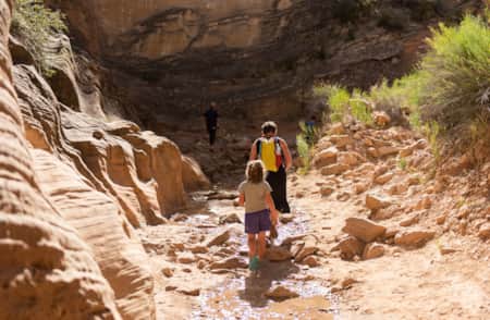
The Paria River is the principal drainage of the Grand Staircase region, coursing 80 miles from Utah’s High Plateaus to its confluence with the Colorado River at Lees Ferry. The Paria River carves the deepest canyon in the region through the Paria Plateau. It approaches 3,000 feet deep in places. Paria Canyon is also one of the region’s longest backcountry journeys. Stretching nearly 40 miles from White House Trailhead to the canyon’s mouth at Lees Ferry on the Colorado River, the trail meanders through canyons renowned for their narrow slots and is a popular attraction for hikers.
Be Prepared
-

Grand Staircase-Escalante Hiking
Hiking in Grand Staircase-Escalante’s otherworldly landscape delivers slot canyons, narrows, slick rock and waterfalls. Find family-friendly trails and challenging multi-day hikes for adventurers.
-
How to Visit Grand Staircase-Escalante
Explore and stay safe in Grand Staircase-Escalante’s remote desert wonderland — what to drive (2WD vs. 4WD), what to pack and where to fuel up and gather supplies.
-
Scenic Drives
Take the road less traveled. Find solitude and scenery on Scenic Byway 12, Cottonwood Canyon Road, Hole-in-the-Rock Road and Burr Trail.