Trail Guide
Difficulty: Easy
Distance: 11.8 miles, out and back
Elevation gain: 777 feet
Trail type: Monday to Friday crossings onto City Creek Canyon Road are closed due to heavy construction equipment on the road.
Trail uses: Hiking, running, cycling
Dogs: Allowed on-leash
Fees: None
Seasonality: Year round
Bathroom: Bathrooms are closed.
Pro tip: Traffic on Bonneville Blvd. will be two-way for heavy construction vehicles. Flaggers (crew members directing traffic on site) will be there Monday to Friday.
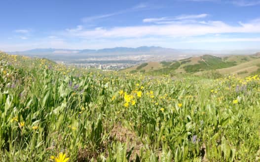
When Salt Lakers boast of Utah’s closeness to the mountains, City Creek Canyon is top of mind. The mind-clearing effect of leaving the bustle of downtown Salt Lake City behind as you ascend into the undeveloped foothills behind the state Capitol Building is a stunning transition. The trail can literally be accessed with a walk from downtown, including Temple Square, through serene Memory Grove, a park of memorials and monuments, or from access points on either side of the canyon, such as near the visitor center at Council Hall, just south of the Utah Capitol. Regardless of how you get there, you’ll quickly leave the traffic and noise behind for a shady trail, bubbling stream and grassy meadows.
The canyon was once a private preserve set aside by early LDS Church leaders and its undeveloped state continues because of its importance to protecting the watershed that drains into the namesake City Creek. The canyon has a paved roadway ascending to its terminus that is used by city water officials and picnickers who have reserved one of the popular sites along City Creek Canyon Trail. Otherwise this roadway/trail is blissfully car-free and popular with active Salt Lakers who walk, run and cycle its 5.9-mile length practically every day of the year. There is also a singletrack trail that runs parallel to the roadway that further separates you from the works of man and cyclists who travel down canyon at high speeds. (Note: From Memorial Day to Labor Day bikes are only allowed on odd-numbered calendar days).
From the gate house, you’ll start up the roadway, the parallel dirt trail begins to the west of the road near the first numbered picnic area. Soon you’re walking up a shady lane with a steady but not formidable incline. Watch for wildlife on the surrounding hillsides, deer are commonly sighted but canyon users report sightings of rare birds, Lynx and even the very occasional mountain lion. Along the road, mile markers track your progress. The roadway narrows at a boundary sign indicating the beginning of the watershed (where dog walkers must turn back) and continues to climb into even shadier and wooded terrain, spotted with a selection of ornate picnicking areas built by the Salt Lake Rotary Club in the 1920s. The club still helps service and maintain the area today. The most popular of these is called “The Grotto,” that includes secluded sitting spots along the creek and is worth a detour. City Creek Canyon Trail is an easy, well-traveled route and although it’s rewarding to journey to the very back of the canyon, turn around whenever you feel like it. One of our favorite stopping points is the “Hobbit Fountain” a warm spring trickling on the left on the bend just after the 2-mile marker. The warm water keeps the foliage (including watercress, if you like to forage) green even in winter.
Find It
Nearest destinations: Utah Capitol Building, Memory Grove, Temple Square and Downtown Salt Lake City
Trailhead parking: At the gated trailhead. Note: Car traffic on City Creek Canyon Road is only one way and must be driven from the top of Avenue B at 11th Avenue.
Trailhead GPS coordinates: Memory Grove, 40.7762447, -111.8854952
Contributed by Jeremy Pugh
