Travel with Respect
The sites are artifacts and should be treated with respect. Don’t climb throughout them unless it’s specified that you can, leave what you find, and don’t carve on the walls or rocks. Always "Respect and Protect." Some destinations require a day use permit from the Bureau of Land Management. Dogs are allowed in most areas, and signs will designate if they must be kept on leash. Please review our travel advisory.
Cliff Dwellings & Ancient Structures
In addition to the GPS coordinates* below, detailed maps to some hard-to-find cliff dwellings can be found at area visitors centers.
Mule Canyon Sites
Read: Exploring Mule Canyon
(Parking 37.540177, -109.742857)
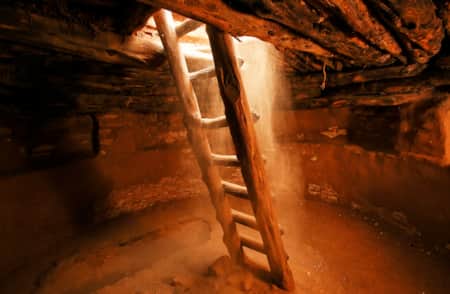
House on Fire
Read: Exploring Mule Canyon
(37.542504, -109.730760; Parking 37.537314, -109.732772)
Within the boundaries of Bears Ears National Monument, the House on Fire is one of the region's most popular cliff dwellings that's right along Highway 95 between Blanding and Natural Bridges in the South Fork of Mule Canyon. It's a one-quarter mile drive on well-maintained native-surface road. It's called House on Fire because at certain times of days the lighting makes it looks like there's a glow to it, with smoke and flames coming out of it. It's really popular with photographers. It's short hike, 3 miles round trip with little elevation so it's good for the whole family.
Time your trip to House on Fire by arriving to the trailhead with enough time to hike the 1.5 miles and hit the site approximately late morning, depending on the season. You’ll never forget this magical place lit ablaze with sunlight reflecting off red-orange rock. You’ll also remember the mystery and the wonderment you feel gazing upon ancient structures, pictographs, and petroglyphs.
The Mule Canyon/House on Fire trailhead requires a $2.00 per person permit at trailhead if not purchased in advance at Kane Gulch Ranger Station. Beginning in March 2018, advance reservations for overnight trips in the Bears Ears area may be obtained on recreation.gov or the Kane Gulch Ranger Station. Please visit the BLM Cedar Mesa Permits webpage for more information.
Butler Wash
.5 mile hike to "cliff dwelling" overlook
(37.522797100, -109.633673400)
Cave Towers Site
Read: Exploring Mule Canyon
.5 mile Rough road access, .25 mile hike
(Parking 37.528938, -109.733040)
River House Site
Read: The History of River House (And How to Experience it Today)
(37.222791, -109.687882)
Salvation Knoll Historic Site
A short but steep hike
(Parking 37.564787, -109.818655)
Arch Canyon
2.75 miles native surface road; expect to hike last .25 mile
(Parking 37.546072, -109.668667)
Bears Ears National Monument includes two tiny satellite units that protect Doll House and Moon House sites. Located in Dark Canyon and Cedar Mesa respectively, these famous sites were already subject to access restrictions prior to the national monument designation." Visitors should note that both Doll House and Moon House are difficult to reach and that extensive planning, preparedness and prior permit from the BLM are required to visit.
Nearby Ancestral Puebloan Sites
-

Edge of the Cedars State Park Museum
Edge of the Cedars State Park Museum in Blanding, Utah, is the site of a prehistoric Native American village. Explore history here!
-
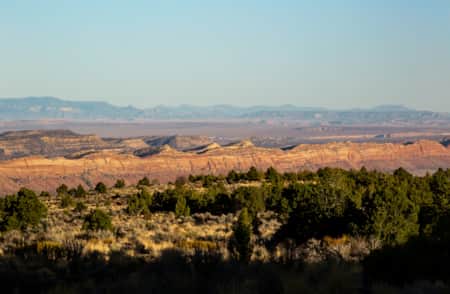
Greater Cedar Mesa
The Cedar Mesa area is home to more than 100,000 archaeological sites. For adventurers with a love of solitude, archaeology and geographic beauty, this area has it all.
-
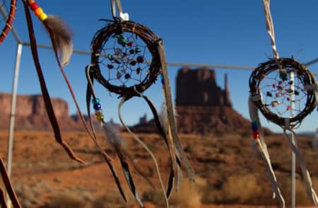
Monument Valley Navajo Tribal Park
Monument Valley Navajo Tribal Park features towering sandstone rock formations, sculpted over 300 million years, that soar 400 to 1,000 feet above the valley floor.