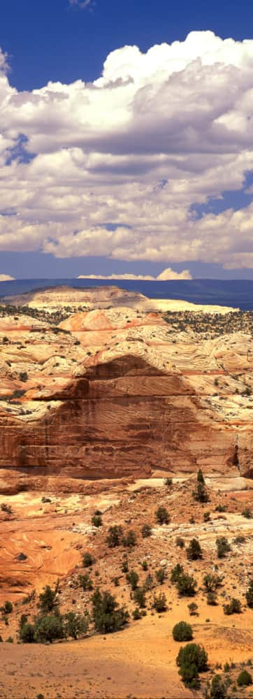
Cottonwood Canyon Road
Top off your fuel tank and drive 32 miles east on US-89 from Kanab, then turn left (north) onto Cottonwood Road at a signpost between mile markers 17 and 18. Please note that the road is unpaved, but it’s generally doable for a hardy 2WD car, although more comfortable in a 4x4. In the spring or after a particularly significant rainstorm, it can become muddy and impassable even for high-clearance SUVs.
The beginning of the drive will take you through a beautifully stark landscape before rolling into the Paria River valley, an oasis in the surrounding badlands. About 25 winding miles after turning off US-89, you’ll hit a trailhead worth checking out: the Cottonwood Wash Narrows. (The trailhead is found at a nice little parking turnoff along Cottonwood Road.)
This narrow canyon is a beginner-friendly hike that also impresses experienced hikers with its stunning rock formations and tall Navajo sandstone walls. You won’t gain much elevation on this 1.5-mile amble through a narrow river-bottomed slot canyon, but you will have fun. You can then return via the dirt road, but it’s prettiest to just descend back down the canyon the way you came.
Five miles past the Cottonwood Wash (30 miles after turning off US-89), you’ll hit a real highlight of the Cottonwood Canyon drive: Grosvenor Arch. There’s a parking lot and short paved trail to get to the actual rock formation. There are actually two separate arches towering from the same base, forming an otherworldly pinnacle. Once you’re below them, you’ll want to spend some serious time looking up at the sky through the rock suspensions defying gravity’s sway.
Another 17 miles or so past your Grosvenor stop-off, hold onto your hats: you’ll roll right into Kodachrome Basin State Park, famed for its breathtaking colors. A rainbow of rock types layered together over the course of history now form fascinating spires, pinnacles, and arches. The potential for hiking here is wide-open; consult with the friendly folks at the visitor’s center to snag your own map and get a few tips on where to go.
The Angel’s Palace Trail in particular is prime-time for amazing photography, while the Grand Parade Trail is mellow and family-friendly. Keep in mind that in this corner of the world, the soil is delicate, and a critical part of the local ecosystem. It’s called a cryptobiotic crust, and is held together by handy microorganisms that help prevent soil erosion. So tread lightly, and stay on established trails only.
As an added bonus, you can also camp here in one of Kodachrome’s multiple campgrounds, so you just might make it an overnight ending to an exceptional day.
Road Conditions and Coordinates
If you wish to overnight elsewhere along the road, you must get a permit at one of the monument’s visitor centers. Also check at the visitor centers if you have any concerns about road conditions or if a storm is a remote possibility. There is a visitor center in Big Water and a field office in Kanab on the south side. Approaching from the north there’s a center in Cannonville, right near the beginning of the drive.
GPS Coordinates: 37.110649, -111.922150
