Hole-in-the-Rock Road
Even with modern SUVs, the 55.5-mile road brings a sense of adventure and demands a bit of preparation. For most of the way, it’s doable for a handy driver even without a high-clearance vehicle, but toward the end the going gets rough, and a proper 4x4 is absolutely necessary.
You also wouldn’t want to undertake the drive if a single raincloud is on the way — once the road is muddy it becomes completely impassable, rendering motorists stranded on a rarely-patrolled route. You’ll want to bring plenty of extra water, maps, a full fuel tank (with perhaps a spare gas container), and other basic supplies in case something unforeseen happens.
With that in mind, the modern-day adventurer has it quite a bit easier than the original pioneers who were sturdy enough to undertake this in wagons. Along the way there are many amazing stop-offs to explore — lovely camping spots and slot canyons worth peeking into.
Highlights of Hole-in-the-Rock
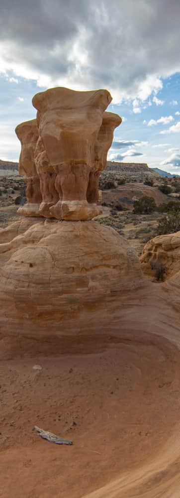
You’ll turn onto Hole-in-the-Rock Road from UT-12 just a few minutes outside the town of Escalante, and it’s “Southward, ho!” from there. Twelve miles down the road, you’ll reach Devils Garden, a head-turning rock formation with a couple of interesting arches, a picnic area, and a short pathway worth checking out.
At about mile 26, you’ll reach the turnoff for the Dry Fork of Coyote Gulch trailhead, which bears its own list of wonders. A detailed map and guidebook will point you in the right direction to explore the famed non-technical slot canyons, Peek-a-boo and Spooky, from this gulch. (Both are doable as a day-hike.)
At mile 36 (at which point traffic is extremely sparse), you’ll pass Dance Hall Rock, a natural sandstone amphitheater where the original pioneers set up a base camp and held dances to violin music to keep their spirits up.
Hole-in-the-Rock Hike to Lake Powell
Finally at Mile 55.5, you’ll arrive at the famed Hole-in-the-Rock, where original travelers had to literally dig in and blast a passage through the red rocks to descend to the river below. After six weeks of chiseling, digging, and blasting in terrible conditions, they finally completed what roughly passed as a road for their wagons. This section can now be hiked down by intrepid hikers unafraid of an unmaintained, steep pathway that descends several hundred feet to the water.
It’s a challenging scramble down (and back up), but if you think of the early settlers who managed to get full-sized wagons and cattle down it, you’ll truly take pause in utter awe at their determination.
For additional information on the Hole-in-the-Rock expedition, check out the Bluff Fort Historic Site in Bluff.
GPS Coordinates: 37.728098, -111.532497
