Start: Schoolhouse Springs Trailhead or Dry Creek Trailhead.
Distance: 12 miles point to point.
Difficulty: Extremely difficult.
Trail surface: Forest trail.
Seasons: Early summer through fall.
Land status: Wilderness area, national forest, city, private.
Nearest town: Alpine.
Fees and permits: No fees or permits required.
Maps: USGS Lehi, Draper, Dromedary Peak, and Timpanogos Cave quads; National Geographic Trails Illustrated Uinta National Forest Map.
Trail contacts: Unita-Wasatch-Cache National Forest
Finding the trailhead: To reach the Schoolhouse Springs Trailhead in Alpine, drive south on Interstate 15 to exit 287, Alpine-Highland, and turn east onto Highway 92 (Alpine Scenic Highway). Travel east on Highway 92 about 5 miles to its junction with Highway 74. Here turn left onto Highway 74 and travel north into the city of Alpine. In Alpine, Highway 74 becomes Main Street. Continue north on Main to the four-way stop at 200 North. Turn east onto 200 North and go 2 blocks to 200 East. At this four-way stop, turn left onto Grove Drive and continue north past the cemetery. Follow Grove approximately 1 mile to a ninety-degree turn to the right. For the Schoolhouse Springs Trailhead, turn left here onto Alpine Cove Drive and continue north to Aspen Drive. At the end of Aspen Drive are two gates. If the gate on the right is locked, you must park on the street and begin your hike at this point. (Note: There is no designated parking at this point, so be sure your vehicle doesn’t restrict local traffic.) If this gate is open, you may travel farther north to a second gate with LEHI CITY as a logo. There are several parking spots near this gate. Beyond the Lehi gate a jeep road crosses and ascends about 1.5 miles of city property (respect it) before reaching the Uinta National Forest boundary and the meadow area known as First Hamongog.
To leave a car at Bells Canyon (Boulders Trailhead), turn south off Little Cottonwood Canyon Road on Wasatch Boulevard and follow it less than a mile to the trailhead, which is on the left (east) side of Wasatch Boulevard. DeLorme: Utah Atlas & Gazetteer: Page 53 C5.
GPS of Schoolhouse Springs Trailhead: 40.479532, -111.762150
GPS of bottom of Bells Canyon (Boulders Trailhead): 40.565305, -111.803711
Trail Notes
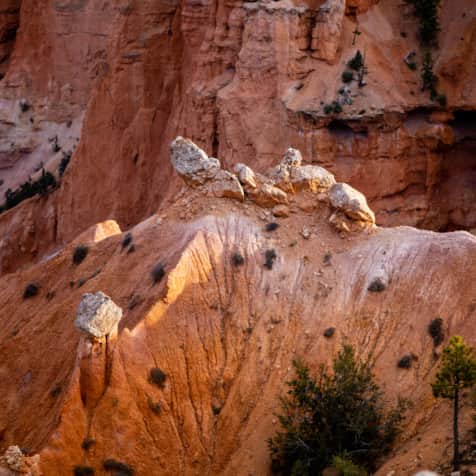
The rocky cirques, wooded canyons, and alpine meadows and ridges of the Wasatch are nowhere more plentiful than in the Lone Peak Wilderness southeast of Salt Lake City. A demanding but spectacular ascent to this area is from the town of Alpine in Utah County, climbing past Lake Hardy and descending through Bells Canyon on the Little Cottonwood Canyon side.
Bells Canyon, a major drainage under 11,253-foot Lone Peak, has long been a favorite, if somewhat secret, three-season hiking area. Day trips into Bells Canyon are popular, but you must hike nearly 7 miles and 5,000 feet in elevation to the top. After crossing the ridge from Lake Hardy, you may thus prefer to spend a night on the Little Cottonwood side.
Keep in mind that wilderness regulations require you to make camp at least 200 feet from the nearest water source. Forest Service personnel do enforce this regulation.
A car shuttle is necessary if you choose this hike over the ridge. Of course, you could ascend from Alpine, spend a night or two, explore the area, and return to your car along the same route.
As you look north from the trailhead at about 5,700 feet, Lone Peak forms the sharp summit on the extreme left of the skyline. The peak’s east ridge slopes gradually to the right — the horizon broken by a rocky outcropping — before climbing to the more rounded summit of 10,877-foot Big Horn. Lake Hardy, your destination for the first night, is behind and to the right of the Big Horn summit.
The Hike
There are a couple of routes to Lake Hardy, either up the main drainage below the lake or along the slopes nearby. The more popular route starts from the Schoolhouse Springs Trailhead and then switches back up 1,300 vertical feet over the next 1.5 miles to the First Hamongog at the wilderness boundary. (Hamongog is a biblical term for “meadow.”)
Two signed trails leave the First Hamongog. One heads north to the Second Hamongog (Trail 187); the other takes a steeper and more direct route (see the option at the end of this hike) to Lake Hardy.
Take Trail 187 to the Second Hamongog, situated beneath Big Horn. Notice the prominent ridge that drops south from this peak, with tree and brush cover ending about two-thirds of the way up the ridge at granite cliffs. From the Second Hamongog, the trail climbs northeast along the west side of this ridge (about a mile) before crossing to the east side. It then traverses northeast into the bowl (at just under 10,000 feet) framed by Big Horn, Thunder Mountain (11,154 feet), and Chipman Peak (10,954 feet).
Picturesque islands of conifers and wildflowers dot the granite slopes above timberline. The slopes allow fairly unrestricted cross-country travel.
Lake Hardy sits in a bowl north of an imaginary line between Big Horn and Chipman Peak. As you hike toward the lake, notice that the bowl is divided by a north–south ridge, indicated by a 10,035-foot location on the topo map. The route climbs along the side of this ridge, through beautiful secluded pockets, finally topping the crest of the ridge and dropping northeast to the lake.
As you approach Lake Hardy, stay midway up the granite slopes to the west of the lake. A cairned route winds through draws and granite boulders, among wildflowers, grasses, and stunted shrubs. Lightning-struck and weathered conifers attest to the harsh conditions and provide endless photographic and sketchbook compositions.
While there are springs at lower elevations, Lake Hardy offers the only reliable water near the crest. Be sure to treat all water before drinking.
The Lake Hardy area has good campsites, rewarding beauty, and opportunities for after-dinner exploration. The lake doesn’t get the pounding from visitors that some areas across the ridge in Little Cottonwood Canyon receive, but that is no reason not to observe common sanitation and backcountry rules. A backpacker stove is recommended here, and remember to carry out all trash. Check with the Forest Service for current fire regulations.
The easiest and most scenic route to Bells Canyon is to return to the ridge, 0.25 mile west of Lake Hardy. Another 0.25 mile to the northwest, a grassy meadow just south of the saddle makes a good high campsite. Along this route, as well as elsewhere on the trail, you may see grouse, woodpeckers, and many passerine species. Also look for red-tailed hawks and golden eagles soaring above the ridges.
From here, you could traverse the high ridge west and northwest to the summit of 11,253-foot Lone Peak. You might also climb a mile due east from Lake Hardy to the saddle north of Chipman Peak. Here you get a magnificent view of upper Hogum Fork before traversing northwest under and to the west of the ridgeline toward Bells Canyon.
From the saddle at the head of Bells, the view is spectacular in every direction. Rugged peaks and ridgelines flank the saddle to the east and west, while the panorama of Box Elder Peak, Mount Timpanogos, and Utah Lake spreads to the south.
Dominated by an upper cirque, Bells Canyon descends to the north from a 10,400-foot saddle northwest of Lake Hardy. A nice side trip from here is to traverse northeast, climbing a few hundred feet under Thunder Mountain (11,154 feet). About 0.5 mile from the saddle above Bells, climb to the 11,000-foot saddle just north of Thunder. From here or from the clifftop perch on Thunder Mountain, the three cirques of Hogum Fork spread out to the east, while all of upper Little Cottonwood Canyon can be seen in the distance.
Pick your route carefully down to Upper Bells Canyon Reservoir. Use ridges and avoid the boulder accumulation in drainages when possible. Stay on the right (east) side of the canyon to find the upper reservoir, about 1.5 miles from the ridge.
As you descend Bells Canyon, observe the distinct vegetative changes. Keep an eye out for mountain goats, introduced from Washington by the Division of Wildlife Resources. And note the cirques, basins, moraines, and polished tracks left by glaciers.
Just below Upper Bells Canyon Reservoir, a cairned route starts on the left (west) side of the creek. (Note: Older editions of the Dromedary Peak topo incorrectly show the trail on the other side.) Within 0.5 mile the stream cascades down a steep granite gorge and the trail veers farther left (west), continuing on the west side of a rocky ridge that divides the canyon. The trail passes amid dense spruce-fir forests, through a secluded willow and wildflower meadow, and, after another 0.5 mile, onto the center of a ridge dividing the upper forks of Bells Canyon Creek. From the ridge to this spot, you’ve descended about 2,000 feet.
Incredible avalanche debris obscures the trail. Stay out of the gullies and thread your way through the deadfall and sumac until you are above the ravine where the upper forks combine.
A small park is found half a mile down the canyon where the drainage from Thunder Mountain enters from the southeast. Reach it by hiking along the east side of the stream or climbing higher to the east and descending the ridge.
The trail is on the right (northeast) side of the stream here. Again, the USGS topo may be in error. Continue down the canyon on a good pathway to Lower Bells Canyon Reservoir, 2.5 miles below. Along the way, you’ll hear many waterfalls; spur trails lead to scenic views.
Some of the lower sections of the trail are a bit tricky, since they are straight down the fall line and quite eroded — not pleasant hiking after a strenuous climb over the ridge.
When the canyon widens a mile before the lower reservoir, work your way through the confusion of trails to the right (north) side of the canyon, around the reservoir, and down to the Boulders Trailhead where you have left your car.
Miles and Directions
- 0.0 Start at the Schoolhouse Springs Trailhead.
- 4.5 Reach Lake Hardy.
- 6.0 Side trip to Thunder Mountain at 11,154 feet.
- 7.5 Arrive at Upper Bells Canyon Reservoir dam. Continue northwest.
- 11.0 Arrive at Lower Bells Canyon Reservoir.
- 12.0 Arrive at your vehicle at the dead end at the bottom of Bells Canyon.