
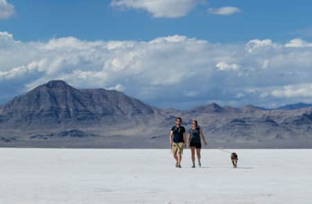
Bonneville Salt Flats
Read the stories
-

Salt & Speed
Utah’s Bonneville Salt Flats are home to three annual speed events where racers can go all in with whatever speed device meets their fancy.
-
A Quick Guide to the Bonneville Salt Flats
Here's everything you need to know to visit and plan for Salt Lake City's nearby Bonneville Salt Flats.
-
Great Salt Lake Needs Your Visit
While you visit this mysterious natural wonder, you can also help save it.

Plan Your Trip
- Entrance is free and open to the public most of the year.
- During events and/or filming projects, special security restrictions may be required to maintain public safety.
- For tips on when to visit, where to stay, what to pack and more, read: A Quick Guide to the Bonneville Salt Flats
Events
Potash Canals
Recently there's been a lot of social media attention around the potash production canals north of Interstate 80, located just east of the Bonneville Salt Flats. The canals are industrial facilities leased to Intrepid Potash for potash mining activities and are not designed or safe for public recreation. The public should not access, swim, float, kayak, canoe, or pursue any other recreation activities in these industrial canals. In addition, the Utah Highway Patrol has indicated that parking along I-80 to access to the canals is illegal and extremely dangerous due to the proximity to the interstate highway. Please travel responsibly. Learn more.
Leave No Trace
- Do not drive on the salt flats when they are wet or flooded from precipitation. You can easily damage the salt crust and/or become stuck in the underlying mud.
- Come prepared.
- Travel and camp on durable surfaces.
- Dispose of waste properly.
- Leave what you find.
- Minimize fire impacts.
- Respect wildlife.
- Be considerate of other visitors.
- Learn more here.
Groups or Filming
Special permit fees will usually be required for organized group events or commercial filming. For more details, contact the BLM at 801-977-4300 or review the film permitting process.
For more safety tips, restrictions, event schedules and educational information, click here.
What's Nearby
-
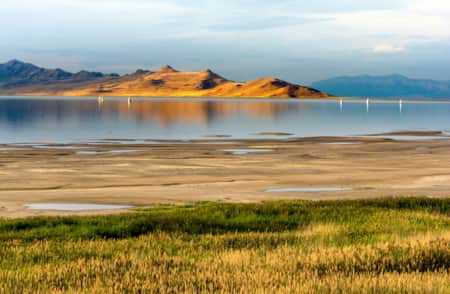
Antelope Island State Park
Antelope Island State Park is 25 miles north of Salt Lake City. Accessed by a causeway, the island sits in Great Salt Lake and features free-roaming bison and antelope herds.
-
Bear River Migratory Bird Refuge
This is the Bear River Migratory Bird Refuge, an eye-opening stop along Utah's populous Wasatch Front for any traveler and a top destination for any serious birder with gaps on their life lists.
-
Salt Lake City
Salt Lake City makes a great gateway for travelers making a trip to Utah's ski resorts or southward to Utah’s renowned red rock country.
