Paradise and Slickrock
Utah's national parks seen through a lifelong relationship with Capitol Reef

“Rock. No other word can precede it.”
I began my 1978 interpretive booklet about Capitol Reef with these words, and I began my introduction to “The Capitol Reef Reader” with the same words. Every traveler who passes through the park encounters a panorama ruled by geology, where rabbitbrush, raven and rock art are accents, where the layers of earth history overwhelm every other element of the scenery.
I felt this for the first time when, in 1975, at 24, I found myself headed into Capitol Reef on Utah’s Highway 24, to begin my season as a park ranger/naturalist. The redefinition of “Capitol Reef” was new, too — after its six-fold enlargement as a national monument in 1969 and subsequent designation as a national park in 1971.
"Each mile took me into new strata, older rocks, each with its own textural personality and mineral-stained flamboyance."
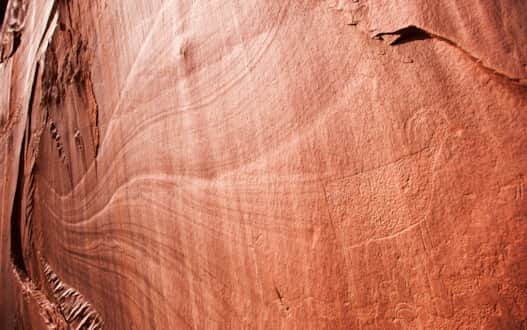
Pleasant Creek Petroglyph
Photo: Stephen Trimble
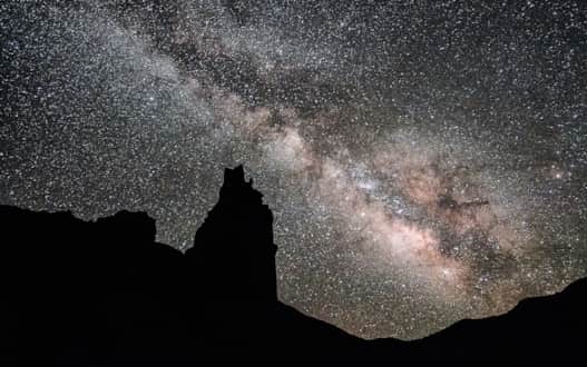
Milky Way over Chimney Rock
Photo: Stephen Trimble
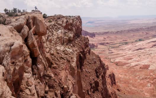
Halls Creek Rim
Photo: Stephen Trimble
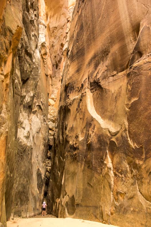
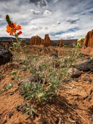
Navajo Dome and Fremont River Canyon
Photo: Stephen Trimble
I kept heading west, swinging around the curves and against the grain of the Waterpocket Fold, the tipped-back wrinkle of rock layers that runs for a hundred miles across southern Utah. Each mile took me into new strata, older rocks, each with its own textural personality and mineral-stained flamboyance.
I knew enough about these rocks to know that they recorded what geologists call “deep time,” layer after layer deposited in environments so different from today. Oceans, deserts, dinosaur-filled swamps. It was as if all of the earth’s history had been distilled into a single rock column in this one spot.
My highway followed the Fremont River, a ribbon of life-affirming green in a daunting expanse of stone. Cottonwoods defined this verdant corridor, as both river and road threaded the canyon between golden domes of Navajo Sandstone. And then the Fremont canyon widened. The fractured red wall of the Wingate Sandstone lifted and pulled away from the river, creating a tiny, isolated pocket of irrigable fields with a grid of fruit trees between river and cliff. A pioneer one-room school, a barn and an old Mormon farmhouse punctuated all that green like a movie set.
This was the village of Fruita, a cherished oasis in a labyrinth of canyons, the single outpost of settlement within the small original Capitol Reef National Monument created in 1937. This would be my home for the next seven months.
In the more than 40 years since I arrived at that seasonal ranger job at Capitol Reef, I’ve lived all over the Four Corners states (Utah, Colorado, New Mexico and Arizona), but this many-layered little haven where water meets cliff is still the heart of my spiritual home.
***
Each of Utah’s five national parks — Arches, Canyonlands, Capitol Reef, Bryce Canyon and Zion — defines a special place on the Colorado Plateau, the vast sweep of flat-lying rocks surrounding the Four Corners and eroded into a maze of canyons by the Colorado River.
Arches, Canyonlands and Capitol Reef lie within the inner canyon country, the redrock playground of southeastern Utah that most Utahns mean when they say they are “going to the desert.” Bryce Canyon and Zion lie beyond — each carved into one of the High Plateaus, the chain of great flat-topped mountains that separate the inner canyonlands from the Great Basin to the west.
Bryce Canyon is highest, a bowl of hoodoos etched through the rim of the Paunsaugunt Plateau at 9,000 feet in elevation. Zion Canyon slices to the roots of the Markagunt Plateau at the far southwestern corner of Utah’s canyon country. As you follow the Virgin River away from Zion and toward St. George, slickrock fantasies and slot canyons give way to the arid basins of the Mojave Desert.
I always think of our parks in just this order, east to west — perhaps because I grew up in Colorado, and the bonsai gardens of Arches’ piñons and junipers came first when I crossed into Utah. Arches was also my first park job as a seasonal ranger, where I managed to take a wrong turn the first time I led a nature walk through the Fiery Furnace. Zion was the humbling climax at the far end of the state, the park with the highest sandstone walls, almost Grand Canyon in scale. In between lay intimate Bryce and the backcountry adventures of Canyonlands and Capitol Reef.
"In the more than 40 years since I arrived at that seasonal ranger job at Capitol Reef, I’ve lived all over the Four Corners states, but this many-layered little haven where water meets cliff is still the heart of my spiritual home."
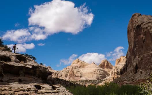
Cooper Canyon
Photo: Stephen Trimble
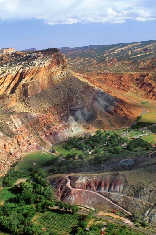
The town of Fruita from above
Photo: Stephen Trimble
My assignment to create a Capitol Reef anthology focused on this one little-known national park. I knew I would want to capture the spirit of the place and its surrounding landscape through personal narratives, philosophical riffs, and historic and scientific records. I’d want pieces that are a pleasure to read and authors who tell us better than anyone else about some aspect of Capitol Reef. But how should I define Capitol Reef?
I chose geography rather than the right-angled zigzags of survey lines that delineate the park on a map.
To build your mental map of Capitol Reef country, begin with the view eastward from Boulder Mountain, as did so many 19th century explorers perched at that same 11,000-foot-high rim — a vertical mile above Fruita. Below, the sandstone domes and reefs of the Waterpocket Fold run in the middle distance to left and right, and they keep running, clear out of sight.
Off to the right, the Fold runs behind the Circle Cliffs and the canyons of the Escalante River — both protected by the enormous Grand Staircase-Escalante National Monument proclaimed in 1996. At the far left, barrier cliffs yield to open badlands and free-standing stone temples in the isolated north end of the park in Cathedral Valley (read: Serenity Found in Torrey and Capitol Reef’s Cathedral Valley District).
Breaking the horizon beyond the Waterpocket Fold rise the five island summits of the Henry Mountains, dominating the view from every high point in Capitol Reef.
Descend from Boulder Mountain along Highway 12. The big views continue northward to Torrey, gateway community for Capitol Reef National Park. You’ve arrived in Wayne County and its string of villages along the Fremont River. You’ve landed in the heart of the region’s history and culture, reaching all the way back to prehistory.
Humans have lived in Capitol Reef for at least 12,000 years. We don’t think much about the first 11,800 of those years when we talk about “pioneers.” But the park’s first residents left their mark through these more than a hundred centuries — most easily seen in the petroglyphs and pictographs sheltered by cliffs along the Fold.
In the 1870s, at the same time that John Wesley Powell and his company of geologists and topographers began to define and explore the Colorado Plateau, Mormon pioneers came to Wayne County. They noted the glowing domes of Navajo Sandstone that rose with the commanding presence of the U.S. Capitol, and Capitol Reef had its name.
***
As visitation even here in Utah’s “forgotten park” passes a million people a year, how do we make sure all these visitors know to avoid stepping on fragile biological soil crust? How do we make sure they understand enough about the legacy of Native peoples to caress chippings and arrowheads with reverence and then return these precious bits of stone to the sand? To observe the ancient stories carved on rock but never touch? How do we make sure every visitor knows that adding graffiti to the petroglyph panels constitutes an act of vandalism?
I pondered the ironies of 21st century Capitol Reef on a recent journey with my family to the rim of Hall Mesa in the park’s backcountry.
We drove our Subaru south from Highway 24 onto Notom Road. Pavement gave way to dirt. We wound our way through fields of late-summer sunflowers near Bitter Creek Divide, passed the Burr Trail and The Post, and took four more turns onto ever rougher roads.
We were sixty miles from the Capitol Reef Visitor Center. We had seen no other vehicles. We parked when the road got too rough and walked for a half-hour to the rim above Halls Creek Narrows, where a peregrine falcon took off from an aerie on a thousand-foot cliff and sailed off into space, screaming at us in cautionary warning.
What place could be wilder? What place could be more remote?
We settled on a rocky perch for lunch — and discovered that in this place where so few venture, we had cell phone service. On a whim, we called family in San Diego. “Guess where we are?”
Our next question could have been: in 21st century Capitol Reef, what defines “remote?” Where, truly, are we? What decisions shall we make to plan effectively for a future Capitol Reef linked to issues far beyond the park — the looming climate catastrophe, deteriorating regional air quality that degrades world-class dark-night skies, conflicts over how much land to protect from development and unmanaged tourism, and a sensible accommodation to Utah’s population growth, fastest in the nation?
"These people know Capitol Reef. Their stories await, spilling from The Capitol Reef Reader. And so, as Ed Abbey says in his contribution to the book, “Come on in and see for yourself.”"
We must consider preservation and enjoyment, our need for refuge and solitude, the conservation and stewardship imperative. And we work always within the miniscule National Park Service budget. Each of Utah’s five national parks faces these same challenges.
We will make decisions most wisely if we know everything we can about our parks. Ideas, knowledge and resilience lie within the rootedness of Native peoples, in the affectionate memories of longtime locals who love their home, in the sharp observations of naturalists and scientists, in the professional expertise of park staff, in the creative responses to the landscape by writers, photographers, and artists, in the backcountry puzzles worked out by hikers.
These people know Capitol Reef. Their stories await, spilling from The Capitol Reef Reader. And so, as Ed Abbey says in his contribution to the book, “Come on in and see for yourself.”
This piece is excerpted from "The Capitol Reef Reader" (University of Utah Press, 2019). More information on Stephen Trimble's "The Capitol Reef Reader".
Serenity Found in Torrey and Capitol Reef’s Cathedral Valley District
Taking Southern Utah’s remote, less-traveled path in Capitol Reef's Cathedral Valley District to nurture your body, mind and spirit.
Discover More
-

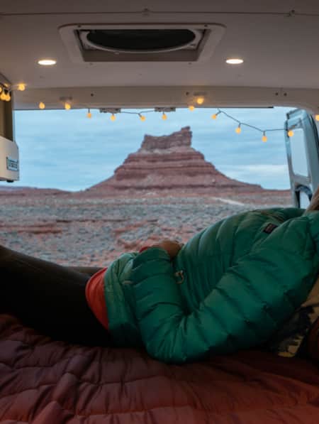
A Van Lifer’s Guide to Responsible Travel in Southern Utah
When Utah’s dirt roads are calling you, it’s time to plan your van life road trip. Here’s what you need to know to travel safely, protect Utah’s rural communities, and help preserve sensitive desert landscapes.
-
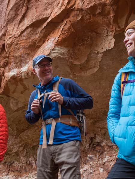
Hiking the Desert in Capitol Reef National Park
-
A Winter’s Desert: Visiting Southern Utah in the Slow Months
Experiencing the peace of canyon country in the winter is an attraction of its own.
-
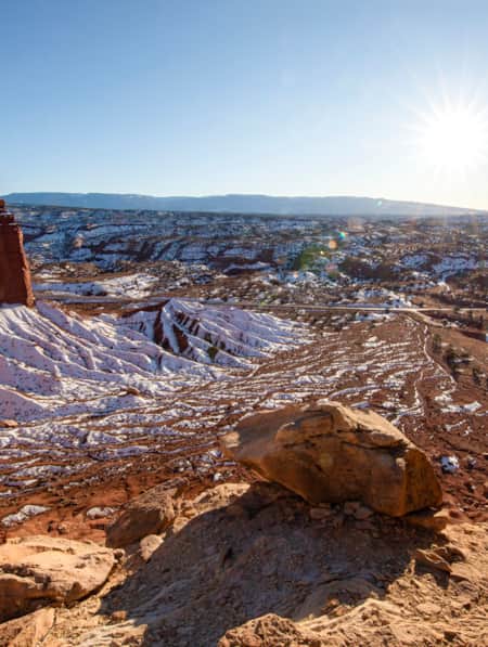
The Complete Winter Camping Packing List for Staying Warm in Southern Utah
For most travelers, Southern Utah winters prevent comfortable camping, and occasional snowfall can make outdoor adventure a little more challenging. With a little extra planning, good layers, and the right equipment, however, you can enjoy Utah's national parks in the solitude of winter.
-
How to Slow Travel in Utah
Avoid the mad scramble and consider slow travel as a better approach to your Utah trip.
-
How To Stay Safe in the Outdoors
Know how to stay safe and informed during your Utah trip and who is helping when you get into trouble.