Ridin' Greater Zion
5 Trails to Ride in Southern Utah’s Other Mountain Biking Mecca

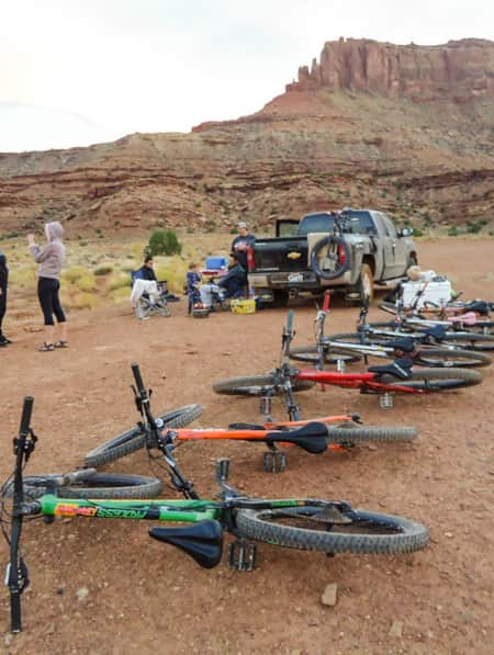
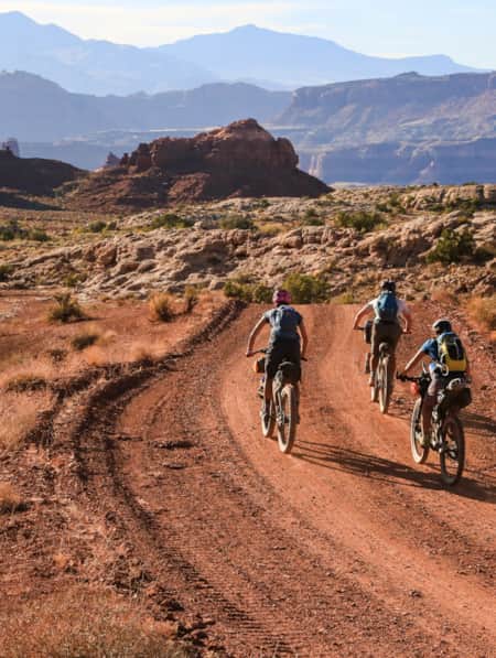
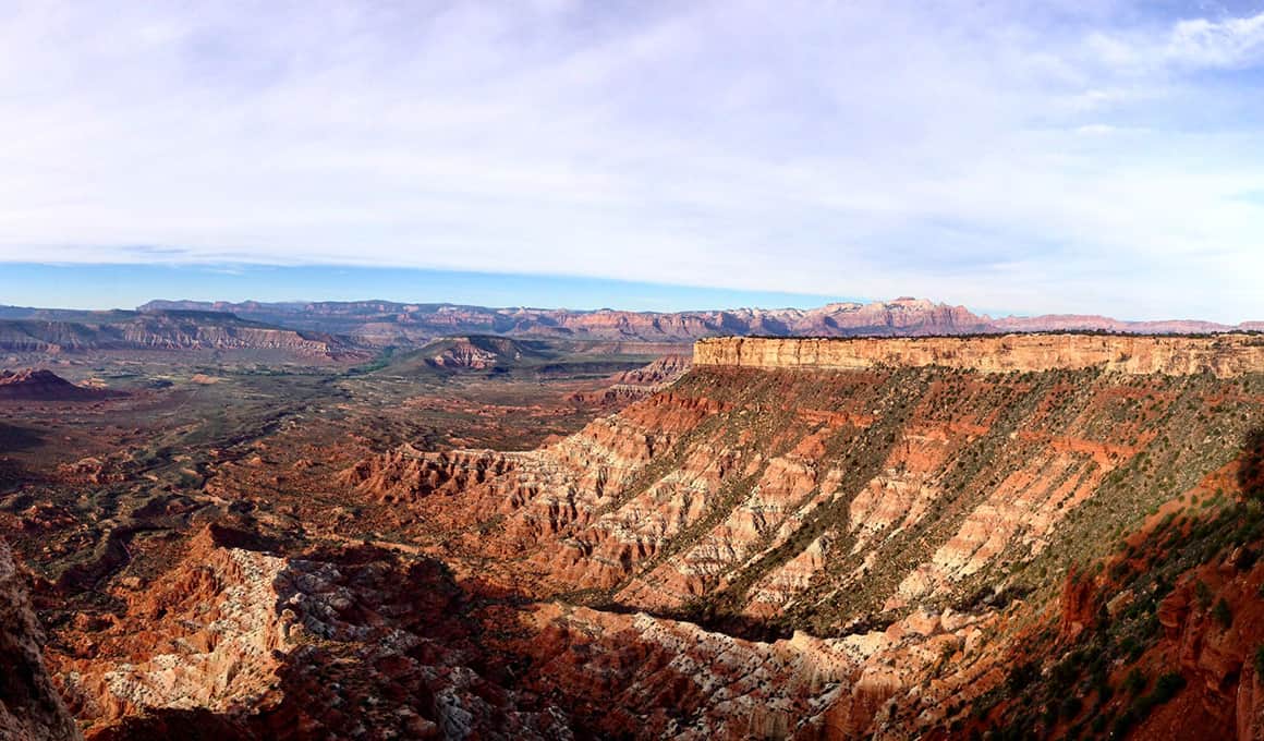
Southern Utah is known for its world-class mountain biking trails, but riders often miss out on the impressive yet largely unsung and less crowded trails located in southwestern Utah because they are overshadowed by the reigning mountain biking real estate in the east. Though, Moab has long held the crown in the magical mountain biking kingdom, the southwestern region of Utah — from Cedar City to St. George — is fast becoming a must-see mountain biking destination in its own right. Check out some of the top mountain bike trails in Utah below.
Trail Rating:
ADVANCED •••
INTERMEDIATE ••
NOVICE •
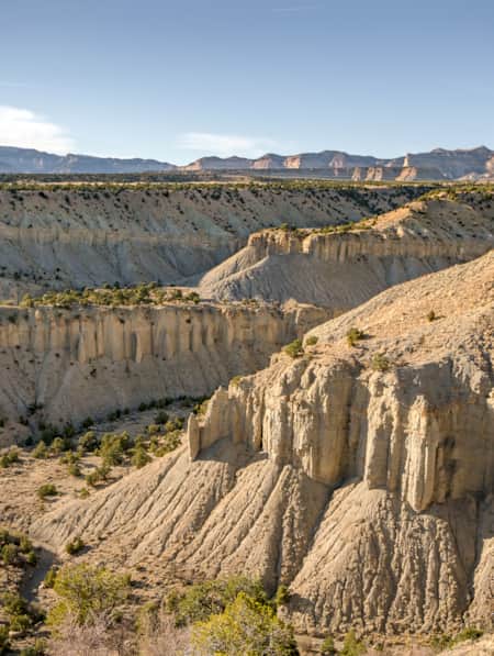
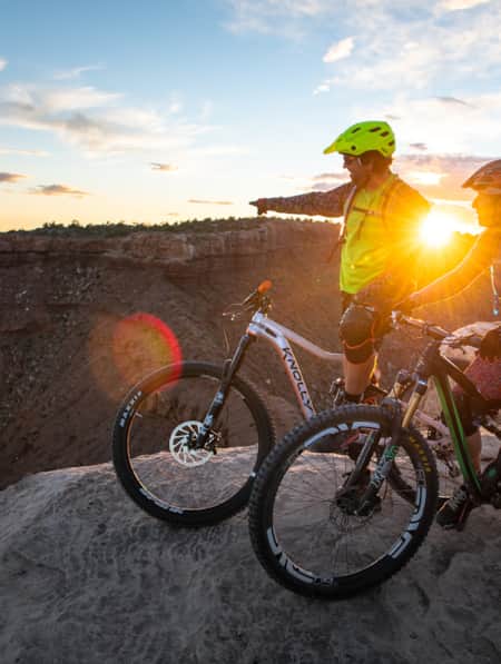
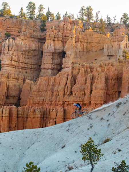
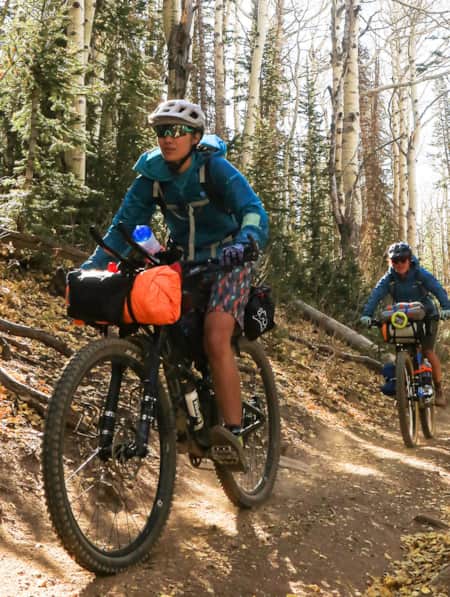
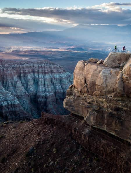
Gooseberry Mesa (Hurricane) •••
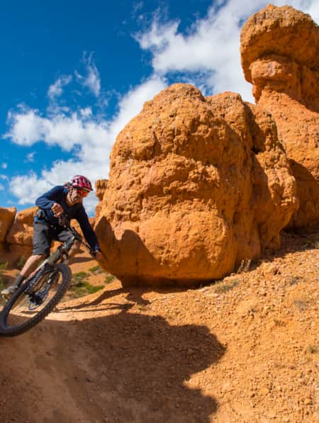
Gooseberry Mesa might be the most popular trail in all of , and rightly so — 30 miles of networked singletrack make it very appealing to riders who want to customize their mileage — but the real persuasion is the rolling slickrock trails that give way to epic panoramas of Zion National Park, making it one of the most scenic rides in the world. It’s easy to get distracted by the fantastic views, but this technical trail will demand your attention. Most of the trail is ideal for moderate to advanced riders, but for especially advanced riders, there are some double-black-diamond sections on the South Rim Trail that provide well-earned vistas, but little room for error in the narrow spots.
Night riding is a good option on these trails if, say, you’re there in mid-July and daytime temperatures are averaging above 100 degrees. Winter biking is also an option. Either way, bring more water than you think you’ll need, snacks, and a detailed trail map with you because you will be out of cellular coverage and you won’t be able to call Ghostbusters or anyone else for help.
Getting to Gooseberry Mesa's remote location could prove to be the most challenging part of your ride if you don’t know where you’re going. There is a sign for the turnoff on S.R. 89 directing you to Gooseberry Mesa, which leads you to an unpaved, bumpy dirt road that you’ll stay on for about 30 minutes until you get to the trailhead parking lot. Fuel up for your ride at Springdale’s Deep Creek Coffee Co., which serves delicious healthy breakfasts, coffee, and smoothies to early morning adventurers visiting Zion from around the world. Post-ride refreshments can be found at Zion Canyon Brew Pub, a favorite of adventure travelers and locals alike.
Little Creek (Hurricane) •••
Another secret beauty in the Hurricane area is Little Creek just south of Gooseberry Mesa. This area can be difficult and is best for more technically advanced riders, though less experienced riders can always hop off their bikes and walk the challenging sections. The open slickrock and singletrack trail winds up and down through stunning scenery peppered with piñon pines and junipers against a backdrop of classic desert terrain. This fairly technical ride rewards its patrons with amazing views of Zion National Park from the edge of the mesa and archeological gems such as ancient petroglyphs along the route. Riders with enough skill and courage will find that stunt options abound throughout the loops, but beware it’s very easy to get lost on these trails. The Magic Carpet Ride on The Main Loop aka West Mesa Loop is easier than the rest of the trails and is also marked better than the others. It connects with the Northpoint Loop aka Eastern Loop for a variety of technical slickrock riding. If you’re in search of off-trail diversions that involve other outdoor activities, have a look-see at nearby Sand Hollow State Park, which attracts a lot of watersports enthusiasts and is a great spot to camp, especially for those getaways with the kids.
From Hurricane, head south on Highway 59, you’ll be headed southeast. Head toward the Hurricane Valley for 13 miles and then turn right on the gravel road. Stay on that road for 14 miles and stay right at 15 miles. After that you’ll stay left for 2.5 more miles and then go straight past the cattle guard for 1.5 more miles and then take right turn and veer left. Continue until you get to the parking area. It’s worth hiring a local guide or going with someone who knows their way around the network of trails to avoid getting lost on your way to and from the trail, but guides can also show you where to find the sweet spots.
Hurricane Rim–Goulds Rim–J.E.M. •••–••
20 miles of networked rollercoaster singletrack connects the Hurricane Rim Trail, Goulds Rim, and J.E.M. (John, Ellen, Mike) trails for an epic cross-country loop perfect for riders who want to log a few hours of quality ride time. This trail, located west of Zion National Park, is unique because you can start your ride at any one of three trailheads. The trails are considered primarily intermediate, with some advanced technical sections. Not surprisingly, the views are spectacular, but so is the exposure. Most of the riding is friendly with not very much climbing and great downhill flow. You’ll probably be stopping to take a lot of photos. The J.E.M. trail is a nice out-and-back if you don’t want to ride the full distance of all three loops.
To get there, at the junction of S.R. 9 with S.R. 17, head east toward Zion National Park then continue for 5 miles. Head south on the gravel road named Sheep Bridge Road and you’ll cross the Virgin River about a half a mile later. Pass the cattle guard and take the double track on your right just past the bridge. There’s an overlook point and the singletrack begins at the end of the turnaround.
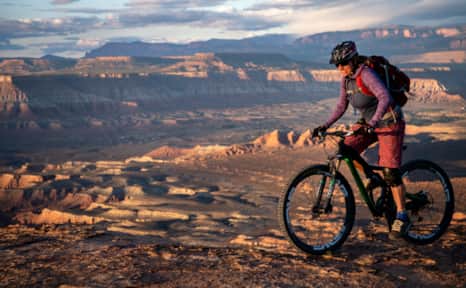
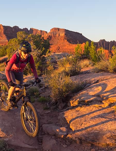
Mountain biking in Gooseberry Mesa.
Gooseberry Mesa
"Southern Utah is known for its world-class mountain biking trails."
Guacamole Mesa (Virgin) ••
If you like the terrain of Gooseberry Mesa, you’ll also enjoy Guacamole Mesa located near Zion National Park. You’ll need a 4x4 vehicle to access the terrain. Riders can choose between the 2.2-mile loop known simply as the Guacamole trail or opt for the Whole Guacamole (see: Whole Enchilada), an 11-mile flow loop of alternating slickrock and singletrack trail that features peek-a-boo views of the Virgin River amid a wild expanse of red rock in every direction. Trail finding can be a bit iffy in some places so look for the cairns and don’t get lost in the dip. If your appetite still isn’t sated when you’re done with Guacamole, you can also try the Holy Guacamole extension loop for a spicy detour with more technical aspects in the mix. The sweeping views alone make the extra difficulty and effort well worth it.
If you’re still feeling adventurous after your ride, you can scout for your own natural hot springs pools that occur within the Virgin River Canyons between Hurricane and La Verkin. The Pah Tempe Hot Springs are officially closed, but the springs that feed it are still active and bubbling in some areas.
From Highway 9 you’ll take Dalton Wash Road on the North side of the highway (between Virgin and Rockville) and head northeast on that dirt road for almost two miles. Then take a left (North) at the fork in the road and continue for 1.7 miles until you get to another fork and then you’ll find the trail system straight ahead on that path. It might be wise to park in this area and ride the rest of the way to the trailhead in case the rest of the road has been rutted out from a storm.
Bearclaw Poppy (St. George) •
Locals love St. George’s Bearclaw Poppy trail because it’s fun for riders of all fitness and ability levels, can be ridden year-round, and can be done as a quick out-and-back before or after work. It’s close to town and not very technical, but more ambitious riders can connect this trail with the Stucki Springs Trail or the Zen trail, which are among more conditioned rides. Downhill riders have the right-of-way on this trail, which is in a wilderness preserve area named after the Bearclaw Poppy flower, which is endangered and only blooms briefly in the spring, so be sure to stay on the trail. The trail features fairly steady, gradual-grade climbing with a lot of fun rollers, berms, and mellow drops. Don’t be intimidated by the Three Fingers of Death feature; it has more bark than bite. Speaking of bites and bears ... St. George’s Bear Paw Cafe is a local hot spot for breakfast; don’t miss this classic mom and pop diner while you’re there.
The trailhead lies just to the north of the intersection at Navajo Drive and Paiute Road near the Bloomington Country Club. After you turn north onto Paiute Road from Navajo Drive, you’ll see the trail. There are trailheads at Green Valley and Bloomington, which are 4 miles apart so you can choose which direction you would like to ride.


Discover More
-

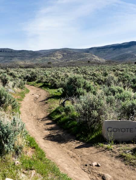
The Coyote Canyon Loop
An easy 20-minute trip south from Park City, the Coyote Canyon Trail is a gorgeous 20-mile loop that undulates through the sprawling expanses of Heber Valley and showcases some of its best features along the way.
-
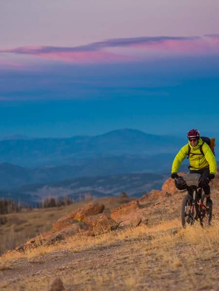
A High Elevation Southern Utah Mountain Bike Adventure
Mountain biking in Southern Utah usually inspires visions of red rock destinations such as Moab and St. George. But as the heat of summer kicks in and the triple digit temps become more frequent, heading south to ride may seem out of reach. Fear not my friend, as there are some riding destinations within Southern Utah, where the elevation will keep you cool.
-
Top 5 Rules of the Ride: How to Mountain Bike Responsibly on Utah Trails
Mountain biking is one of Utah’s most popular activities enjoyed by riders of all ages and skill levels. Be able to fly down that flow trail by, first, understanding and respecting the rules of the ride.
-
Seven Must-Ride Mountain Biking Trails in Utah
To help you plan a Utah mountain biking trip, we've assembled a list of seven of Utah’s best mountain biking trails followed by a roundup of Utah’s best fat-tire destinations.
-
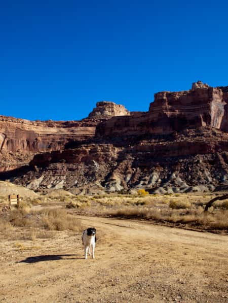
Dog-Friendly Utah: The Road to Mighty
Want to bring your furry friend on your next vacation? Utah is home to several great dog-friendly national parks and other fun destinations. Check it out and plan your trip!
-
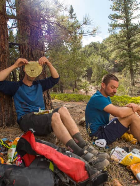
How to Bikepack: Pro Tips for Planning a Multi-day Backcountry Ride
Want to learn how to bikepack? Check out these tips and bikepacking gear list from veteran rider Kurt Gensheimer and plan your own Utah bikepacking trip!
-
Knobby Tired Nomads: Bikepacking the Utah High Country
If you’re into bikepacking, Utah is a place you’ll want to check out. Read about a self-supported tour of Utah’s backcountry here, and start planning your trip.
-
Mountain Biking the Wood Hill Trail System
Luke’s Loop is one of several options in the Wood Hill trail system in central Utah, a favorite for locals and those just passing through.
-
Mission to Mars: Riding Gooseberry Mesa
You haven’t truly ridden a mountain bike until you’ve visited the stunning slickrock of Gooseberry Mesa. Learn more about this spectacular Utah trail.
-
Moab's Singletrack Renaissance
Moab isn’t just for burly Slickrock riders anymore. In the last few years, local groups have established dozens of miles of new mountain bike trails.
-
A Quick and Dirty Guide to Brian Head Area Mountain Biking
Whether you’re visiting the area for Brian Head’s seemingly endless bike options or making it part of a multi-stop Southern Utah adventure (Cedar Breaks National Monument is just five miles away), it’s a must-see for bikers of all abilities. Here’s what you need to know to get started.
-
A Family Bike Tour of Salt Lake’s East Canyon
East Canyon has always been a path for travelers, from the Donner Party to Brigham Young to the Pony Express. In this modern-day tale of travel, a family of three takes on East Canyon by bicycle for a weekend camping trip. They discover historical markers, swimming spots, and lots of ice cream.
-
6 Steps to a Family MTB Trip on Canyonlands' White Rim
Want to take the family mountain biking on the White Rim Trail? Tackle 100 miles of biking and three days of backcountry camping in Canyonlands with the kids.
-
Wild Heber: Close-to-Home Adventure
Just 45 minutes from Salt Lake City, Heber Valley’s state parks and national forest lands offer a world of adventure. Hike, bike, camp, kayak, watch wildlife and reel in blue-ribbon trout while learning about nature and how to protect it.
-
A Local’s Guide to Logan: Northern Utah’s Outdoor Adventure College Town
Logan is teeming with some of the best arts, food and outdoor adventure opportunities in the state. Whether you’re passing through or just looking for new places to explore, here are some of the best ways to experience Logan.
-
Bikepacking Across the Aquarius Plateau
A 5-night bikepacking trail has opened up a beautiful swath of the Southern Utah landscape. Following trails from Brian Head to Boulder, riders can experience long days in the saddle, and then recuperate in backcountry huts stocked with creature comforts.
-
3 Utah Bikepacking Routes for Beginners to Intermediates
Find a route for your next Utah bikepacking trip that promises immersion in history, culture and ridiculous scenic beauty.
-
Visions of Grandeur: Heaven and Hell on Two Wheels
The story of a women’s bikepacking trip unspoils 250 miles of the majesty of Bear Ears country, including three national monuments, one national recreation area and a national park.
-
How To Bikepack Utah Like a Girl Boss
Here are the key things you need to know as you start planning your first bikepacking trip.
-
Bikepacking through Time in the San Rafael Swell
We're miles away from civilization here in southeastern Utah’s San Rafael Swell, and we carry everything we need on our bikes. This is the type of adventure I've longed for, a trip that reminds us of our self-worth, resilience, and how little we actually need to survive.
-
The Complete Winter Camping Packing List for Staying Warm in Southern Utah
For most travelers, Southern Utah winters prevent comfortable camping, and occasional snowfall can make outdoor adventure a little more challenging. With a little extra planning, good layers, and the right equipment, however, you can enjoy Utah's national parks in the solitude of winter.
-
A Guided Ride on the Rolling Slickrock of Gooseberry Mesa
Utah resident and tour guide Katharina Merchant shares her "backyard" mountain biking
-
Find a Winter Refresh in a Utah State Park
The best Utah state parks will entice you with ice fishing, white sand and snow-dusted scenery. Take a winter break to refresh with a visit to a few of these places.
-
Utah's Outdoors Are Wide Open for All Abilities
Utah’s National Ability Center is known for changing lives through its adaptive recreation programs. Truth is, just setting foot on the center’s 26-acre ranch can feel transformative.
-
Spreading the Joy of Adaptive Recreation
Meet three National Ability Center staffers who live outdoor adventuring.