Trail Guide
Difficulty: Strenuous
Distance and elevation gain: 6.6 miles out and back with 2,100 feet elevation gain. Up to five hours of hiking time.
Trail type: Dirt and rock path
Multi-use: Hiking only
Dogs: Not allowed
Fees: Fee required to enter the state park gate, payable at the causeway
Seasonality: Spring and fall are best due to summer heat and bugs. Trails may close in case of natural hazards, fawning or lambing seasons.
Bathroom: At park visitor center, day-use area and Fielding Garr Ranch
Parking: At trailhead

The Great Salt Lake paints a stark and stunning backdrop to the west side of the valley north of Salt Lake City. There are many islands on the lake, but none more prominent or intriguing than Antelope Island State Park. One point, in particular, stands out on the craggy ridgeline: Frary Peak.
It's a short drive from Salt Lake City, but the park feels far removed from the city. Once on the island, you'll pass cyclists on the rolling drive to the trailhead of Frary Peak and start to spot some of the island's signature wildlife. Along the way, you'll have views back across the Great Salt Lake to the Wasatch Mountains. The island is home to 36 miles of hiking and mountain bike trails meandering among free-roaming bison and antelope herds who keep watch over alluvial plains and Precambrian rocks that are among the oldest in America. There are excellent short hikes like the Buffalo Point Trail, but the best views of the island and the unusual lake and desertscape come from 6,596' above sea level. It's a low summit by Utah's standards, but this is not a hike to be taken lightly.
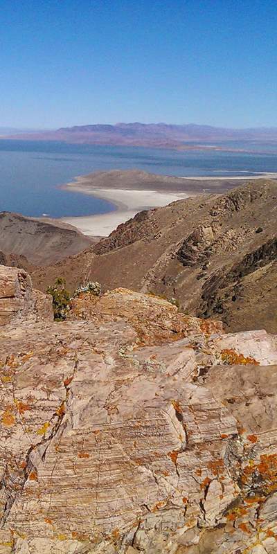
Frary Peak Trail is a hiking-only trail with the best views and photography opportunities on the island. Great Salt Lake and its islands are a crucial stopover point for millions of migrating waterfowl. The area hosts 250 bird species each year. The trail affords a view across the island that often provides glimpses of the herds of bison and the peak is the only vantage point from which the entire island, including the south side, can be viewed.
Find Your Way
The trailhead is a big gravel lot with plenty of parking and looks out over the Great Salt Lake. Two trails head out from the south side. Take the upper trail to the right, which quickly begins to climb the desert mountain. Views immediately open to the east over the lake. The trail is rimmed with grass and sagebrush, so the views open wide across the island. The trail is also interspersed with interesting rock, and you find the first as you start your climb.
The trail forks at Dooly Knob junction. The right fork heads to the other side of the island. Follow the left fork as it continues straight (south). The trail climbs to the top ridge of the island and then drops down onto the west side, with views over the other side of the island and the lake to the west.
At 1.3 miles the trail passes under a set of boulders that create a shaded cave. The trail then continues to the right and then circles above the rocks to begin a set of steep switchbacks before an open climb through the grasses to get back up to the ridge of the island.
Atop the next ridge is a nice rock outcropping and lookout point to the south and east. From here the easy-to-follow trail again cuts around over the west side of the island and heads south. The southern two-thirds of the island contains some of the oldest rock found anywhere in North America. The Farmington Canyon Complex dates back 2.7 billion years, older than rocks found at the bottom of the Grand Canyon.
At 2.7 miles you reach another overlook ridge that affords interesting views down into White Rock Bay to the west. From this point, you can also see to the east, with the Wasatch Front in full view.
After 2.8 miles you'll reach the island's radio towers, and from there Frary Peak is only a short 0.5-mile climb to the south with the option to scramble over rocky outcroppings on the left (eastern) trail or a trail with a little elevation drop on the right, to the west. Take the rocky route only if you’re surefooted, unafraid of heights, and ready to climb over rocks using both hands and feet. There are nice views no matter which route you take, and both end up at the summit with plenty of room to rest while you take in your surroundings.
Finding the Trailhead
From Salt Lake City take I-15 north to Antelope Drive (exit 332) near Layton. Turn left (west) off the exit onto Antelope Drive. The road connects directly to the causeway on the far west side at a fee station. When you get to the island, head left along the east side of the island toward Fielding Garr Ranch. The Frary Peak trailhead is 5 miles down this road.
Trailhead GPS: 40.9936944,-112.2047443
