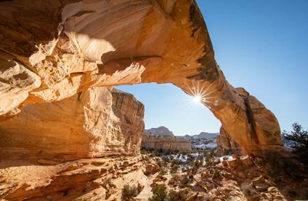
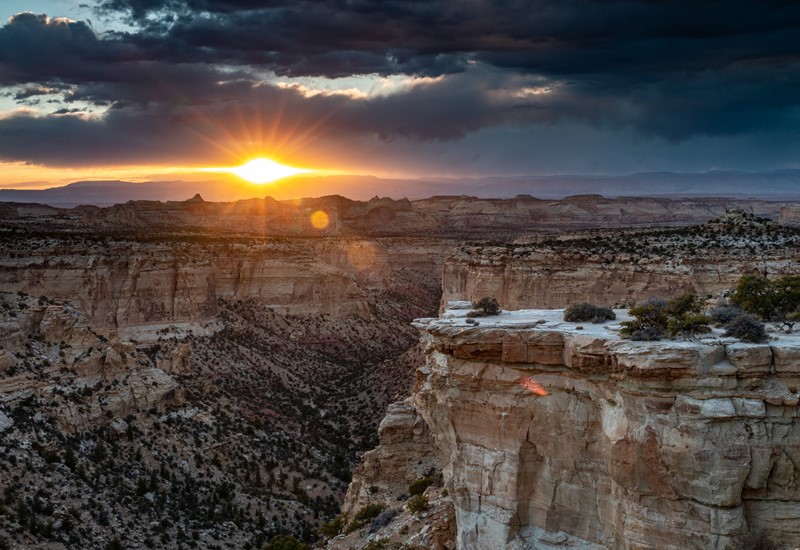
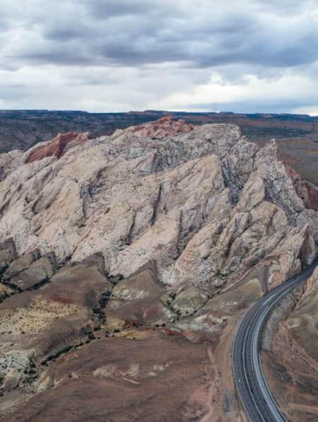
San Rafael Swell
Things to Do
-
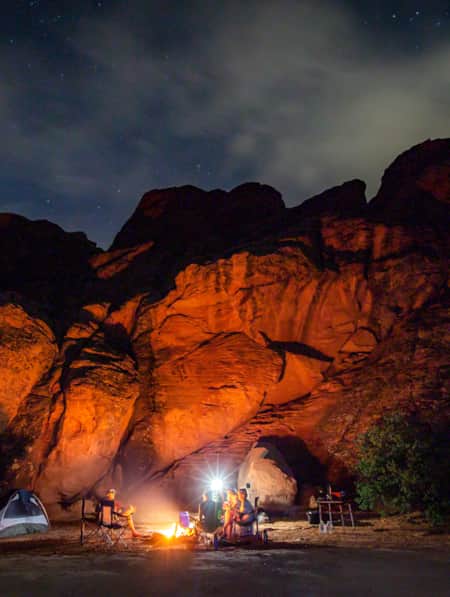
Camping
Camping at the Wedge in designated sites offers some of the best sunrise and sunset views just feet from your tent. These campgrounds are available on a first-come, first-served basis. There is a BLM fee campground with pit toilets, tables and fire rings near the San Rafael Swinging Bridge at the east end of the Little Grand Canyon. Tip: All campgrounds here are dry, so bring plenty of water, especially during the hot summer months.
-
Hiking
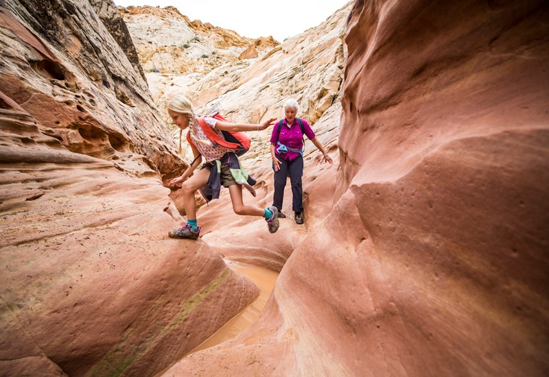
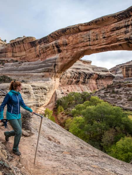
Just beyond the Swinging Bridge and BLM campground is the east trailhead of the Little Grand Canyon. Follow a well-used footpath along the river beneath the towering cottonwoods and through the tamarisk from this trailhead or the one at Fuller Bottom on the western edge. This pleasant hike has minimal elevation change and is moderate, making it one of the most popular San Rafael hikes for visitors. Discover more hiking at the Swell.
-
Kayaking
Floating the class I-II 14-mile length of the Little Grand Canyon in kayaks from Fuller Bottom to the Swinging Bridge is a popular activity for those with a basic boating experience,. It is completely dependent on a water flow rate above 200 CFS.
-
Mountain Biking
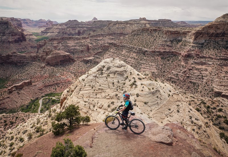
Mountain biking on any dirt roads in the Swell is suitable for the whole family, but the Good Water Trail on the Wedge will do the job for those looking for single-track action with minimal climbing. This hiking and mountain biking trail is perfect for those with intermediate biking skills and some endurance.
More to Do
-
Backcountry
Toward the south end of the swell, near Goblin Valley State Park and the northern stretches of Capitol Reef National Park, backcountry roads access features like the slot canyons of Little Wild Horse and Ding and Dang and the excellent Hondu Arch.
-
Backpacking
If you choose to backpack the length of the canyon you will find many sites suitable for camping.
-
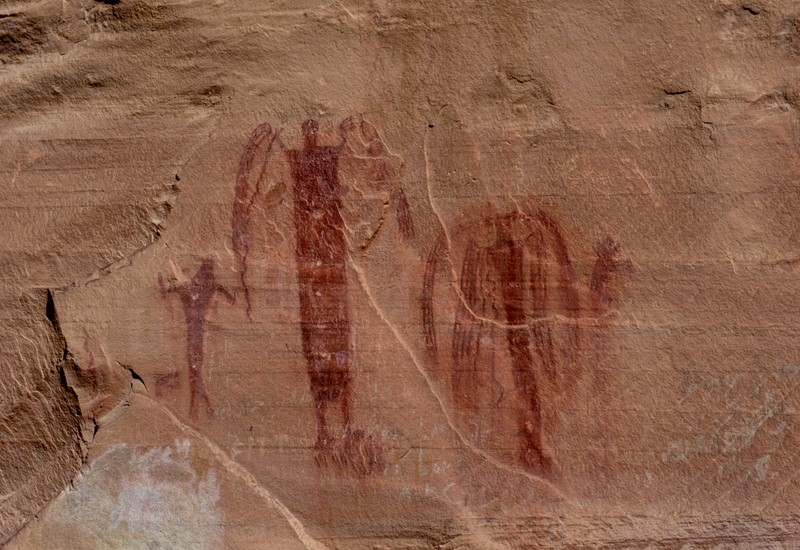
Buckhorn Draw Pictograph Panel
Human presence in the Swell goes back thousands of years. Evidence of the Barrier Canyon and Fremont Culture is on display at the Buckhorn Draw Pictograph Panel, which can be seen on your drive or ride down to the river from the Wedge. Additionally, sites like the Rochester Art Panel and Little Wild Horse Canyon further enrich the tapestry of human history within the Swell, offering additional contexts and insights into the ancient hunter-gatherer communities that once thrived in these lands. Together, these sites paint a vivid picture of the cultural and historical significance of the Swell, enhancing its natural beauty with layers of human storytelling.
-
Energy Loop: Huntington and Eccles Canyons National Scenic Byway
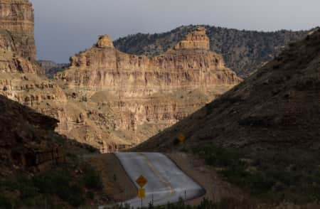
The Energy Loop: Huntington and Eccles Canyons National Scenic Byway (S.R. 96, 264, 31, U.S. 6) carries you over the Wasatch Plateau, capturing Utah’s high-alpine experience with 360 degree views including Mount Nebo to the north and the San Rafael Swell to the east. During the fall, contrasting fields of yellow aspens and deep green conifers line the path. Don’t miss the Wedge Overlook of the San Rafael Swell (the Little Grand Canyon), Huntington Reservoir and Mammoth Discovery Site of 8-8-88, Stuart Guard Station, Electric Lake and the famous Arapeen OHV trail.
-
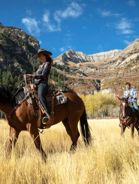
Horseback Riding
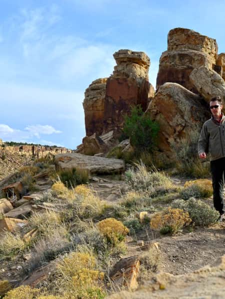
Exploring the San Rafael Swell on horseback offers a uniquely thrilling adventure in the swell’s vast sandstone formations and expansive plateaus. Whether you're a seasoned equestrian or someone looking to saddle up for the first time, the Swell provides a variety of trails that cater to all experience levels.
-
Old Spanish Trail
From the mid-eighteenth to mid-nineteenth centuries the Old Spanish Trail trade route passed through the Swell on its northern
-
San Rafael Swell OHV Trails
Explore the San Rafael Swell's OHV trails for unmatched off-roading through Utah's diverse landscapes. The area, rich in mountains, canyons, deserts and forests, is perfect for adventurers seeking paths less traveled. With trails rated from easy to difficult, there's something for every skill level, whether navigating the technical Devil's Racetrack or enjoying scenic rides like South Skyline Drive. Always ride responsibly, protect the delicate ecosystem and enjoy the unique beauty of the Carbon Corridor's off-road adventures.
-
San Rafael Swinging Bridge
You can visit this historic site built in the 1930s by the Civilian Conservation Corps to aid cattle crossing the San Rafael River.
Basecamps
-

Green River
The city of Green River was once a stomping ground for Butch Cassidy and his Wild Bunch, and is a haven for river runners who raft places such as Desolation and Gray Canyons.
-
Price
Price sits close to the northern section of the San Rafael Swell, which is home to vast deserts, yawning canyons, and fascinating rock formations. The area is known for its coal mining, as well as its recreational opportunities.

Read the Stories
-
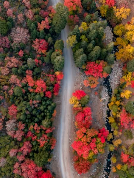
11 Utah Scenic Byways for Leaf Peeping
Explore 11 Scenic Drives in Utah for some serious leaf peeping. Utah is one of the best places to see fall foliage, visit great attractions, events and festivals.
-
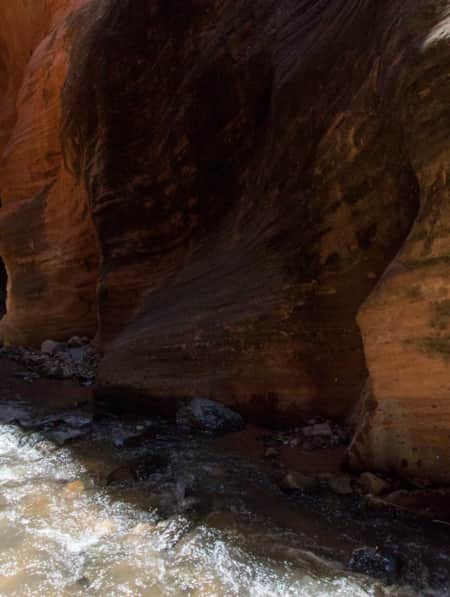
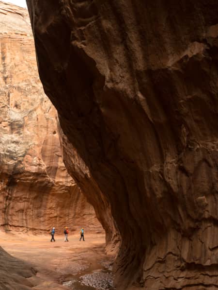
15 Non-Technical Slot Canyons
You don’t have to be Spider-Man to explore some of the best slot canyons Utah has to offer. You just need to be ready for an adventure in tight spaces with huge photographic rewards
-
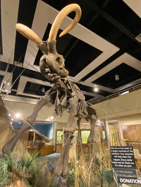
A Deep Dig into Utah’s Deep Time
Utah is one of the most important archeological zones on the planet. Discover how dedicated, local paleontologists and volunteers teach stewardship alongside exploration.
-
A Grand Tour of the San Rafael Swell
This grand tour goes into the heart of Utah's Swell from north to south, connecting the uplift’s spectacular views with playful slot-canyon hikes, bike excursions, rock art, dinosaur bones, and soft-serve cones in town.
-
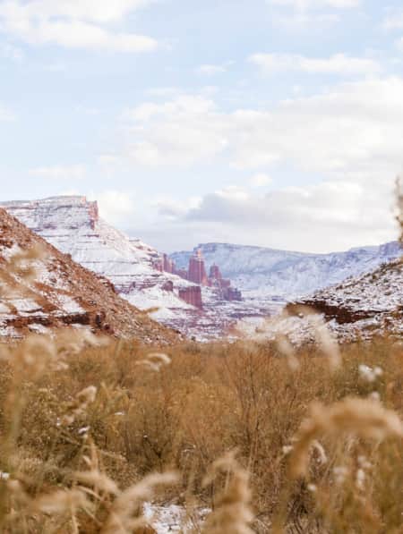
Across a Snow-Covered Desert
Follow this itinerary for a week-long winter road trip across the snow-covered desert of Southeastern Utah.
-
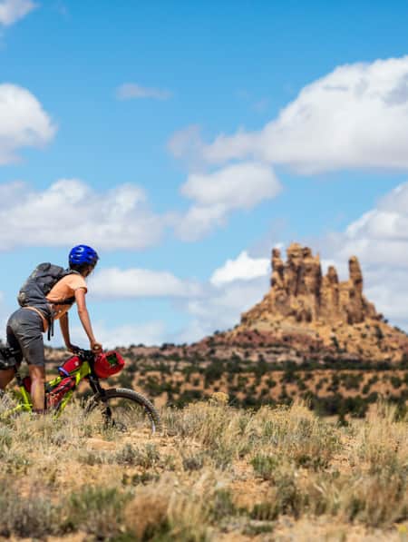
Bikepacking through Time in the San Rafael Swell
We're miles away from civilization here in southeastern Utah’s San Rafael Swell, and we carry everything we need on our bikes. This is the type of adventure I've longed for, a trip that reminds us of our self-worth, resilience, and how little we actually need to survive.
-
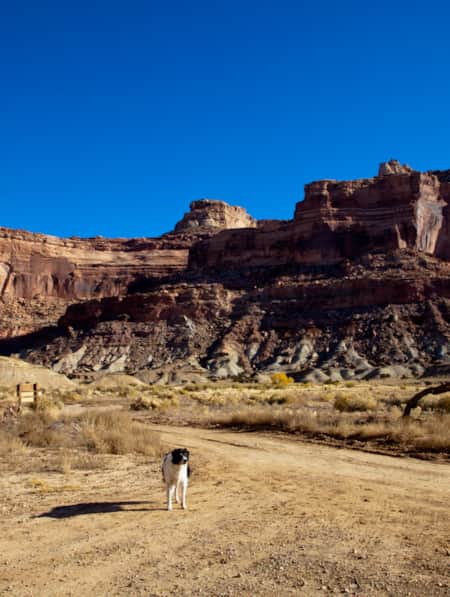
Dog-Friendly Utah: The Road to Mighty
Want to bring your furry friend on your next vacation? Utah is home to several great dog-friendly national parks and other fun destinations. Check it out and plan your trip!
-
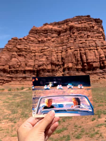
Filmed in Utah: 7 Itineraries Through Hollywood's Most Iconic Settings
Whether hitting the Sundance Film Festival in Park City and Salt Lake City in January or visiting Utah throughout the year, you’ll find yourself near some Utah’s most iconic and most filmed places.
-
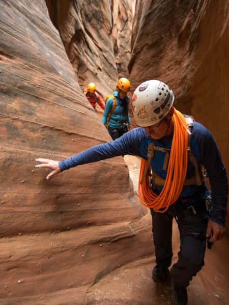
How to Canyoneer Safely
Whether you’re a newbie or a seasoned canyoneer, here are six expert tips for your next canyoneering adventure.
-
It’s About Time We All Unplugged
After months of being at home, we’ve all been disconnected from each other but connected permanently to our screens. It’s time to pull the plug—literally. In Utah, you can find far-flung places to reset, wellness resorts that promote digital detox, and destinations where you can swap screen time for much-needed adventure time.
-
Movies Filmed in Utah: Plotting a Cinematic Drive-Through
Follow a Germany-based film enthusiast on an extended road trip to discover the rich history of Utah cinematography.
-
Permit of Solitude in Robbers Roost
Local guide Christopher Hagedorn leads a group through Robbers Roost in Southern Utah, where wind, water and time has left a primitive maze of canyons.
-
Reef Walking, Petroglyphs and Bones
Check out the world’s densest concentration of dinosaur bones at Cleveland Lloyd Dinosaur Quarry and explore other prehistoric wonders around Utah.
-
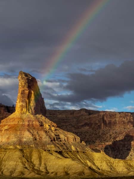
San Rafael Swell Throughout the Seasons: 4 Reasons to Visit
From narrow slot canyons to grand sweeping vistas, sandstone plateaus to meandering rivers, San Rafael Country and the San Rafael Swell are home to some of the most spectacular scenery in Utah.
-
Searching for Dinosaur Bones in Capitol Reef Country
The Hanksville-Burpee Dinosaur Quarry dates back to the Jurassic Period and is approximately 150 feet wide by 600 feet long. Hundreds of dinosaur bones have been discovered here, including those of the Stegosaurus, Brontosaurus and Brachiosaurus.
-
The Underrated Trails Within the San Rafael Swell
Utah's San Rafael Swell features a vast landscape of winding gorges carved deep by rivers, and you'll find multi-colored sandstone mountains and mysterious slot canyons. Here's a quick guide to some of the best trails to explore the region.
-
The Undiscovered San Rafael Swell
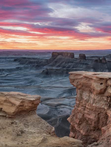
Circle back to the San Rafael Swell, a gem of public lands in Central Utah you may have missed on your last visit through some of Southern Utah's Mighty 5® national parks. The Little Grand Canyon of the San Rafael Swell is a stunning panorama from above, and an incredible adventure within.
-
Touring Utah with the State’s Most Well Known Women Writers
The diversity and beauty found in Utah has often been captured by women. Here are the places that seven of Utah’s most well known women writers knew and loved most.

What's Nearby
-
Canyonlands National Park
Canyonlands is home to many different types of travel experiences, from sublime solitude in the more remote stretches of the park to moderate hikes through the Needles district to the opportunity to create your own version of one of the West's most photographed landforms, Mesa Arch.
-
Capitol Reef National Park
Even considering Utah’s many impressive national parks and monuments, it is difficult to rival Capitol Reef National Park’s sense of expansiveness, of broad, sweeping vistas, of a tortured, twisted, seemingly endless landscape, or of limitless sky and desert rock.
-
Fishlake National Forest
This is a paradise known for its beautiful aspen forests, sundry scenic drives, trails, elk hunting, and mackinaw and rainbow trout fishing. Recreational opportunities include scenic drives, mountain biking, snowmobiling, hiking, camping and OHV use.
-
Goblin Valley State Park
Goblin Valley State Park could almost be mistaken for a martian landscape with intricate and bizarre geologic formations. Bring the family and experience this amazing place by hiking, camping, mountain biking and exploring the surrounding canyons.
-
Green River State Park
Green River State Park is a great place to begin your adventure on the Green River. If you make the journey you’ll be rewarded with easy access to the river, sheltered campgrounds and picnic areas, a nine-hole golf course, and a new eighteen-basket disc golf course.