Exploring Mule Canyon: House on Fire and Cave Tower
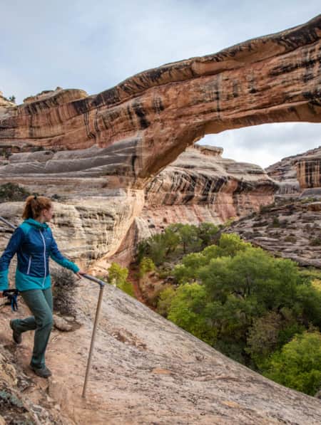
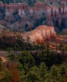
Solitude and mystery beneath rust-colored cliffs

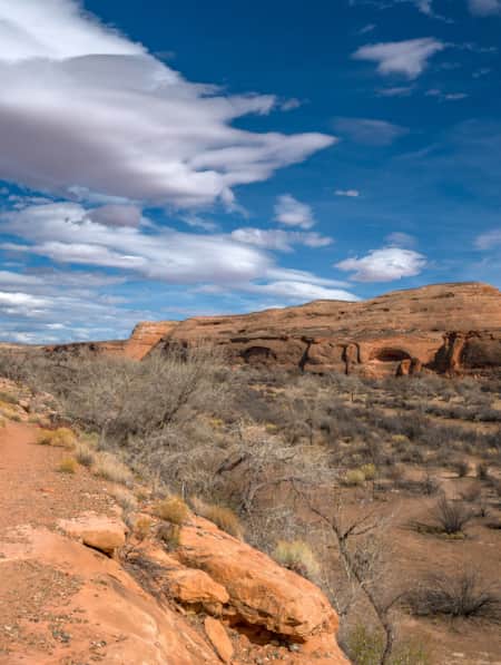
The sweet, peppery scent of juniper hangs in the air, and all is silent, except for the hollow knock of a distant woodpecker. Overhead, hawks and golden eagles glide quietly, and the occasional jackrabbit and lizard scurry into the scrub. Gazing up at the high cliff walls, you spy the dusty site of a vanished civilization.
This is a hypnotic place, quiet and calm, where a person can dwell in solitude and really absorb the beauty of the landscape and the creatures that call it home.
When most people speak of Mule Canyon, they reference the South Fork. But the seldom-visited North Fork is also a great destination for hikers seeking seclusion. While the Native American sites in the North Fork are not as well-restored as those in the south, you will find one well-preserved site perched under a protective overhang high above the wash. Because there’s no great way to access the dwelling, you should bring binoculars to get a closer look.
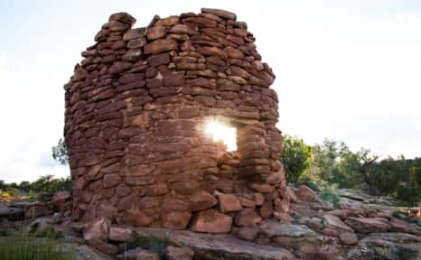
Cave Tower
The Cave Tower Site (also called Cave Canyon Site or Mule Canyon Site) is located down a small spur road that is off S.R. 95 at about mile marker 102.5. The short dirt road ends and becomes the parking area, and a trail to the east heads to the site. After walking 100 yards, you’ll see the remains of the few towers still standing in all of Cedar Mesa.
With no obvious villages or dwellings nearby, the reason for these towers is unclear.
At Cave Canyon, there is a water source that possibly had some bearing on the location. The Mule Canyon Site is a mile north and would be within sight — were these towers defensive or serve as lookout posts? Fortunately, we don’t have to know their original purpose to appreciate them.
With no obvious villages or dwellings nearby, the reason for these towers is unclear.
Cave Tower is located just off Highway 95, also known as the Trail of the Ancients Scenic Byway.
"This is a hypnotic place, quiet and calm, where a person can dwell in solitude and really absorb the beauty of the landscape."
South Fork of Mule Canyon: House on Fire
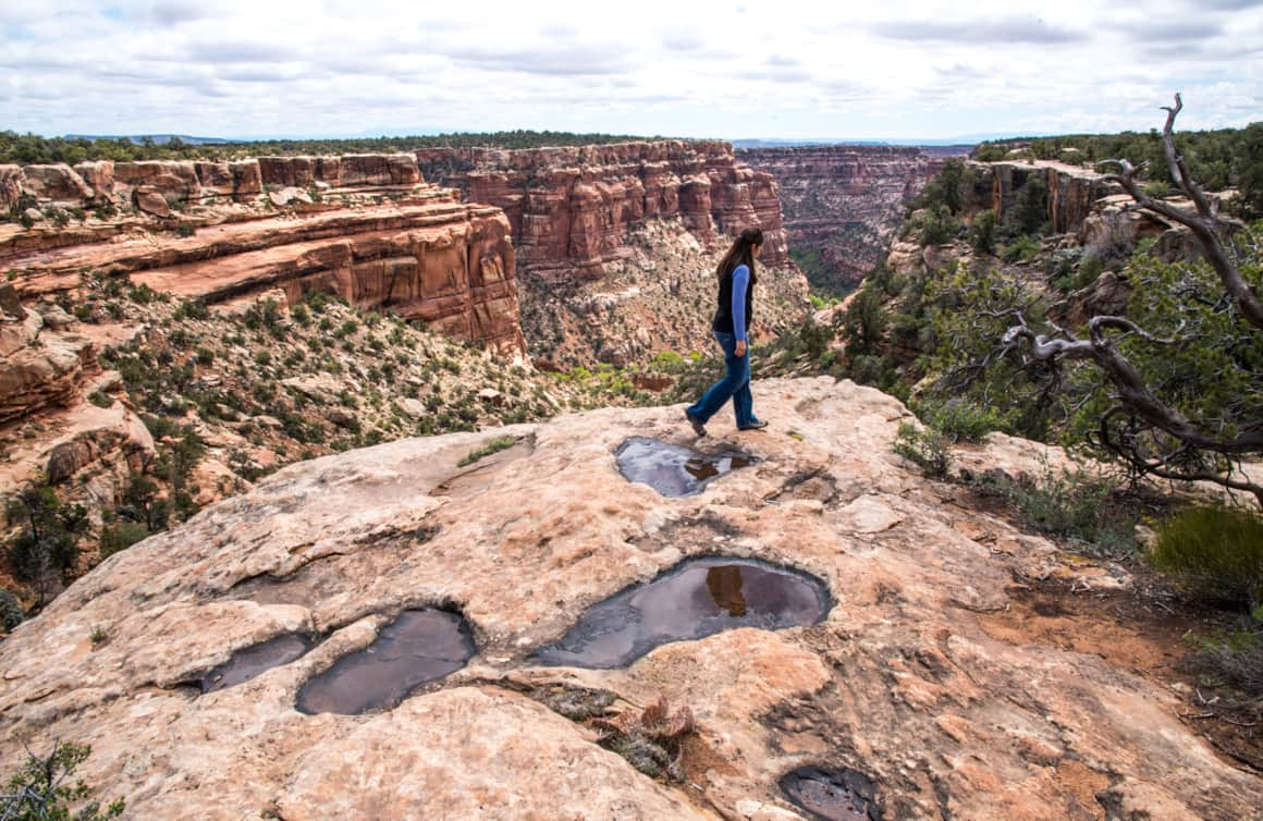
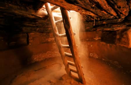
This 4.3-mile hike is mostly level, up a shallow canyon. It passes eight sites of varying intricacy and size. At just under a mile, you see the first major site: the famous House on Fire. This well-preserved site consists of five granaries built into Cedar Mesa sandstone. The overhang that forms the ceiling has a unique, streaked pattern that resembles flames at certain times of the day.
Pro tip: To get the iconic photograph of the “flames,” visit around 10 or 11 a.m. (depending on the time of the year), when the sun hits the bottom of the canyon and bounces off the canyon walls. By noon, light hits the wall directly and washes it out.
As you take in the view, imagine how the ancient Puebloans lived here between 700 and 2,500 years ago. The granaries perched high in the cliffs stored corn, a main source of food. The Puebloans also ground Indian ricegrass into meal to make bread, and they ate abundant prickly pears. The ever-present yucca was invaluable, as its leaves were spun into fiber and woven into baskets, sandals, and bags. The Native Americans used the root of the yucca for soap, and they roasted and ate the base of the plant.
The pinyon pines that you weave around and duck under to reach the ancient sites were a key source of building material, fuel, and food. When burned, the wood created the high temperatures needed for firing pottery, while pine bark served as roofing and padding, and pinon nuts provided much-needed vitamins and protein.
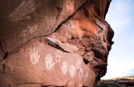
Before you continue up the canyon, stop and check out the rock art located beneath an overhanging boulder in the wash below the House on Fire. (Most people walk right past it!)
The majority of hikers visit House of Fire and head back to the car, but there are several more sites worth seeing. While some sit right off the trail, others require binoculars to see or you have to climb 200 or so feet to reach them. Toward the end of the canyon sits the spectacular Wall Site, which has several intact rooms built into small caves in the pock-marked cliff. Some of the roofs still showcase the original roof timbers. Also, there are a few permanent springs nearby, so this is a good resting spot if you’re hiking with children or your dog.
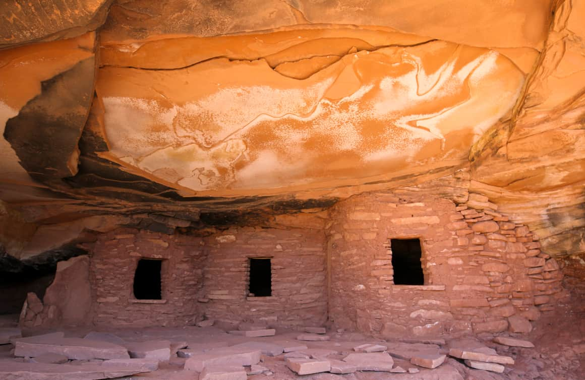
The well-preserved site of House on Fire consists of five granaries built into Cedar Mesa sandstone.
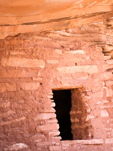
The granaries perched high in the cliffs stored corn, a main source of food.
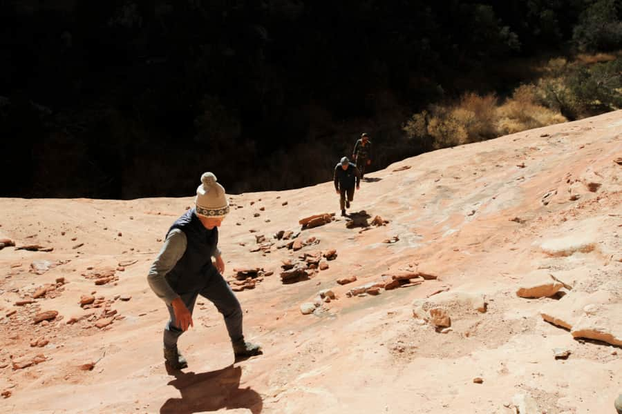
The South Fork of Mule Canyon is 4.3-mile hike, and it's mostly level, up a shallow canyon
Trail Guide
Difficulty: Easy
Distance and elevation gain: South Fork of Mule Canyon is 4.3 miles one-way, and elevation gain is 250 feet. Cave Tower Site is 1-1.5 miles round trip, and elevation change is less than 200 feet.
Trail type: packed dirt, slickrock, and some scrambling over rocks
Multi-use: Yes — hiking, backpacking
Dog: Yes — on-leash
Fees: Passes are required for day hiking, check with the Bureau of Land Management for the current fee amount. Be prepared with exact change.
Seasonality: Spring, summer (early mornings), and fall are best.
Bathroom: There is a pit toilet near the pay kiosk on CR 263.
Where to park: There are parking lots at the trailheads.
Trailhead GPS coordinates: South Fork of Mule Canyon: 37.497000, -109.662000; Cave Tower Site: 37.526944, -109.733055
More Nearby
-

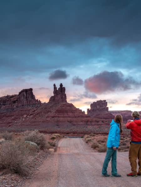
Bears Ears National Monument
A pair of towering buttes stand against beautiful scenery. The twin buttes are so distinctive that in each of the native languages of the region their name is the same: Hoon'Naqvut, Shash Jáa, Kwiyagatu Nukavachi, Ansh An Lashokdiwe, or in English: Bears Ears.
-
Edge of the Cedars State Park Museum
Edge of the Cedars State Park Museum in Blanding, Utah, is the site of a prehistoric Native American village. Explore history here!
-
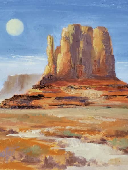
Monument Valley Navajo Tribal Park
Monument Valley, Utah, an iconic symbol of the American West, is the sacred heart of the Navajo Nation and the ideal setting for your next adventure in the warm, high desert climate of southeastern Utah.
Discover More
-
An Uncommon Confluence
A solo sojourn where snow and desert meet in a lesser-known corner of Utah’s red rock country.
-
Touring the Indian Creek Corridor Scenic Byway
Prepare to be captivated as you drive along Indian Creek Utah’s Corridor Scenic Byway. Explore the Needles District, Canyonlands NP and admire Utah’s natural beauty.
-
The Petroglyphs of Comb Ridge
Comb Ridge in Southeastern Utah offers dramatic galleries of ancient petroglyphs engraved on sandstone cliffs by Ancestral Puebloan artists over 1,000 years ago. Learn more about Comb Ridge and its unique rock art sites, including the famed Procession Panel.
-
Utah’s Unexpected Pit Stops
You’re doing it wrong if you think road trip pit stops are boring layovers on your way to more exciting destinations. How many of these hidden gems have you been to? Here are 11 mini-adventures to check off your list next time you’re road-tripping through Utah.
-
The Art of Supporting Utah Artists
Here’s a look at six local artists whose work draws upon Utah’s diverse environments as inspiration.
-
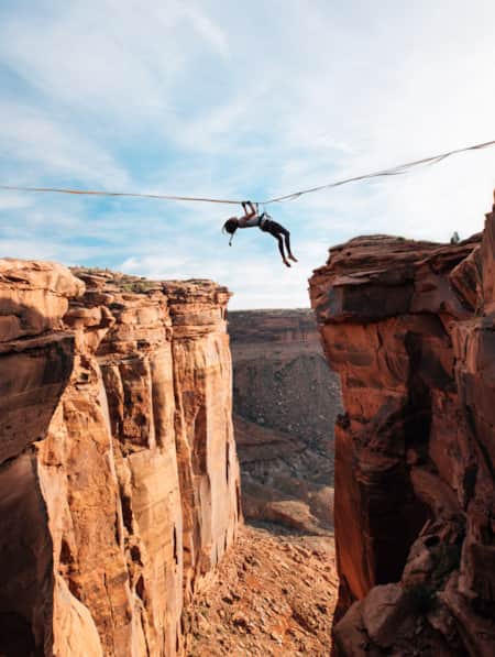
Walking The Line Between Risk and Responsibility
Why a Hawaii-based highliner and influencer hasn't returned to Utah — yet.
-
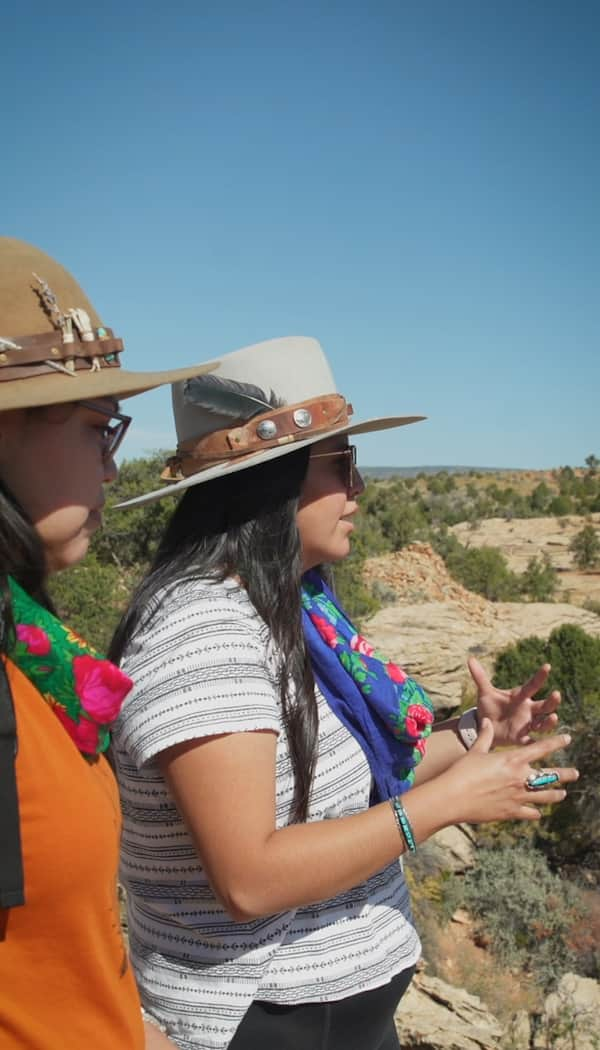
The Voices of Bears Ears
Bears Ears National Monument is at the heart of southeastern Utah. These lands are imbued with layers of culture — layers of life. In this four-part video series, meet the locals who connect with the land in their own distinct ways.
-
Finding Strength and Inspiration Deep in the Utah Desert
How a series of hiking and camping trips in Utah’s parks and wilderness put Elisabeth Brentano on a transformative journey from urbanite to nature lover.
-
Touring Utah with the State’s Most Well Known Women Writers
The diversity and beauty found in Utah has often been captured by women. Here are the places that seven of Utah’s most well known women writers knew and loved most.
-
Winter in Southern Utah Like a Local
Southern Utah comes alive in winter with unexpected experiences for those who are well-prepared and solitude for those who want to expand their view.